
List of A roads in zone 6 in Great Britain starting east of the A6 and A7 roads, and west of the A1 (road beginning with 6).
List of A roads in zone 6 in Great Britain starting east of the A6 and A7 roads, and west of the A1 (road beginning with 6).
| Road | From | To | Notes |
|---|---|---|---|
| Luton | Carlisle | Originally London to Carlisle, starting from the A1 at Barnet. The fourth longest numbered route in the UK at 299 miles. | |
| Loughborough | Doncaster | ||
| Derby | Thirsk | Runs through Leeds as the eastern flank of Leeds Inner Ring Road. Forms the primary route between Leeds and Harrogate but is superseded to the south by the M1 motorway to Wakefield. Originally went on what is now the A6135 north of Sheffield. | |
| Leeds | Manchester | Former main Trans Pennine route from Lancashire to Yorkshire, most of the traffic now uses the M62 motorway, which follows roughly the same route between Manchester and Leeds, but extends to Hull and Liverpool | |
| Leeds | Kingston upon Hull | ||
| Leeds | Scarborough | Main road from West Yorkshire to the East Coast. Is briefly A64(M) as part of Leeds Inner Ring Road. | |
| Leeds | Kendal | Trans Pennine route. | |
| Grangetown | Workington | ||
| Bowes | Crathorne | ||
| Edinburgh | Darlington | ||
| Denton Burn | Carlisle |
| Road | From | To | Notes |
|---|---|---|---|
| Hitchin | Bedford | Runs through Shortstown and Cotton End. Originally started in Welwyn, but the section south of Hitchin is now B656, Codicote Road, High Street, and London Road. | |
| Derby Inner Ring Road. See also the A601(M) motorway in Lancashire. Previously allocated to a road from Luton to near Babraham. Became a portion of the A505 in 1935 when it was extended north to the A11; the section through Hitchin and Baldock is now the B656. | |||
| Hitchin | Ware | ||
| Bedford | Cambridge | Section from Sandy to New Wimpole (on the A1198) downgraded to B1042. | |
| Unused | Used to run from Barton Seagrave to Harwich. Downgraded to sections of the A14, A1307, A143, A1017, A1124, A137, B1352, A120 and A136 by 1998. The original route went from the A6 at Barton Seagrave to the A14 at Huntingdon. Historically, the Godmanchester to Colchester section was the original A132, and the Colchester to Harwich section was the original A135. | ||
| A14 J13 | Hobbs Lot Bridge, near Guyhirn | ||
| Stamford | West Bridgford | ||
| Leicester | Bracebridge Heath | ||
| Newstead | Derby | ||
| Nottingham | Belper | ||
| Nottingham | Ambergate | ||
| Nottingham | Mansfield | ||
| Nottingham | Newark-on-Trent | Runs via Southwell | |
| Unused | Originally ran from Nuthall to Alfreton. The extension of the M1 to J28 and the completion of the A615 Alfreton bypass (now the A38) resulted in a faster route between Nottingham and Alfreton, and this was the final nail in the coffin for the A613. It was downgraded to the B600, probably in the late 1960s or early 1970s (does not show on maps after that). Later used for the Gateshead Western Bypass from Birtley to Blaydon. Became part of the A69 early on and then the A1 in the 1990s. [1] Number also appears in the DfT Road lists from around 2002 as "Reserved for use for the Kirkumgate - Disforth proposals". Both place names do not exist with these spellings ("Kirkumgate" is probably an archaic spelling for Kirkhamgate and "Disforth" is a typo). The route is likely a descendant of the Kirkhamgate - Dishforth Motorway, a proposal to extend the M1 north between Leeds and Bradford, which later became the A6183, before being rerouted east of Leeds and becoming the M1 extension north of J43. | ||
| Calverton | Bridlington | ||
| Alfreton | Matlock | Former section between Alfreton and Mansfield now part of A38 | |
| Newark-on-Trent | Huddersfield | Becomes M1 motorway between Junctions 30 & 35A | |
| Chesterfield | Newark-on-Trent | ||
| Clowne | Rotherham | ||
| Bakewell | Worksop | ||
| Ranby | Beckingham | ||
| Sheffield | Baslow | ||
| Unused | Originally ran from Bakewell to Hathersage; downgraded to the B6001 in the 1960s, although a section in Calver is the southern end of the A625. Later used as a provisional number along the Haslingden Bypass in east Lancashire. It was extended to meet the M65 at J8 in 1985 and was then renumbered as part of a rerouted A56. | ||
| Chapel-en-le-Frith | Baslow | ||
| Glossop | Chapel-en-le-Frith | Prior to rerouting of the A6 via Chapel-en-le-Frith this used to go as far as Buxton | |
| Sheffield | Calver | Rerouted following collapse of part of the route | |
| Glossop | Heaton Chapel | ||
| Hazel Grove | Rochdale | Between Oldham and Rochdale runs as the A627(M). | |
| Hollingworth | Pontefract | Trans Pennine route. | |
| Rotherham | Skipton | Runs between Chapeltown and the junction with A61 west of Burncross as B6546. Originally went south via current A61 routing to Sheffield. | |
| Sheffield | M18 Junction 4 | ||
| Greenland | Louth | ||
| Matlock | Cuckney | Previously allocated to a road from Rotherham to north of Sheffield; this became part of the rerouted A629 at the same time the current A632 was created. The section between old and current A61 is now the B6546. | |
| Rotherham | New Lodge | ||
| Maltby | A638 near Retford | ||
| Manchester | Doncaster | Trans Pennine route. The westernmost section in Manchester is part of the unsigned A635(M). | |
| Denby Dale | Wakefield | ||
| Gawber | Grange Moor | ||
| A1 at Markham Moor | M62 Chain Bar junction | Formerly the A1 but renumbered after the construction of the A1 Retford bypass (Markham Moor to Blyth) and the A1(M) Doncaster bypass (Blyth to Carcroft) | |
| Skellow | Leeds | ||
| Rochdale | Huddersfield | Trans Pennine route. | |
| Huddersfield | Bradford | Main road between Huddersfield and Bradford. | |
| Huddersfield | Garforth | ||
| M62 Junction 23 | Leeds | ||
| Dewsbury | Denholme Clough | ||
| Crofton | Snaith | Joins the A638 at Crofton and this continues to Wakefield. | |
| Halifax | Burnley | ||
| Leeds | Halifax | Britain's first High Occupancy Vehicle Lane (HOV lane). | |
| Unused | Ran from Denholme to Brighouse. Renumbered as an extension of the A644 in 1935. Next used from Kegworth to West Bridgford, linking the M1 at J24 to Nottingham; a portion of the route was formally the B679. In 1978, the section west of the A614 was renumbered as a portion of a rerouted A453; the section to the east returned to the B679. | ||
| Liversedge | Hipperholme | ||
| Wakefield | Keighley | ||
| Liversedge | East Bierley | ||
| Dewsbury | Gomersal | ||
| Dewsbury | Leeds | ||
| Tingley | Oulton | ||
| near Crofton | Castleford | ||
| Castleford | Aberford | ||
| Shipley | Leeds | ||
| Bradford | A59 east of Knaresborough | ||
| Tadcaster | Otley | ||
| Leeds | Burley in Wharfedale | ||
| Wetherby | Harrogate | ||
| Manchester | Droylsden | ||
| Failsworth | Newhey | ||
| Manchester | Rochdale | ||
| Manchester | Ainsworth Junction with A58 | ||
| Pendlebury | Langho | ||
| Kearsley | Whitefield | ||
| Unused | Ran from Whitefield to Ainsworth. The section from Whitefield to Radcliffe became an extension of the A665 in the 1960s and the remainder was downgraded to Class II in the early 1970s: the section in Whitefield became the B6473 and the section from Radcliffe to Ainsworth became the B6292. | ||
| Middleton | Greenfield | ||
| Ashton-under-Lyne | Diggle | ||
| Oldham | Worston | ||
| Oldham | Ripponden | ||
| Bolton | Heath Charnock | ||
| Chorley | Blackburn | ||
| Bolton | Walton-le-Dale | ||
| Ramsbottom | Bolton | ||
| Blackburn | Samlesbury | ||
| Blackburn | Padiham | ||
| Blackburn | Burnley | ||
| Rochdale | Whalley | ||
| Haslingden | Todmorden | ||
| Bent Gate | Long Preston | Part of the road is the most dangerous in the UK | |
| Heysham | Kirkby Stephen | includes the Bay Gateway opened 2016 | |
| Kendal | A19 east of Ellerbeck | ||
| Kendal | Brough | ||
| Penrith | Haydon Bridge | ||
| Ingleton | Cantsfield | Originally allocated between Scotch Corner and Darlington (the A1 was routed from Boroughbridge to Darlington via Thirsk and Northallerton). But as early as February 1922, it was decided that the A1 should run via Scotch Corner, as its route was more important. Eventually the MOT caved in to local authority knowledge, and the A687 was one of the first A roads to be decommissioned, becoming the A1. Much of route has since been downgraded due to completion of nearby A1(M) and A66(M), and the portion running through Barton was declassified. The section in County Durham is now part of the A66. | |
| Barnard Castle | Bowburn | ||
| A595 near Carlisle | Hartlepool | ||
| Crook | Sunderland | ||
| Consett | Durham | ||
| Castleside | A1 near Gateshead | ||
| Leadgate | Chester-le-Street | ||
| Consett | A1 near MetroCentre | ||
| Newcastle-upon-Tyne | Hexham | Part was proposed to be the A695(M) Shields Road Motorway | |
| Otterburn | Newcastle-upon-Tyne | ||
| Morpeth | Oxton | ||
| Berwick | Hawick | ||
| Selkirk | Kelso |
| Road | From | To | Notes |
|---|---|---|---|
| Unused | Ran from the A600 to the A601 (now A505) in Hitchin; decommissioned sometime after 1960. The portion along Bedford Road is now part of the A505. | ||
| Biggleswade | Biggleswade | Originally ran from Henlow Camp to Biggleswade. The route from Biggleswade to Henlow Camp was downgraded to the B659. [2] | |
| Stapleford | Bulwell | Originally ran from Bedford to the A1 near Chawston. Became an extension of the A428 in 1935; the eastern section is now unclassified due to rerouting of the A421 and the western section is now part of the A4280. | |
| Barton Seagrave | Oakham | Joins A14 opposite A6 | |
| Loughborough | Loughborough railway station | Loughborough Ring Road | |
| Nottingham | Derby | ||
| Hathern | Melton Mowbray | Originally ran near Castle Donington between the A6 (now A50) and the A453 (now the B6540); declassified in 1970 or 1971. | |
| Codnor | Bramcote | ||
| Broad Marsh Centre | Victoria Centre | Nottingham Inner Ring Road | |
| Mansfield | Mansfield | Mansfield Inner Circle Originally ran from Budby to Worksop. Renumbered to B6005 in the 1970s and much of the route became part of the B6034 in the 1980s except for one section that was declassified. | |
| Chorlton-cum-Hardy | Cheetham | Manchester Intermediate Ring Road Originally ran from Stony Middleton to Grindleford Bridge. Downgraded in the 1960s to a portion of the B6521 (the A622 was downgraded at the same time to the B6001). | |
| Nottingham (Meadow Lane) | Gamston | Originally ran from Grindleford Bridge to the Fox House Inn. Downgraded in the 1960s to a portion of the B6521 (the A622 was downgraded at the same time to the B6001). | |
| Unused | Was once a road in Bamford, cutting the corner between the A625 (now A6187) from Hope and the A6013. Declassified in the 1970s after the western end was blocked off. | ||
| Ashopton | Bamford | The original northern end (along with Ashopton itself) was flooded in 1945 when the Ladybower Reservoir was built and was rerouted over the A6014. | |
| Kettering bypass | Northampton Road, Kettering | Former portion of the A43 before it was rerouted to bypass Kettering. Duplicate number. | |
| Corby | Great Oakley | Originally on a route cutting the southeast corner between the A6013 and the A57 east of Ashopton. Became a portion of a rerouted A6013 in 1945 due to completion of the Ladybower Reservoir; the northern end is now gone, submerged beneath the reservoir. Parts of the old road can still be seen, including the spilt from the A6013 leading down towards the reservoir. | |
| Newtown, New Mills | Hayfield | ||
| Simmondley, | Charlestown, Glossop | Linking the A57 with the A624. Glossop Town Road. | |
| Bredbury | Ashton-under-Lyne | ||
| Mottram in Longdendale | Stalybridge | ||
| Nottingham | Nottingham | A short stretch of road in Nottingham city centre. An older routing went from A57 High Street to A616 Bank Street in Sheffield, but was later extended north to A61 when it was rerouted along West Bar. Became part of the A621 by the 1960s and is now unclassified. | |
| Ashford-in-the-Water | A619 near Bakewell | Acts as a bypass for Bakewell. Originally ran along Commercial Street in Sheffield, linking the A57 to the A61. Although the road was still classified in the 1990s, it did not have the A6020 number (it was moved to its current route in the 1930s) and had likely become a spur of the A57. Now unclassified. | |
| South East Rotherham | South West Rotherham | Originally used on a route from the A628 Hemsworth Bypass to the A1/A639 junction at Barnsdale Bar, constructed in 2008-2009. The number stems from a typo, as the road was to be the A6201, but the route was mapped and signed as A6021. The signs have since been corrected. | |
| Mexborough | Swinton | ||
| Wath upon Dearne | Conisbrough | ||
| A628 at Woodhead | Honley | ||
| Brighouse | A629 near Elland | ||
| A58 near Sowerby Bridge | A629 near Greetland | ||
| Horwich | Horwich | Originally ran from King Cross to the A629 south of Halifax. Became a portion of the A646 (probably in the 1930s) along with the decommissioning of the A6028. | |
| Unused | Ran from the A640 near Outlane to the A643 in Brighouse; became a portion of the A643 in 1935 when its western end was rerouted. | ||
| Morley | Tingley | ||
| A563/A47 at Evington | A6 at Stoneygate | Relic of former Leicester ring road, now mostly substituted by A563 Outer Ring. Originally ran from the A642 to the A61 in Wakefield. The section along Marygate is now part of the A650 and the section along Bull Ring is unclassified, although some maps claim that it is also part of the A650. | |
| Unused | Linked the A650 to the A61 in northern Wakefield, was one of the shortest A roads in the 1922 list at around 300 feet; became a portion of the A650 when it was rerouted. | ||
| Castleford | Castleford | ||
| Littleborough | Haworth | ||
| Steeton | Addingham | ||
| Keighley | Keighley | ||
| Halifax | Bradford | ||
| Shipley | Bradford | ||
| Shipley | Otley | ||
| Unused | Ran from the A65 in Menston to the A659 (now A660) in Otley. Decommissioned when the A660 Otley bypass was built; the section west of the bypass became an extension of the A6038 and the eastern section became a portion of the A659. Number possibly used in Mansfield (appears on a DfT map from c. 2002), but no further information is known. Before Mansfield town center was bypassed, a tangle of A roads was shown on OS maps, and one of these probably had the A6039 number. | ||
| Harrogate | Harrogate | ||
| Manchester | Salford | ||
| Manchester | Manchester | Forms the western section of the Manchester & Salford Inner Relief Route | |
| Ashton-under-Lyne | Ashton-under-Lyne | Signed westbound as (A627) and eastbound as A6018. | |
| Pendlebury | Heaton Park | Takes on the names of Sheepfoot Lane, Scholes Lane, Hilton Lane, Rainsough Brow and finally Agecroft Road, respectively. | |
| Heywood | Heaton Park | ||
| Heywood | Middleton | ||
| Heywood | Heywood | ||
| Oldham | Oldham | ||
| Unused | Ran from the A62 to the A627 along George Street in Oldham. The northern end is now gone, with the Town Square shopping center built on top. | ||
| A670 near Mossley | A669 near Lydgate | ||
| Greenfield | Greenfield | Shortest A road in Britain, less than half a mile long | |
| Uppermill | Denshaw | ||
| Kearsley | A56 near Bury | ||
| Unused | Ran along Marsden Road in Bolton from the A58 and B6203 to the A673. Became a spur of the A673 as a part of the 1935 renumbering, but a photograph from 1937 shows the road as A6054, so the change must have been after 1935. | ||
| Knaresborough | Barton, North Yorkshire | Originally ran from Knaresborough to Boroughbridge; extended to replace the former A1 between Baldersby Gate and Barton after the A1(M) extension opened. Originally used for the northern end of Derby Street in Bolton, linking the A579 to the A568 (now A676). Route is now gone due to redevelopment. | |
| Unused | Ran along Crook Street and Orlando Road in Bolton from the A6055 to the A66. | ||
| Unused | Ran from the A6056 to the A6058 in Bolton. Now part of the A579. | ||
| Bolton | Bolton | ||
| Unused | Connected the A666 and A676 in northern Bolton. Downgraded to B6472 in the 1960s. | ||
| Rochdale | Rochdale | Along Dane Street - From A680 between Spotland Road and Edenfield Road to A58 Junction to The Esplanade and Dane Street | |
| A675 in Riley Green, Lancashire | A674 near Feniscowles, Lancashire | ||
| A674 in Feniscowles, Blackburn | A666 in Ewood, Blackburn | The A6062 passes through Livesey and is called Livesey Branch Road for its entire length. The road was originally a turnpike road built in 1810 as a branch of the Blackburn & Bolton Trust. [3] | |
| Preston | Deepdale, Preston | Originally ran from the A677 along Branch Road to Whalley Road (then the A59) in Mellor Brook. This became part of a rerouted A59 after World War II and the A6063 was reassigned to a portion of bypassed A59 through Myerscough Smithy. Later the route was extended to go around Samlesbury Aerodrome. In the 1960s the A59 and A677 were given their routes back, but the A6063 was declassified instead of being given its original route. | |
| Unused | Ran from Rishton to Harwood Bar. Downgraded to the B6535 in the 1970s. | ||
| Unused | First used along Blackburn Road in Accrington from Abbey Street (then A680) to Broadway (then A679). Declassified to remove traffic from the center of Accrington. Ran as a loop off of the A1 along the former A1 via through Newark-on-Trent Renumbered to the A616, B6325 and B6326 because there was no need for a Class I road through Newark after the bypass opened in 1990. | ||
| A681 in Stacksteads, Lancashire | A671 in Britannia, Lancashire | Near Bacup | |
| Unused | Ran from the A58 in Littleborough to the A681 near Todmorden along the Rochdale Canal. Became an extension of the A6033 in 1935. Number later used from Annfield Plain to Flint Hill along a former section of A6076. This was downgraded to the B6168 in the 1960s. | ||
| Kildwick, North Yorkshire | Hapton, Lancashire | Via Padiham, Colne | |
| Skipton | Skipton | ||
| Carnforth | Crooklands | Includes the route of the former A601(M) motorway following its downgrading. | |
| Brampton | Gretna | ||
| Heighington | Bishop Auckland | ||
| Unused | Ran from Bishop Auckland to the A68 at High Etherley. Except for the easternmost section (now unclassified), the route is now part of the B6282. | ||
| Unused | Ran from Bishop Auckland to the A1 (now A167) at Croxdale. Much of route now A688 (much of it bypassed, however), the section north of Spennymoor is now B6288 and the bypassed sections are now unclassified. | ||
| Sutton in Ashfield | Darlton | Originally ran from Castleside to Leadgate via Consett. Became a western extension of the A692 in 1935. | |
| Lanchester | Sunniside | ||
| Blackburn | M65 at Guide | Previously numbered A6177 until 2005, to remove duplication as another A6177 (the current one) exists. Was originally B6232. Originally ran from A693 in Stanley to A692 in Hobson. Downgraded to Class II status as the B6173. | |
| Blackburn | Blackburn | Blackburn Orbital Route Originally ran from A686 in Crook Hill to A69 in Haydon Bridge (now Shaftoe Street; bridge demolished). Declassified in the 1960s, probably when the current bridge was built. | |
| Hexham | A68 road | ||
| Unused | Cut the corner between the A66 and A69 (both now A695) in Corbridge. Now part of the A695. | ||
| Unused | Ran from Gateshead to Blaydon (Now Ellison Road, Market Lane, and B6317/Hexham Road; also went east along A1114 and Derwentwater Road before the A184 was built). | ||
| Unused | Ran in Gateshead from the A184 to the A695 (now A189; originally went south along First Street and Elysium Street to the A692 before the A184 was built). | ||
| Unused | Ran in Gateshead from the A6081 to the A6082 (became part of the A184 when it was built). | ||
| Unused | Ran along Mulgrave Terrace from A6125/West Street to A692/Bensham Road in Gateshead. This became part of the A184 as parts were closed off; reused on the old route of the A184 along Askew Road, East Gate, Hawks Road, and Saltmeadow Road. | ||
| Scotswood Bridge | Throckley | ||
| Corby | Corby | Originally ran along Grainger Street West and Grainger Street in Newcastle-upon-Tyne; now unclassified. | |
| Unused | Ran from the A6087 in Belsay to the A1 (now B1337) south of Morpeth. Downgraded to the B6524 in the 1970s. | ||
| Hawick | Carter Bar (A68) | ||
| Whiteburn | Kelso | ||
| Bonjedward | Bonjedward | Most likely to be the second shortest "A road" in Great Britain after the A962 in Kirkwall. | |
| Galashiels | Newtown St Boswells | Used as the link to the A68, bypassing Melrose | |
| Unused | Ran from the A7 to Melrose Road (former A6091). Downgraded to the B6452 when the A6091 was rerouted, although some maps claim the road is the western end of the B6374. | ||
| Fordel | Haddington | ||
| Leadburn | Wallyford | ||
| Edinburgh | Musselburgh | ||
| Spondon | Giltbrook | Originally ran from Meadowbank to Joppa, connecting the A1 to itself. Became the A1 in 1935 when it was rerouted; the eastern section is now the A199 when the A1 was rerouted onto the Musselburgh bypass. | |
| Bingham | Warren Hill, near Farnsfield, Nottinghamshire | ||
| Kettering | Kettering | ||
| Bolton | Halliwell | Originally ran along Vicar Lane in Chesterfield, possibly a replacement for the B6046 which paralleled the route to the south. This became a spur of the A619 in 1935. |
| Road | From | To | Notes |
|---|---|---|---|
| Ran along London Road in Sheffield, connecting the A621 to itself; was the B6068 until the mid-1920s. The London Road section is now the B6388 and the Wolseley Road section is now part of a rerouted A621. | |||
| Rivelin, Sheffield | Hillsborough, Sheffield | ||
| A61 at Greenhill | A616 at Deepcar | ||
| Reserved | Reserved for Derby, possibly for the southern part of the A61. The original route went from A62 in Newton Heath via Lightbowne Road to A6104 in Moston; this became part of an extended B6393 by the 1970s. | ||
| Hathershaw | Prestwich | ||
| Earlston | Berwick-upon-Tweed | ||
| Dalkeith | Portobello | The section between the A720 and Dalkeith was previously part of the A68 before that road was diverted further east. | |
| A643 near Brighouse | A62 at Bradley | ||
| Scotch Corner | Ripon | ||
| Sheffield | Rotherham | ||
| Beeston, Leeds | Bramley, Leeds | Part of the Leeds Outer Ring Road. | |
| Ran from Wooler to Scremerston; was the B6350 before it was upgraded to Class I status. Downgraded back to Class II status and is now the B6525. | |||
| Coldstream | Grantshouse | ||
| Cut the corner between the A627 and A560 south of Hyde. Now part of a rerouted A627. | |||
| Burnley | Reedley | ||
| Ran as a road in Newcastle-upon-Tyne from A191 to A1 (now A194) (former A69 and A184; the A1 went southeast via current A19 and A194 at the time). When the western bypass was built and the A1 was rerouted over it, it became part of the A186 and A184. The original A6115 was in Welwyn from the A600 (High Street; this section of the A600 has since been removed) in Welwyn town centre to the A1 at the Clock Hotel (now Church Street and Roman Street). | |||
| Thrapston | Rockingham | ||
| Mansfield | Mansfield Woodhouse | Originally ran from Leicester Bridge to the A606 and B679. Now part of a rerouted A606. | |
| Ran from Stibbington to Wansford along an old routing of the A1. Declassified in 2017. [4] | |||
| Beardwood | Whitebirk | Part of the Blackburn Ring Road. | |
| A647 | M1 J46 | Part of the Leeds Outer Ring Road. | |
| Morcott | Bourne | ||
| South East Rotherham | North Rotherham | ||
| Musselburgh | Fordel | ||
| Ran from Gateshead to Seaton Burn; now Wellington Street, High Level Bridge, B1307, B1318, and A1 | |||
| Ran from the A1 across the Swing Bridge to Newcastle upon Tyne; was originally the northern end of the A184 until the rerouting of the A1 put it out of zone. All of route unclassified except the section along Sandhill (now B1600), the northern end of the route around Grey's Monument is now pedestrianized. | |||
| Ran from Chester-le-Street to Blakelaw; became a portion of the A167 after the Newcastle western bypass opened in the 1990s. Current A167(M) originally had the designation of A6127(M). | |||
| Since the A6135 was created in 1930, this road definitely existed, but it is unknown where. | |||
| Welwyn | Welwyn | ||
| Lenton | Mapperley Park | Originally ran along Huntingdon Street and the middle part of Lower Parliament Street in Nottingham; formerly the B681. Now part of the A60. | |
| Low Snaygill | Skipton Bypass | ||
| Ran between the A600 and the A505 along Fishpond and Nightingale roads in Hitchin, bypassing Hitchin town center to the north. Now a part of the A505. | |||
| Measborough Dike | Pogmoor | Originally ran between Sleaford Road in Newark-on-Trent to Beauford Cross; a portion of the route was formerly B689. | |
| Was part of the Sheffield Inner Ring Road; became part of the A61 in the 1990s. | |||
| M1 J30, near Barlborough | M1 J36, near Hoyland | Via Sheffield City Centre. Originally allocated to a road from A629 north of Sheffield northeast to A61; this became part of a rerouted A61, and the road number was reused on the old route of the A61. | |
| Richmond | A1 | ||
| Aderlady | Haddington | ||
| Since the former A6141 was created in 1930, this road definitely existed, but it is unknown where. | |||
| Sowerby Bridge | Sowerby Bridge | ||
| Ashton-under-Lyne | Guide Bridge | Most of its route is the Ashton-under-Lyne Northern By-Pass. Originally ran along former A58 in Bolton, linking the A58 to itself. Now the western end of the A676. | |
| Ran from Letchworth to Baldock. Became the A505 and B197 in the 2000s after Baldock was bypassed. | |||
| Sowerby Bridge | Halifax | ||
| Manchester | Deansgate | ||
| Lymm | Stretford | Includes the Carrington Spur, formerly the A6144(M). Originally used in Bolton, possibly allocated in the 1960s alongside the A6145. Probably short-lived as the number was reused slightly further south in the 1970s. | |
| Daubhill | Fernhill Gate | ||
| Former route in Bolton. It is unknown where it went, but it probably ran alongside the A6145. | |||
| Unused | |||
| Ran from the A6127 (former A1) to the A6125 in Gatehead. | |||
| Great Moor Street from A575 to Black Horse Street in Bolton (formerly part of the A579). The original A6172 went along Roff Avenue, Park Avenue, and Polehill Avenue in Bedford (it is unknown whether this was signed or even numbered). | |||
| Unused | |||
| Clay Cross | M1 | ||
| Ravenscliffe | Bolton, Bradford | ||
| Bradford | Bradford | Also used in 1997 between Blackburn and the A56 at Haslingden Grane when the M65 was completed. Originally the B6232, it returned to that number in 2005 when it was found that the number was a duplicate; the section west of the M65 became the A6077. | |
| Rotherham | Sheffield | ||
| Unused | |||
| Ran between Romiley and Bredbury; originally was the western end of the B6104. It is unknown if the number was ever used as the road still had Class II status in the 1960s but had been upgraded to the A6017 by the 1980s. | |||
| Bradford | Bradford | ||
| M18 J3 | Doncaster | ||
| Kettering | Weekley | Kettering northern bypass, formerly a section of the A43. Originally proposed as an alternative number for the M1 west of Leeds proposal between Kirkhamgate and Dishforth. Dropped in favor of a route from the M1 to the A1 that ran east of Leeds, eventually becoming the M1 extension. | |
| Unused | |||
| Rishton | Accrington | ||
| Durkar | Milnthorpe | ||
| A625 | Castleton | Part of the former route of the A625 Ends to a single track road leading to Chapel-en-le-frith | |
| A6188 | Heaton Chapel | Shaw Heath | Designated 2019; former portions of the A626 and B5465. |
| Unused | |||
| Mansfield | Rainworth | A section of old A617, renamed after designation of a new by-pass section using A617, both roads having junctions with the old A617 on Mansfield outskirts and with the old A617 on the outskirts of Rainworth village | |
| Milnrow | Rochdale | It is Sir Isaac Newton Way running from A640 roundabout between Elizabethan Way and Newhey Road to A644 (Kingsway) | |
| Wakefield Eastern Relief Road, also known as Neil Fox Way | |||
| M1 J36 | Shafton | ||
| A6196 | Cutsyke | Glasshoughton | Glasshoughton Southern Link Road, opened in June 2020. |
| Unused | |||
| Nottingham | Nottingham | ||
| A628 southeast of Hemsworth | A1 - A639 intersection at Barnsdale Bar (South of Pontefract) | Renumbered from A6021 when it was found the original A6021 in Rotherham still existed. | |
| Woodthorpe, Arnold | Gedling, Carlton | ||
| Listed in the DfT Roads List as "Wakefield, West Yorkshire Between A64 and A642 link road", but as it does not appear on any known maps, the number may have been short-lived or was simply never used. A 2002 Wakefield MDC planning document stated that the route did in fact become Bar Lane, though it was seemingly never classified (and the number not mentioned). | |||
| Lenton Abbey | Beeston | ||
| Arnold | Wollaton | Part of the Nottingham Ring Road, linking the A52 west of the city to the A60 north of the city. | |
| Trent Bridge | Nottingham | ||
| M62 J32 | Castleford Asda | ||
| Kettering | Kettering |

The A1000 is a main road in the United Kingdom, going from London to Welwyn.
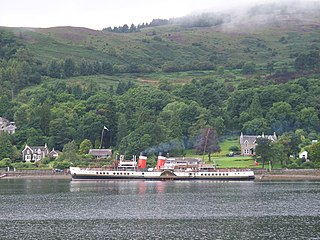
Tighnabruaich; is a village on the Cowal peninsula, on the western arm of the Kyles of Bute in Argyll and Bute, Scotland. In 2011 the population was 660. It is west of Glasgow and north of the Isle of Arran.

The A131 road is a road in Essex, England.

List of A roads in zone 5 in Great Britain starting north/east of the A5, west of the A6, south of the Solway Firth/Eden Estuary.

List of A roads in the zone 7 in Great Britain starting north of the Solway Firth/Eden Estuary, west of the A7 and south of the A8. Data from Openstreetmap.

The N60 road is a national secondary road in Ireland, linking Castlebar, County Mayo to Roscommon town via Claremorris, Ballyhaunis and Castlerea. The busiest section of the N60 is between Castlebar and Claremorris, as this is one of the main links from County Mayo to the Irish motorway network at Tuam. This section of the route carries more than 7,000 vehicles daily.
B roads are numbered routes in Great Britain of lesser importance than A roads. See the article Great Britain road numbering scheme for the rationale behind the numbers allocated.

The R416 road, also called the Milltown Road or Athgarvan Road, is a regional road in Ireland, located in County Kildare.

The R408 road is a regional road in Ireland, located in County Kildare.

The R407 road is a regional road in Ireland, located in County Kildare.

The R166 road is a regional road in Ireland, located in County Louth.

The R211 road is a regional road in Ireland, located in County Louth, located north of Dunleer.

The R404 road is a regional road in Ireland, located in County Kildare.
The R405 road is a regional road in Ireland, located in County Dublin and County Kildare.

The R410 road, also called the Blessington Road, is a regional road in Ireland, located in County Wicklow and County Kildare.

The R429 road is a regional road in Ireland, located in County Laois and County Kildare.

The R167 road is a regional road in Ireland, located in County Louth.
The R180 road is a regional road in County Monaghan, Ireland.

The R769 road is a regional road in Ireland, located in County Wexford. It forms the pre-bypass route of the N25 into Wexford town.