
Rockport is a town in Knox County, Maine, United States. It is thirty-five miles southeast of Augusta. The population was 3,644 at the 2020 census. Rockport is a popular tourist destination and art colony.

Vinalhaven is a town on the larger of the two Fox Islands in Knox County, Maine, United States. Vinalhaven is also used to refer to the island itself. The population was 1,279 at the 2020 census. It is home to a thriving lobster fishery and hosts a summer colony. Since there is no bridge to the island, Vinalhaven is primarily accessible from Rockland via an approximately 75-minute state ferry ride across West Penobscot Bay, or by air taxi from Knox County Regional Airport.

Monhegan is an island in the Gulf of Maine. A plantation, a minor civil division in the state of Maine falling between unincorporated area and a town, it is located approximately 12 nautical miles (22 km) off the mainland and is part of Lincoln County, Maine, United States. The population was 64 at the 2020 census. The plantation comprises its namesake island and the uninhabited neighboring island of Manana. The island is accessible by scheduled boat service from Boothbay Harbor, New Harbor and Port Clyde. Visitors' cars are not allowed on the island. It was designated a United States National Natural Landmark for its coastal and island flora in 1966.

Lubec is a town in Washington County, Maine, United States. It is the easternmost municipality in the contiguous U.S. and is the country's closest continental location to Africa.

Camden is a resort town in Knox County, Maine, United States. The population was 5,232 at the 2020 census. The population of the town more than triples during the summer months, due to tourists and summer residents. Camden is a summer colony in the Mid-Coast region of Maine. Similar to Bar Harbor, Nantucket and North Haven, Camden is well known for its summer community of wealthy Northeasterners, mostly from Boston, New York City, and Philadelphia.

Bear Island is an 11-acre (4.5 ha) island located in Maine, United States. It is one of the five islands of the Town of Cranberry Isles. The island is located just off Northeast Harbor and south of Mount Desert Island.

Wood Island Light is an active lighthouse on the eastern edge of Wood Island in Saco Bay, on the southern coast of Maine. The light is just outside the entrance to Biddeford Pool and the end of the Saco River. The lighthouse is a 47-foot (14 m) conical white tower of granite rubble. The light itself sits 71 feet (22 m) above mean high water. Its automated beacon alternates between green and white every 10 seconds.

Bass Harbor is a village in Hancock County, Maine, United States. It is within the town of Tremont on Mount Desert Island, and near Acadia National Park. With its well-protected natural harbor, it ranks as one of the most lucrative lobster-producing ports in the state. Bass Harbor Head Lighthouse lies at the mouth of the harbor. The village is also the departure point for Maine State Ferry Service transport to Swans Island and Frenchboro.

Baker Island is an island located in Maine, United States. It marks the southwestern entrance to Frenchman Bay, about four miles (2.5 km) south of Mt. Desert Island. It is one of the five islands in the town of Cranberry Isles, Maine.
Port Clyde is the southernmost settlement on the St. George peninsula in central/coastal Maine and part of the town of St. George in Knox County, Maine, United States. The ZIP Code for Port Clyde is 04855.
Little Deer Isle is an island in Penobscot Bay, lying just north of the town of Deer Isle, Maine, United States, of which it is a part. The island is served by Maine State Route 15 via the Deer Isle Bridge. The northern end of the island is called Eggemoggin and there is a small island with a lighthouse on it at the tip called Pumpkin Island. Little Deer is approximately four miles (6.4 km) long and connects to Deer Isle by way of a causeway. There are only about 300 year-round residents of Little Deer, but many more summer residents. There is abundant wildlife on the island including deer, fox, squirrels, wild turkeys, ospreys, and bald eagles.
Alexandra Strait is a natural waterway in the Canadian territory of Nunavut. It separates King William Island to the east from Royal Geographical Society Island to the west. The strait, an arm of the Arctic Ocean, connects Victoria Strait to the north with Queen Maud Gulf to the south.
The Ducktrap River is a river in Waldo County, Maine. From the outflow in Tilden Pond in Belmont, the river runs 10.0 miles (16.1 km) southeast, through Camden Hills State Park, to West Penobscot Bay in Lincolnville.

The Megunticook River is a short river in Camden, Maine.
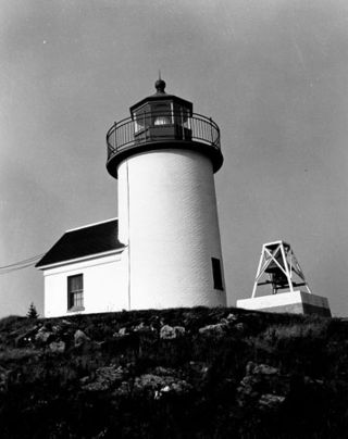
Curtis Island Light, originally Negro Island Light, is a lighthouse marking the approach to the harbor of Camden, Maine. It is located on Curtis Island, which shelters the harbor from ocean storms. It was first established in 1835, and the present structure was built in 1896. The light was automated in 1972, and listed on the National Register of Historic Places in 1973.
Whitehead Island is an island in St. George, Knox County, Maine, United States. Whitehead Light was built on the island in 1807. The island is approximately 70 acres (28 ha) in area and is known for "bleached, rugged granite shores". It is one of the foggiest places on the Maine coast, averaging 80 days of fog a year. Whitehead Lifesaving Station, a property on the National Register of Historic Places is also located on the island.

Popham Beach is a sandy beach in Maine that extends southwest about three miles from Fort Popham, at the mouth of the Kennebec River, toward the mouth of the Morse River. It is near the site of the short-lived Popham Colony, founded in 1607 and abandoned the following year. The beach and the surrounding area are considered part of the town of Phippsburg in Sagadahoc County.
The American Lighthouse Foundation (ALF) is a 501(c)(3) non-profit organization founded in 1994 with a primary mission of lighthouse preservation. ALF's main office and storefront are headquartered in Rockland, Maine, and the organization currently has thirteen chapters that have stewardship responsibility over the following twenty-two lighthouses in Connecticut, Maine, Massachusetts, New Hampshire, and Rhode Island:
