
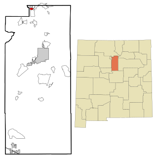
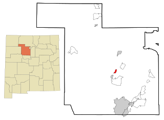
Santa Fe County is located in the U.S. state of New Mexico. As of the 2010 census, the population was 144,170, making it New Mexico's third-most populous county, after Bernalillo County and Doña Ana County. Its county seat is Santa Fe, the state capital.

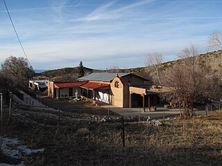
Agua Fria is a census-designated place (CDP) in Santa Fe County, New Mexico, United States. It is part of the Santa Fe, New Mexico Metropolitan Statistical Area. The population was 2,800 at the 2010 census. Agua Fria Village is a "Traditional Historic Community" (THC) as designated by the Santa Fe Board of County Commissioners in 1995 and subsequent Santa Fe County Ordinance #1996-16, as allowed by State Statute.

Cañada de los Alamos is a census-designated place (CDP) in Santa Fe County, New Mexico, United States. It is part of the Santa Fe, New Mexico Metropolitan Statistical Area. The population was 434 at the 2010 census.

Cedar Grove is a census-designated place (CDP) in Santa Fe County, New Mexico, United States. It is part of the Santa Fe, New Mexico Metropolitan Statistical Area. The population was 747 at the 2010 census.

Chupadero is a census-designated place (CDP) in Santa Fe County, New Mexico, United States. It is part of the Santa Fe, New Mexico Metropolitan Statistical Area. The population was 362 at the 2010 census.

Cuartelez is a census-designated place (CDP) in Santa Fe County, New Mexico, United States. It is part of the Santa Fe, New Mexico Metropolitan Statistical Area. The population was 469 at the 2010 census.

Cundiyo is a census-designated place (CDP) in Santa Fe County, New Mexico, United States. It is part of the Santa Fe, New Mexico Metropolitan Statistical Area. The population was 72 at the 2010 census. The name means round hill of the little bells in Tewa.

El Rancho is a census-designated place (CDP) in Santa Fe County, New Mexico, United States. It is part of the Santa Fe, New Mexico Metropolitan Statistical Area. The population was 1,199 at the 2010 census.

El Valle de Arroyo Seco is a census-designated place (CDP) in Santa Fe County, New Mexico, United States. It is part of the Santa Fe, New Mexico Metropolitan Statistical Area. The population was 1,440 at the 2010 census.

Galisteo is a census-designated place (CDP) in Santa Fe County, New Mexico, United States. It is part of the Santa Fe, New Mexico Metropolitan Statistical Area. The population was 253 at the 2010 census.

Jaconita is a census-designated place (CDP) in Santa Fe County, New Mexico, United States. It is part of the Santa Fe, New Mexico Metropolitan Statistical Area. The population was 332 at the 2010 census. It is considered to be a part of the Pojoaque Valley.

La Cienega is a census-designated place (CDP) in Santa Fe County, New Mexico, United States. It is part of the Santa Fe, New Mexico, metropolitan statistical area. The population was 3,007 at the 2000 census.

La Puebla is a census-designated place (CDP) in Santa Fe County, New Mexico, United States. It is part of the Santa Fe, New Mexico Metropolitan Statistical Area. The population was 1,296 at the 2000 census.

Los Cerrillos is a census-designated place (CDP) in Santa Fe County, New Mexico, United States. It is part of the Santa Fe, New Mexico Metropolitan Statistical Area. The population was 229 at the 2000 census. Accessible from State Highway 14 or The Turquoise Trail, Cerrillos is on the road from Santa Fe to Albuquerque, closer to Santa Fe. There are several shops and galleries, a post office, and the Cerrillos Hills State Park, which has five miles of hiking trails. The Cerrillos Turquoise Mining Museum contains hundreds of artifacts from the American Old West and the Cerrillos Mining District. It also displays cardboard cutouts of characters from the film Young Guns and information on other movies which have been filmed in and around Cerrillos.

Pojoaque, Po’su wae geh, which translates to “water gathering place”, is a census-designated place (CDP) in Santa Fe County, New Mexico, United States. It is part of the Santa Fe, New Mexico Metropolitan Statistical Area. The population was 1,907 at the 2010 census. Pojoaque Pueblo, a neighboring community, is an Indian reservation, and the town of Pojoaque is a collection of communities near the pueblo with people from various ethnic backgrounds. The area of Pojoaque includes the neighborhoods of Cuyamungue, Jacona, Jaconita, Nambé and El Rancho.
Rio en Medio is a census-designated place (CDP) in Santa Fe County, New Mexico, United States. It is part of the Santa Fe, New Mexico Metropolitan Statistical Area. The population was 131 at the 2000 census.

Santa Cruz is a census-designated place (CDP) in Santa Fe County, New Mexico, United States. It is part of the Santa Fe, New Mexico Metropolitan Statistical Area. The population was 423 at the 2000 census.
Sombrillo is a census-designated place (CDP) in Santa Fe County, New Mexico, United States. It is part of the Santa Fe, New Mexico Metropolitan Statistical Area. The population was 493 at the 2000 census.

Tesuque is a census-designated place (CDP) in Santa Fe County, New Mexico, United States. It is part of the Santa Fe, New Mexico, Metropolitan Statistical Area. The population was 909 at the 2000 census. The area is separate from but located near Tesuque Pueblo, a member of the Eight Northern Pueblos, and the Pueblo people are from the Tewa ethnic group of Native Americans who speak the Tewa language. The pueblo was listed as a historic district on the National Register of Historic Places in 1973.
Jemez Pueblo is a census-designated place (CDP) in Sandoval County, New Mexico, United States. The population was 1,788 at the 2010 census. It is part of the Albuquerque Metropolitan Statistical Area.


