Chesterfield Charter Township is a charter township of Macomb County in the U.S. state of Michigan. As of the 2020 census the population was 45,376.

San Ildefonso Pueblo is a census-designated place (CDP) in Santa Fe County, New Mexico, United States, and a federally recognized tribe, established c. 1300 C.E. The Pueblo is self-governing and is part of the Santa Fe, New Mexico Metropolitan Statistical Area. The population was 524 as of the 2010 census, reported by the State of New Mexico as 1,524 in 2012, and there were 628 enrolled tribal members reported as of 2012 according to the Department of the Interior. San Ildefonso Pueblo is a member of the Eight Northern Pueblos, and the pueblo people are from the Tewa ethnic group of Native Americans, who speak the Tewa language.

Santa Fe Baldy is a prominent summit in the Sangre de Cristo Mountains of New Mexico, United States, located 15 mi (24 km) northeast of Santa Fe. There are no higher mountains in New Mexico south of Santa Fe Baldy. It is prominent as seen from Los Alamos and communities along the Rio Grande in northern New Mexico, but is relatively inconspicuous from Santa Fe, as its north-south trending main ridge line is seen nearly end-on, disguising the size of the mountain. Tree line in the Sangre de Cristos is unusually high and only the top 600 to 800 feet of the mountain is perpetually free of trees, but several severe forest fires have created bare spots extending to lower elevations. An extensive region of aspen trees on its flanks produces spectacular orange-yellow coloration during the fall that is the subject of many photographic studies.
Tres Alamos is a ghost town in Cochise County in the U.S. state of Arizona. The town was settled in 1874 in what was then the Arizona Territory.

Somis is an unincorporated community in Ventura County, California. It was established in 1892 by Thomas Bard and D.T. Perkins on a portion of the Rancho Las Posas Mexican land grant. Somis is in the Las Posas Valley on the south bank of Fox Barranca, just west of Arroyo Las Posas. For statistical purposes, the United States Census Bureau has defined Somis as a census-designated place (CDP).

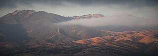
The Gabilan Range or Gabilán Range are a mountain range in the inner California Coast Ranges System, located in Monterey County and San Benito County of central California. Pinnacles National Park is located in the southern section of the range.

Ohkay Owingeh, known by its Spanish name as San Juan Pueblo from 1589 to 2005, is a pueblo and census-designated place (CDP) in Rio Arriba County, New Mexico. Ohkay Owingeh is also a federally recognized tribe of Pueblo people inhabiting the town.
Alpine, more fully Alpine Springs and also called Harold, was an unincorporated community in Los Angeles County, California located 2 miles south of where Palmdale is now.

Los Alamos is a census-designated place in Los Alamos County, New Mexico, United States, that is recognized as one of the development and creation places of the atomic bomb—the primary objective of the Manhattan Project by Los Alamos National Laboratory during World War II. The town is located on four mesas of the Pajarito Plateau, and had a population of about 19,200 as of 2022. It is the county seat and one of two population centers in the county known as census-designated places (CDPs); the other is White Rock.
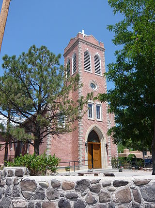
El Rito,, is an unincorporated community in Rio Arriba County, New Mexico, United States. Its elevation is 6,875 feet (2,096 m).
Dwyer is an unincorporated community in Grant County, New Mexico, United States. It is located southeast of Silver City, along the Mimbres River, and on NM 61.

San Fidel is a census-designated place in Cibola County, New Mexico, United States. Its population was 138 as of the 2010 census. San Fidel has a post office with ZIP code 87049, which opened on December 24, 1910. New Mexico State Road 124, the original Route 66, also known as the "Old Road," passes through the community.
Riverside is a former village, now a suburb of Espanola, in Rio Arriba County, New Mexico, in the southwestern United States. It is located in north-central New Mexico, on the left bank of the Rio Grande across the river from Española proper. It is on NM Route 68 just north of U.S. Route 285 and just south of the former village of Santa Niño. To the southeast is the former village of San Pedro.
Los Ojos is a census-designated place (CDP) in Rio Arriba County, New Mexico, United States. Its population was 125 as of the 2010 census. Los Ojos has a post office with ZIP code 87551, which opened on February 7, 1877. The community is located near U.S. routes 64 and 84.
Rutheron is an unincorporated community located in Rio Arriba County, New Mexico, United States. Rutheron is located on New Mexico State Road 95, 2.8 miles (4.5 km) west-southwest of Los Ojos. Rutheron had its own post office from May 27, 1927, to March 1, 1997.
Buckman is a ghost town in Santa Fe County, New Mexico, United States of America, about 5 miles (8.0 km) south of San Ildefonso Pueblo, on the east bank of the Rio Grande in White Rock Canyon.
Jacona is an unincorporated community and census-designated place in Santa Fe County, New Mexico, United States. Its population was 412 as of the 2010 census.

Poindexter is an unincorporated community in Louisa County, Virginia, United States It is located at the 4-way intersection of minor Virginia State Routes 613 and 640. State Route 717 spurs off of State Route 613 nearby.


