Santa Fe County is located in the U.S. state of New Mexico. As of the 2020 census, the population was 154,823, making it New Mexico's third-most populous county, after Bernalillo County and Doña Ana County. Its county seat is Santa Fe, the state capital.

Rancho Santa Fe is a census-designated place (CDP) in San Diego County, California, United States, within the San Diego metropolitan area. The population was 3,156 at the 2020 census. The CDP is primarily residential with a few shopping blocks, a middle and elementary school, and several restaurants.

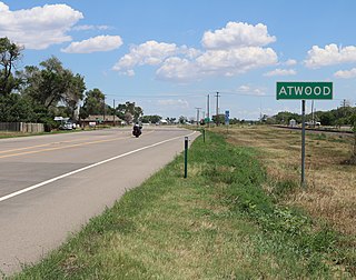
Atwood is an unincorporated town, a post office, and a census-designated place (CDP) located in and governed by Logan County, Colorado, United States. The CDP is a part of the Sterling, CO Micropolitan Statistical Area. The Atwood post office has the ZIP Code 80722. At the United States Census 2020, the population of the Atwood CDP was 138.

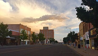
Clovis is a city in and the county seat of Curry County, New Mexico. The city had a population of 37,775 as of the 2010 census, and a 2020 census population of 38,567. Clovis is located in the New Mexico portion of the Llano Estacado, in the eastern part of the state.

Cedar Grove is a census-designated place (CDP) in Santa Fe County, New Mexico, United States. It is part of the Santa Fe, New Mexico Metropolitan Statistical Area. The population was 747 at the 2010 census. Cedar Grove was formerly a stage and freight stop. It has developed into a Santa Fe suburb. New Mexico "cedars" are abundant in the town.

Edgewood is a town in Santa Fe County, New Mexico, United States. Through annexations, its town boundaries now extend into Bernalillo and Sandoval counties. It is part of the Albuquerque–Santa Fe–Las Vegas combined statistical area.

Santa Cruz, historically known as Santa Cruz de la Cañada, is a census-designated place (CDP) in Santa Fe County, New Mexico, United States. It is part of the Santa Fe, New Mexico Metropolitan Statistical Area. The population was 423 at the 2000 census.

Moriarty is a city in Torrance County, New Mexico, United States. The population was 1,946 at the 2020 Census. It is part of the Albuquerque Metropolitan Statistical Area.

Kingsville is a city in the southern region of the U.S. state of Texas and the county seat of Kleberg County. Located on the U.S. Route 77 corridor between Corpus Christi and Harlingen, Kingsville is the principal city of the Kingsville Micropolitan Statistical Area, which is part of the larger Corpus Christi-Kingsville Combined Statistical Area. The population was 25,402 at the 2020 census, and in 2022 the U.S. Census Bureau estimated the population at 24,833.

Liberty is a city in the U.S. state of Texas, within Liberty County. The population was 8,279 at the 2020 census. It serves as the seat of Liberty County.
Villanueva is an unincorporated community and census-designated place in San Miguel County, New Mexico, United States. Known as La Cuesta until 1890, it is located along the Pecos River and New Mexico State Road 3. Villanueva has the ZIP code 87583. The 87583 ZIP Code Tabulation Area had a population of 234 in the 2010 United States census, compared to 267 in 2000. A total of 211 residents of Villanueva in 2010 identified themselves as Hispanic.

Gary Kenneth King is an American lawyer, politician, and energy consultant who served as the 30th attorney general of New Mexico from January 1, 2007, to January 1, 2015. King previously served as an advisor in the United States Department of Energy, a member of the New Mexico House of Representatives, and the Democratic nominee for New Mexico governor in the 2014 election.

Santa Fe is the capital of the U.S. state of New Mexico. With a population of 87,505 at the 2020 census, it is the fourth-most populous city in the state. It is also the county seat of Santa Fe County. Its metropolitan area is part of the Albuquerque–Santa Fe–Las Vegas combined statistical area, which had a population of 1,162,523 in 2020. Human settlement dates back thousands of years in the region. The city was founded in 1610 as the capital of Nuevo México, replacing previous capitals at San Juan de los Caballeros and San Gabriel de Yunque; this makes it the oldest state capital in the United States.
Santa Fe Public Schools (SFPS) is a school district based in Santa Fe, New Mexico. Santa Fe Public Schools serves the city of Santa Fe, the communities of Tesuque and Eldorado, and the historic neighborhood of Agua Fria, and other communities with a total area of 1,016 square miles (2,630 km2). The school district has a total of 31 schools: three high schools, three combined high/middle schools, three middle schools, and 21 elementary schools.
Anton Chico, or Anton Chico Abajo or Anton Chico de Abajo, is a census-designated place in Guadalupe County, New Mexico, United States. Its population was 188 as of the 2010 census, of which 167 were Hispanic in origin. Anton Chico has a post office with ZIP code 87711. New Mexico State Road 386 passes through the community. Anton Chico is listed in the National Register of Historic Places.
San Pedro is an unincorporated community and census-designated place in Santa Fe County, New Mexico, United States. Its population was 184 as of the 2010 census. New Mexico State Road 344 passes through the community.
Tesuque Pueblo is an unincorporated community and census-designated place in Santa Fe County, New Mexico, United States. Its population was 233 as of the 2010 census.
Barton is a census-designated place (CDP) in Bernalillo and Santa Fe counties, New Mexico, United States. It was first listed as a CDP prior to the 2020 census.
Thunder Mountain is an unincorporated community and census-designated place (CDP) in Santa Fe County, New Mexico, United States. It was first listed as a CDP prior to the 2020 census.
Moriarty-Edgewood School District (MESD), also known as Moriarty Municipal Schools, is a school district headquartered in unincorporated Torrance County, New Mexico, near Moriarty.


