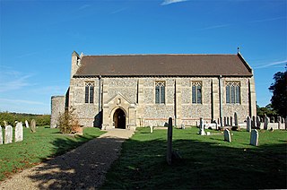
Dilham is a village and civil parish in the English county of Norfolk. The village is located 4.3 miles south-east of North Walsham and 12 miles north-east of Norwich, and is situated on the River Ant.

Denver is a village and civil parish in the English county of Norfolk. The village is situated on the River Great Ouse, approximately 1 mile (1.6 km) south of the small town of Downham Market, 14 miles (23 km) south of the larger town of King's Lynn, and 37 miles (60 km) west of the city of Norwich.

Bradwell is a village and civil parish in the English county of Norfolk. The village is immediately to the west of, and largely indistinguishable from, the built-up urban area of the town of Great Yarmouth.

Cringleford is a civil parish and village in the English county of Norfolk. The village sits on the River Yare and forms part of the outskirts of Norwich.
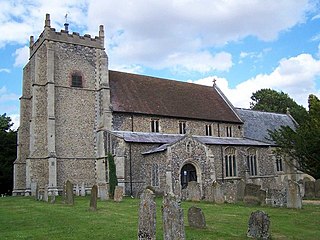
Carleton Rode is a village and civil parish in Norfolk, England. It is situated approximately five miles south-east of Attleborough. In the 2011 Census, Carleton Rode was recorded as having a population of 785 people in 324 households.

Booton is a village and civil parish in the Broadland district of Norfolk, England, just east of Reepham and seven miles west of Aylsham. According to the 2001 census, it had a population of 100, including Brandiston and increasing to 196 at the 2011 Census.

Brooke is a village and civil parish in the South Norfolk district of Norfolk, England, about 7 miles south of Norwich and roughly equidistant from Norwich and Bungay.
Broome is a village and civil parish in the English county of Norfolk. It is situated on the north bank of the River Waveney, which forms the border with Suffolk, some 2 km north of the town of Bungay and 20 km south-east of the city of Norwich.

Castle Rising is a village and civil parish in the English county of Norfolk. The village is situated some 8 kilometres (5 mi) north-east of the town of King's Lynn and 60 kilometres (37 mi) west of the city of Norwich. The River Babingley skirts the north of the village separating Castle Rising from the site of the lost village of Babingley.

Clenchwarton is a village, civil parish and electoral ward in the English county of Norfolk. It is located about 1+1⁄4 miles (2 km) west of the River Great Ouse, about 2+1⁄4 miles (4 km) from the town of King's Lynn on the east side of the river.

Croxton is a village and civil parish in the English county of Norfolk, within the district of Breckland. Croxton is located 2.2 miles north of Thetford and 26 miles south-east of Norwich.
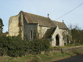
Cockley Cley is a village and civil parish in the English county of Norfolk. The village covers an area of 17.94 km2 (6.93 sq mi) and falls within the district of Breckland.

Briston is a village, civil parish and electoral ward in the English county of Norfolk that contains the hamlet of Briston Common. The village is 11 miles (18 km) east north east of the town of Fakenham, 13.3 miles (21.4 km) west south west of Cromer, 20.3 miles (32.7 km) north north west of the city of Norwich, and 125 miles (201 km) north north east of London. The village is situated on the route of the B1354 that runs between the A148 at Thursford and the B1149 at Saxthorpe.

Catfield is a village and civil parish in the English county of Norfolk. The village is 19.7 miles (31.7 km) south-east of Cromer, 17.3 miles (27.8 km) north-east of Norwich and 136 miles (219 km) north-east of London. The village lies 2.7 miles (4.3 km) south-south-east of the nearby town of Stalham.
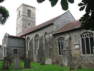
Colby is a village and a civil parish in the English county of Norfolk. The village is 8.6 miles (13.8 km) south of Cromer, 16.8 miles (27.0 km) north-north-west of Norwich, 5.2 miles (8.4 km) west-north-west of North Walsham and 131 miles (211 km) north-east of London.
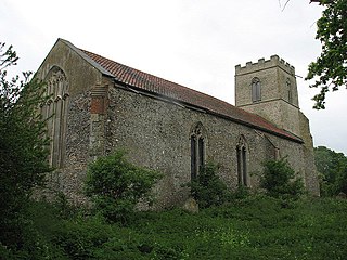
Corpusty is a village and former civil parish, now in the parish of Corpusty and Saxthorpe, in the North Norfolk district, in the county of Norfolk, England, situated on the River Bure. Corpusty is about sixteen miles from Norwich and six miles (10 km) from Holt.

Caston is a village and civil parish in the English of Norfolk.

Earsham is a village and civil parish in the English county of Norfolk. Earsham is located 1.7 kilometres (1.1 mi) west of its postal town of Bungay and 21 kilometres (13 mi) south-east of Norwich. The village is located close to the border between Norfolk and Suffolk, and the River Waveney.

East Rudham is a village and civil parish in the English county of Norfolk. The village is located 14 miles (23 km) north-east of King's Lynn and 28 miles (45 km) north-west of Norwich.
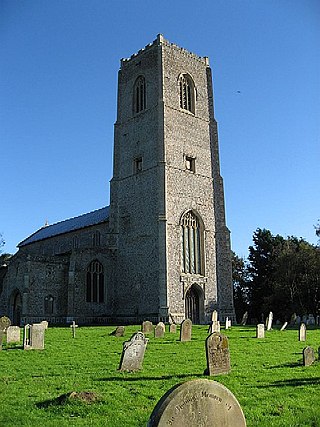
Carbrooke is a village and civil parish in the Breckland district of Norfolk, England. It is 3 miles (4.8 km) from the centre of Watton and 17 miles (27 km) from Thetford. In the 2011 Census, Carbrooke had a population of 2,073 people in 835 households.


