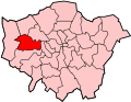
Dormers Wells

Last updated

Dormers Wells
Houses on Allenby Road, Dormer's Wells - geograph.org.uk - 22995.jpg
Houses in Allenby Road, Dormer's Wells
Dormers Wells High School - geograph.org.uk - 1239575.jpg
Dormers Wells High School
Greater London UK location map 2.svg
Red pog.svg
Dormers Wells
Location within Greater London
Population13,910 (2011 Census.Ward) [1]
OS grid reference TQ 136 809
London borough
Ceremonial county Greater London
Region
Country England
Sovereign state United Kingdom
Post town SOUTHALL
Postcode district UB1
Dialling code 020
Police Metropolitan
Fire London
Ambulance London
UK Parliament
London Assembly
List of places
UK
England
London
51°30′58″N0°21′50″W / 51.516°N 0.364°W / 51.516; -0.364

Dormers Wells or Dormer's Wells is an urban community or neighbourhood in west London, England consisting of a grid of mostly semi-detached or terraced houses with gardens and small parks: in the London Borough of Ealing, and the Southall post town area.

Contents

History

Map of Middlesex Sheet 015, Ordnance Survey, 1868-1883.jpg
Extract from Map, Ordnance Survey, 1868-1883. Fields surrounding Mount Pleasant (house) and Dormer's Well Farmhouse form the modern area.

Until urban/suburban development in the mid 20th century this area formed a small, east part of the precinct of Norwood a relatively rare half subdivision of the large parish of Hayesh Hayes measured 5,772 acres (23.4 km2) 9 mi2 (3 miles by 3 miles). Southall and Norwood manors in much of the medieval period belonged to the Archbishop of Canterbury hence giving the Norwood quasi-chapelry virtually all a mixed agricultural area which covered today's Dormer's Wells, Norwood Green and Southall the higher, less alienable status of a precinct. The 12th century founded, much-altered chapel is St Mary's Church, Norwood Green.

St John's Church, Southall was built and endowed in 1838; consecrated in three years and made a parish in 1850. Nine years later Norwood precinct was created a parish separate from that of Hayes. [2] Further Anglican churches followed: Holy Trinity, St George, Christ the Redeemer and Emmanuel none are named after this area. [2] [3] [4]

In 1800 the precinct's overshot flour mill on the edge of the fields associated with "Dorman's Well Farm" belonged to the Hayes manorial estate, the main manor in the parish. At that date it stood, together with a house and other property, at Dorman's Well. The overshot mill, comprising a mill, house, millpond, and land, was owned by the Earl of Jersey in 1821 (Villiers family seated at nearby Osterley Park) and in the 1860s stood, as before, on Windmill Lane at Dorman's Well. [5]

It is possible that the Dorman's Well estate (an earlier recorded form of Dormer's Well farm) formed the demesne (Lord of the Manor's own grounds) of Southall manor in the late 16th century. [5]

In the late 20th century migration into the area included part of London's Sikh community, who established a large community building and venue for public hire, the Baba Wadbhag Singh Trust building.

Amenities

The area has a large secondary school, Dormers Wells High School which has widened the area's informal scope as it has no traditional clear definition but is commonly a feature of local government ward names; a primary school, a playcentre, nursery, a community centre and an old people's home.

Subsumed estates

Almost uniform housing plots and buildings, mainly semi-detached built in the 1930s to 1970s, has taken over former farms and large demolished houses. From these three of Dormer's Wells' residential estates take their first-advertised and official name, which remain used by some residents: Mount Pleasant, Telford and Allenby. Mount Pleasant as an isolated cluster of houses on a road junction similar to Dormer's Well Farm features in official 19th century maps of the area. [6]

Related Research Articles

<span class="mw-page-title-main">Hanwell</span> Human settlement in England

Hanwell is a town in the London Borough of Ealing. It is about 1.5 miles (2.4 km) west of Ealing Broadway and had a population of 28,768 as of 2011. It is the westernmost location of the London post town.

<span class="mw-page-title-main">Harmondsworth</span> Human settlement in England

Harmondsworth is a village in the London Borough of Hillingdon in the county of Greater London with a short border to the south onto London Heathrow Airport and close to the Berkshire county border. The village has no railway stations, but adjoins the M4 motorway and the A4 road. Harmondsworth was in the historic county of Middlesex until 1965. It is an ancient parish that once included the large hamlets of Heathrow, Longford and Sipson. Longford and Sipson have modern signposts and facilities as separate villages, remaining to a degree interdependent such as for schooling. The Great Barn and parish church are medieval buildings in the village. The largest proportion of land in commercial use is related to air transport and hospitality. The village includes public parkland with footpaths and abuts the River Colne and biodiverse land in its Regional Park to the west, once the grazing meadows and woodlands used for hogs of Colnbrook.

<span class="mw-page-title-main">Sipson</span> Human settlement in England

Sipson is a village in the London Borough of Hillingdon, the westernmost borough of Greater London, England. It is 14.3 miles (23 km) west of Charing Cross and near the north perimeter of London Heathrow Airport.

<span class="mw-page-title-main">Southall</span> Area of London Borough of Ealing, England

Southall is a large suburban town in West London, England, part of the London Borough of Ealing and is one of its seven major towns.

<span class="mw-page-title-main">Ealing</span> District in West London, United Kingdom

Ealing is a district in West London, England, 7.5 miles (12.1 km) west of Charing Cross in the London Borough of Ealing. It is the administrative centre of the borough and is identified as a major metropolitan centre in the London Plan.

<span class="mw-page-title-main">Longford, London</span> Human settlement in England

Longford is a suburban village in the London borough of Hillingdon, England. It is immediately northwest of London Heathrow Airport, which is in the same borough. It is the westernmost settlement in Greater London, very close to the borders of both Berkshire and Surrey.

<span class="mw-page-title-main">Bedfont</span> Human settlement in England

Bedfont is a suburb in the London Borough of Hounslow, approximately 15 miles (24 km) west of Charing Cross. Originally a distinct village, Bedfont has a large central conservation area around Bedfont Green. The majority of the housing was built at a time of an emerging economy of aviation and distribution-related businesses. The area was formerly part of the Staines Rural District and was one of the formerly agricultural areas chosen for significant low-rise social housing, planned and built in the mid 20th century.

<span class="mw-page-title-main">Norwood Green</span> Human settlement in England

Norwood Green is a place in the London Borough of Ealing in London, England, that forms the southern part of Southall. It is a suburban development centred 10.7 miles (17.2 km) west of Charing Cross and 4 miles (6.4 km) ENE of Heathrow Airport.

<span class="mw-page-title-main">Municipal Borough of Uxbridge</span>

Uxbridge was a local government district in north west Middlesex, England, from 1849 to 1965, seated in the town of Uxbridge.

<span class="mw-page-title-main">Elthorne Hundred</span>

Elthorne was a hundred of the historic county of Middlesex, England.

<span class="mw-page-title-main">Chapelry</span>

A chapelry was a subdivision of an ecclesiastical parish in England and parts of Lowland Scotland up to the mid 19th century.

<span class="mw-page-title-main">Mellow Lane School</span> Comprehensive school in Hayes, Greater London, England

Mellow Lane School was a comprehensive school, located in Hayes, in the London Borough of Hillingdon, Middlesex. It closed in 2011 and reopened in August of that year, as Hewens College.

<span class="mw-page-title-main">St Mary with St Richard, Northolt</span> Church

St Mary the Virgin is a 13th-century Anglican parish church in Northolt, London Borough of Ealing. It is on a slope shared with Belvue Park, the site of a 15th-century manor house — both overlooked the old village of Northolt. It is one of London's smallest churches, its nave measuring 15 yards (14 m) by 8 yards (7.3 m). The church was built around 1290 and was expanded over the centuries, with the chancel being added in 1521, the spired bell tower in the 16th century, and a gallery at the west end of the church in 1703. Twin buttresses were erected against the west wall around 1718 to alleviate concerns that the church could slip down the hill. The internal beams are original and the bells date from the 17th century. The church was constructed from a variety of materials; the nave incorporates clunch, flint and ironstone, and the mouldings of the doors and windows are made from Reigate Stone.

John Pritchett was an English churchman, bishop of Gloucester from 1672.

<span class="mw-page-title-main">Brentford railway station (1860–1942)</span> Former railway station in London, England

Brentford railway station opened on 1 May 1860 on the Brentford Branch Line which had opened in 1859 from Southall to Brentford Dock. It stood immediately north of Brentford High Street on the embankment leading to the viaduct into the dock. The station closed on 22 March 1915 as a wartime economy measure, re-opened on 12 April 1920 and closed permanently on 4 May 1942. The station was demolished in 1957.

Alec Reed Academy is a mixed all-through school and sixth form located in the Northolt area of the London Borough of Ealing, England. The school operates nursery, primary, secondary and sixth form departments for pupils aged 3 to 19.

<span class="mw-page-title-main">Northolt Manor</span>

Northolt Manor is a 1.8 hectare scheduled monument, local nature reserve and Site of Borough Importance for Nature Conservation, Grade II, in Northolt in the London Borough of Ealing. It is owned and managed by Ealing Council.

<span class="mw-page-title-main">Benjamin Lethieullier</span> British politician

Benjamin Lethieullier (1729-1797), was a British politician who sat in the House of Commons between 1768 and 1797.

<span class="mw-page-title-main">Southall Town Hall</span> Municipal building in London, England

Southall Town Hall is a municipal building in High Street, Southall, London. It has been designated a local heritage asset.

References

  1. "Ealing Ward population 2011". Neighbourhood Statistics. Office for National Statistics. Retrieved 21 October 2016.
  2. 1 2 Diane K Bolton, H P F King, Gillian Wyld and D C Yaxley, 'Norwood, including Southall: Churches', in A History of the County of Middlesex: Volume 4, ed. T F T Baker, J S Cockburn and R B Pugh (London, 1971), pp. 50-52. British History Online http://www.british-history.ac.uk/vch/middx/vol4/pp50-52.
  3. http://www.achurchnearyou.com/church/15712/ Church of Christ The Redeemer, The Church of England; Anglican parish for north of this area
  4. http://www.achurchnearyou.com/church/15713/ Emmanual Church Anglican parish for north of this area
  5. 1 2 Diane K Bolton, H P F King, Gillian Wyld and D C Yaxley, 'Norwood, including Southall: Economic and social history', in A History of the County of Middlesex: Volume 4, ed. T F T Baker, J S Cockburn and R B Pugh (London, 1971), pp. 45-48. British History Online http://www.british-history.ac.uk/vch/middx/vol4/pp45-48.
  6. "Map of Middlesex | British History Online".