Northfields, London

Last updated

Northfields
Northfields Avenue, London, W13 - geograph.org.uk - 58943.jpg
Northfield Avenue
Greater London UK location map 2.svg
Red pog.svg
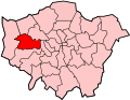
Northfields
Location within Greater London
OS grid reference TQ153802
London borough
Ceremonial county Greater London
Region
Country England
Sovereign state United Kingdom
Post town LONDON
Postcode district W13, W5
Dialling code 020
Police Metropolitan
Fire London
Ambulance London
UK Parliament
London Assembly
List of places
UK
England
London
51°30′00″N0°18′54″W / 51.500°N 0.315°W / 51.500; -0.315

Northfields is an area in Ealing, west London. It is centred on Northfield Avenue, a shopping street of mostly independent shops and restaurants. It lies partially in the Ealing W5 and partially in west Ealing's W13 postcode. It lies in the southwest corner of Ealing.

Contents

From the 14th century this area was part of the manor of Coldhall, or West Ealing. Great and Little Northfields were two large fields in the late Middle Ages, lying in the extreme west of Ealing parish. By the mid-17th century, Northfields Road as it was first called, was constructed to connect Little Ealing (next to South Ealing) to the road to Uxbridge (the current Uxbridge Road running from Shepherds Bush to Uxbridge). Yet the area remained rural, covered in apple orchards into the late nineteenth century.

Today the area is served by the Piccadilly line from Northfields tube station designed by architect Charles Holden and by the E2 and E3 bus services running to Greenford, Ealing, Brentford, Hanwell, Acton and Chiswick, and the N11, a night bus to Central London. Northfields is a middle-class area, with high levels of education, employment and home ownership. [1] It is home to three local authority primary schools, Little Ealing Primary School, Fielding Primary School and Mount Carmel Catholic Primary School.

Northfield Avenue has an annual street festival organised by the local trade association, NABA (Northfield Avenue Business Association). The first festival was held in summer 2007.

History

The Plough Inn which marks the junction of Little Ealing Lane and Northfield Avenue was in existence by 1722. [2] Maps of Ealing from 1890 and before show Northfields as almost entirely rural, with just a few houses along Little Ealing Lane. [3] The rest of the area was largely orchards. The arrival of the District Railway in 1883, and the opening of the Northfields Halt in 1908, prompted development of the area.

Notable residents

The acrobat and tightrope walker Charles Blondin was best known for his crossing of Niagara Falls on a tightrope. Blondin retired to live in Northfields from 1886 until his death in 1897 in a house on the site of what is now Niagara House, opposite The Plough pub on Northfield Avenue. [4] Blondin Avenue, Blondin Park and Niagara Avenue are named after him; they were formerly the site of part of Hugh Ronalds' renowned nursery. [5]

Between 1815 and 1817 John Quincy Adams, later to become the 6th President of the United States lived with his family at Little Boston House in Windmill Road in Little Ealing in Northfields. [6]

The pop singer Dusty Springfield was a pupil at St Anne's Convent School on Little Ealing Lane in the 1950s. [7]

The BBC Weather presenter Tomasz Schafernaker lives in this area.

Notable buildings

Former ODEON cinema, now Ealing Christian Centre Odeon Ealing, Northfields, W5 (8515308163).jpg
Former ODEON cinema, now Ealing Christian Centre

A former cinema on Northfield Avenue is the area's only Grade 2* listed building. Built in 1932 in an unusual Spanish style, it closed in 1987 and was converted into the Ealing Christian Centre in 1994.

Other Grade 2 listed buildings in Northfields are: [8]

Related Research Articles

<span class="mw-page-title-main">Acton, London</span> Town in Greater London, England

Acton is a town and area in west London, England, within the London Borough of Ealing. It is 6.1 miles (10 km) west of Charing Cross.

<span class="mw-page-title-main">Brentford</span> Suburb of West London

Brentford is a suburban town in West London, England and part of the London Borough of Hounslow. It lies at the confluence of the River Brent and the Thames, 8 miles (13 km) west of Charing Cross.

<span class="mw-page-title-main">Cowley, London</span> Suburban village in the United Kingdom

Cowley is a village contiguous with the town of Uxbridge in the London Borough of Hillingdon. A largely suburban village with 16 listed buildings, Cowley is 15.4 miles (24.8 km) west of Charing Cross, bordered to the west by Uxbridge Moor in the Green Belt and the River Colne, forming the border with Buckinghamshire. Cowley was an ancient parish in the historic county of Middlesex.

<span class="mw-page-title-main">London Borough of Hounslow</span> London borough in United Kingdom

The London Borough of Hounslow is a London borough in West London, England, forming part of Outer London. It was created in 1965 when three smaller borough councils amalgamated under the London Government Act 1963. It is governed by Hounslow London Borough Council.

<span class="mw-page-title-main">Hanwell</span> Human settlement in England

Hanwell is a town in the London Borough of Ealing. It is about 1.5 miles (2.4 km) west of Ealing Broadway and had a population of 28,768 as of 2011. It is the westernmost location of the London post town.

<span class="mw-page-title-main">Perivale</span> Town in West London, England

Perivale is an area of Greater London, 9.5 miles (15.3 km) west of Charing Cross. It is the smallest of the seven towns which make up the London Borough of Ealing.

<span class="mw-page-title-main">Ealing</span> District in West London, United Kingdom

Ealing is a district in West London, England, 7.5 miles (12.1 km) west of Charing Cross in the London Borough of Ealing. It is the administrative centre of the borough and is identified as a major metropolitan centre in the London Plan.

<span class="mw-page-title-main">Shepherd's Bush</span> Suburb of West London, England

Shepherd's Bush is a suburb of West London, England, within the London Borough of Hammersmith and Fulham 4.9 miles (7.9 km) west of Charing Cross, and identified as a major metropolitan centre in the London Plan.

<span class="mw-page-title-main">West Ealing</span> Human settlement in England

West Ealing is a district in the London Borough of Ealing, in West London. The district is about three-quarters of a mile (1.2 km) west of Ealing Broadway. Although there is a long history of settlement in the area, West Ealing in its present form is less than one hundred years old. West Ealing falls under the postcode district W13 and neighbours Hanwell, Ealing, Perivale and Northfields

<span class="mw-page-title-main">Charles Blondin</span> French tightrope walker (1824–1897)

Charles Blondin was a French tightrope walker and acrobat. He toured the United States and was known for crossing the 1,100 ft (340 m) Niagara Gorge on a tightrope.

<span class="mw-page-title-main">Norwood Green</span> Human settlement in England

Norwood Green is a place in the London Borough of Ealing in London, England, that forms the southern part of Southall. It is a suburban development centred 10.7 miles (17.2 km) west of Charing Cross and 4 miles (6.4 km) ENE of Heathrow Airport.

<span class="mw-page-title-main">Parks and open spaces in the London Borough of Ealing</span>

The London Borough of Ealing, one of the outer London boroughs although not on the periphery, has over 100 parks and open spaces within its boundaries. These include allotments, cemeteries, playgrounds, and golf courses in addition to the larger open spaces such as nature conservation areas.

<span class="mw-page-title-main">Uxbridge Road</span> Road in west London

Uxbridge Road is the name of the A4020 road in West London. The 12-mile (19 km) route starts at Shepherd's Bush Green and goes west towards Uxbridge. It passes through Acton, Ealing, Hanwell, Southall, Hayes, and Hillingdon.

<span class="mw-page-title-main">Pitshanger</span> Human settlement in England

Pitshanger is a small but busy local suburb, centred on the shops in Pitshanger Lane, located about 1 mile north of Ealing Broadway in west London. First mentioned in 1493, possibly meaning an area of sloped woodland frequented by birds. It contains numerous small independent shops, several cafes, two pubs, two churches, a school, and a park, and is often taken to also include parts of the nearby Brentham Garden Suburb.

Charles Jones was Ealing's first architect, engineer and surveyor. He held these posts for fifty years, and is known for his work on civic buildings.

<span class="mw-page-title-main">Nowell Parr</span>

Thomas Henry Nowell Parr FRIBA was a British architect, best known for designing pubs in west London. Many of these were built while Parr was "house architect" for Fuller's Brewery. Parr designed various buildings in Brentford while he was surveyor and then architect to the Council from 1894 to 1907.

<span class="mw-page-title-main">Blondin Park</span>

Blondin Park is an 8.5-hectare (21-acre) public park in Northfields in the London Borough of Ealing. It has allotments area and sports pitches. It is owned by Ealing Council and managed by the Council together with the Friends of Blondin Park. An area of 2.3 ha in the south-west corner is a Local Nature Reserve, and the nature area and allotments are a Site of Local Importance for Nature Conservation.

Hugh Ronalds was an esteemed nurseryman and horticulturalist in Brentford, who published Pyrus Malus Brentfordiensis: or, a Concise Description of Selected Apples (1831). His plants were some of the first European species to be shipped to Australia when the British colony was founded.

<span class="mw-page-title-main">Ealing Fields High School</span> Academy in Ealing, Greater London, England

Ealing Fields High School is a coeducational secondary school, located in the London Borough of Ealing, England. The school site is on a Grade II listed building with a set of new teaching buildings. It was opened as a Free school in 2016 and joined the Twyford CofE Academies Trust in 2017. Ealing Fields is currently rated 'Good' by Ofsted, with Outstanding features.

References

  1. Hidden London
  2. Hidden London
  3. Ealing c1890
  4. "Northfields - Hidden London".
  5. Ronalds, B.F. (2017). "Ronalds Nurserymen in Brentford and Beyond". Garden History. 45: 82–100.
  6. "An American President in Ealing | Little Ealing History".
  7. childrenshomes.org.uk, Peter Higginbotham /. "The Convent, Ealing, Middlesex". www.childrenshomes.org.uk. Retrieved 3 September 2017.
  8. http://www.ealing.gov.uk/ealing3/export/sites/ealingweb/services/environment/planning/planning_policy/new_plan_for_the_environment/_volume2/chapter10schedule1009.pdf [ dead link ]
  9. "NORTHFIELDS LONDON REGIONAL TRANSPORT STATION INCLUDING FORECOURT WALLS AND PLATFORMS, non Civil Parish - 1263487 | Historic England".