Douglass Township, Montgomery County, Pennsylvania

Last updated

Douglass Township
Douglass Township Bldg, Gilbertsville, MontCo PA 01.JPG
The Douglass Township Building and War Memorial in Gilbertsville
Douglass Township Montgomery County.png
Location of Douglass Township in Montgomery County, Pennsylvania
Pennsylvania in United States (US48).svg
Location of Pennsylvania in the United States
Coordinates: 40°22′36″N75°34′29″W / 40.37667°N 75.57472°W / 40.37667; -75.57472
CountryUnited States
StatePennsylvania
County Montgomery
Established1741
Area
[1]
  Total15.30 sq mi (39.62 km2)
  Land15.30 sq mi (39.62 km2)
  Water0.00 sq mi (0.01 km2)
Elevation
459 ft (140 m)
Population
 (2010)
  Total10,195
  Estimate 
(2016) [2]
10,489
  Density685.69/sq mi (264.75/km2)
Time zone UTC-5 (EST)
  Summer (DST) UTC-4 (EDT)
ZIP Codes
18084, 19472, 19504, 19505, 19512, 19525
Area code(s) 610
Website www.douglasstownship.org

Douglass Township is a township in Montgomery County, Pennsylvania, United States. The population was 10,195 at the 2010 census.

Contents

Geography

According to the United States Census Bureau, the township has a total area of 15.4 square miles (40 km2), all land. It is drained by the Schuylkill River via the Perkiomen Creek. The township's villages include Congo, Englesville (also in Berks County,) Gilbertsville, Niantic, and Sassamansville (also in New Hanover Township.)

The township has a hot-summer humid continental climate (Dfa) and is in hardiness zones 6b and 7a. The average monthly temperatures in Gilbertsville range from 30.2 °F in January to 74.9 °F in July. The average annual absolute minimum temperature in Gilbertsville is -0.5 °F. Archived July 4, 2019, at the Wayback Machine The average monthly temperatures in Niantic range from 29.5 °F in January to 74.3 °F in July.

Neighboring municipalities

Transportation

PA Route 100 southbound at PA Route 73 in Douglass Township 2022-10-10 10 01 03 View south along Pennsylvania State Route 100 from the overpass for Pennsylvania State Route 73 (Philadelphia Avenue) in Douglass Township, Montgomery County, Pennsylvania.jpg
PA Route 100 southbound at PA Route 73 in Douglass Township

As of 2020 there were 79.77 miles (128.38 km) of public roads in Douglass Township, of which 6.69 miles (10.77 km) were maintained by the Pennsylvania Department of Transportation (PennDOT) and 73.08 miles (117.61 km) were maintained by the township. [3]

The principal routes in Douglass Township are Route 73 east-to-west and Route 100 north-to-south. These meet at an interchange in Gilbertsville and other major local roads include Congo Road, Congo-Niantic Road, County Line Road, Gilbertsville Road, Hoffmansville Road, Niantic Road, and Swamp Pike. Pottstown Area Rapid Transit (PART) provides bus service to the Gilbertsville section of the township along the Orange Line route, which heads south to Pottstown. [4]

Demographics

Historical population
CensusPop.Note
1930 1,705
1940 1,91312.2%
1950 2,0467.0%
1960 3,08350.7%
1970 4,17735.5%
1980 5,83339.6%
1990 7,04820.8%
2000 9,10429.2%
2010 10,19512.0%
2020 10,5853.8%
[5] [6]

As of the 2010 census, the township was 96.0% White, 1.0% Black or African American, 0.3% Native American, 1.1% Asian, and 1.2% were two or more races. 1.8% of the population were of Hispanic or Latino ancestry. [7]

As of the census [8] of 2000, there were 9,104 people, 3,211 households, and 2,552 families residing in the township. The population density was 593.4 inhabitants per square mile (229.1/km2). There were 3,292 housing units at an average density of 214.6 per square mile (82.9/km2). The racial makeup of the township was 97.77% White, 0.77% African American, 0.08% Native American, 0.71% Asian, 0.02% Pacific Islander, 0.14% from other races, and 0.51% from two or more races. Hispanic or Latino of any race were 0.47% of the population.

There were 3,211 households, out of which 41.8% had children under the age of 18 living with them, 66.6% were married couples living together, 9.0% had a female householder with no husband present, and 20.5% were non-families. 16.9% of all households were made up of individuals, and 7.4% had someone living alone who was 65 years of age or older. The average household size was 2.83 and the average family size was 3.20.

In the township the population was spread out, with 29.3% under the age of 18, 6.3% from 18 to 24, 31.0% from 25 to 44, 22.8% from 45 to 64, and 10.7% who were 65 years of age or older. The median age was 37 years. For every 100 females, there were 97.8 males. For every 100 females age 18 and over, there were 91.9 males.

The median income for a household in the township was $55,679, and the median income for a family was $62,404. Males had a median income of $45,728 versus $25,461 for females. The per capita income for the township was $22,476. About 2.7% of families and 2.8% of the population were below the poverty line, including 2.4% of those under age 18 and 4.9% of those age 65 or over.

Government and politics

Presidential elections results [9]
Year Republican Democratic
2020 60.3%3,68038.1% 2,323
2016 61.9%3,17032.9% 1,683
2012 59.9%2,76238.5% 1,772
2008 52.0%2,48547.2% 2,258
2004 59.1%2,65540.2% 1,808
2000 57.6%1,83539.1% 1,244
1996 49.1%1,30736.2% 964
1992 43.8%1,10630.2% 763

Legislators

Board of Supervisors

Related Research Articles

<span class="mw-page-title-main">Amity Township, Berks County, Pennsylvania</span> Township in Pennsylvania, United States

Amity Township is a township in Berks County, Pennsylvania, United States. The population was 13,435 at the 2020 census. Amity Township, especially in the Douglassville area, is seeing growth in development.

<span class="mw-page-title-main">Boyertown, Pennsylvania</span> Borough in Pennsylvania, United States

Boyertown is a borough in Berks County, Pennsylvania, United States. The population was 4,264 at the 2020 census. Boyertown is known for the many painted fiberglass bears that can be found throughout the town and borough.

<span class="mw-page-title-main">Colebrookdale Township, Pennsylvania</span> Township in Pennsylvania, United States

Colebrookdale Township is a township in Berks County, Pennsylvania, United States. The population was 5,127 at the 2020 census.

<span class="mw-page-title-main">Douglass Township, Berks County, Pennsylvania</span> Township in Pennsylvania, United States

Douglass Township is a township in Berks County, Pennsylvania, United States. The population was 3,664 at the 2020 census.

<span class="mw-page-title-main">Earl Township, Berks County, Pennsylvania</span> Township in Pennsylvania, United States

Earl Township is a township in Berks County, Pennsylvania, United States. The population was 3,102 at the 2020 census. Earl Township was named for early German settler Hans Graaf. His surname Graaf means "earl" in English.

<span class="mw-page-title-main">Hereford Township, Pennsylvania</span> Township in Pennsylvania, United States

Hereford Township is a township in Berks County, Pennsylvania, United States. It is the easternmost municipality within Berks County. Its population was 2,969 at the 2020 census. It is in Upper Perkiomen School District.

<span class="mw-page-title-main">South Heidelberg Township, Pennsylvania</span> Township in Pennsylvania, United States

South Heidelberg Township is a township in Berks County, Pennsylvania, United States. The population was 7,271 at the 2010 census.

<span class="mw-page-title-main">St. Lawrence, Pennsylvania</span> Borough in Pennsylvania, United States

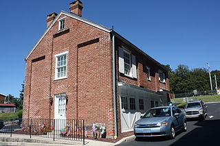
St. Lawrence, is a borough in Berks County, Pennsylvania, United States. The population was 1,892 at the 2020 census. It sits just east of Mount Penn and Reading. It is served by the Exeter Township School District.

<span class="mw-page-title-main">Washington Township, Berks County, Pennsylvania</span> Township in Pennsylvania, United States

Washington Township is a township in eastern Berks County, Pennsylvania, United States. The population was 3,810 at the 2010 census.

<span class="mw-page-title-main">North Coventry Township, Pennsylvania</span> Township in Pennsylvania, United States

North Coventry Township is a township in Chester County, Pennsylvania, United States. The population was 7,866 at the 2010 census.

<span class="mw-page-title-main">Lower Macungie Township, Pennsylvania</span> Township in Pennsylvania, United States

Lower Macungie Township is a township in Lehigh County, Pennsylvania, United States. The township's population was 31,964 as of the 2020 census, making it the second-largest population center in Lehigh County after Allentown and the third-largest population center in the Lehigh Valley metropolitan area after Allentown and Bethlehem.

<span class="mw-page-title-main">Gilbertsville, Pennsylvania</span> Census-designated place in Pennsylvania, United States

Gilbertsville is a census-designated place (CDP) in Douglass Township in northwestern Montgomery County, Pennsylvania, United States. It is located at the junction of Routes 73 and 100. The population was 4,832 at the 2010 census, and the ZIP code is 19525. The name is also applied to an indeterminate adjacent section of New Hanover Township served by the Gilbertsville Post Office, located in Gilbertsville. Boyertown Area School District provides public education to Gilbertsville. Gilbertsville is considered a exurb of Philadelphia, the nation's sixth-largest city, and is located to the city's northwest.

<span class="mw-page-title-main">Limerick Township, Pennsylvania</span> Township in Pennsylvania, United States

Limerick Township is a township in Montgomery County, Pennsylvania, United States.

<span class="mw-page-title-main">Lower Pottsgrove Township, Pennsylvania</span> Township in Pennsylvania, United States

Lower Pottsgrove Township is a township in Montgomery County, Pennsylvania, United States, approximately 30 miles northwest of Philadelphia and 18 miles southeast of Reading, along the Schuylkill River. The population was 12,059 at the 2010 census.

<span class="mw-page-title-main">New Hanover Township, Pennsylvania</span> Township in Pennsylvania, United States

New Hanover Township is a township in Montgomery County, Pennsylvania, United States. The population was 10,939 at the 2010 census.

<span class="mw-page-title-main">Pottstown, Pennsylvania</span> Borough in Pennsylvania, United States

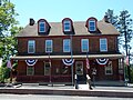
Pottstown is a borough in Montgomery County, Pennsylvania, United States. Pottstown was laid out in 1752–53 and named Pottsgrove in honor of its founder, John Potts. The old name was abandoned at the time of the incorporation as a borough in 1815. In 1888, the limits of the borough were considerably extended. Pottstown is the center of a productive farming and dairying region.

<span class="mw-page-title-main">Stowe, Pennsylvania</span> Census-designated place in Pennsylvania, United States

Stowe is a census-designated place (CDP) in West Pottsgrove Township, Montgomery County, Pennsylvania, United States. The population was 3,695 at the 2010 census. It uses the Pottstown ZIP code of 19464.

<span class="mw-page-title-main">Upper Hanover Township, Pennsylvania</span> Township in Pennsylvania, United States

Upper Hanover Township is a township in Montgomery County, Pennsylvania, United States. The population was 6,464 at the 2010 census.

<span class="mw-page-title-main">Upper Pottsgrove Township, Pennsylvania</span> Township in Pennsylvania, United States

Upper Pottsgrove Township is a township in Montgomery County, Pennsylvania, United States. The population was 5,315 at the 2010 census.

<span class="mw-page-title-main">West Pottsgrove Township, Pennsylvania</span> Township in Pennsylvania, United States

West Pottsgrove Township is a township in Montgomery County, Pennsylvania, United States. The population was 3,874 at the 2010 census.

References

  1. "2016 U.S. Gazetteer Files". United States Census Bureau. Retrieved August 14, 2017.
  2. "Population and Housing Unit Estimates" . Retrieved June 9, 2017.
  3. "Douglass Township map" (PDF). PennDOT. Retrieved March 10, 2023.
  4. "Schedule". Pottstown Area Rapid Transit. Retrieved January 20, 2020.
  5. "DVRPC > Site Search". Archived from the original on April 9, 2019. Retrieved January 31, 2017.
  6. "Census 2020".
  7. "Census 2010: Philadelphia gains, Pittsburgh shrinks in population". USA Today . Archived from the original on March 14, 2011.
  8. "U.S. Census website". United States Census Bureau . Retrieved January 31, 2008.
  9. "Election Results".