Merion Station, Pennsylvania

Last updated

Merion Station
Merion
Merion Station post office.jpg
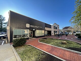
Merion Station post office, which is part of the SEPTA Regional Rail station
USA Pennsylvania location map.svg
Red pog.svg
Merion Station
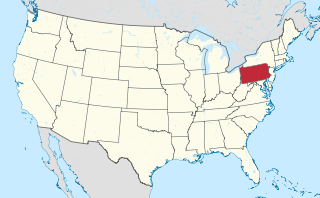
Location of Merion Station in Pennsylvania
Usa edcp location map.svg
Red pog.svg
Merion Station
Merion Station (the United States)
Coordinates: 39°59′36″N75°15′04″W / 39.99333°N 75.25111°W / 39.99333; -75.25111
CountryUnited States
StatePennsylvania
County Montgomery
Township Lower Merion
Elevation
233 ft (71 m)
Time zone UTC-5 (EST)
  Summer (DST) UTC-4 (EDT)
ZIP Code
19066
Area codes 610 and 484

Merion Station, also known as Merion, is an unincorporated community in Montgomery County, Pennsylvania. It borders Philadelphia to its west and is one of the communities that make up the Philadelphia Main Line. Merion Station is part of Lower Merion Township, Montgomery County. The community is known for its grand mansions and for the wealth of its residents.

Contents

Merion Station is contiguous to the Overbrook and Overbrook Park neighborhoods of Philadelphia and is also bordered by Lower Merion Township's unincorporated communities of Wynnewood and Bala Cynwyd and the borough of Narberth.

History

Merion Meeting House was built at the present intersection of Montgomery Avenue and Meetinghouse Lane in 1695 by Welsh settlers.

The General Wayne Inn and Merion Friends Meeting House are listed on the National Register of Historic Places. The Merion Friends Meeting House is also a National Historic Landmark. [1]

Nomenclature

The community was named after Merionethshire, Wales, the native home of a large share of the first settlers. [2] Merion is often referred to as "Merion Station," as this is the place name that the United States Postal Service recommends using in order to distinguish Merion from other areas in Pennsylvania with similar names. [3] However, the historical name of the town, used by historical figures such as Theodore Roosevelt, is Merion. [4]

Merion Civic Association

Merion Tribute House (April 2012) 20120405 0625HAZELHURST.jpg
Merion Tribute House (April 2012)

The Merion Civic Association was organized in 1913 by Edward W. Bok with the motto "To be Nation right and State right, we must first be Community right." The Merion Civic Association made several important improvements to Merion such as paving, better lighting, cast-iron street signs, better fire and police protection, and planned tree-planting. President Theodore Roosevelt wrote an article in 1917 for Bok's magazine entitled "Model Merion." [5]

After World War I, the Merion Civic Association sought to construct a community center in memorial to the 81 men from Merion Station who served in the armed forces during the conflict. [6] Eldridge R. Johnson, the founder and president of the Victor Talking Machine Company, donated his house on Hazelhurst Avenue to this cause. The house was demolished and a new Merion Tribute House was built on its foundation. It was built with careful attention to detail, with Gothic patterns and local stone. The stone was shaped on site and window mullions were all hand cut to match. The Tribute House is still used today for meetings of the Merion Civic Association and is supported by renting the space for parties or meetings. Merion also has its own public elementary school—Merion Elementary of the Lower Merion School District on South Bowman Avenue. [7]

Institutions

Barnes Foundation in Merion Station, April 2010 Barnes-foundation.png
Barnes Foundation in Merion Station, April 2010

The institution for which Merion Station was singularly world-renowned was the Barnes Foundation, an important art collection of Impressionist and Post-Impressionist paintings amassed by drug entrepreneur Albert C. Barnes that since the 1920s had been housed in a granite mansion with gardens on Latches Lane. [8] The Barnes collection has been moved to a newly designed museum building on Benjamin Franklin Parkway in Center City Philadelphia that includes a replication of Barnes's original gallery in Merion. [9] The Barnes Foundation Merion grounds remain open to the public as the Arboretum at the Barnes Foundation.

In addition to public Merion Elementary, Catholic, all-girls Merion Mercy Academy and its feeder school, Catholic, coeducational Waldron Mercy Academy, and Kohelet Yeshiva High School, formerly Stern Hebrew High School, are located in Merion. Before its move to Bryn Mawr, Akiba Hebrew Academy was located in Merion as was Episcopal Academy prior to its consolidation in Newtown Square.

Merion Botanical Park is located between Merion Road and the railroad tracks and City Line Ave and Civic Center Drive.

Saint Joseph's University straddles City Avenue. It also purchased and repurposed the former Episcopal Academy campus on the Merion Stationside of the Avenue to contain classroom and student activity buildings. [10] The university bought and renovated Merion Gardens Apartments, at the northwest corner of the East Wynnewood Road/City Avenue intersection, for student housing.

Transportation

The Paoli/Thorndale Line, originally part of the Pennsylvania Railroad, was built through Merion station in the late 19th century. Most SEPTA trains heading east to Philadelphia or west to Thorndale stop at Merion Station, located in the center of Merion Station.

Other public transportation options in Merion Station include the SEPTA Route 44 buses that travels along Old Lancaster Road and Montgomery Avenue between Ardmore and Center City, some of which stop at the Narberth Station; the SEPTA Route 65 bus that traverses the length of City Line Avenue; and the SEPTA Route 105 bus that runs the entire length of the Main Line along Lancaster Avenue (Route 30) and stops at the Wynnewood Shopping Center. All are within walking distance of Merion Station.

Demographics and government

Merion Station is located in zipcode 19066. Lower Merion Township is responsible for all governance.

According to the 2000 U.S. census, Merion Station has 5,951 residents, 93.6% of whom are White; 2.1% are Black or African American; 2.7% are Asian; and 1.3% are Hispanic or Latino. 95.1% have a high school diploma or higher and 76.7% have a bachelor's degree or higher. 9.4% were born in a foreign country. 12.3% speak a language other than English at home, and out of that percentage the number that speak Hebrew at home is 10.1%. The median household income in 1999 was $103,229, and 2.7% of individuals were below the poverty line.

Faith communities

Merion Station has a comparatively large Jewish population and serves as home to Temple Adath Israel of the Main Line, a Conservative Jewish congregation. Its Orthodox Jewish population is served by Lower Merion Synagogue on Old Lancaster Road, Aish HaTorah on Montgomery Avenue, Young Israel of the Main Line on Montgomery Avenue, and the Chabad Center of the Main Line, located in the former General Wayne Inn on Montgomery Avenue. Reform Jews in Merion are likely to travel a mile west up Montgomery Avenue to Main Line Reform Temple-Beth Elohim, to Gladwyne's Beth David Congregation, or to Congregation Rodeph Shalom on North Broad Street in Center City.

Shopping

The main commercial area of Merion Station is located along Montgomery Avenue east and west of its intersection with Old Lancaster Road and extends into neighboring Bala Cynwyd, officially known as the Merion-Cynwyd Commercial District. It includes restaurants, gift shops and other stores, and local landmarks more than a half century old whose reputations extend well beyond Merion Station's limits, notably Hymie's Merion Delicatessen, The Tavern Restaurant, Murray's Delicatessen, Babis's Pharmacy, Bob Wark's Liberty Service Station, and the Township Cleaners.

Hospitals

Merion Station is served by Lankenau Medical Center, which is part of the larger Main Line Health System that includes Bryn Mawr Hospital and Paoli Hospital. Lankenau, on Lancaster Avenue (U.S. Route 30) in nearby Wynnewood near the Overbrook border, has traditionally been affiliated with either Jefferson or Hahnemann (now Drexel) colleges of medicine and is always (with Bryn Mawr and Paoli) on the list of the nation's top community hospitals. The Lankenau Hospital campus includes affiliated doctors' office and medical services in Medical Building East, Medical Build West and Saunders House, a rehabilitation facility, is located adjacent to Lankenau Hospital.

Neighborhoods

The community north of Montgomery Avenue surrounding General Wayne Park is usually referred to as Merion Park and is in the same zipcode as Merion Station. It was built by developer Ralph Madway decades after the closing of the General Wayne Racetrack that once drew thousands of spectators to Merion for horse races on the green now the Park's grounds and bounded by Maplewood and Revere Roads.

Notable people

Points of interest

Related Research Articles

<span class="mw-page-title-main">Lower Merion Township, Pennsylvania</span> Township in Pennsylvania, United States

Lower Merion Township is a township in Montgomery County, Pennsylvania, United States. It is part of the Philadelphia Main Line. The township's name originates with the county of Merioneth in north Wales. Merioneth is an English-language transcription of the Welsh Meirionnydd.

<span class="mw-page-title-main">Narberth, Pennsylvania</span> Borough in Montgomery County, Pennsylvania

Narberth is a borough in Montgomery County, Pennsylvania. It is one of many neighborhoods on the historic Philadelphia Main Line. The population was 4,282 at the 2010 census.

<span class="mw-page-title-main">Penn Wynne, Pennsylvania</span> Census-designated place in Pennsylvania, United States

Penn Wynne is a census-designated place (CDP) in Montgomery County, Pennsylvania, United States. It is part of Lower Merion Township, and the mailing address is Wynnewood. The population was 5,697 at the 2010 census. It is mainly a residential area. The main arteries are Haverford Road and Manoa Road.

<span class="mw-page-title-main">Ardmore, Pennsylvania</span> Census-designated place in Pennsylvania, United States

Ardmore is an unincorporated community and census-designated place (CDP) spanning the border between Delaware and Montgomery counties in the U.S. state of Pennsylvania. The population was 12,455 at the time of the 2010 census and had risen to 13,566 in the 2020 census.
<span class="mw-page-title-main">Philadelphia Main Line</span> Collection of suburban communities in Pennsylvania, United States

The Philadelphia Main Line, known simply as the Main Line, is an informally delineated historical and social region of suburban Philadelphia, Pennsylvania. Lying along the former Pennsylvania Railroad's once prestigious Main Line, it runs northwest from Center City Philadelphia parallel to Lancaster Avenue, also known as U.S. Route 30.

<span class="mw-page-title-main">Haverford, Pennsylvania</span> Place in Pennsylvania, United States

Haverford is an unincorporated community located in both Haverford Township in Delaware County, Pennsylvania, United States, and Lower Merion Township in Montgomery County, approximately 3 miles (4.8 km) west of Philadelphia. The Pennsylvania Railroad (PRR) opened Haverford Station in 1880 on their Main Line west out of Broad Street Station in Philadelphia. Haverford sits at milepost 9.17.

<span class="mw-page-title-main">Bala Cynwyd, Pennsylvania</span> Community in Pennsylvania, United States

Bala Cynwyd is a community in Lower Merion Township, Pennsylvania, United States. It is located on the Philadelphia Main Line in Southeastern Pennsylvania and borders the western edge of Philadelphia at U.S. Route 1. The present-day community was originally two separate towns, Bala and Cynwyd, but was united as a singular community largely because the U.S. Post Office, the Bala Cynwyd branch, served both towns using ZIP Code 19004. The community was long known as hyphenated Bala-Cynwyd. Bala and Cynwyd are currently served by separate stations on SEPTA's Cynwyd Line of Regional Rail.

<span class="mw-page-title-main">Radnor, Pennsylvania</span> Locality on the Philadelphia Main Line

Radnor is a community which straddles Montgomery and Delaware Counties, Pennsylvania, United States. It is located approximately 13 miles west of Philadelphia, in the Main Line suburbs. The community was named after Radnor, in Wales.

<span class="mw-page-title-main">Wayne, Pennsylvania</span> Unincorporated community in Delaware County, Pennsylvania, United States

Wayne is an unincorporated community centered in Delaware County, Pennsylvania, United States, on the Main Line, a series of highly affluent Philadelphia suburbs located along the railroad tracks of the Pennsylvania Railroad and one of the wealthiest areas in the nation. While the center of Wayne is in Radnor Township, Wayne extends into both Tredyffrin Township in Chester County and Upper Merion Township in Montgomery County. The center of Wayne was designated the Downtown Wayne Historic District in 2012. Considering the large area served by the Wayne post office, the community may extend slightly into Easttown Township, Chester County, as well.

<span class="mw-page-title-main">Overbrook, Philadelphia</span> Neighborhood of Philadelphia in Philadelphia County, Pennsylvania, United States

Overbrook is an historic neighborhood that is located in the Commonwealth of Pennsylvania, United States. It is situated northwest of West Philadelphia, Philadelphia.
<span class="mw-page-title-main">West Philadelphia</span> Neighborhood of Philadelphia, Pennsylvania

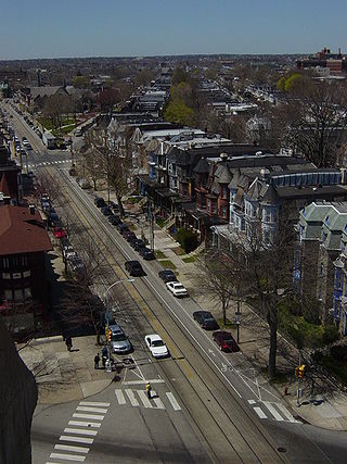
West Philadelphia, nicknamed West Philly, is a section of the city of Philadelphia. Although there are no officially defined boundaries, it is generally considered to reach from the western shore of the Schuylkill River, to City Avenue to the northwest, Cobbs Creek to the southwest, and the SEPTA Media/Wawa Line to the south. An alternate definition includes all city land west of the Schuylkill; this would also include Southwest Philadelphia and its neighborhoods. The eastern side of West Philadelphia is also known as University City.
<span class="mw-page-title-main">Wynnewood, Pennsylvania</span> Place in Pennsylvania, United States

Wynnewood is a suburban unincorporated community, located west of Philadelphia, straddling Lower Merion Township in Montgomery County, Pennsylvania and Haverford Township in Delaware County, Pennsylvania, United States.

<span class="mw-page-title-main">Keystone Corridor</span> High-speed rail corridor in Pennsylvania

The Keystone Corridor is a 349-mile (562 km) railroad corridor between Philadelphia and Pittsburgh, Pennsylvania, that consists of two rail lines: Amtrak and SEPTA's Philadelphia-to-Harrisburg main line, which hosts SEPTA's Paoli/Thorndale Line commuter rail service, and Amtrak's Keystone Service and Pennsylvanian inter-city trains; and the Norfolk Southern Pittsburgh Line. The corridor was originally the Main Line of the Pennsylvania Railroad.

<span class="mw-page-title-main">Wynnewood station</span>

Wynnewood station is a SEPTA Regional Rail station in Wynnewood, Pennsylvania. It is located at Wynnewood and Penn Roads in Philadelphia's western suburbs, and is served by most Paoli/Thorndale Line trains with the exception of several express runs.
<span class="mw-page-title-main">Lankenau Medical Center</span> Hospital in Pennsylvania, United States

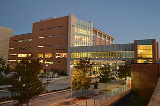
Lankenau Medical Center, part of Main Line Health, is a 370-bed acute care, teaching hospital in Wynnewood, Pennsylvania.

<span class="mw-page-title-main">Penn Valley, Pennsylvania</span> Unincorporated community in Pennsylvania, United States

Penn Valley is an unincorporated community located within Lower Merion Township, Pennsylvania, United States. Penn Valley residents share a zip code with Merion, Narberth, or Wynnewood because the community does not have its own post office. However, Penn Valley is a distinct community whose civic association demarcates its boundaries with iconic signs featuring William Penn and a farmhouse in blue or red on white, dating from 1930.

<span class="mw-page-title-main">52nd Street station (SEPTA Regional Rail)</span> Former train station in Philadelphia, Pennsylvania (closed 1980)

52nd Street is a closed train station that was located at the intersection of North 52nd Street & Merion Avenue in the West Philadelphia section of Philadelphia, Pennsylvania, United States. It was built by the Pennsylvania Railroad (PRR) at the junction of its Main Line and its Schuylkill Branch. Today, these lines are the SEPTA Regional Rail Paoli/Thorndale Line and Cynwyd Line, respectively.
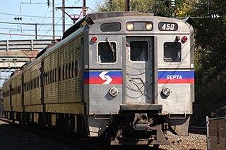
<span class="mw-page-title-main">Paoli/Thorndale Line</span> SEPTA Regional Rail service from Philadelphia to Thorndale

The Paoli/Thorndale Line, commonly known as the Main Line, is a SEPTA Regional Rail service running from Center City Philadelphia through Montgomery County and Delaware County to Thorndale in Chester County. It operates along the far eastern leg of Amtrak's Philadelphia to Harrisburg Main Line, which in turn was once the Main Line of the Pennsylvania Railroad and is now part of the Keystone Corridor, a federally-designated high-speed rail corridor.

<span class="mw-page-title-main">Cynwyd Line</span> SEPTA Regional Rail line

The Cynwyd Line is a SEPTA Regional Rail line from Center City Philadelphia to Cynwyd in Montgomery County, Pennsylvania. Originally known as the Ivy Ridge Line, service was truncated on May 17, 1986, at its current terminus at Cynwyd.
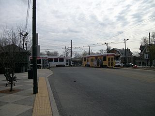
<span class="mw-page-title-main">63rd Street and Malvern Avenue station</span> SEPTA trolley stop and turnaround loop in Philadelphia, Pennsylvania

63rd Street and Malvern Avenue station is a SEPTA trolley station in Philadelphia. It is the western terminus of Route 10 of the SEPTA Subway–Surface Trolley Lines and northern terminus of SEPTA Bus Route 46. The station loop is located at 63rd Street and Malvern Avenue in the Overbrook neighborhood of West Philadelphia, near Lancaster Avenue. It is also close to the border with Lower Merion Township. Trolleys run from here to Center City Philadelphia. The Overbrook station of the Paoli/Thorndale Line is within walking distance of the station.

References

  1. "National Register Information System". National Register of Historic Places . National Park Service. July 9, 2010.
  2. Espenshade, A. Howry (1925). Pennsylvania place names. State College, PA: The Pennsylvania State College. p. 245. Archived from the original on October 11, 2021.
  3. Merion Civic – Frequently Asked Questions
  4. http://www.merioncivic.org/about/ModelMerion.pdf [ bare URL PDF ]
  5. Bok, Edward. The Americanization of Edward Bok. New York, Scribners, 1923.
  6. Joel Fram, "Volunteer of the week" The Main Line Times, (Volume 77, No. 28, July 12, 2007 – July 18, 2007) page 2.
  7. Jones, Dick. The First Three Hundred: The Amazing and Rich History of Lower Merion. Ardmore: Lower Merion Historical Society, 2001.
  8. Barnes Foundation. Great French Paintings from the Barnes Foundation. New York: Alfred Knopf, 1995.
  9. Andrew Solomon: Sensation. NYT, May 11, 2003 – review of: Anderson, John. Art Held Hostage: The Battle Over the Barnes Foundation. Boston: W. W. Norton, 2003.
  10. Agreement Finalized With St. Joseph's University – August 18, 2005
  11. Potok, Chaim. A Collection of Five Books by Chaim Potok. New York: Fawcett Crest, 2000.
  12. The von Trapp Story | Trapp Family Lodge