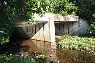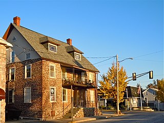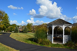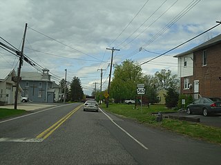
Franconia Township is a township in Montgomery County, Pennsylvania, United States. The population was 13,064 at the 2010 census.

Horsham is a census-designated place in Horsham Township, Montgomery County, Pennsylvania, United States. The population was 15,193 at the 2020 census. It is home to the Biddle Air National Guard Base at the former site of Naval Air Station Joint Reserve Base Willow Grove.

Souderton is a borough in Montgomery County, Pennsylvania, United States. The population was 7,246 in 2022 according to the Census Bureau.

Pennsylvania Route 309 is a state highway that runs for 134 miles (216 km) through eastern Pennsylvania. The route runs from an interchange between PA 611 and Cheltenham Avenue on the border of Philadelphia and Cheltenham Township north to an intersection with PA 29 in Bowman Creek, a village in Monroe Township in Wyoming County. The highway connects Philadelphia and its northern suburbs to Allentown and the Lehigh Valley, and Hazleton and Wilkes-Barre in Wyoming Valley.

Main Street station is a SEPTA Regional Rail station in Norristown, Pennsylvania, United States. It serves the Manayunk/Norristown Line. It is one of the two stations on the short electrified branch to Elm Street in Norristown. The station has 76 parking spaces. It is located at Main and Markley Streets. In FY 2013, Main Street station had a weekday average of 189 boardings and 181 alightings.

Pennsylvania Route 222 is a 4.482 mi (7.213 km)-long state highway located in Allentown and its surrounding suburbs in the Lehigh Valley region in eastern Pennsylvania.

Pennsylvania's 15th congressional district has been located in western and central Pennsylvania since 2019. Since 2023, the district includes all of Armstrong, Cameron, Centre, Clarion, Clearfield, Clinton, Elk, Forest, Jefferson, McKean, Potter, Snyder, Tioga, Union, and Warren counties and parts of Indiana, Lycoming, and Venango counties.

Franconia is an unincorporated community in Franconia Township in Montgomery County, Pennsylvania, United States. Franconia is located at the intersection of Pennsylvania Route 113 and Allentown Road.

Crestmont is an unincorporated community in Abington Township in Montgomery County, Pennsylvania, United States. Crestmont is located at the intersection of Easton Road and Old Welsh Road, southwest of Willow Grove. The community is served by the Crestmont station along SEPTA Regional Rail's Warminster Line. Crestmont uses the Willow Grove ZIP code of 19090.

Noble is an unincorporated community in Abington Township in Montgomery County, Pennsylvania, United States. Noble is located at the intersection of Pennsylvania Route 611 and Baeder Road, north of Jenkintown. The community is served by the Noble station along SEPTA Regional Rail's West Trenton Line. Noble uses the Jenkintown ZIP code of 19046.
Argus is an unincorporated community in Bucks County, Pennsylvania, United States. It operated a United States Post Office until 1953.
Klinesville is an unincorporated community in Greenwich Township in Berks County, Pennsylvania, United States. Klinesville is located at the intersection of Old Route 22 and Kohlers Hill Road. In 2019, several homes in Klinesville were demolished in order to widen Interstate 78/U.S. Route 22.
Creamery is an unincorporated community in Skippack Township in Montgomery County, Pennsylvania, United States. Creamery is located at the intersection of Pennsylvania Route 113 and Creamery Road.
Lederach is an unincorporated community in Lower Salford Township in Montgomery County, Pennsylvania, United States. Lederach is located at the intersection of Pennsylvania Route 113, Salfordville Road/Morris Road, Old Skippack Road, and Cross Road.
Salfordville is an unincorporated community in Upper Salford Township in Montgomery County, Pennsylvania, United States. Salfordville is located at the intersection of Old Skippack Road and Wolford Road/Bergey Road.
Mainland is an unincorporated community in Lower Salford Township in Montgomery County, Pennsylvania, United States. Mainland is located at the intersection of Mainland Road and Store Road, with Pennsylvania Route 63 bypassing the community to the northeast.

Frederick is an unincorporated community in Upper Frederick Township in Montgomery County, Pennsylvania, United States. Frederick is located at the intersection of Pennsylvania Route 73 and Colonial Road.

Tylersport is an unincorporated community in Salford Township in Montgomery County, Pennsylvania, United States. Tylersport is located at the intersection of Pennsylvania Route 563 and Allentown Road.
Montgomery Square is an unincorporated community in Montgomery Township in Montgomery County, Pennsylvania, United States. Montgomery Square is located at the intersection of Pennsylvania Route 309 and U.S. Route 202 Business /Upper State Road. It is the de facto downtown of Montgomery Township.
McKinley is an unincorporated community, in Abington Township, Montgomery County, Pennsylvania, United States. McKinley is located along Forrest Avenue between Pennsylvania Route 73 and Jenkintown Road southeast of Jenkintown.


