Dreher Township, Wayne County, Pennsylvania

Last updated

Dreher, Pennsylvania
Township of Dreher
Ella C. Ehrhardt General Store.jpg
The historic Ella C. Ehrhardt General Store [2] in Newfoundland.
Wayne County Pennsylvania incorporated and unincorporated areas Dreher township highlighted.svg
Location in Wayne County and the state of Pennsylvania.
Country United States
State Pennsylvania
US Congressional District PA-8
State Senatorial District 20
State House of Representatives District 115
County Wayne
School District Wallenpaupack Area
Settled c. 1794 [3]
Incorporated September 7, 1877 [3]
Founded byDenman Coe [3]
Named for Samuel S. Dreher [4]
Government
  Type Board of Supervisors
  Board of Supervisors [5]
Supervisors
   US Representative Matt Cartwright (D)
  State Senator Lisa Baker (R)
  State Representative Frank Farina (D)
Area
[6]
  Total15.11 sq mi (39.12 km2)
  Land14.85 sq mi (38.46 km2)
  Water0.26 sq mi (0.66 km2)
Elevation
1,791 ft (546 m)
Population
 (2010)
  Total1,412
  Estimate 
(2016) [7]
1,342
  Density90.37/sq mi (34.89/km2)
Time zone UTC-5 (Eastern (EST))
  Summer (DST) UTC-4 (Eastern Daylight (EDT))
Area code(s) 570 & 272
GNIS feature ID1217218 [8]
FIPS code 42-127-19864 [9]

Dreher is a second-class township in Wayne County, Pennsylvania, United States. The township's population was 1,412 at the time of the 2010 United States Census. [10]

Contents

History

The Bridge in Dreher Township and Patriotic Order Sons of America Washington Camp 422 are listed on the National Register of Historic Places. [11] [12]

Geography

According to the United States Census Bureau, [13] the township has a total area of 15.1 square miles (39 km2), of which 14.85 square miles (38.5 km2) is land and 0.25 square miles (0.65 km2) (1.66%) is water.

Communities

The following villages are located in Dreher Township:

In addition, the township is also home to one private community, Breezewood Acres. [14] [19]

Demographics

Historical population
CensusPop.Note
2010 1,412
2016 (est.)1,342 [7] −5.0%
U.S. Decennial Census [20]

As of the census of 2010, there were 1,412 people, 542 households, and 358 families residing in the township. The population density was 95.1 inhabitants per square mile (36.7/km2). There were 703 housing units at an average density of 47.3/sq mi. The racial makeup of the township was 95.6% White, 2.1% African American, 0.3% Native American, 0.4% Asian, 0.1% Pacific Islander, 0.5% from other races, and 1% from two or more races. Hispanic or Latino of any race were 4.9% of the population.

There were 542 households, out of which 27.7% had children under the age of 18 living with them, 53.3% were married couples living together, 7.2% had a female householder with no husband present, and 33.9% were non-families. 28.4% of all households were made up of individuals, and 13.3% had someone living alone who was 65 years of age or older. The average household size was 2.44 and the average family size was 2.98.

In the township the population was spread out, with 20% under the age of 18, 63.1% from 18 to 64, and 16.9% who were 65 years of age or older. The median age was 45.6 years.

The median income for a household in the township was $32,639, and the median income for a family was $42,708. Males had a median income of $31,989 versus $22,109 for females. The per capita income for the township was $15,945. About 9.7% of families and 12.2% of the population were below the poverty line, including 16.3% of those under age 18 and 9.5% of those age 65 or over.

Related Research Articles

<span class="mw-page-title-main">Rich Township, Michigan</span> Civil township in Michigan, United States

Rich Township is a civil township of Lapeer County in the U.S. state of Michigan. The population was 1,500 at the 2020 Census.

<span class="mw-page-title-main">Skandia Township, Michigan</span> Civil township in Michigan, United States

Skandia Township is a civil township of Marquette County in the U.S. state of Michigan. The 2020 census recorded a population of 810 people. The township contains the Dukes Research Natural Area, a National Natural Landmark.

<span class="mw-page-title-main">Wayne Township, Armstrong County, Pennsylvania</span> Township in Pennsylvania, United States

Wayne Township is a township that is located in Armstrong County, Pennsylvania, United States.

<span class="mw-page-title-main">East Providence Township, Bedford County, Pennsylvania</span> Township in Pennsylvania, United States

East Providence Township is a township in Bedford County, Pennsylvania, United States. The population was 1,756 at the 2020 census. The unincorporated community of Breezewood is in the township, which holds the Township's municipal buildings.

<span class="mw-page-title-main">Greene Township, Pike County, Pennsylvania</span> Township in Pennsylvania, United States

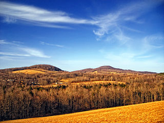
Greene Township is a township in Pike County, Pennsylvania, United States. The population was 3,453 at the 2020 census.

<span class="mw-page-title-main">Herrick Township, Susquehanna County, Pennsylvania</span> Township in Pennsylvania, United States

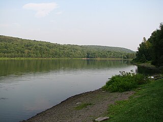
Herrick Township is a township in Susquehanna County, Pennsylvania. The population was 711 at the 2020 census.

<span class="mw-page-title-main">Berlin Township, Wayne County, Pennsylvania</span> Second-class township in Pennsylvania, United States

Berlin Township is a second-class township in Wayne County, Pennsylvania, United States. The township's population was 2,452 at the time of the 2020 United States Census.

<span class="mw-page-title-main">Buckingham Township, Wayne County, Pennsylvania</span> Second-class township in Pennsylvania, United States

Buckingham is a second-class township in Wayne County, Pennsylvania, United States. The township's population was 520 at the time of the 2010 United States Census.

<span class="mw-page-title-main">Canaan Township, Pennsylvania</span> Second-class township in Pennsylvania, United States

Canaan is a second-class township in Wayne County, Pennsylvania, United States. The township's population was 3,963 at the time of the 2010 United States Census.

<span class="mw-page-title-main">Cherry Ridge Township, Wayne County, Pennsylvania</span> Second-class township in Pennsylvania, United States

Cherry Ridge is a second-class township in Wayne County, Pennsylvania, United States. The township's population was 1,895 at the time of the 2010 United States Census.

<span class="mw-page-title-main">Clinton Township, Wayne County, Pennsylvania</span> Second-class township in Pennsylvania, United States

Clinton Township is a second-class township in Wayne County, Pennsylvania, United States. The township's population was 2,053 at the time of the 2010 United States Census.

<span class="mw-page-title-main">Damascus Township, Wayne County, Pennsylvania</span> Second-class township in Pennsylvania, United States

Damascus is a second-class township in Wayne County, Pennsylvania, United States. The township's population was 3,659 at the time of the 2010 United States Census.

<span class="mw-page-title-main">Dyberry Township, Wayne County, Pennsylvania</span> Second-class township in Pennsylvania, United States

Dyberry is a second-class township in Wayne County, Pennsylvania, United States. The township's population was 1,401 at the time of the 2010 United States Census.

<span class="mw-page-title-main">Lake Township, Wayne County, Pennsylvania</span> Second-class township in Pennsylvania, United States

Lake is a second-class township in Wayne County, Pennsylvania, United States. The township's population was 5,269 at the time of the 2010 United States Census.

<span class="mw-page-title-main">Mount Pleasant Township, Wayne County, Pennsylvania</span> Second-class township in Pennsylvania, United States

Mount Pleasant is a second-class township in Wayne County, Pennsylvania, United States. The township's population was 1,357 at the time of the 2010 United States Census.

<span class="mw-page-title-main">Preston Township, Pennsylvania</span> Second-class township in Pennsylvania, United States

Preston is a second-class township in Wayne County, Pennsylvania, United States. The township's population was 1,014 at the time of the 2010 United States Census.

<span class="mw-page-title-main">Sterling Township, Pennsylvania</span> Township in Pennsylvania, United States

Sterling is a second-class township in Wayne County, Pennsylvania. The township's population was 1,450 at the time of the 2010 United States Census.

<span class="mw-page-title-main">Gouldsboro, Pennsylvania</span> Village in Pennsylvania, United States

Gouldsboro is a village and census-designated place (CDP) in Lehigh Township in Wayne County, and Coolbaugh Township, in Monroe County, Pennsylvania, United States. The CDP's population was 750 at time of the 2020 United States Census.

<span class="mw-page-title-main">Pocono Springs, Pennsylvania</span> Place in Pennsylvania, United States

Pocono Springs is a private community and census-designated place (CDP) in Lehigh and Sterling Townships in Wayne County, Pennsylvania, United States. The CDP's population was 926 at the time of the 2010 United States Census.

<span class="mw-page-title-main">Wallenpaupack Lake Estates, Pennsylvania</span> Place in Pennsylvania, United States

Wallenpaupack Lake Estates is a private community and census-designated place in Paupack Township, Wayne County in the U.S. State of Pennsylvania. The community's population was 1,279 as of the 2010 United States Census.

References

  1. "Ella C. Ehrhardt General Store". Wayne County Historical Society. 2014. Archived from the original on December 13, 2014. Retrieved December 8, 2014.
  2. "Ella C. Ehrhardt General Store". Wayne County Historical Society. 2014. Archived from the original on December 13, 2014. Retrieved December 8, 2014.
  3. 1 2 3 "Dreher Township". Wayne County Historical Society. 2014. Archived from the original on December 13, 2014. Retrieved December 8, 2014.
  4. Goodrich, Phineas G. (1992) [1880]. History of Wayne County. Baltimore: Gateway Press, Inc. p. 285.
  5. "Municipal Index" (PDF). Wayne County Planning Commission/GIS. WordPress. 2011. Archived from the original (PDF) on December 3, 2014. Retrieved December 8, 2014.
  6. "2016 U.S. Gazetteer Files". United States Census Bureau. Retrieved August 14, 2017.
  7. 1 2 "Population and Housing Unit Estimates" . Retrieved June 9, 2017.
  8. "Township of Dreher". Geographic Names Information System . United States Geological Survey, United States Department of the Interior. December 1, 1989. Retrieved December 8, 2014.
  9. U.S. Census Bureau. Census 2000. "Census Demographic Profiles, Dreher Township" (PDF). CenStats Databases. Retrieved December 8, 2014.{{cite web}}: CS1 maint: numeric names: authors list (link)[ dead link ]
  10. "U.S. Census website". United States Census Bureau . Retrieved May 14, 2011.
  11. "National Register Information System". National Register of Historic Places . National Park Service. July 9, 2010.
  12. "National Register of Historic Places Listings". Weekly List of Actions Taken on Properties: 12/27/10 through 12/30/10. National Park Service. January 7, 2011.
  13. "US Gazetteer files: 2010, 2000, and 1990". United States Census Bureau. February 12, 2011. Retrieved April 23, 2011.
  14. 1 2 3 4 5 6 "DREHER: SECOND CLASS TOWNSHIP MAP" (PDF). Pennsylvania Department of Transportation. Commonwealth of Pennsylvania. May 28, 2013. Retrieved December 9, 2014.[ permanent dead link ]
  15. "Angels". Geographic Names Information System. United States Geological Survey. August 2, 1979. Retrieved December 9, 2014.
  16. "East Sterling". Geographic Names Information System. United States Geological Survey. August 2, 1979. Retrieved December 9, 2014.
  17. "Haags Mill". Geographic Names Information System. United States Geological Survey. August 2, 1979. Retrieved December 9, 2014.
  18. "South Sterling". Geographic Names Information System. United States Geological Survey. August 2, 1979. Retrieved December 9, 2014.
  19. "Breezewood Acres Community Association". Breezewood Acres Community Association. 2014. Retrieved December 9, 2014.
  20. "Census of Population and Housing". Census.gov. Retrieved June 4, 2016.