Wayne County, Pennsylvania

Last updated

Wayne County
Wayne County courthouse mod.jpg
The Wayne County Courthouse in Honesdale
Map of Pennsylvania highlighting Wayne County.svg
Location within the U.S. state of Pennsylvania
Pennsylvania in United States.svg
Pennsylvania's location within the U.S.
Coordinates: 41°39′N75°19′W / 41.65°N 75.31°W / 41.65; -75.31
CountryFlag of the United States.svg United States
StateFlag of Pennsylvania.svg  Pennsylvania
FoundedMarch 21, 1798
Named for Anthony Wayne
Seat Honesdale
Largest borough Honesdale
Area
  Total751 sq mi (1,950 km2)
  Land726 sq mi (1,880 km2)
  Water25 sq mi (60 km2)  3.3%
Population
 (2020)
  Total51,155
  Density70/sq mi (30/km2)
Time zone UTC−5 (Eastern)
  Summer (DST) UTC−4 (EDT)
Congressional district 8th
Website waynecountypa.gov

Wayne is a county in the Commonwealth of Pennsylvania. The county's population was 51,155 at the 2020 census. [1] The county seat is the Borough of Honesdale. [2] The county was formed from part of Northampton County on March 21, 1798, [3] and was named for the Revolutionary War General Anthony Wayne. [2] The county is part of the Northeast Pennsylvania region of the state. [lower-alpha 1]

Contents

The Lehigh River, a 109-mile-long (175 km) tributary of the Delaware River, rises in southern Wayne County.

Geography

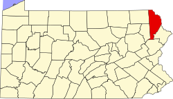
According to the U.S. Census Bureau, Wayne County has a total area of 751 square miles (1,950 km2), of which 726 square miles (1,880 km2) is land and 25 square miles (65 km2) (3.3%) is water. [4]

The terrain of the county is varied. In the wider northern half, the land is rugged along its border with New York State, while the southern portion tends to be swampier. Higher hills and mountains are predominantly found along the county's western edge, while lower ones are more common in the east, near the Delaware River. The middle section of Wayne County is a wide plain.

The highest elevation in the county, 2,659 ft (810 m), is the summit of Mount Ararat in Orson. Two other summits at the north end of the same ridge also exceed 2,640 ft (800 m) in elevation. The county's lowest point, at approximately 680 ft (210 m) above sea level, is along the Delaware, near Wayne County's border with Pike County, Pennsylvania.

Most of Wayne County is drained by the Delaware (which separates Pennsylvania from New York), with the exception of a few small areas in the western part of the county, which are drained by either the Starrucca Creek or the Lackawanna River (which both eventually flow into the Susquehanna River).

The county has a warm-summer humid continental climate (Dfb) and average monthly temperatures in Honesdale range from 22.8 °F in January to 67.9 °F in July. [5]

Adjacent counties

Major highways

Demographics

Historical population
CensusPop.Note
1800 2,562
1810 4,12561.0%
1820 4,1270.0%
1830 7,66385.7%
1840 11,84854.6%
1850 21,89084.8%
1860 32,23947.3%
1870 33,1882.9%
1880 33,5131.0%
1890 31,010−7.5%
1900 30,171−2.7%
1910 29,236−3.1%
1920 27,435−6.2%
1930 28,4203.6%
1940 29,9345.3%
1950 28,478−4.9%
1960 28,237−0.8%
1970 29,5814.8%
1980 35,23719.1%
1990 39,94413.4%
2000 47,72219.5%
2010 52,82210.7%
2020 51,155−3.2%
U.S. Decennial Census [6]
1790–1960 [7] 1900–1990 [8]
1990–2000 [9] 2010–2017 [10] 2010-2020 [11]

As of the Census of 2010, there were 52,822 people, 20,625 households, and 13,952 families in Wayne County. The county's population density was 72.797 people per square mile (28.107 people/km2), and there were 31,653 housing units at an average density of 43.623 per square mile (16.843/km2). The racial makeup of the populace was 94.2% White, 3.1% African American, 0.2% Native American, 0.5% Asian, 0.0% Pacific Islander, 0.9% of other races, and 1.1% of two or more races. Hispanics and Latinos of all races made up 3.4% of the population. [4] [12]

67.6% of Wayne County's households were families, 53.9% were headed by a heterosexual married couple (Pennsylvania did not allow same-sex marriage until May 20, 2014, after the 2010 Census had been completed), and 26.6% included children under the age of 18. 9.2% of households were headed by a female householder with no husband present, 4.5% by a male householder with no wife present, and 32.4% consisted of non-families. 27.2% of all households were made up of individuals, and 12.3% consisted of a person 65 years of age or older living alone. The average household size was 2.38 and the average family size was 2.87. [12]

Wayne County's age distribution was 21.1% under the age of 18, 4.5% between the ages of 18 and 24, 23.1% between 25 and 44, 32.4% between 45 and 64, and 19.0% 65 years of age or older. The population's median age was 45.9 years. For every 100 females, there were 110 males. For every 100 females age 18 and over, there were 112 males in the same age range. [12]

According to American Community Survey (ACS) estimates, the median income for a household in Wayne County in 2013 was $49,313, and the median income for a family was $58,934. Males had a median income of $36,173, while females had a median income of $23,636. The per capita income for the county was $24,005. 8.4% of families and 12.2% of people were below the Census Bureau's poverty thresholds (different from the federally defined poverty guidelines), including 18.5% of those under age 18 and 7.6% of those age 65 or over. [13] [14]

According to self-reported ancestry figures recorded by the ACS, the five largest ancestral groups in Wayne County in 2013 were Germans (30.3%), Irish (22.1%), Italians (13.9%), English (10.9%), and Poles (10.1%). Those reporting American ancestry made up 8.6% of the population. [15]

2020 census

Wayne County Racial Composition [16]
RaceNum.Perc.
White (NH)44,82187.62%
Black or African American (NH)1,6473.22%
Native American (NH)730.14%
Asian (NH)4180.82%
Pacific Islander (NH)00%
Other/Mixed (NH)1,8493.61%
Hispanic or Latino 2,3474.6%

Politics

United States presidential election results for Wayne County, Pennsylvania [17]
Year Republican Democratic Third party
No.%No.%No.%
2020 18,63766.21%9,19132.65%3191.13%
2016 16,24467.63%7,00829.18%7663.19%
2012 12,89659.50%8,39638.74%3821.76%
2008 12,70255.39%9,89243.14%3381.47%
2004 13,71362.43%8,06036.69%1940.88%
2000 11,20159.21%6,90436.50%8114.29%
1996 8,07749.45%5,92836.29%2,32914.26%
1992 8,18448.65%4,81728.64%3,82122.71%
1988 9,92671.61%3,77527.23%1611.16%
1984 10,06175.66%3,15523.73%810.61%
1980 8,46867.48%3,37526.90%7055.62%
1976 7,81163.45%4,24434.48%2552.07%
1972 8,94874.51%2,73322.76%3282.73%
1968 7,82766.39%3,17626.94%7876.68%
1964 6,51252.82%5,78146.89%350.28%
1960 9,36067.77%4,42532.04%260.19%
1956 9,65875.64%3,09224.22%180.14%
1952 9,62378.96%2,53020.76%340.28%
1948 7,70877.14%2,28422.86%00.00%
1944 8,24274.43%2,79325.22%390.35%
1940 9,20372.44%3,46027.24%410.32%
1936 9,34765.00%4,86433.82%1691.18%
1932 6,21561.47%3,66636.26%2302.27%
1928 8,57672.78%3,14826.72%590.50%
1924 5,57872.87%1,47719.29%6007.84%
1920 5,16473.14%1,58922.51%3074.35%
1916 2,86955.84%2,01939.30%2504.87%
1912 65912.29%1,92435.90%2,77751.81%
1908 3,65056.67%2,43837.85%3535.48%
1904 3,38656.85%2,09735.21%4737.94%
1900 3,22950.91%2,64741.74%4667.35%
1896 3,70856.59%2,47337.74%3715.66%
1892 2,69044.41%2,91548.13%4527.46%
1888 2,93946.47%3,01047.60%3755.93%

As of January 8, 2024, there were 35,181 registered voters in Wayne County, with the following party breakdown: [18]

Chart of Voter Registration

   Republican (57.70%)
   Democratic (25.96%)
   Independent (13.16%)
   Other Parties (3.18%)

Wayne has long been one of the most Republican counties in Pennsylvania, as Republicans consistently win easily in federal, state and local elections. In 2000, Republican George W. Bush won 59.21 percent of the vote to Democrat Al Gore's 36.50 percent, [19] and in 2004, Bush won with 62.43 percent to Democrat John Kerry's 36.69 percent. [20] In 2008, Republican John McCain won with 55.39 percent of the vote to Democrat Barack Obama's 43.14 percent, [21] and in 2012, Republican Mitt Romney won with 59.50 percent to Obama's 38.74 percent. [22] In 2016, Republican Donald J. Trump won with 67.63 percent to Hillary Clinton's 29.18 percent.

Wayne County was one of the four counties that Barry Goldwater won in Pennsylvania in 1964; [23] the last Democrat to win a plurality in the county was Grover Cleveland in 1892. [24] [25] Since then, only three Democrats have won even forty percent of the county's vote – William Jennings Bryan in 1900, Lyndon Johnson in 1964 and Obama in 2008.

Government and infrastructure

United States senators

United States representative

State representatives [26]

State senator [26]

County commissioners

Other county officers

Healthcare services

Wayne County is served by the Wayne Memorial Health System. The Health System consists of Wayne Memorial Hospital in Honesdale and several other subsidiaries and/or affiliates. In addition, the community has a number of physicians and other professionals providing needed care. The Farview State Hospital is located in Farview.

Emergency services

Paramedic services are provided by three different agencies:

BLS services are provided as dispatched through the Wayne County Communication Center. These agencies include:

Maplewood Fire and Rescue provides QRS "quick response service" to all medical calls in Lake townships.

Prisons

The Federal Bureau of Prisons United States Penitentiary, Canaan is in Canaan Township, near Waymart. [41] [42]

Education

Map of Wayne County's school districts. Map of Wayne County Pennsylvania School Districts.png
Map of Wayne County's school districts.

Public school districts

Private schools

There are five private or parochial schools in Wayne County:

Libraries

The Wayne Library Alliance [47] operates seven public libraries throughout the county:

Communities

Map of Wayne County with municipalities and CDPs labeled. Wayne County, Pennsylvania, Municipalities and CDPs.png
Map of Wayne County with municipalities and CDPs labeled.

Under Pennsylvania law, there are four types of incorporated municipalities: boroughs, cities, townships, and one town. Wayne County has only boroughs and townships. The latter type is classified based on population by the state government; all of its townships are second-class. A complete list of the county's municipalities follows:

Boroughs

Townships

Census-designated places

In addition, Pennsylvania also has a few types of unincorporated communities, namely villages and private communities. Villages are unincorporated communities within a township, often defined by ZIP code boundaries, property deeds, and local consensus, but which have no official boundaries or population, unless they are also census-designated places (CDPs), geographical areas designated by the US Census Bureau for the purposes of compiling demographic data. Regardless of whether or not they are CDPs, however, they are not actual jurisdictions under Pennsylvania law. Private communities are gated settlements usually governed by a community association, which also often defines the boundaries of the community and may keep track of the number of its members. However, like villages, private communities have no official boundaries or populations, unless they are CDPs, and are never Pennsylvanian jurisdictions. The following is an incomplete list by necessity, but more complete lists of Wayne County's villages and private communities may be found in the corresponding township entry.

Unincorporated communities

Population ranking

The population ranking of the following table is based on the 2010 census of Wayne County. [55]

county seat

RankCity/Town/etc.Municipal typePopulation (2010 Census)
1 Honesdale Borough4,480
2 The Hideout CDP3,013
3 Waymart Borough1,341
4 Wallenpaupack Lake Estates CDP1,279
5 Big Bass Lake (mostly in Lackawanna County )CDP1,270
6 Hawley Borough1,211
7 Pocono Springs CDP926
8 Gouldsboro (partially in Monroe County )CDP890
9 White Mills CDP659
10 Prompton Borough250
11 Bethany Borough246
12 Starrucca Borough173

See also

Related Research Articles

<span class="mw-page-title-main">Wyoming County, Pennsylvania</span> County in Pennsylvania, United States

Wyoming County is a county in the Commonwealth of Pennsylvania. As of the 2020 census, the population was 26,069. Its county seat is Tunkhannock. It was created in 1842 from part of Luzerne County. The county is part of the Northeast Pennsylvania region of the state.

<span class="mw-page-title-main">Susquehanna County, Pennsylvania</span> County in Pennsylvania, United States

Susquehanna County is a county in the Commonwealth of Pennsylvania. As of the 2020 census, the population was 38,434 Its county seat is Montrose. The county was created on February 21, 1810, from part of Luzerne County and later organized in 1812. It is named for the Susquehanna River. The county is part of the Northeast Pennsylvania region of the state.

<span class="mw-page-title-main">Snyder County, Pennsylvania</span> County in Pennsylvania, United States

Snyder County is a county in the Commonwealth of Pennsylvania. As of the 2020 census, the population was 39,736. The county seat is Middleburg. Snyder County was formed in 1855 from parts of Union County. The county is part of the Central Pennsylvania region of the state.

<span class="mw-page-title-main">Pike County, Pennsylvania</span> County in Pennsylvania, United States

Pike County is a county in the Commonwealth of Pennsylvania. As of the 2020 census, the population was 58,535. Its county seat is Milford. The county is part of the Northeast Pennsylvania region of the state.

<span class="mw-page-title-main">Perry County, Pennsylvania</span> County in the United States

Perry County is a county in the Commonwealth of Pennsylvania. As of the 2020 census, the population was 45,842. The county seat is New Bloomfield. The county was created on March 22, 1820, and was named for Oliver Hazard Perry, a hero of the War of 1812, who had recently died. It was originally part of Cumberland County and was created in part because residents did not want to travel over the mountain to Carlisle, the county seat of Cumberland County. Landisburg became the temporary county seat before New Bloomfield was ultimately chosen. The county is part of the South Central Pennsylvania region of the state.

<span class="mw-page-title-main">Northumberland County, Pennsylvania</span> County in Pennsylvania, United States

Northumberland County is a county in the Commonwealth of Pennsylvania. As of the 2020 census, the population was 91,647. Its county seat is Sunbury. The county is part of the Central Pennsylvania region of the state.

<span class="mw-page-title-main">Montour County, Pennsylvania</span> County in Pennsylvania, United States

Montour County is a county in the Commonwealth of Pennsylvania. As of the 2020 census, the population was 18,136. Its county seat is Danville. The county is named for Andrew Montour, a prominent Métis interpreter who served with George Washington during the French and Indian War. It encompasses 132 sq mi, making it the smallest county by land area in the state. The county is part of the Central Pennsylvania region of the state.

<span class="mw-page-title-main">Luzerne County, Pennsylvania</span> County in Pennsylvania, United States

Luzerne County is a county in the Commonwealth of Pennsylvania. According to the United States Census Bureau, the county has a total area of 906 square miles (2,350 km2), of which 890 square miles (2,300 km2) is land and 16 square miles (41 km2) is water. It is Northeastern Pennsylvania's second-largest county by total area. As of the 2020 census, the population was 325,594, making it the most populous county in the northeastern part of the state. The county seat and most populous city is Wilkes-Barre. Other populous communities include Hazleton, Kingston, Nanticoke, and Pittston. Luzerne County is included in the Scranton–Wilkes-Barre–Hazleton Metropolitan Statistical Area, which has a total population of 555,426 as of 2017. The county is part of the Northeast Pennsylvania region of the state.

<span class="mw-page-title-main">Lebanon County, Pennsylvania</span> County in Pennsylvania, United States

LebanonCounty is a county in the Commonwealth of Pennsylvania, United States. As of the 2020 census, the population was 143,257. Its county seat is the city of Lebanon. It lies 72 miles northwest of Philadelphia, which is the nearest major city. The county is part of the South Central Pennsylvania region of the state.

<span class="mw-page-title-main">Lackawanna County, Pennsylvania</span> County in Pennsylvania, United States

Lackawanna County is a county in the Commonwealth of Pennsylvania. It is located in Northeastern Pennsylvania and had a population of 215,615 (2022). Its county seat and most populous city is Scranton. The county is part of the Northeast Pennsylvania region of the state.

<span class="mw-page-title-main">Dauphin County, Pennsylvania</span> County in Pennsylvania, United States

Dauphin County is a county in the Commonwealth of Pennsylvania. As of the 2020 census, the population was 286,401. The county seat is Harrisburg, Pennsylvania's state capital and ninth-most populous city. The county was created on March 4, 1785, from part of Lancaster County and was named after Louis Joseph, Dauphin of France, the first son of King Louis XVI. The county is part of the South Central Pennsylvania region of the state.

<span class="mw-page-title-main">Columbia County, Pennsylvania</span> County in Pennsylvania, United States

Columbia County is a county in the Commonwealth of Pennsylvania. It is located in Northeastern Pennsylvania. As of the 2020 census, the population was 64,727. Its county seat is Bloomsburg. The county was created on March 22, 1813, from part of Northumberland County. It was named Columbia, alluding to the United States and Christopher Columbus. The county is part of the Central Pennsylvania region of the state.

<span class="mw-page-title-main">Carbon County, Pennsylvania</span> County in Pennsylvania, United States

Carbon County is a county in the Commonwealth of Pennsylvania. As of the 2020 census, the population was 64,749. The county is part of the Northeast Pennsylvania region of the state.

<span class="mw-page-title-main">Bradford County, Pennsylvania</span> County in Pennsylvania, United States

Bradford County is a county in the Commonwealth of Pennsylvania. As of the 2020 census, its population was 59,967. Its county seat is Towanda. The county was created on February 21, 1810, from parts of Lycoming and Luzerne Counties. Originally called Ontario County, it was reorganized and separated from Lycoming County on October 13, 1812, and renamed Bradford County for William Bradford, who had been a chief justice of the Pennsylvania Supreme Court and United States Attorney General. The county is part of the Northeast Pennsylvania region of the state.

<span class="mw-page-title-main">Orson, Pennsylvania</span> Village in Pennsylvania, United States

Orson is a village in Preston Township, Pennsylvania, United States, situated in the Lake Region of the Poconos. It was once an important depot of the Scranton Division of the New York, Ontario & Western (O&W) Railway, but today, when it is known outside of its immediate vicinity, it is largely for being the site of the intersection of two state roads, Belmont Turnpike and Crosstown Highway, or as the location of Independent Lake Camp (ILC), since ILC's reputation and commercial reach, like those of most rural American summer camps, extend beyond the community in which the camp is physically located.

<span class="mw-page-title-main">Pennsylvania's 10th congressional district</span> U.S. House district for Pennsylvania

Pennsylvania's 10th congressional district is located in the south-central region of the state. It encompasses all of Dauphin County as well as parts of Cumberland County and York County. The district includes the cities of Harrisburg and York. Prior to 2019, the district was located in the northeastern part of the state. The Supreme Court of Pennsylvania redrew the district in 2018 after ruling the previous map unconstitutional because of gerrymandering. The court added State College to the old district's boundaries while removing some Democratic-leaning areas and redesignated it the twelfth district; an area encompassing Harrisburg and York was numbered as the "10th". The new tenth district is represented by Republican Scott Perry, who previously represented the old fourth district.

<span class="mw-page-title-main">Pennsylvania Route 247</span> State highway in Pennsylvania, US

Pennsylvania Route 247 is a 50.5-mile-long (81.3 km) state highway located in Lackawanna, Susquehanna, and Wayne counties in Pennsylvania. The southern terminus is at Interstate 84 (I-84) in Mount Cobb. The northern terminus is at PA 370 in Preston Park. The route heads north from I-84 in Lackawanna County and crosses the Moosic Mountains before it heads into suburban areas northeast of Scranton, serving Jessup, Blakely, and Archbald. In this area, PA 247 has an interchange with the U.S. Route 6 freeway in Jessup and intersects US 6 Business in Archbald. Past here, the route continues north into rural areas in northern Lackawanna County. PA 247 heads into the southeastern part of Susquehanna County and passes through Forest City, where it forms a short concurrency with PA 171. The route continues into Wayne County and heads east before curving to the north and continuing to its terminus at PA 370.

Pennsylvania State Senate District 40 includes parts of Lackawanna County and Wayne County and all of Monroe County. It is currently represented by Republican Rosemary Brown.

<span class="mw-page-title-main">Poyntelle, Pennsylvania</span> Village in Pennsylvania, United States

Poyntelle is a village that is located in Preston Township, Wayne County, Pennsylvania, United States, in the Lake Region of the Poconos.

<span class="mw-page-title-main">Lakewood, Pennsylvania</span> Village in Pennsylvania, United States

Lakewood is a village that is located in Preston Township, Wayne County, Pennsylvania, United States. It is situated on Pennsylvania Route 370 (PA-370), approximately 7 miles (11 km) east of Thompson, Pennsylvania and about 10 miles (16 km) southwest of Hancock, New York.

References

  1. Includes Luzerne, Lackawanna, Monroe, Schuylkill, Carbon, Pike, Bradford, Wayne, Susquehanna, Wyoming and Sullivan Counties
  1. "Census - Geography Profile: Wayne County, Pennsylvania". United States Census Bureau . Retrieved December 18, 2022.
  2. 1 2 "Wayne County, PA". Wayne County, PA. Wayne County Courthouse. 2014. Archived from the original on June 30, 2015. Retrieved June 27, 2015.
  3. Goodrich, Phineas G. (1992) [1880]. History of Wayne County. Baltimore: Gateway Press, Inc.
  4. 1 2 2014 Census National Counties Gazetteer File for Pennsylvania (Report). United States Census Bureau. 2014. Retrieved June 27, 2015.
  5. "PRISM Climate Group at Oregon State University".
  6. "U.S. Decennial Census". United States Census Bureau. Retrieved August 5, 2015.
  7. "Historical Census Browser". University of Virginia Library. Retrieved August 5, 2015.
  8. Forstall, Richard L., ed. (March 27, 1995). "Population of Counties by Decennial Census: 1900 to 1990". United States Census Bureau. Retrieved August 5, 2015.
  9. "Census 2000 PHC-T-4. Ranking Tables for Counties: 1990 and 2000" (PDF). United States Census Bureau. April 2, 2001. Archived (PDF) from the original on October 9, 2022. Retrieved August 5, 2015.
  10. "State & County QuickFacts". United States Census Bureau. Archived from the original on June 6, 2011. Retrieved August 5, 2015.
  11. "Census 2020".
  12. 1 2 3 Profile of General Population and Housing Characteristics: 2010 Demographic Profile Data for Wayne County, Pennsylvania (Report). U.S. Department of Commerce. 2010. Archived from the original on February 13, 2020. Retrieved June 27, 2015.
  13. Selected Economic Characteristics 2009–2013 American Community Survey 5-Year Estimates for Wayne County, Pennsylvania (Report). U.S. Department of Commerce. 2013. Archived from the original on February 13, 2020. Retrieved June 27, 2015.
  14. Occupation by Sex and Median Earnings in the Past 12 Months (In 2013 Inflation-Adjusted Dollars) For the Civilian Employed Population 16 Years and Over 2009–2013 American Community Survey 5-Year Estimates for Wayne County, Pennsylvania (Report). U.S. Department of Commerce. 2013. Archived from the original on February 13, 2020. Retrieved June 27, 2015.
  15. Selected Social Characteristics in the United States 2009–2013 American Community Survey 5-Year Estimates for Wayne County, Pennsylvania (Report). U.S. Department of Commerce. 2013. Archived from the original on February 13, 2020. Retrieved June 29, 2015.
  16. "P2 HISPANIC OR LATINO, AND NOT HISPANIC OR LATINO BY RACE – 2020: DEC Redistricting Data (PL 94-171) – Wayne County, Pennsylvania".
  17. Leip, David. "Dave Leip's Atlas of U.S. Presidential Elections". uselectionatlas.org. Retrieved April 7, 2018.
  18. Pennsylvania Department of State (May 15, 2023). "Voter registration statistics by county". dos.pa.gov. Retrieved May 17, 2023.
  19. Leip, Dave (2012). "2000 Presidential General Election Results - Pennsylvania". Dave Leip's Atlas of U.S. Presidential Elections. David Leip. Archived from the original on November 17, 2015. Retrieved November 15, 2015.
  20. Leip, Dave (2012). "2004 Presidential General Election Results - Pennsylvania". Dave Leip's Atlas of U.S. Presidential Elections. David Leip. Archived from the original on November 17, 2015. Retrieved November 15, 2015.
  21. Leip, Dave (2012). "2008 Presidential General Election Results - Pennsylvania". Dave Leip's Atlas of U.S. Presidential Elections. David Leip. Archived from the original on November 17, 2015. Retrieved November 15, 2015.
  22. Leip, Dave (2012). "2012 Presidential General Election Results - Pennsylvania". Dave Leip's Atlas of U.S. Presidential Elections. David Leip. Archived from the original on September 7, 2015. Retrieved November 15, 2015.
  23. Leip, Dave (2012). "1964 Presidential General Election Results - Pennsylvania". Dave Leip’s Atlas of U.S. Presidential Elections. David Leip. Archived from the original on February 29, 2012. Retrieved November 15, 2015.
  24. "Presidential election of 1892 - Map by counties". geoelections.free.fr. Retrieved April 7, 2018.
  25. Sullivan, Robert David; ‘How the Red and Blue Map Evolved Over the Past Century’; America Magazine in The National Catholic Review; June 29, 2016
  26. 1 2 Center, Legislativate Data Processing. "Find Your Legislator". The official website for the Pennsylvania General Assembly. Archived from the original on May 6, 2017. Retrieved May 9, 2017.
  27. 1 2 3 "Commissioners". Wayne County, PA. Wayne County Courthouse. 2014. Archived from the original on December 2, 2014. Retrieved December 17, 2014.
  28. "Auditors". Wayne County, PA. Wayne County Courthouse. 2014. Archived from the original on December 2, 2014. Retrieved December 17, 2014.
  29. "Coroner". Wayne County, PA. Wayne County Courthouse. 2014. Archived from the original on December 2, 2014. Retrieved December 17, 2014.
  30. "District Attorney". Wayne County, PA. Wayne County Courthouse. 2014. Archived from the original on December 2, 2014. Retrieved December 17, 2014.
  31. "Prothonotary". Wayne County, PA. Wayne County Courthouse. 2014. Archived from the original on December 2, 2014. Retrieved December 17, 2014.
  32. "Recorder of Deeds". Wayne County, PA. Wayne County Courthouse. 2014. Archived from the original on December 2, 2014. Retrieved December 17, 2014.
  33. "Register of Wills". Wayne County, PA. Wayne County Courthouse. 2014. Archived from the original on December 2, 2014. Retrieved December 17, 2014.
  34. "Sheriff". Wayne County, PA. Wayne County Courthouse. 2014. Archived from the original on December 2, 2014. Retrieved December 17, 2014.
  35. "Treasurer". Wayne County, PA. Wayne County Courthouse. 2014. Archived from the original on December 2, 2014. Retrieved December 17, 2014.
  36. "Wayne Ambulance - Ambulance Service Area". Archived from the original on March 14, 2014. Retrieved December 2, 2018.
  37. Writer), Michael Iorfino (Staff (July 29, 2013). "Moses Taylor Hospital acquires Lackawanna Ambulance". thetimes-tribune.com. Retrieved April 7, 2018.
  38. Cottage Hose Ambulance Employee Manual
  39. 1 2 Ambulance Company still struggles after fire, Wayne Independence, January 14, 2013
  40. "Northern Wayne Fire Company - Lakewood, PA". FireDepartment.net. Archived from the original on August 1, 2014. Retrieved April 7, 2018.
  41. "USP Canaan Contact Information Archived 2010-05-27 at the Wayback Machine ." Federal Bureau of Prisons. Retrieved on February 23, 2011. "3057 Easton Turnpike Waymart, PA 18472."
  42. "Canaan township, Wayne County, Pennsylvania [ permanent dead link ]." U.S. Census Bureau. Retrieved on February 23, 2011.
  43. "Canaan Christian Academy". Canaan Christian Academy. 2014. Archived from the original on December 19, 2014. Retrieved December 15, 2014.
  44. "Saint Dominic's Academy". Saint Dominic's Academy. 2013. Archived from the original on December 15, 2014. Retrieved December 15, 2014.
  45. "Serendipity Center Inc". upspring. 2014. Archived from the original on December 15, 2014. Retrieved December 15, 2014.
  46. "Sonshine Christian Preschool and Daycare". yelp. Yelp, Inc. 2014. Archived from the original on December 15, 2014. Retrieved December 15, 2014.
  47. "Wayne County Pennsylvania Public Libraries". Wayne County Pennsylvania Public Libraries. 2014. Archived from the original on December 15, 2014. Retrieved December 15, 2014.
  48. "Bethany Public Library Home Page!". Bethany Public Library Home Page!. Archived from the original on December 15, 2014. Retrieved December 15, 2014.
  49. "Hamlin Community Library". Hamlin Community Library. Wix.com. March 25, 2020. Retrieved March 25, 2020.
  50. "Hawley Public Library". Hawley Borough. Dynamic Technology Software, Inc. Archived from the original on December 15, 2014. Retrieved December 15, 2014.
  51. "Newfoundland Area Public Library". Wayne County Pennsylvania Public Libraries. 2014. Archived from the original on December 15, 2014. Retrieved December 15, 2014.
  52. "Northern Wayne Community Library". Wayne County Pennsylvania Public Libraries. 2014. Archived from the original on December 15, 2014. Retrieved December 15, 2014.
  53. "Pleasant Mount Public Library". Facebook. Facebook, Inc. November 20, 2014. Retrieved December 15, 2014.
  54. "Wayne County PA Library". Facebook. Facebook, Inc. December 12, 2014. Retrieved December 15, 2014.
  55. Promotions, Center for New Media and. "US Census Bureau 2010 Census". www.census.gov. Retrieved April 7, 2018.

41°39′N75°18′W / 41.650°N 75.300°W / 41.650; -75.300