Mifflin County, Pennsylvania

Last updated

Mifflin County
Mifflin County Courthouse and War Memorial Apr 10.JPG
former Mifflin County Courthouse
Mifflin County PA Seal.png
Map of Pennsylvania highlighting Mifflin County.svg
Location within the U.S. state of Pennsylvania
Pennsylvania in United States.svg
Pennsylvania's location within the U.S.
Coordinates: 40°37′N77°37′W / 40.61°N 77.62°W / 40.61; -77.62
CountryFlag of the United States.svg United States
StateFlag of Pennsylvania.svg  Pennsylvania
FoundedSeptember 19, 1789
Named for Thomas Mifflin
Seat Lewistown
Largest boroughLewistown
Area
  Total415 sq mi (1,070 km2)
  Land411 sq mi (1,060 km2)
  Water3.7 sq mi (10 km2)  0.9%
Population
 (2020)
  Total46,143
  Density110/sq mi (43/km2)
Time zone UTC−5 (Eastern)
  Summer (DST) UTC−4 (EDT)
Congressional district 13th
Website www.co.mifflin.pa.us

Mifflin County is a county in the Commonwealth of Pennsylvania. As of the 2020 census, the population was 46,143. [1] Its county seat is Lewistown. [2] [1] The county was created on September 19, 1789, from parts of Cumberland County and Northumberland County. It was named for Thomas Mifflin, the first Governor of Pennsylvania. Mifflin County comprises the Lewistown, PA Micropolitan Statistical Area. The county is part of the Central Pennsylvania region of the state. [lower-alpha 1]

Contents

Geography

The county terrain is formed by the folded Appalachian Mountain ridges which run from southwest to northeast across the county. The terrain slopes to the northeast, [3] with its highest point (Broad Mtn) 1.25 miles (2.01 km) East Northeast from the county's Northwest corner, just south of the county's border with Centre County. It measures 2,339 ft (713 m) Above sea level. [4] The Juniata River flows northeast through the lower part of the county, exiting northeastward into Juniata County near Hawstone. [5] The county has a total area of 415 square miles (1,070 km2), of which 411 square miles (1,060 km2) is land and 3.7 square miles (9.6 km2) (0.9%) is water. [6]

Mifflin County is located in, and has its boundaries defined by, the Ridge-and Valley Appalachian Mountains of Pennsylvania. US Route 322, a major divided highway, connects the county to the rest of the state on its route between Harrisburg and State College. US Route 522 also connects the county to the rest of the state on its route between Selinsgrove and Mount Union.

The county has a humid continental climate (Dfa/Dfb) and average temperatures in downtown Lewistown range from 27.8 °F in January to 72.7 °F in July. [7]

Adjacent counties

Major highways

Protected areas

Demographics

Historical population
CensusPop.Note
1790 7,562
1800 13,60980.0%
1810 12,132−10.9%
1820 16,61837.0%
1830 21,69030.5%
1840 13,092−39.6%
1850 14,98014.4%
1860 16,3409.1%
1870 17,5087.1%
1880 19,57711.8%
1890 19,9962.1%
1900 23,16015.8%
1910 27,78520.0%
1920 31,43913.2%
1930 40,33528.3%
1940 42,9936.6%
1950 43,6911.6%
1960 44,3481.5%
1970 45,2682.1%
1980 46,9083.6%
1990 46,197−1.5%
2000 46,4860.6%
2010 46,6820.4%
2020 46,143−1.2%
2021 (est.)46,1360.0%
US Decennial Census [8]
1790-1960 [9] 1900-1990 [10]
1990-2000 [11] 2010-2017 [12] [13]

2010 census

As of the 2010 U.S. census, there were 46,682 people and 18,743 households in the county. The population density was 113.6 people per square mile (43.9 people/km2). There were 21,537 housing units at an average density of 52.4 units per square mile (20.2/km2). The racial makeup of the county was 97.53% White, 0.64% Black or African American, 0.11% Native American, 0.36% Asian, 0.01% Pacific Islander, 0.31% from other races, and 1.03% from two or more races. 1.14% of the population were Hispanic or Latino of any race. 38.8% were of German, 19.2% American, 8.0% Irish and 7.5% English ancestry. 5.7% report speaking Pennsylvania Dutch, Dutch, or German at home. [14]

There were 18,743 households, out of which 29.1% had children under the age of 18 living with them, 57.60% were married couples living together, 8.50% had a female householder with no husband present, and 29.90% were non-families. 26.00% of all households were made up of individuals, and 13.20% had someone living alone who was 65 years of age or older. The average household size was 2.49 and the average family size was 2.99.

The county population contained 23.1% under the age of 18, 2.2% from 18 to 19, 5.1% from 20 to 24, 10.4% from 25 to 34, 20.1% from 35 to 49, 20.6% from 50 to 64, and 18.5% who were 65 years of age or older. The median age was 39 years. The population was 48.93% male, and 51.07% female.

2020 census

Mifflin County Racial Composition [15]
RaceNum.Perc.
White (NH)43,34394%
Black or African American (NH)3500.75%
Native American (NH)510.11%
Asian (NH)1600.34%
Pacific Islander (NH)00%
Other/Mixed (NH)1,2602.73%
Hispanic or Latino 9792.12%

Amish community

The Amish community in Mifflin County, established in 1791, had a total population of 3,905 people (in 30 congregations) in 2017, [16] or 8.5% of the county's population.

Dialect

The dominant form of speech in Mifflin County is the Central Pennsylvania accent. Almost everyone in Mifflin County speaks English. The Amish and some Mennonites speak Pennsylvania German, also known as Pennsylvania Dutch, a West Central German dialect, which is quite different from modern Standard German. The Amish and Mennonites also can speak English. Few non-Amish or Mennonites in Mifflin County today speak Pennsylvania German, but this was not true in the past.

Micropolitan Statistical Area

The United States Office of Management and Budget [17] has designated Mifflin County as the Lewistown, PA Micropolitan Statistical Area (µSA). [18] As of the 2010 United States Census [19] the micropolitan area ranked 10th most populous in the State of Pennsylvania and the 237th most populous in the United States with a population of 46,682.

Law and government

County Commissioners

County Auditors

Other County Officers

State Representatives [20]

(as of January 2023)

State Senator [20]

(as of January 2023)

United States Representative

United States Senators

Mifflin County voters have been reliably Republican. In only one national election since 1940 has the county selected the Democratic Party candidate.

United States presidential election results for Mifflin County, Pennsylvania [21]
Year Republican Democratic Third party
No.%No.%No.%
2020 16,67077.37%4,60321.36%2741.27%
2016 14,09475.28%3,87720.71%7504.01%
2012 11,93972.73%4,27326.03%2041.24%
2008 10,92965.89%5,37532.40%2831.71%
2004 11,72669.79%4,88929.10%1871.11%
2000 9,40064.32%4,83533.08%3792.59%
1996 6,88850.21%5,32738.83%1,50310.96%
1992 6,30042.89%4,94633.67%3,44223.43%
1988 8,17062.49%4,79036.63%1150.88%
1984 9,10663.35%5,17836.03%890.62%
1980 7,54155.78%5,22638.65%7535.57%
1976 7,69854.56%6,21044.01%2011.42%
1972 9,98972.10%3,66726.47%1991.44%
1968 8,13355.33%5,68138.65%8846.01%
1964 6,00640.43%8,81159.31%390.26%
1960 10,31567.85%4,81631.68%720.47%
1956 8,63862.94%5,07837.00%90.07%
1952 8,62059.22%5,88940.46%470.32%
1948 5,66653.84%4,76245.25%950.90%
1944 6,20551.92%5,69347.63%540.45%
1940 6,35247.48%6,99352.27%340.25%
1936 6,86741.56%9,58157.98%770.47%
1932 5,52558.95%3,65438.99%1932.06%
1928 8,93286.97%1,27012.37%680.66%
1924 4,78066.92%1,99927.99%3645.10%
1920 3,87258.93%2,40036.52%2994.55%
1916 2,10547.37%1,96544.22%3748.42%
1912 65414.60%1,40031.25%2,42654.15%
1908 2,90259.39%1,79936.82%1853.79%
1904 3,05466.10%1,37829.83%1884.07%
1900 2,59456.48%1,84240.10%1573.42%
1896 2,66254.22%2,05241.79%1963.99%
1892 2,17549.82%2,02946.47%1623.71%
1888 2,32151.46%2,08446.21%1052.33%

Economy

Major employers in Mifflin County include:

Education

Map of Mifflin County Pennsylvania Public School Districts Map of Mifflin County Pennsylvania School Districts.png
Map of Mifflin County Pennsylvania Public School Districts

Public school districts

Most of the county is served by the Mifflin County School District, with the exception of Wayne Township and the boroughs of Newton-Hamilton and Kistler, which are part of the Mount Union Area School District.

Head Start preschool programs

Head Start is a federally and state funded preschool program for low income children. The program serves 3- and 4-year-olds. In order to participate the family income must be below federal poverty guidelines.

Private schools

Colleges and universities

Mifflin County Academy of Science and Technology located in Lewistown provides post high school degrees in nursing, auto mechanics and electrical services and other technology driven careers.

The Lewistown branch of the South Hills School of Business and Technology offers associate degrees and other certifications in various areas of business, technology, and some health care. (Closed 2019)

The Penn State Learning Center in Lewistown offers both two-year and four-year degrees. Recently, the Learning Center opened a state-of-the-art science lab to be used by students attending the Lewistown Hospital School of Nursing.

Media

Radio stations

AM

FM

Television

Mifflin County does not have a local television station but it is provided with local coverage from the following stations outside of the county from both the Harrisburg and Johnstown/Altoona markets:

Newspapers

Communities

Mifflin County, showing Boroughs (red), Townships (white), and Census-designated places (blue). Map of Mifflin County Pennsylvania With Municipal and Township Labels.png
Mifflin County, showing Boroughs (red), Townships (white), and Census-designated places (blue).

Under Pennsylvania law, there are four types of incorporated municipalities: cities, boroughs, townships, and, in at most two cases, towns.

Boroughs

Census-designated places and unincorporated communities

Census-designated places are geographical areas designated by the US Census Bureau for the purpose of compiling demographic data. They are not actual jurisdictions under Pennsylvania law. Other unincorporated communities are listed here as well.

Townships

Population ranking

The population ranking of the following table is based on the 2010 census of Mifflin County. [19]

county seat

RankCity/Town/etc.Municipal typePopulation (2010 Census)
1 Lewistown Borough8,338
2 Burnham Borough2,054
3 Belleville CDP1,827
4 Church Hill CDP1,627
5 Milroy CDP1,498
6 Highland Park CDP1,380
7 Yeagertown CDP1,050
8 Strodes Mills CDP757
9 Reedsville CDP641
10 Juniata Terrace Borough542
11 Allensville CDP503
12 Granville CDP440
13 Maitland CDP357
14 McVeytown Borough342
15 Kistler Borough320
16 Mattawana CDP276
17 Lumber City CDP255
18 Longfellow CDP215
19 Newton Hamilton Borough205
20 Cedar Crest CDP195
21 Atkinson Mills CDP174
22 Potlicker Flats CDP172
23 Barrville CDP160
24 Alfarata CDP149
25 Wagner CDP128
26 Siglerville CDP106

See also

Related Research Articles

<span class="mw-page-title-main">Lancaster County, Pennsylvania</span> County in Pennsylvania, United States

Lancaster County, sometimes nicknamed the Garden Spot of America or Pennsylvania Dutch Country, is a county in the Commonwealth of Pennsylvania. As of the 2020 census, the population was 552,984, making it Pennsylvania's sixth-most populous county. Its county seat is also Lancaster. Lancaster County comprises the Lancaster, Pennsylvania metropolitan statistical area. The county is part of the South Central Pennsylvania region of the state.

<span class="mw-page-title-main">Union County, Pennsylvania</span> County in Pennsylvania, United States

Union County is a county in the Commonwealth of Pennsylvania. As of the 2020 census, the population was 42,681. Its county seat is Lewisburg. The county was created on March 22, 1813, from part of Northumberland County. Its name is an allusion to the federal Union. Mifflinburg was established by legislation as the first county seat until it was moved to New Berlin in 1815. Lewisburg became county seat in 1855 and has remained so since. Union County comprises the Lewisburg, PA Micropolitan Statistical Area, which is also included in the Bloomsburg-Berwick-Sunbury, PA Combined Statistical Area. The county is part of the Central Pennsylvania region of the state.

<span class="mw-page-title-main">Snyder County, Pennsylvania</span> County in Pennsylvania, United States

Snyder County is a county in the Commonwealth of Pennsylvania. As of the 2020 census, the population was 39,736. The county seat is Middleburg. Snyder County was formed in 1855 from parts of Union County. The county is part of the Central Pennsylvania region of the state.

<span class="mw-page-title-main">Perry County, Pennsylvania</span> County in the United States

Perry County is a county in the Commonwealth of Pennsylvania. As of the 2020 census, the population was 45,842. The county seat is New Bloomfield. The county was created on March 22, 1820, and was named for Oliver Hazard Perry, a hero of the War of 1812, who had recently died. It was originally part of Cumberland County and was created in part because residents did not want to travel over the mountain to Carlisle, the county seat of Cumberland County. Landisburg became the temporary county seat before New Bloomfield was ultimately chosen. The county is part of the South Central Pennsylvania region of the state.

<span class="mw-page-title-main">Northumberland County, Pennsylvania</span> County in Pennsylvania, United States

Northumberland County is a county in the Commonwealth of Pennsylvania. As of the 2020 census, the population was 91,647. Its county seat is Sunbury. The county is part of the Central Pennsylvania region of the state.

<span class="mw-page-title-main">Montour County, Pennsylvania</span> County in Pennsylvania, United States

Montour County is a county in the Commonwealth of Pennsylvania. As of the 2020 census, the population was 18,136. Its county seat is Danville. The county is named for Andrew Montour, a prominent Métis interpreter who served with George Washington during the French and Indian War. It encompasses 132 sq mi, making it the smallest county by land area in the state. The county is part of the Central Pennsylvania region of the state.

<span class="mw-page-title-main">Juniata County, Pennsylvania</span> County in Pennsylvania, United States

Juniata County is a county in the Commonwealth of Pennsylvania. As of the 2020 census, the population was 23,509. Its county seat is Mifflintown. The county was created on March 2, 1831, from part of Mifflin County and named for the Juniata River. The county is part of the Central Pennsylvania region of the state.

<span class="mw-page-title-main">Huntingdon County, Pennsylvania</span> County in Pennsylvania, United States

Huntingdon County is a county in the Commonwealth of Pennsylvania. As of the 2020 census, the population was 44,092. Its county seat is Huntingdon. The county was created on September 20, 1787, mainly from the northern part of Bedford County, plus an addition of territory on the east from Cumberland County. The county is part of the Southwest Pennsylvania region of the state.

<span class="mw-page-title-main">Franklin County, Pennsylvania</span> County in Pennsylvania, United States

Franklin County is a county in the Commonwealth of Pennsylvania. As of the 2020 census, the population was 155,932. Its county seat is Chambersburg.

<span class="mw-page-title-main">Dauphin County, Pennsylvania</span> County in Pennsylvania, United States

Dauphin County is a county in the Commonwealth of Pennsylvania. As of the 2020 census, the population was 286,401. The county seat is Harrisburg, Pennsylvania's state capital and ninth-most populous city. The county was created on March 4, 1785, from part of Lancaster County and was named after Louis Joseph, Dauphin of France, the first son of King Louis XVI. The county is part of the South Central Pennsylvania region of the state.

<span class="mw-page-title-main">Columbia County, Pennsylvania</span> County in Pennsylvania, United States

Columbia County is a county in the Commonwealth of Pennsylvania. It is located in Northeastern Pennsylvania. As of the 2020 census, the population was 64,727. Its county seat is Bloomsburg. The county was created on March 22, 1813, from part of Northumberland County. It was named Columbia, alluding to the United States and Christopher Columbus. The county is part of the Central Pennsylvania region of the state.

<span class="mw-page-title-main">Centre County, Pennsylvania</span> County in Pennsylvania, United States

Centre County is a county in the Commonwealth of Pennsylvania, United States. As of the 2020 census, the population was 158,172. Its county seat is Bellefonte. Centre County comprises the State College, PA Metropolitan Statistical Area. The county is part of the Central Pennsylvania region of the state.

<span class="mw-page-title-main">Mifflintown, Pennsylvania</span> Borough in Pennsylvania, United States

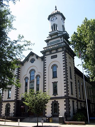
Mifflintown is a borough in and the county seat of Juniata County, Pennsylvania, United States. The population was 842 at the 2020 census.

<span class="mw-page-title-main">Lewistown, Pennsylvania</span> Borough in Pennsylvania, United States

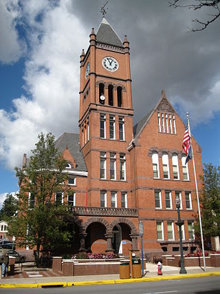
Lewistown is a borough in and the county seat of Mifflin County, Pennsylvania, United States. It is the principal city of the Lewistown, PA Micropolitan Statistical Area, which encompasses all of Mifflin County. It lies along the Juniata River, 61 miles (98 km) northwest of Harrisburg.

<span class="mw-page-title-main">Menno Township, Pennsylvania</span> Township in Pennsylvania, United States

Menno Township is a township in Mifflin County, Pennsylvania, United States. The population was 1,973 at the time of the 2020 census.

<span class="mw-page-title-main">Mifflin County School District</span> Public school district in Pennsylvania, United States

The Mifflin County School District is a midsized, rural public school district located in the Commonwealth of Pennsylvania. The district boundaries coincide with the boundaries of Mifflin County, minus the southwestern municipalities of Kistler and Newton Hamilton boroughs and Wayne Township, which are part of the Mount Union Area School District. Mifflin County School District encompasses approximately 362.3 square miles. According to 2010 federal census data, it served a resident population of 43,607. Based on 2020 federal census data, the district's resident population shrank to 43,285. The educational attainment levels for the Mifflin County School District population were 81.4% high school graduates and 11.1% college graduates.

<span class="mw-page-title-main">Pennsylvania Route 103</span> State highway in Pennsylvania, US

Pennsylvania Route 103 is a 30.8-mile (49.57 km) long north–south designated state route in the Commonwealth of Pennsylvania. Its primary course is along the south/east side of the Juniata River, while U.S. Route 522 runs along the opposite side. PA 103's southern terminus is an at-grade intersection with US 522 at Allenport in Shirley Township, a bit south of US 522's bridge across the Juniata River in Mount Union. Its northern terminus is an intersection with US 22 Business in Lewistown. It intersects the northern terminus of PA 333 just south of Juniata Terrace.

<span class="mw-page-title-main">Pennsylvania Route 655</span> State highway in Pennsylvania, US

Pennsylvania Route 655 is an 83-mile-long (134 km) north–south state highway located in central Pennsylvania. The southern terminus of the route is at the Mason–Dixon line in Thompson Township, where the road becomes a local road in Hancock, Maryland. The northern terminus is at State Route 1005, the former alignment of U.S. Route 322, in Reedsville.

Joseph Yoder was an educator, musicologist, and writer, the first successful Mennonite literary figure in the United States, especially known for his semi-fictional account of his mother's life, Rosanna of the Amish (1940), and for his investigation of the sources of the Amish tunes of the Ausbund, along with his efforts to record and preserve traditional Amish music.

<span class="mw-page-title-main">Pennsylvania Route 305</span> State highway in Pennsylvania, US

Pennsylvania Route 305 is a 29-mile-long (47 km) state highway located in Huntingdon and Mifflin counties in Pennsylvania. The western terminus is at U.S. Route 22 in Alexandria. The eastern terminus is at PA 655 in Belleville. The route crosses the Stone Mountain ridge following a valley along a fault line at 40°37′46″N77°45′31″W near Greenwood Furnace State Park.

References

  1. Includes Centre, Lycoming, Northumberland, Columbia, Mifflin, Union, Snyder, Clinton, Juniata and Montour Counties
  1. 1 2 "QuickFacts: Mifflin County, Pennsylvania". Census.gov. Retrieved May 29, 2022.
  2. "Find a County". National Association of Counties. Retrieved June 7, 2011.
  3. ""Find an Altitude/Mifflin County PA" - Google Maps (accessed 23 May 2019)". Archived from the original on May 21, 2019. Retrieved May 23, 2019.
  4. "Broad Mountain Pennsylvania" - PeakBagger.com (accessed 23 May 2019)
  5. Mifflin County PA - Google Maps (accessed 23 May 2019)
  6. "2010 Census Gazetteer Files". US Census Bureau. August 22, 2012. Retrieved March 9, 2015.
  7. "PRISM Climate Group at Oregon State University".
  8. "US Decennial Census". US Census Bureau. Retrieved March 9, 2015.
  9. "Historical Census Browser". University of Virginia Library. Retrieved March 9, 2015.
  10. Forstall, Richard L., ed. (March 24, 1995). "Population of Counties by Decennial Census: 1900 to 1990". US Census Bureau. Retrieved March 9, 2015.
  11. "Census 2000 PHC-T-4. Ranking Tables for Counties: 1990 and 2000" (PDF). US Census Bureau. April 2, 2001. Archived (PDF) from the original on October 9, 2022. Retrieved March 9, 2015.
  12. "State & County QuickFacts". United States Census Bureau. Archived from the original on June 6, 2011. Retrieved November 20, 2013.
  13. "Census 2020".
  14. "Language Map Data Center". www.mla.org. Retrieved November 27, 2018.
  15. "P2 HISPANIC OR LATINO, AND NOT HISPANIC OR LATINO BY RACE – 2020: DEC Redistricting Data (PL 94-171) – Mifflin County, Pennsylvania".
  16. The 12 Largest Amish Communities (2017) at Amish America
  17. "Office of Management and Budget". whitehouse.gov. Retrieved April 3, 2018.
  18. "Businesses that Received Forms in 2012: Pennsylvania - U.S. Census Bureau". Archived from the original on September 24, 2015. Retrieved December 7, 2017.
  19. 1 2 Promotions, Center for New Media and. "US Census Bureau 2010 Census". www.census.gov. Retrieved April 3, 2018.
  20. 1 2 Center, Legislativate Data Processing. "Find Your Legislator". The official website for the Pennsylvania General Assembly. Retrieved May 9, 2017.
  21. Leip, David. "Dave Leip's Atlas of U.S. Presidential Elections". uselectionatlas.org. Retrieved April 3, 2018.
  22. Snyder, Union, Mifflin Child Development Report. Feb 2010
  23. Sacred Heart School/Academics (accessed 23 May 2019)
  24. County Observer (Manta, accessed 23 May 2019)
  25. Anderson PA - Google Maps (accessed 23 May 2019)
  26. Anderson PA (MapQuest, accessed 23 May 2019)
  27. Belltown PA - Google Maps (accessed 23 May 2019)
  28. Belltown PA (MapQuest, accessed 23 May 2019)
  29. Hawstone PA - Google Maps (accessed 23 May 2019)
  30. Hawstone, Mifflin County, Pennsylvania (Hometown Locator, accessed 23 May 2019)
  31. Little Kansas PA - Google Maps (accessed 23 May 2019)
  32. Little Kansas PA (MapQuest, accessed 23 May 2019)
  33. Menno PA - Google Maps (accessed 23 May 2019)
  34. Menno PA (MapQuest, accessed 23 May 2019)
  35. Naginey, Mifflin County PA (Roadside Thoughts Gazeteer; accessed 23 May 2019)
  36. Naginey PA - Google Maps (accessed 23 May 2019)
  37. Ryde PA - Google Maps (accessed 23 May 2019)
  38. Ryde PA (MapQuest, accessed 23 May 2019)
  39. Shindle PA - Google Maps (accessed 23 May 2019)
  40. Shindle PA (MapQuest, accessed 23 May 2019)
  41. Union Mills PA - Google Maps (accessed 23 May 2019)
  42. Union Mills PA (MapQuest, accessed 23 May 2019)
  43. Woodland PA - Google Maps (accessed 23 May 2019)
  44. Woodland PA (MapQuest, accessed 23 May 2019)

Further reading

40°37′N77°37′W / 40.61°N 77.62°W / 40.61; -77.62