Duchess Street is a street in the City of Westminster, London, that runs west to east from Mansfield Street in the west to Hallam Street in the east, and crosses Portland Place about halfway. It is named after Margaret Bentinck, Duchess of Portland.

Duchess Street is a street in the City of Westminster, London, that runs west to east from Mansfield Street in the west to Hallam Street in the east, and crosses Portland Place about halfway. It is named after Margaret Bentinck, Duchess of Portland.

The Anglo-Dutch merchant banker, author, philosopher and art collector Thomas Hope had an Egyptian-influenced house built at no. 10 in 1799, and decorated it extravagantly. [1] The building has been Grade II listed since 1954. [2] The Egyptian Room in his house was the inspiration for the Egyptian Hall in Piccadilly, an exhibition hall built in the ancient Egyptian style in 1812, and demolished in 1905.

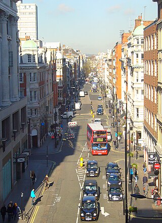
Jermyn Street is a one-way street in the St James's area of the City of Westminster in London, England. It is to the south of, parallel, and adjacent to Piccadilly. Jermyn Street is known as a street for gentlemen's-clothing retailers.

Great Portland Street in Marylebone, in the West End of London, links Oxford Street with the A501 Marylebone Road. The street, which is part of a broader rectilinear street pattern, includes the Embassy of the Democratic Republic of the Congo. and a number of small independent shops.

Soho Square is a garden square in Soho, London, hosting since 1954 a de facto public park let by the Soho Square Garden Committee to Westminster City Council. It was originally called King Square after Charles II, and a much weathered statue of the monarch has stood in the square, with an extended interruption, since 1661, one year after the restoration of the monarchy.

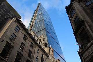
Leadenhall Street is a street in the City of London. It is about 1⁄3-mile-long (0.54 km) and links Cornhill in the west to Aldgate in the east. It was formerly the start of the A11 road from London to Norwich, but that route now starts further east at Aldgate.

Richmond Green is a recreation area near the centre of Richmond, a town of about 20,000 inhabitants situated in south-west London. Owned by the Crown Estate, it is leased to the London Borough of Richmond upon Thames. The Green, which has been described as "one of the most beautiful urban greens surviving anywhere in England", is roughly square in shape and its open grassland, framed with broadleaf trees, extends to roughly twelve acres. On the north-east side there is also a smaller open space called Little Green. Richmond Green and Little Green are overlooked by a mixture of period townhouses, historic buildings and municipal and commercial establishments including the Richmond Lending Library and Richmond Theatre.

Coade stone or Lithodipyra or Lithodipra is stoneware that was often described as an artificial stone in the late 18th and early 19th centuries. It was used for moulding neoclassical statues, architectural decorations and garden ornaments of the highest quality that remain virtually weatherproof today.

Brocket Hall is a neo-classical country house set in a large park at the western side of the urban area of Welwyn Garden City in Hertfordshire, England. The estate is equipped with two golf courses and seven smaller listed buildings, apart from the main house. The freehold on the estate is held by the 3rd Baron Brocket. The house is Grade I-listed.

The Egyptian Hall in Piccadilly, London, was an exhibition hall built in the ancient Egyptian style in 1812, to the designs of Peter Frederick Robinson. The Hall was a considerable success, with exhibitions of artwork and of Napoleonic era relics. The hall was later used for popular entertainments and lectures, and developed an association with magic and spiritualism, becoming known as "England's Home of Mystery".

Langham Place is a short street in Westminster, central London, England. Just north of Oxford Circus, it connects Portland Place to the north with Regent Street to the south in London's West End. It is, or was, the location of many significant public buildings, and gives its name to the Langham Place group, a circle of early women's rights activists.

Marylebone is a district in the West End of London, in the City of Westminster. Oxford Street, Europe's busiest shopping street, forms its southern boundary.

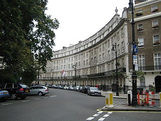
Wilton Crescent is a street in central London, comprising a sweeping elegant terrace of Georgian houses and the private communal gardens that the semi-circle looks out upon. The houses were built in the early 19th century and are now Grade II listed buildings. The street is the northern projection of Belgravia and is often taken to fall into the category of London's garden squares.

Chandos House is a Grade I listed building at N° 2 Queen Anne Street, Marylebone, in central London. It was designed by Robert Adam, the most prominent architect in Georgian Britain, and built by William Adam and Company. It is seen as the first of a series of large townhouses in London, including 20 St. James's Square and Derby House.

Rathbone Place is a street in central London that runs roughly north-west from Oxford Street to Percy Street. it is joined on its eastern side by Percy Mews, Gresse Street, and Evelyn Yard. The street is mainly occupied by retail and office premises.

Riding House Street is a street in central London in the City of Westminster.

Homer Street is a quiet one-way street in the Marylebone neighbourhood of the City of Westminster, London. It runs from Old Marylebone Road in the north to Crawford Street in the south. The street is part of the Marylebone Ward of Westminster City Council. Its postcode is W1H.

D'Arblay Street is a street in the Soho district of the City of Westminster, London, named after Frances Burney. It was formerly known as Portland Street and was built on land owned by the Dukes of Portland known as Doghouse Close.

New Cavendish Street is a street in the City of Westminster, London, that runs from Marylebone High Street in the west to Cleveland Street in the east. The street was built in 1775 and named after the Cavendish family, who were related to the ground landlords, the Dukes of Portland.

Lansdowne Terrace is a street in Bloomsbury, London WC1.

Bulstrode Street is a street in Marylebone in the City of Westminster that runs from Welbeck Street in the east to Thayer Street in the west. It is crossed only by Marylebone Lane.

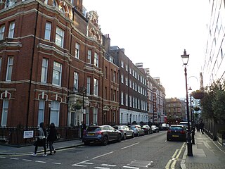
Chesterfield Street is a "virtually intact" Georgian street in London's Mayfair district. Several of the buildings are Grade II listed on the National Heritage List for England.
![]() Media related to Duchess Street, London at Wikimedia Commons 51°31′10″N0°08′37″W / 51.5194°N 0.1437°W
Media related to Duchess Street, London at Wikimedia Commons 51°31′10″N0°08′37″W / 51.5194°N 0.1437°W