A popular tourist destination in Durrell is the Durrell Museum, located on Museum Street. It features many different historical exhibits including a polar bear that once set foot on Twillingate island.
Durrell has one department store, which has groceries and hardware, other stores are found in the nearby main town of Twillingate. There are no educational institutions in the village either, instead residents travel to Twillingate for elementary, middle and high school.
Durrell is split into many different "divisions", which aren't marked today but still are known by past and current residents of the area including Upper Jenkins Cove (mainly Upper Jenkins Cove Road; Gillesport Road area), Lower Jenkins Cove (Durrell Street) and Gillesport (Farmers Arm Road - Howlett's Road). There are many other side streets around the village.
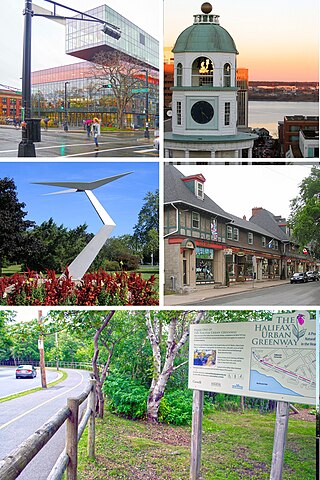
The Halifax Peninsula is a peninsula within the urban area of the Municipality of Halifax, Nova Scotia.
Twillingate is a town of 2,121 people located on the Twillingate Islands ("Toulinquet") in Notre Dame Bay, off the north eastern shore of the island of Newfoundland in the province of Newfoundland and Labrador, Canada. The town is about 100 kilometres (62 mi) north of Lewisporte and Gander.
Cole Harbour is a former village and current community located in Nova Scotia, Canada, that is part of the Halifax Regional Municipality.
Springdale is a town in Newfoundland and Labrador, Canada, which had a population of 2,965 people in 2021, up from 2,764 in the Canada 2006 Census. The community is located on the Northwestern shores of Hall's Bay in Central Newfoundland, near the mouth of Indian River.
Triton is a town that lies on Triton Island just off the coast of northeastern Newfoundland, in the Canadian province of Newfoundland and Labrador. Triton is the economic center of Green Bay South. According to Statistics Canada, Triton's population fell from 983 in 2016 to 896 in 2021.
Virgin Arm–Carter's Cove is a local service district and designated place on New World Island in the Canadian province of Newfoundland and Labrador. Virgin Arm-Carter's Cove is located approximately 90 km Northwest of Gander in Subdivision H of Division No. 8.
Back Harbour is a Canadian community located on the northern island of Twillingate in the province of Newfoundland and Labrador. It is part of the Town of Twillingate.
Rose Blanche–Harbour le Cou Town on Newfoundland's southwest shore, about 45 km from Port aux Basques, at the end of Route 470.
Nova Central School District was a school district headquartered in Gander in the Canadian province of Newfoundland and Labrador. The district had 66 schools located in 50 different communities, and served about 13,000 students, including a significant rural population. The District was formed by the merger of the Lewisporte-Gander and Baie Verte-Central-Connaigre school boards in 2004. The largest school in the district was Gander Academy. The district was replaced by the Newfoundland and Labrador English School District upon provincial amalgamation in 2013.
Little Harbour is a drive-through community of 13 families on South Twillingate Island, off the north shore of the Canadian island of Newfoundland. It is located approximately 3 km south of Twillingate on Route 340. Little Harbour is known for a scenic atmosphere and authentic small-town feel.
Purcell's Harbour is a local service district and designated place in the Canadian province of Newfoundland and Labrador. It is on the southern Twillingate island, about 4 km (2.5 mi) outside the town of Twillingate, near the community of Little Harbour.
Bayview is an area in the town of Twillingate, Newfoundland and Labrador. It consists of three small fishing communities along the shore of South Twillingate Island. The communities within Bayview are called Bluff Head Cove, Gillard's Cove and Manuel's Cove. Mainly older residents of the community still refer to these places separately but street signs only read Bayview and Ragged Point.
Wild Cove is a small community on the north island of Twillingate, Newfoundland and Labrador. South of Wild Cove is Twillingate and north is Crow Head and the famous Long Point Lighthouse. Wild Cove is part of the Town of Twillingate.
Black Duck Cove is a community located south of Twillingate, Newfoundland and Labrador, Canada. Located on the southern island of Twillingate, few people reside in Black Duck Cove.
Crow Head is a small town located on the north island of Twillingate in Newfoundland and Labrador, Canada. It is home to the Long Point Lighthouse. Its only land border is with the Town of Twillingate, to the southeast.
Twillingate Islands are a group of islands in Notre Dame Bay of the island of Newfoundland in the province of Newfoundland and Labrador, Canada. There are two main islands, North Twillingate Island and South Twillingate Island, and several smaller islands that lie close to those; the largest is Burnt Island. The southern island is connected to New World Island via the Walter B. Elliott Causeway. The northern island is connected to the southern island by Tickle Bridge, which runs along Main Street in the town. The actual town of Twillingate is located on both islands.
Route 340, also known as Road to the Isles, is a road in the Canadian province of Newfoundland and Labrador passing through the towns of Lewisporte, Summerford and Twillingate, all in The Isles of Notre Dame region of the province.
Indian Cove is a local service district and designated place in the Canadian province of Newfoundland and Labrador. It is just off Route 340 on New World Island. It is the last community before crossing the causeway to Twillingate. Before the construction of the causeway, there was a ferry that ran from Indian Cove to Twillingate. Education is provided by New World Island Academy in Summerford and grocery shopping can be done in nearby Twillingate.
Lobster Harbour may refer to either a settlement located in Notre Dame Bay or to one in White Bay, Newfoundland and Labrador.
Division No. 1, Subdivision G is an unorganized subdivision on the Avalon Peninsula in Newfoundland and Labrador, Canada. It is in Division 1 and contains the unincorporated communities of Baccalieu Island, Besom Cove, Bradley's Cove, Burnt Point, Caplin Cove, Daniel's Cove, Grates Cove, Gull Island, Job's Cove, Kingston, Long Beach, Lower Island Cove, Low Point, Northern Bay, Ochre Pit Cove, Red Head Cove, Riverhead, Smooth Cove and Western Bay.
This page is based on this Wikipedia article Text is available under the CC BY-SA 4.0 license; additional terms may apply. Images, videos and audio are available under their respective licenses.