
The Wildlife Trust for Bedfordshire, Cambridgeshire and Northamptonshire (WTBCN) is a registered charity which manages 126 nature reserves covering 3,945 hectares. It has over 35,000 members, and 95% of people in Bedfordshire, Cambridgeshire and Northamptonshire live within five miles of a reserve. In the year to 31 March 2016 it employed 105 people and had an income of £5.1 million. It aims to conserve wildlife, inspire people to take action for wildlife, offer advice and share knowledge. The WTBCN is one of 36 wildlife trusts covering England, and 46 covering the whole of the United Kingdom.
Cople Pits is a 2-hectare (4.9-acre) nature reserve in Cople in Bedfordshire. It is managed by the Wildlife Trust for Bedfordshire, Cambridgeshire and Northamptonshire.

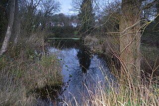
Pavenham Osier Beds is a 1.3 hectare nature reserve south of Pavenham, on the banks of the River Great Ouse, in Bedfordshire. It is managed by the Wildlife Trust for Bedfordshire, Cambridgeshire and Northamptonshire.

The Riddy is an 8.4 hectare flood meadow and Local Nature Reserve located in Sandy, Bedfordshire, United Kingdom, bordering the River Ivel. Owned by Sandy Town Council but managed by both the Wildlife Trust for Bedfordshire, Cambridgeshire and Northamptonshire and Bedfordshire Rural Communities Charity, the 7.7 hectares site gains its name from a small stream which flows through the eastern end of the reserve. The different habitats in the Riddy support a diverse range of species, including a multiplicity of grasses and flowering plants in the meadows, aquatic plants and water voles which inhabit the ditches, ponds and stream, and birds which feed and hunt across the reserve.

Totternhoe Knolls is a 13.1-hectare (32-acre) Site of Special Scientific Interest (SSSI) in Totternhoe in Bedfordshire. It is also a local nature reserve, and part of the Chilterns Area of Outstanding Natural Beauty. The site is owned by Central Bedfordshire Council and leased to the National Trust. Most of the site is maintained jointly by the National Trust and the Wildlife Trust for Bedfordshire, Cambridgeshire and Northamptonshire (WTBCN), and is part of the WTBCN Totternhoe nature reserve, which also includes Totternhoe Chalk Quarry and Totternhoe Stone Pit. The SSSI also includes Totternhoe Castle, the earthworks of a Norman motte-and-bailey castle which is a Scheduled monument.
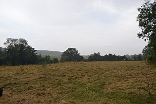
Wansford Pasture is a 3.1-hectare (7.7-acre) biological Site of Special Scientific Interest in Wansford in Cambridgeshire. It is part of the 7.3 hectare Wansford Pasture & Standen's Pasture, a nature reserve managed by the Wildlife Trust for Bedfordshire, Cambridgeshire and Northamptonshire (WTBCN).

Totternhoe nature reserve is managed by the Wildlife Trust for Bedfordshire, Cambridgeshire and Northamptonshire (WTBCN). The 31-hectare (77-acre) site is in Totternhoe in Bedfordshire, and it includes parts of three Sites of Special Scientific Interest (SSSIs). Totternhoe Knolls is a biological SSSI owned by Central Bedfordshire Council and leased to the National Trust. Most of it is managed jointly by the National Trust and the WTBCN, excluding Totternhoe Castle, the earthworks of a Norman motte-and-bailey castle which is part of the SSSI but not of WTBCN's nature reserve. Totternhoe nature reserve also includes the geological SSSI, Totternhoe Stone Pit, which is not open to the public, and other areas owned by WTBCN, including part of Totternhoe Chalk Quarry, another biological SSSI.

Mill Crook is a 5.9-hectare (15-acre) biological Site of Special Scientific Interest east of Towcester in Northamptonshire. Mill Crook and Grafton Regis Meadow are a 7.9-hectare (20-acre) nature reserve managed by the Wildlife Trust for Bedfordshire, Cambridgeshire and Northamptonshire.

Kingsthorpe Meadow is a 14.4 hectare Local Nature Reserve in Northampton. It is owned by Northampton Borough Council and managed by the Wildlife Trust for Bedfordshire, Cambridgeshire and Northamptonshire.

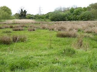
Ditchford Lakes and Meadows is a 31.1-hectare (77-acre) nature reserve Northamptonshire. It is managed by the Wildlife Trust for Bedfordshire, Cambridgeshire and Northamptonshire. It is part of the Upper Nene Valley Gravel Pits Site of Special Scientific Interest, Ramsar wetland site of international importance, and Special Protection Area under the European Communities Birds Directive.

Tailby Meadow is a 4.9 hectare Local Nature Reserve in Desborough in Northamptonshire. It is owned by Kettering Borough Council and managed by the Wildlife Trust for Bedfordshire, Cambridgeshire and Northamptonshire.

Barford Wood and Meadows or Barford Meadow Nature Reserve is a 36 hectare nature reserve east of Rushton in Northamptonshire. It is managed by the Wildlife Trust for Bedfordshire, Cambridgeshire and Northamptonshire. The north-eastern end is part of the River Ise and Meadows Site of Special Scientific Interest.

Storton's Pits is a 21.9 hectare Local Nature Reserve in Northampton. It is managed by the Wildlife Trust for Bedfordshire, Cambridgeshire and Northamptonshire.

Grafton Regis Meadow is a 2-hectare (4.9-acre) nature reserve east of Grafton Regis in Northamptonshire. It is managed by the Wildlife Trust for Bedfordshire, Cambridgeshire and Northamptonshire.

Barnes Meadow is a 29.4 hectare Local Nature Reserve in Northampton. An area of 20 hectares is managed by the Wildlife Trust for Bedfordshire, Cambridgeshire and Northamptonshire.
Abington Meadows is a 9.6-hectare (24-acre) nature reserve in Northampton. It is owned by Northamptonshire County Council and managed by the Wildlife Trust for Bedfordshire, Cambridgeshire and Northamptonshire.

