
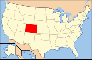
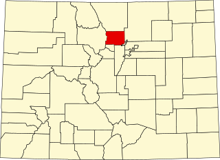
Teller County is one of the 64 counties in the U.S. state of Colorado. As of the 2010 census, the population was 23,350. The county seat is Cripple Creek, and the most populous city is Woodland Park.

Routt County is one of the 64 counties in the U.S. state of Colorado. As of the 2010 census, the population was 23,509. The county seat is Steamboat Springs.

Park County is one of the 64 counties in the U.S. state of Colorado. As of the 2010 census, the population was 16,206. The county seat is Fairplay. The county was named after the large geographic region known as South Park, which was named by early fur traders and trappers in the area.

Jefferson County, is one of the 64 counties in the U.S. state of Colorado. As of the 2010 census, the population was 534,543, making it the fourth-most populous county in Colorado. The county seat is Golden, and the most populous city is Lakewood.

Gilpin County is the second-least extensive of the 64 counties of the U.S. state of Colorado, behind only the City and County of Broomfield. As of the 2010 census, the population was 5,441. The county seat is Central City. The county was formed in 1861, while Colorado was still a Territory, and was named after Colonel William Gilpin, the first territorial governor.

Clear Creek County is one of the 64 counties of the U.S. state of Colorado. As of the 2010 census, the population was 9,088. The county seat is Georgetown.

Cañon City is a Home Rule Municipality that is the county seat and the most populous municipality of Fremont County, Colorado, United States. The city population was 16,400 at the 2010 United States Census. Cañon City straddles the easterly flowing Arkansas River and is a popular tourist destination for sightseeing, whitewater rafting, and rock climbing. The city is known for its many public parks, fossil discoveries, Skyline Drive, The Royal Gorge railroad, the Royal Gorge, and extensive natural hiking paths.

Conococheague Creek, a tributary of the Potomac River, is a free-flowing stream that originates in Pennsylvania and empties into the Potomac River near Williamsport, Maryland. It is 80 miles (129 km) in length, with 57 miles (92 km) in Pennsylvania and 23 miles (37 km) in Maryland. The watershed of Conococheague Creek has an area of approximately 566 square miles (1,470 km2), out of which only 65 square miles (170 km2) are in Maryland.

The Never Summer Mountains are a mountain range in the Rocky Mountains in north central Colorado in the United States consisting of seventeen named peaks. The range is located along the northwest border of Rocky Mountain National Park, forming the continental divide between the headwaters of the Colorado River in Rocky Mountain National Park to the local-east and the upper basin of the North Platte River to the local-west; the continental divide makes a loop in these mountains. The range is small and tall, covering only 25 sq mi (65 km2) with a north-south length of 10 mi (16 km) while rising to over 12,000 ft (3,700 m) at over ten distinct peaks. The range straddles the Jackson-Grand county line for most of its length, and stretches into Jackson and Larimer county at its northern end. A panoramic view of the range is available from sections of Trail Ridge Road in Rocky Mountain National Park. One of the northernmost peaks, Nokhu Crags, is prominently visible from the west side of Cameron Pass.

The Georgetown Loop Railroad is a 3 ft narrow gauge United States heritage railroad located in the Rocky Mountains in Clear Creek County, adjacent to Interstate 70 in Colorado.

Echo Lake Park is a park located along the Mount Evans Scenic Byway about 33.5 mi (54 km) west of Denver, Colorado. The park provides a stone shelter with picnic tables and barbecue grills on one end of the lake, and the 1926 Echo Lake Lodge and an Arapaho National Forest campground are found at the other. Access to backpacking trails, including the Chicago Lakes trail and Lincoln Lakes trail, can be found adjacent to the lake. The park is part of the Denver Mountain Parks system.

There are more than 1,500 properties and historic districts in Colorado listed on the National Register of Historic Places. They are distributed over 63 of Colorado's 64 counties; only Broomfield County has none.
The following is an alphabetical list of articles related to the U.S. state of Colorado.
This is a list of the National Register of Historic Places listings in Boulder County, Colorado.
The Old Fall River Road, sometimes referred to as "The Old Road" by park staff in Rocky Mountain National Park, was the first automobile road to penetrate the interior of the park. The road linked the east side of the park near Estes Park with Grand Lake on the west side. Work began in 1913 but was interrupted in 1914 by World War I with final work being completed between 1918 and 1920.

This is a list of the National Register of Historic Places listings in Larimer County, Colorado.

The historical buildings and structures of Zion National Park represent a variety of buildings, interpretive structures, signs and infrastructure associated with the National Park Service's operations in Zion National Park, Utah. Structures vary in size and scale from the Zion Lodge to road culverts and curbs, nearly all of which were designed using native materials and regional construction techniques in an adapted version of the National Park Service Rustic style. A number of the larger structures were designed by Gilbert Stanley Underwood, while many of the smaller structures were designed or coordinated with the National Park Service Branch of Plans and Designs. The bulk of the historic structures date to the 1920s and 1930s. Most of the structures of the 1930s were built using Civilian Conservation Corps labor.

Cordova Pass in southern Colorado lies on the western shoulder of the West Spanish Peak, east of the Culebra Range of the Sangre de Cristo Mountains of the Western United States. Cordova Pass lies just outside the Spanish Peaks Wilderness, a designated National Wilderness Area in the San Isabel National Forest. Cordova Pass is reached via the Apishapa Road, a leg of the Scenic Highway of Legends. As the National Forest Service does not usually plow the snow, Cordova Pass is normally not accessible from mid-November to late May. Most of the time, the pass may be traversed by passenger vehicles.

Indian Grove is an archaeological site consisting of a grove of 72 mature Ponderosa Pine trees located within Great Sand Dunes National Park & Preserve in Saguache County, Colorado, near Mosca, Colorado. The grove is of interest because sections of the bark of the trees were peeled off in the early 19th century, probably by Utes.
This is a complete list of the properties and districts on the National Register of Historic Places in Rocky Mountain National Park, Colorado, United States. The locations of National Register properties and districts for which the latitude and longitude coordinates are included below, may be seen in a Google map.


