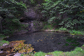
Rock Creek Park is a large urban park that bisects the Northwest quadrant of Washington, D.C. The park was created by an Act of Congress in 1890 and today is administered by the National Park Service. In addition to the park proper, the Rock Creek administrative unit of the National Park Service administers various other federally owned properties in the District of Columbia located to the north and west of the National Mall, including Meridian Hill Park on 16th Street, N.W., the Old Stone House in Georgetown, and certain of the Fort Circle Parks, a series of batteries and forts encircling the District of Columbia for its defense during the U.S. Civil War.

Trail Ridge Road is the name for the 48-mile (77 km) stretch of U.S. Highway 34 that traverses Rocky Mountain National Park from Estes Park, Colorado in the east to Grand Lake, Colorado in the west. Together with the connecting 6.9-mile (11 km) Beaver Meadow Road, Trail Ridge Road forms the 55-mile (89 km) Trail Ridge Road/Beaver Meadow National Scenic Byway, an All-American Road. With a high point at 12,183 feet (3,713 m) elevation, Trail Ridge Road is the highest continuous paved road in North America. The higher portion of Trail Ridge Road is closed from October to May.
Catoctin Mountain Park, located in north-central Maryland, is part of the forested Catoctin Mountain ridge−range that forms the northeastern rampart of the Blue Ridge Mountains, in the Appalachian Mountains System.

Prince William Forest Park is a national park in the U.S. state of Virginia within Prince William County, located adjacent to the Marine Corps Base Quantico near the town of Dumfries. Established as Chopawamsic Recreational Demonstration Area in 1936, the park is the largest protected natural area in the Washington, D.C. metropolitan region at over 13,000 acres (5,300 ha).

There are more than 1,500 properties and historic districts in the U.S. State of Colorado listed on the National Register of Historic Places. They are distributed over 63 of Colorado's 64 counties; only the City and County of Broomfield currently has none.

Yosemite West is an unincorporated community of resort homes located just outside the southern area of Yosemite National Park, just off Wawona Road, a continuation of State Route 41 from Fresno. It is a census-designated place (CDP), with a population of 47 as of the 2020 census. It is situated one mile (1.6 km) south of the Chinquapin intersection of Wawona Road with Glacier Point Road, at an altitude of 5,100 to 6,300 feet. The elevation reported by the USGS is 5,866 feet (1,788 m). The community is part of Henness Ridge, nearly 3,000 feet (910 m) above the southern banks of the Merced River and State Route 140 from Mariposa. Addresses in this area are shown as "Yosemite National Park, CA 95389".

Death Canyon is located in Grand Teton National Park, in the U.S. state of Wyoming. The canyon was formed by glaciers which retreated at the end of the last glacial maximum approximately 15,000 years ago, leaving behind a U-shaped valley. The trailhead for the canyon is located on a side road off the Moose-Wilson Road, approximately 5 miles (8.0 km) from the park headquarters at Moose, Wyoming. At the base of the canyon is Phelps Lake which was created by glacial activity. The Death Canyon Trail extends the length of the canyon to Fox Creek Pass, at which point the Death Canyon Shelf, a relative narrow and level plateau, can be traversed. The canyon has many Whitebark Pine stands, particularly near the tree line. At the junction of the Death Canyon and the Alaska Basin trails, the historic Death Canyon Barn is preserved after being listed on the National Register of Historic Places in 1998.

Table Rock State Park is a 3,083-acre (12.48 km2) park at the edge of the Blue Ridge Mountains in northern Pickens County, South Carolina. The park includes Pinnacle Mountain, the tallest mountain totally within the state.
East Rock Park is a park in the city of New Haven and the town of Hamden, Connecticut that is operated as a New Haven city park. The park surrounds and includes the mountainous ridge named East Rock and was developed with naturalistic landscaping. The entire 427-acre (173 ha) park is listed on the National Register of Historic Places.

Backbone State Park is Iowa's oldest state park, dedicated in 1919. Located in the valley of the Maquoketa River, it is approximately three miles (5 km) south of Strawberry Point in Delaware County. It is named for a narrow and steep ridge of bedrock carved by a loop of the Maquoketa River originally known as the Devil's Backbone. The initial 1,200 acres (490 ha) were donated by E.M. Carr of Lamont, Iowa. Backbone Lake Dam, a relatively low dam built by the Civilian Conservation Corps (CCC) in the 1930s, created Backbone Lake. The CCC constructed a majority of trails and buildings which make up the park.

The Death Canyon Barn is a combination barn and ranger patrol cabin in Grand Teton National Park. The barn was built in Death Canyon on the Death Canyon Trail at its junction with the Alaska Basin Trail by the Civilian Conservation Corps in 1935 in the National Park Service rustic style. Located with a clear view of Prospector Mountain, it shares a common style and purpose with the Cascade Canyon Barn to the north in the park, with minor differences attributable to available materials and the preferences of the work crews building the barns.

The Glacier National Park Tourist Trails, including the Inside Trail, South Circle Trail and North Circle Trail, were established in Glacier National Park to connect a series of tourist camps and hotels established by the Great Northern Railway between 1910 and 1915. Prior to the construction of the Going-to-the-Sun Road, these trails were the primary form of circulation within the park. The trail system includes a number of bridges.

This is a list of the National Register of Historic Places listings in Grand County, Colorado.

The historical buildings and structures of Zion National Park represent a variety of buildings, interpretive structures, signs and infrastructure associated with the National Park Service's operations in Zion National Park, Utah. Structures vary in size and scale from the Zion Lodge to road culverts and curbs, nearly all of which were designed using native materials and regional construction techniques in an adapted version of the National Park Service Rustic style. A number of the larger structures were designed by Gilbert Stanley Underwood, while many of the smaller structures were designed or coordinated with the National Park Service Branch of Plans and Designs. The bulk of the historic structures date to the 1920s and 1930s. Most of the structures of the 1930s were built using Civilian Conservation Corps labor.

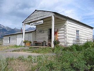
The historical buildings and structures of Grand Teton National Park include a variety of buildings and built remains that pre-date the establishment of Grand Teton National Park, together with facilities built by the National Park Service to serve park visitors. Many of these places and structures have been placed on the National Register of Historic Places. The pre-Park Service structures include homestead cabins from the earliest settlement of Jackson Hole, working ranches that once covered the valley floor, and dude ranches or guest ranches that catered to the tourist trade that grew up in the 1920s and 1930s, before the park was expanded to encompass nearly all of Jackson Hole. Many of these were incorporated into the park to serve as Park Service personnel housing, or were razed to restore the landscape to a natural appearance. Others continued to function as inholdings under a life estate in which their former owners could continue to use and occupy the property until their death. Other buildings, built in the mountains after the initial establishment of the park in 1929, or in the valley after the park was expanded in 1950, were built by the Park Service to serve park visitors, frequently employing the National Park Service Rustic style of design.

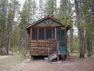
The Holzwarth Historic District comprises a series of cabins built by the Holzwarth family as a guest ranch inholding within the boundaries of Rocky Mountain National Park, at Grand Lake, Colorado. The Holzwarths made their homestead in the Kawuneeche Valley in 1917, two years after the establishment of the park, and received a patent on the homestead in 1923. Guest ranch use began in 1919 and continued until the ranch was purchased by The Nature Conservancy in 1974. The property was transferred to the National Park Service in 1975 for incorporation into the park. The district comprises a number of rustic cabins on the Colorado River. Operations existed on both sides of the river, first known as the Holzwarth Trout Ranch and later as the Never Summer Ranch. All but Joe Fleshut's cabin have been removed from the east side of the river.

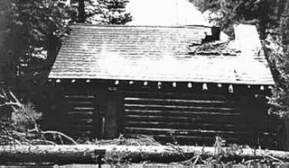
The Milner Pass Road Camp Mess Hall and House was built in 1926 was built to support construction crews working on the new Trail Ridge Road in the vicinity of Milner Pass in Rocky Mountain National Park in 1926. The 35-by-18-foot log structure was designed by Daniel Ray Hull of the National Park Service and represents one of the earliest examples of the National Park Service rustic style in the park. The interior is divided into three rooms. Its original use was as a dining facility and residence for Park Service personnel.
Architects of the National Park Service are the architects and landscape architects who were employed by the National Park Service (NPS) starting in 1918 to design buildings, structures, roads, trails and other features in the United States National Parks. Many of their works are listed on the National Register of Historic Places, and a number have also been designated as National Historic Landmarks.

The Los Burros Ranger Station is a forest ranger station situated in Apache County, Arizona. The station was staffed by rangers who traveled to the nearby Lake Mountain Lookout.


