
Palestine usually refers to:

Scouting in West Virginia has a long history, from the 1910s to the present day, serving thousands of youth in programs that suit the environment in which they live.

The Shenandoah Valley is a geographic valley and cultural region of western Virginia and the Eastern Panhandle of West Virginia in the United States. The valley is bounded to the east by the Blue Ridge Mountains, to the west by the eastern front of the Ridge-and-Valley Appalachians, to the north by the Potomac River and to the south by the James River. The cultural region covers a larger area that includes all of the valley plus the Virginia highlands to the west, and the Roanoke Valley to the south. It is physiographically located within the Ridge and Valley province and is a portion of the Great Appalachian Valley.

West Virginia Route 20 is a major north–south state highway in the U.S. state of West Virginia. The southern terminus of the route is at U.S. Route 52 in Bluewell, a small unincorporated suburb of Bluefield. The northern terminus is at West Virginia Route 7 three miles (5 km) east of New Martinsville. WV Route 20 is the longest state route in West Virginia.

Egypt is an unincorporated community in Jefferson County, West Virginia, United States. It is located between Opequon Creek and Leetown off Sulphur Spring Road on Egypt Road.

Southern West Virginia is a culturally and geographically distinct region in the U.S. state of West Virginia. Generally considered the heart of Appalachia, Southern West Virginia is known for its coal mining heritage and Southern affinity. The region is also closely identified with southwestern Virginia and southeastern Kentucky, with close proximity to northwestern North Carolina and East Tennessee. Today, Southern West Virginia continues to grapple with poverty and continuing population loss. Almost the entire region is located in West Virginia's 3rd congressional district, which was represented by Evan Jenkins until he resigned on September 30, 2018 to take a seat as a Justice on the Supreme Court of Appeals of West Virginia.

This is a list of properties and historic districts in West Virginia that are listed on the National Register of Historic Places. There are listings in every one of West Virginia's 55 counties.

The United States District Court for the Southern District of West Virginia is a federal court in the Fourth Circuit.
Forest Hill is an unincorporated community in Summers County, West Virginia, United States. It lies along West Virginia Route 12 to the southeast of the city of Hinton, the county seat of Summers County. Its elevation is 1,926 feet. Although it is unincorporated, it has a post office, with the ZIP code of 24935.
Nimitz is an unincorporated community in Summers County, West Virginia, United States. It lies along West Virginia Route 3 to the west of the city of Hinton, the county seat of Summers County. Its elevation is 2,523 feet. Although it is unincorporated, it has a post office, with the ZIP code of 25978.
Pipestem is an unincorporated community in Summers County, West Virginia, United States. It lies along West Virginia Route 20 to the south-southwest of the city of Hinton, the county seat of Summers County. Its elevation is 2,382 feet. Although it is unincorporated, it has a post office, with the ZIP code of 25979.
Belva is an unincorporated community and census-designated place in west Nicholas County and north Fayette County, West Virginia, United States; while the CDP only includes the Nicholas County portion, the Fayette County portion is considered part of the community. The town is situated at the bottomland surrounding the convergence of Bells Creek with Twentymile Creek and, subsequently, Twenty Mile Creek with the Gauley River. Belva is also the location of the convergence of two state highways: West Virginia Route 16 and West Virginia Route 39.
The Buckskin Council is the local council of the Boy Scouts of America (BSA) that serves Scouts in Scouts in Kentucky, Ohio, Virginia and West Virginia.
Ballengee is an unincorporated community in Monroe and Summers counties, West Virginia, United States. Ballengee is about 15 miles (24 km) southwest of Alderson.
Mountview is an unincorporated community in Raleigh and Summers counties, West Virginia, United States. Mountview is west of Hinton and southeast of Beckley. County Routes 3/1, 3/12, and 19/22 are in Mountview. There are two ponds: one near Mt. View Road and another near Country Route 3/12. Spicelick Creek, Glade Creek, and Farley Creek run through the town. Features close to Mountview are Lake View Golf Course and the artificial Flat Top Lake.

This is a list of the National Register of Historic Places listings in Summers County, West Virginia.
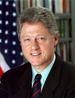
The 1996 United States presidential election in West Virginia took place on November 5, 1996, as part of the 1996 United States presidential election. Voters chose 4 representatives, or electors to the Electoral College, who voted for president and vice president.


