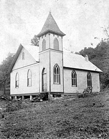
Meadow Bridge is a town in Fayette County, West Virginia, United States. The population was 379 at the 2010 census. The first settler of the area was John Gwin, closely followed by Dan Griffin.

Hinton is a town in west-central Alberta, Canada.

The Greenbrier River is a tributary of the New River, 162 miles (261 km) long, in southeastern West Virginia, in the United States. Via the New, Kanawha and Ohio rivers, it is part of the watershed of the Mississippi River, draining an area of 1,656 square miles (4,290 km2). It is one of the longest rivers in West Virginia.
Sleepy Creek is a 44.0-mile-long (70.8 km) tributary of the Potomac River in the United States, belonging to the Chesapeake Bay's watershed. The stream rises in Frederick County, Virginia, and flows through Morgan County, West Virginia before joining the Potomac near the community of Sleepy Creek.

Yosemite West is an unincorporated community of resort homes located just outside the southern area of Yosemite National Park, just off Wawona Road, a continuation of State Route 41 from Fresno. It is a census-designated place (CDP), with a population of 47 as of the 2020 census. It is situated one mile (1.6 km) south of the Chinquapin intersection of Wawona Road with Glacier Point Road, at an altitude of 5,100 to 6,300 feet. The elevation reported by the USGS is 5,866 feet (1,788 m). The community is part of Henness Ridge, nearly 3,000 feet (910 m) above the southern banks of the Merced River and State Route 140 from Mariposa. Addresses in this area are shown as "Yosemite National Park, CA 95389".

Little Hunting Creek is a 3.6-mile-long (5.8 km) primarily tidal tributary of the Potomac River located in Fairfax County, Virginia, not to be confused with Hunting Creek farther north. A stone-arch bridge, completed in 1931, carries traffic on the George Washington Memorial Parkway across the narrow mouth of the creek, located 96.6 miles (155.5 km) upriver from the mouth of the Potomac. The Washington family built its Mount Vernon plantation on the Potomac River along both banks of Little Hunting Creek during colonial times. The creek is bordered by residential communities in addition to the Mount Vernon property. It is a popular location for recreational fishing, and much of the wildlife characteristic of the tidal Potomac wetlands can be spotted there.
Strange Creek is an unincorporated community along Route 4 in Braxton County, West Virginia, United States, near the border with Clay County. It lies along the bank of the Elk River. The community takes its name from nearby Strange Creek.
Robson is an unincorporated community in Fayette County, West Virginia, United States, situated primarily on the banks of Loup Creek. Robson is served by State Highway 61, and is located 8 miles (13 km) from Montgomery and 15 miles (24 km) from Oak Hill. Robson's Post Office serves the smaller communities of Beards Fork and Mulberry.

The Greenbrier River Watershed Association (GRWA) is one of the oldest watershed associations in the state of West Virginia, founded in 1990. It has supported the creation of other watershed associations throughout the state and maintains a policy of "upstream courtesy" and "downstream courtesy" with its neighbors.
Cabin Creek is an unincorporated community in Kanawha County, West Virginia, United States. Cabin Creek is located on the south bank of the Kanawha River at the mouth of Cabin Creek, southeast of Chesapeake. A notable resident was Adam Clayton Powell, Sr. and his family, who had moved there from Virginia. An exit on the West Virginia Turnpike is located near here.
Lowell is an unincorporated community in Summers County, West Virginia, United States. Lowell is located on the Greenbrier River, east of Hinton and southwest of Alderson. The community was first settled in 1770 and is the oldest community in Summers County.
Lick Creek is an unincorporated community in Summers County, West Virginia, United States. Lick Creek is located near the west bank of the New River, 21 miles (34 km) south of Hinton.
Mandeville is an unincorporated community in Summers County, West Virginia, United States. Mandeville is located near the east bank of the New River, 20 miles (32 km) south of Hinton.
Mountview is an unincorporated community in Raleigh and Summers counties, West Virginia, United States. Mountview is west of Hinton and southeast of Beckley. County Routes 3/1, 3/12, and 19/22 are in Mountview. There are two ponds: one near Mt. View Road and another near Country Route 3/12. Spicelick Creek, Glade Creek, and Farley Creek run through the town. Features close to Mountview are Lake View Golf Course and the artificial Flat Top Lake.
Neponset is an unincorporated community in Summers County, West Virginia, United States. Neponset is located near the east bank of the New River, south of Hinton and north of Peterstown.
Suck Creek is an unincorporated community in Summers County, West Virginia, United States, located southwest of Hinton.

Layland is an unincorporated community in Fayette County, West Virginia, United States. Layland is located on West Virginia Route 41, 6.5 miles (10.5 km) west-northwest of Meadow Bridge. Layland has a post office with ZIP code 25864.
Dry Branch is an unincorporated community in Kanawha County, West Virginia, United States. Dry Branch is 3 miles (4.8 km) southwest of East Bank, along Cabin Creek. Dry Branch has a post office with ZIP code 25061.
Peach Creek is an unincorporated community and census-designated place (CDP) in Logan County, West Virginia, United States. Peach Creek is located on the east bank of the Guyandotte River across from West Logan. Peach Creek has a post office with ZIP code 25639. The community was first listed as a CDP prior to the 2020 census.