The Small Isles are a small archipelago in the Inner Hebrides, off the west coast of Scotland. They lie south of Skye and north of Mull and Ardnamurchan – the most westerly point of mainland Scotland.

Island Davaar or Davaar Island is located at the mouth of Campbeltown Loch off the east coast of Kintyre Peninsula, in Argyll and Bute, west of Scotland. It is a tidal island, linked to the mainland by a natural shingle causeway called the Doìrlinn near Campbeltown at low tide. The crossing can be made in around 40 minutes.

A tidal island is a raised area of land within a waterbody, which is connected to the larger mainland by a natural isthmus or man-made causeway that is exposed at low tide and submerged at high tide, causing the land to switch between being a promontory/peninsula and an island depending on tidal conditions.

Erraid is a tidal island approximately one mile square located in the Inner Hebrides of Scotland. It lies west of Mull and southeast of Iona. The island receives about 1,000 millimetres (40 in) of rain and 1,350 hours of sunshine annually, making it one of the driest and sunniest places on the western seaboard of Scotland. It is attended by numerous uninhabited small islets, the largest being Eilean Dubh, Eilean nam Muc, Eilean Chalmain, Eilean Ghomain and Eilean na Seamair.

The Crowlin Islands are a group of uninhabited islands in the Inner Hebrides of Scotland. They lie between Skye and the Applecross peninsula on the mainland.

Castle Tioram is a ruined castle that sits on the tidal island Eilean Tioram in Loch Moidart, Lochaber, Highland, Scotland. It is located west of Acharacle, approximately 80 km (50 mi) from Fort William. Though hidden from the sea, the castle controls access to Loch Shiel. It is also known to the locals as "Dorlin Castle". The castle is a scheduled monument.
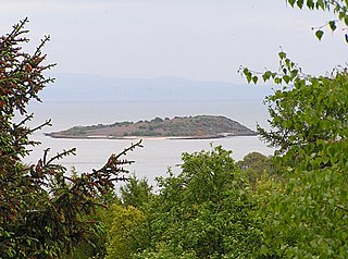
Rough Island is a 20-acre uninhabited tidal island located in the Rough Firth off the Solway Firth, Scotland, in the historical county of Kirkcudbrightshire, the same region where the River Urr flows into the Solway. The isle of Rough is 79 feet at its highest point.

The Sound of Arisaig Lochaber, Scotland, separates the Arisaig peninsula to the north from the Moidart peninsula to the south. At the eastern, landward end, the sound is divided by Ardnish into two sea lochs. Loch nan Uamh lies to the north of Ardnish, Loch Ailort to the south. There are a number of small islands in the sound, of which Eilean nan Gobhar and Samalaman Island, both near to Glenuig on the south shore, are the largest.
Lunga is one of the Slate Islands in the Firth of Lorn in Argyll and Bute, Scotland. The "Grey Dog" tidal race, which runs in the sea channel to the south, reaches 8 knots (15 km/h) in full flood. The name "Lunga" is derived from the Old Norse for "isle of the longships', but almost all other place names are Gaelic in origin.

Eilean nan Ròn is an island near Skerray, in the north of Sutherland, Scotland. An estimated 350 seal pups are born here annually.
Eilean Shona is a tidal island situated at the entrance of Loch Moidart, on the west coast of Scotland, just north of the Ardnamurchan Peninsula. The island is 525 hectares in area, with the highest point being Beinn a' Bhàillidh at 265 metres (869 ft). There are five other peaks of over 150 metres (490 ft) and views of the sea and off-shore islands including Rhum, Eigg and Skye. It is reached by a short boat ride from the mainland. The modern name may be from the Old Norse for "sea island". The pre-Norse Gaelic name, as recorded by Adomnán was Airthrago or Arthràigh, meaning 'foreshore island', similar to the derivation of Erraid.

Calve Island is an uninhabited low-lying island off the east coast of the Isle of Mull in Argyll and Bute on the west coast of Scotland. A whitewashed farmhouse with substantial outbuildings stands on the western shore, used as a summer residence. The island is 1+1⁄4 miles in length, and 1⁄2 mile wide at its widest point. Calve is owned by the Cotton family who make use of it in the summer months.

The Islands of Fleet are a group of small islands in Galloway, Scotland. They are in Fleet Bay, which is part of Wigtown Bay, and is in turn part of the Solway Firth in the Irish Sea. There are three main islands.
Oldany Island is an uninhabited island in Assynt, Sutherland, north-west Scotland.

Bernera Island or simply Bernera is a tidal island off Lismore, in Argyll, Scotland.

Eilean Mhic Chrion is a tidal island sheltering Ardfern in Loch Craignish, Scotland.

Eilean Tigh is a tidal island in the Sound of Raasay of Scotland, that lies between Rona and Raasay.

Loch Sween is a sea loch located near Lochgilphead, Argyll and Bute, Scotland. Castle Sween is located on the southern shore towards the seaward end of the loch. The village of Tayvallich, a favoured haven for water craft as it sits at the head of sheltered Loch a' Bhealaich, lies on the northern shore.

Eilean dà Mhèinn, is a small inhabited island in Loch Crinan and one of the Inner Hebrides of Scotland.