Enfield, Illinois

Last updated

Enfield
White County Illinois Incorporated and Unincorporated areas Enfield Highlighted.svg
Location of Enfield in White County, Illinois.
Illinois in United States (US48).svg
Location of Illinois in the United States
Coordinates: 38°5′54″N88°20′26″W / 38.09833°N 88.34056°W / 38.09833; -88.34056
CountryUnited States
StateIllinois
County White
Area
[1]
  Total1.01 sq mi (2.62 km2)
  Land1.01 sq mi (2.62 km2)
  Water0.00 sq mi (0.00 km2)
Elevation
[2]
479 ft (146 m)
Population
 (2020)
  Total794
  Density785.36/sq mi (303.26/km2)
Time zone UTC-6 (CST)
  Summer (DST) UTC-5 (CDT)
ZIP Code(s)
62835
Area code 618
FIPS code 17-24179
GNIS ID2398835 [2]

Enfield is a village in White County, Illinois, United States. The population was 596 at the 2010 census, which rose to 794 in the 2020 Census.

Contents

Geography

Enfield is located at 38°5′54″N88°20′26″W / 38.09833°N 88.34056°W / 38.09833; -88.34056 (38.098346, -88.340684). [3]

According to the 2010 census, Enfield has a total area of 1.19 square miles (3.08 km2), all land. [4]

Demographics

Historical population
CensusPop.Note
1880 717
1890 87021.3%
1900 97111.6%
1910 927−4.5%
1920 9290.2%
1930 744−19.9%
1940 87517.6%
1950 9063.5%
1960 791−12.7%
1970 764−3.4%
1980 89016.5%
1990 683−23.3%
2000 625−8.5%
2010 596−4.6%
2020 79433.2%
U.S. Decennial Census [5]

As of the 2000 United States Census, [6] there were 625 people, 262 households, and 157 families residing in the village. The population density was 538.8 inhabitants per square mile (208.0/km2). There were 293 housing units at an average density of 252.6 per square mile (97.5/km2). The racial makeup of the village was 98.56% White, 0.16% African American, 0.32% Native American, 0.16% Asian, 0.16% from other races, and 0.64% from two or more races. Hispanic or Latino of any race were 0.16% of the population.

There were 262 households, out of which 26.3% had children under the age of 18 living with them, 49.6% were married couples living together, 9.2% had a female householder with no husband present, and 39.7% were non-families. 34.7% of all households were made up of individuals, and 20.6% had someone living alone who was 65 years of age or older. The average household size was 2.17 and the average family size was 2.79.

In the village, the population was spread out, with 19.8% under the age of 18, 7.4% from 18 to 24, 22.2% from 25 to 44, 25.3% from 45 to 64, and 25.3% who were 65 years of age or older. The median age was 46 years. For every 100 females, there were 77.6 males. For every 100 females age 18 and over, there were 75.2 males.

The median income for a household in the village was $23,750, and the median income for a family was $34,125. Males had a median income of $31,042 versus $17,500 for females. The per capita income for the village was $13,455. About 17.4% of families and 24.7% of the population were below the poverty line, including 32.5% of those under age 18 and 12.0% of those age 65 or over.

Notable person

See also

Related Research Articles

<span class="mw-page-title-main">Sailor Springs, Illinois</span> Village in Illinois, United States

Sailor Springs is a village in Clay County, Illinois, United States. The population was 89 at the 2020 census.

<span class="mw-page-title-main">Inverness, Illinois</span> Village in Illinois, United States

Inverness is a suburban village in Cook County, Illinois, United States. Per the 2020 census, the population was 7,616.
<span class="mw-page-title-main">Ewing, Illinois</span> Village in Illinois, United States

Ewing is a village in Franklin County, Illinois, United States. The population was 300 at the 2020 census.

<span class="mw-page-title-main">Eddyville, Illinois</span> Village in Illinois, United States

Eddyville is a village in Pope County, Illinois, United States. The population was 153 at the 2000 census. Two designated wilderness areas, the Burden Falls Wilderness and the Lusk Creek Wilderness, are nearby.

<span class="mw-page-title-main">Tilden, Illinois</span> Village in Illinois, United States

Tilden is a village in Randolph County, Illinois, United States. The population was 934 at the 2010 census.
<span class="mw-page-title-main">Green Valley, Illinois</span> Village in Illinois, United States

Green Valley is a village in Tazewell County, Illinois, United States. It is south of Pekin near the county border along Illinois State Route 29. The population was 709 at the 2010 census

<span class="mw-page-title-main">Springerton, Illinois</span> Village in Illinois, United States

Springerton is a village in White County, Illinois, United States. The population was 134 at the 2000 census.

<span class="mw-page-title-main">Erie, Illinois</span> Village in Illinois, United States

Erie is a village in Whiteside County, Illinois, United States. The population was 1,602 at the 2010 census, up from 1,589 in 2000. It is known for its unusual layout, specifically its "town triangle".

<span class="mw-page-title-main">Varnado, Louisiana</span> Village in Louisiana, United States

Varnado is a village in Washington Parish, Louisiana, United States. The population was 1,461 at the 2010 census. It is part of the Bogalusa Micropolitan Statistical Area.
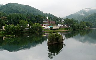
<span class="mw-page-title-main">Gauley Bridge, West Virginia</span> Town in West Virginia, United States

Gauley Bridge is a town in Fayette County, West Virginia, United States. The population was 614 at the 2010 census. The Kanawha River is formed at Gauley Bridge by the confluence of the New and Gauley Rivers. Two miles to the southwest of Gauley Bridge, in Glen Ferris, is Kanawha Falls, a popular stopping point on Midland Trail Scenic Highway.

<span class="mw-page-title-main">Camden-on-Gauley, West Virginia</span> Town in West Virginia, United States

Camden-on-Gauley is a town in Webster County, West Virginia, United States, along the Gauley River. The population was 126 at the 2020 census.

<span class="mw-page-title-main">Friesland, Wisconsin</span> Village in Wisconsin, United States

Friesland is a village in Columbia County, Wisconsin, United States. The population was 320 at the 2020 census. It is part of the Madison Metropolitan Statistical Area, and was named after Friesland, one of the twelve provinces of the Netherlands.

<span class="mw-page-title-main">Neosho, Wisconsin</span> Village in Wisconsin, United States

Neosho is a village in Dodge County, Wisconsin, United States. The population was 574 at the 2010 census.

<span class="mw-page-title-main">Brandon, Wisconsin</span> Village in Wisconsin, United States

Brandon is a village in Fond du Lac County, Wisconsin, United States. The population was 879 at the 2010 census.

<span class="mw-page-title-main">Fairwater, Wisconsin</span> Village in Wisconsin, United States

Fairwater is a village in Fond du Lac County, Wisconsin, United States. The population was 371 at the 2010 census. The town of Metomen surrounds the village.
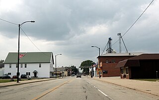
<span class="mw-page-title-main">Coleman, Wisconsin</span> Village in Wisconsin, United States

Coleman is a village in Marinette County, Wisconsin, United States. The population was 726 at the 2020 census. It is part of the Marinette, WI–MI Micropolitan Statistical Area.

<span class="mw-page-title-main">Combined Locks, Wisconsin</span> Village in Wisconsin, United States

Combined Locks is a village in Outagamie County, Wisconsin, United States. The population was 3,328 at the 2010 census.

<span class="mw-page-title-main">Cecil, Wisconsin</span> Village in Wisconsin, United States

Cecil is a village in Shawano County, Wisconsin, United States. The population was 570 at the 2010 census.

<span class="mw-page-title-main">Clyman, Wisconsin</span> Village in Wisconsin, United States

Clyman is a village in Dodge County, Wisconsin, United States. The population was 422 at the 2010 census. The village is located within the Town of Clyman.

<span class="mw-page-title-main">Lowell, Wisconsin</span> Village in Wisconsin, United States

Lowell is a village in Dodge County, Wisconsin, United States, along the Beaver Dam River. The population was 340 at the 2010 census. The village is located within the Town of Lowell.

References

  1. "2020 U.S. Gazetteer Files". United States Census Bureau. Retrieved March 15, 2022.
  2. 1 2 U.S. Geological Survey Geographic Names Information System: Enfield, Illinois
  3. "US Gazetteer files: 2010, 2000, and 1990". United States Census Bureau. February 12, 2011. Retrieved April 23, 2011.
  4. "G001 - Geographic Identifiers - 2010 Census Summary File 1". United States Census Bureau. Archived from the original on February 13, 2020. Retrieved August 3, 2015.
  5. "Census of Population and Housing". Census.gov. Retrieved June 4, 2015.
  6. "U.S. Census website". United States Census Bureau . Retrieved January 31, 2008.