Norris City, Illinois

Last updated

Norris City
White County Illinois Incorporated and Unincorporated areas Norris City Highlighted.svg
Location of Norris City in White County, Illinois.
Illinois in United States (US48).svg
Location of Illinois in the United States
Coordinates: 37°58′47″N88°19′38″W / 37.97972°N 88.32722°W / 37.97972; -88.32722
CountryUnited States
StateIllinois
County White
Government
  MayorRoy Kissel
Area
[1]
  Total1.17 sq mi (3.04 km2)
  Land1.17 sq mi (3.04 km2)
  Water0.00 sq mi (0.00 km2)
Elevation
[2]
427 ft (130 m)
Population
 (2020)
  Total1,145
  Density976.96/sq mi (377.19/km2)
Time zone UTC-6 (CST)
  Summer (DST) UTC-5 (CDT)
ZIP Code(s)
62869
Area code 618
FIPS code 17-53403
GNIS ID2399506 [2]
Wikimedia CommonsNorris City, Illinois
The Norris City Post Office Norris City Post Office 2008.jpg
The Norris City Post Office
The high school in Norris City NCHS-8338c.jpg
The high school in Norris City
Going into downtown Norris City along Main Street Coming Into Norris City.jpg
Going into downtown Norris City along Main Street

Norris City is a village in White County, Illinois. The population was 1,275 at the 2010 census.

Contents

History

Norris City was incorporated in 1901. [3]

The original plat of Norris City was filed for record in the White County Courthouse in Carmi, Illinois on August 17, 1871 at 8 a.m.

The post office at Norris City was established May 15, 1871, with William A. Johnson appointed as the first Postmaster. The name for Norris City had to have been decided prior to the time it was platted and prior to the opening of the post office. The question of how Norris City got its name has caused many debates throughout the years. The new community, for a short time in early 1871, was called “Popeye” or “Popeye’s Station, after William A. Johnson, the first depot agent at the site who had the nickname of Popeye. The trainmen said they were stopping at “Popeye” or “Popeye’s Station.” The story is that Mr. Johnson's eyes protruded, so he was given the nickname of Popeye. This was before the days of the Popeye cartoon character, which was created by a native of Chester, Ill.. The story is, that children going to Gum Prairie Grade School near Mr. Johnson's house gave him the nickname. The other story is that he was given the nickname by the trainmen. Stories about how Norris City got its name are varied, but the following is a result of my research: First off, it was not named after any of the aforementioned people involved in getting Norris City started and platted. This deepens the mystery. According to one story, the people of the new village got together to try to agree upon a name for it. It was decided that the name would come from the person or family having the most land in the area. After the acreages were added up, the Norris family beat out the Johnson family by just a few acres. Thus, as the story goes, it was named Norris City. William Norris was the head of the Norris family at that time so it was said to have been named after him.

Another version is that a meeting was held and the railroad had been doing some business with William Norris so they decided to name the town Norris City after him. So the story goes that he went home from the meeting and told his wife, Emaline (White) Norris, and she replied she didn't think it was such a big deal to have such a small place named after you. Another story is that Thomas Ridgway, for whom Ridgway was named, was on a train going through here. Mr. Ridgway was  the President of the Springfield and Illinois Southeastern Railroad, and he asked what the town had been named. It is said that the foreman of the construction crew, or one version says he was conductor or engineer of the train, spoke up and said the trainmen call it Popeye or Popeye's Station. Mr. Ridgway, so the story goes, said that was no name for a town. This trainman is then supposed to have said, “Why don’t you name it after me?” So they did. His name was supposed to have been John William Norris of Fairfield. Nellie Johnson, wife of Mel Johnson, said her father was on the train when this happened. Mel and Nellie Johnson operated Johnson's Hardware of the south side of East Main Street in Norris City for years. Another version of this story is that the engineer of the work train constructing the railroad tracks to the site of Norris City boarded at the home of William Norris, and his wife Emaline (White) Norris at the west edge of the site of the new village. It is said that he was the one who spoke up and suggested the name for the town. He was fond of the cooking of Mrs. Emaline Norris, who was noted as a good cook. For this reason, it is said that he suggested the name Norris City, naming the town after her and not her husband, William Norris. Jessie (Robb) Newkirk, wife of Vollie Newkirk (parents of Beth (Newkirk) Rister) and a granddaughter of William and Emaline Norris said that her grandmother always said that the town was named after her and not after her husband. A brother and a sister of Jessie Newkirk also told the same story that had been told to them by their grandmother Norris.

The book, “Illinois, a Descriptive and Historical Guide,” compiled in 1939 by Federal Works Agency, Works Project Administration, states that Norris City, altitude 444, population 1109, a trading center for an agricultural and coal mining district was named in honor of a pioneer settler, William Norris. A reference report of the Illinois State Historical Library states, “No information is available in our records as to the origins of the name, Norris City.”

Geography

Norris City is located at 37°58′47″N88°19′38″W / 37.97972°N 88.32722°W / 37.97972; -88.32722 (37.979816, -88.327219). [4] According to the 2010 census, Norris City has a total area of 1.182 square miles (3.06 km2), of which 1.18 square miles (3.06 km2) (or 99.83%) is land and 0.002 square miles (0.01 km2) (or 0.17%) is water. [5]

Demographics

Historical population
CensusPop.Note
1880 40
1890 223457.5%
1900 868289.2%
1910 1,05521.5%
1920 1,30023.2%
1930 1,109−14.7%
1940 1,29516.8%
1950 1,3705.8%
1960 1,243−9.3%
1970 1,3196.1%
1980 1,51514.9%
1990 1,341−11.5%
2000 1,057−21.2%
2010 1,27520.6%
2020 1,145−10.2%
U.S. Decennial Census [6]

As of the census [7] of 2000, there were 1,057 people, 492 households, and 296 families residing in the village. The population density was 911.6 inhabitants per square mile (352.0/km2). There were 563 housing units at an average density of 485.6 per square mile (187.5/km2). The racial makeup of the village was 98.30% White, 0.66% Native American, 0.28% Asian, and 0.76% from two or more races. Hispanic or Latino of any race were 0.09% of the population.

There were 492 households, out of which 23.6% had children under the age of 18 living with them, 49.8% were married couples living together, 6.9% had a female householder with no husband present, and 39.8% were non-families. 37.0% of all households were made up of individuals, and 22.2% had someone living alone who was 65 years of age or older. The average household size was 2.15 and the average family size was 2.81.

In the village, the population was spread out, with 20.4% under the age of 18, 8.2% from 18 to 24, 26.1% from 25 to 44, 21.9% from 45 to 64, and 23.4% who were 65 years of age or older. The median age was 41 years. For every 100 females, there were 84.8 males. For every 100 females age 18 and over, there were 80.9 males.

The median income for a household in the village was $22,121, and the median income for a family was $29,412. Males had a median income of $25,972 versus $14,868 for females. The per capita income for the village was $13,671. About 9.4% of families and 14.4% of the population were below the poverty line, including 23.9% of those under age 18 and 9.7% of those age 65 or over.

Culture

A popular festival known as Dairy Days takes place during the weekend of the fourth Saturday in September each year. Dairy Days has been held annually since 1947. The festival was organized by the Lions Club until 2009, when the Dairy Days Association was formed to coordinate the annual festival. [8] [9]

Notable people

Related Research Articles

<span class="mw-page-title-main">White County, Illinois</span> County in Illinois, United States

White County is a county located in the U.S. state of Illinois. According to the 2020 census, it had a population of 13,877. Its county seat is Carmi. It is located in the southern portion of Illinois known locally as "Little Egypt".

<span class="mw-page-title-main">Bensenville, Illinois</span> Village in Illinois, United States

Bensenville is a village located near O'Hare International Airport in DuPage County, Illinois, with a portion of the town in Cook County. As of the 2020 census, the village population was 18,813.

<span class="mw-page-title-main">Norris, Illinois</span> Village in Illinois, United States

Norris is a village in Fulton County, Illinois, United States. The population was 213 at the 2010 census, up from 194 at the 2000 census.

<span class="mw-page-title-main">Omaha, Illinois</span> Village in Illinois, United States

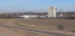
Omaha is a village in Gallatin County, Illinois, United States. The population was 266 at the 2010 census.

<span class="mw-page-title-main">Ridgway, Illinois</span> Village in Illinois, United States

Ridgway is a village in Gallatin County, Illinois, United States. As of the 2020 census, the population was 851. As of 2018, Rebecca Mitchell was the town mayor.

<span class="mw-page-title-main">Coal City, Illinois</span> Village in Illinois, United States

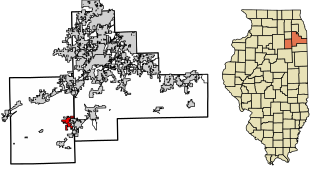
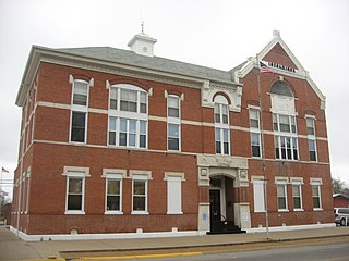
Coal City is a village in Grundy and Will Counties in the U.S. state of Illinois. It is considered a fringe town of the Chicago metropolitan area. The population was 5,587 at the 2010 census.

<span class="mw-page-title-main">Coal Valley, Illinois</span> Village in Illinois, United States

The village of Coal Valley is located in both Rock Island County and Henry County in the U.S. state of Illinois. The population was 3,743 at the 2010 census, up from 3,606 in 2000. It is mostly residential, housing families who work in or out of the greater Quad Cities Area and is considered a suburb. The students of the Rock Island County part of Coal Valley attend the Moline School District number 40, and in the Henry County portion, Orion Community Unit School District 223

<span class="mw-page-title-main">Brighton, Illinois</span> Village in Illinois, United States

Brighton is a village located mostly in Macoupin County and partially in Jersey County, Illinois, United States. As of the 2020 census, the village had a population of 2,221. The village's current mayor is Matthew P. Kasten.

<span class="mw-page-title-main">Vienna, Illinois</span> City in Illinois, United States

Vienna is a city in and the county seat of Johnson County, Illinois, United States, and it is the site of two well-known state penitentiaries. The population of Vienna was 1,434 at the 2010 census.

<span class="mw-page-title-main">Tallula, Illinois</span> Village in Illinois, United States

Tallula is a village in Menard County, Illinois, United States. It was founded in 1857 by William G. Greene. The population was 434 at the 2020 census, down from 488 in 2010. It is part of the Springfield, Illinois Metropolitan Statistical Area.

<span class="mw-page-title-main">Chester, Illinois</span> City in Illinois, United States

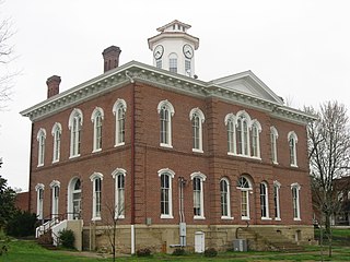
Chester is a city in and the county seat of Randolph County, Illinois, United States, on a bluff above the Mississippi River. The population was 7,640 at the 2020 census. It lies 61 miles (98 km) south of St. Louis, Missouri.

<span class="mw-page-title-main">Millstadt, Illinois</span> Village in Illinois, United States

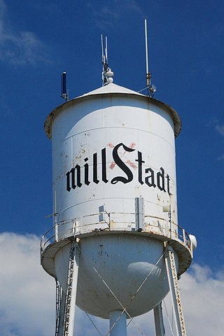
Millstadt is a village in St. Clair County, Illinois, United States, located at the crossing of Illinois Routes 163 and 158. The village is known for its German heritage, with more than half its people of German descent. The population was 4,011 at the 2010 census, but a more recent study in July 2018 estimated the number at 3,885.

<span class="mw-page-title-main">Coleridge, Nebraska</span> Village in Nebraska, United States

Coleridge is a village in Cedar County, Nebraska, United States. The population was 537 at the 2020 census.

<span class="mw-page-title-main">Firth, Nebraska</span> Village in Nebraska, United States

Firth is a village in Lancaster County, Nebraska, United States. It is part of the Lincoln, Nebraska Metropolitan Statistical Area. The population was 649 at the 2020 census.

<span class="mw-page-title-main">Byron, New York</span> Town in New York, United States

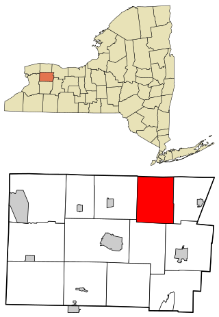
Byron is a town in Genesee County, New York, United States. The town is named after a famous poet, Lord Byron. It on the northern border of the county, and lies northeast of the city of Batavia. The population was 2,369 at the 2010 census. The local school district, Byron-Bergen Central School District, is shared with the town of Bergen.

<span class="mw-page-title-main">Kendall, New York</span> Town in New York, United States

Kendall is a town in Orleans County, just west of the town of Hamlin in Monroe County, in New York State, United States. The population of Kendall was 2,724 at the 2010 census. The Town of Kendall is in the northeast corner of Orleans County and is northwest of Rochester.

<span class="mw-page-title-main">Newkirk, Oklahoma</span> City in Oklahoma, United States

Newkirk is a city and county seat of Kay County, Oklahoma, United States. The population was 2,172 at the 2020 census.

<span class="mw-page-title-main">Cross Timber, Texas</span> Town in Texas, United States

Cross Timber is a town in Johnson County, Texas, in the United States. As of the 2010 census the population was 268.

Homa Hills is a census-designated place (CDP) in Natrona County, Wyoming, United States. It is part of the Casper, Wyoming Metropolitan Statistical Area. The population was 278 at the 2010 census.

<span class="mw-page-title-main">Sun City Center, Florida</span> Census-designated place in Florida, United States

Sun City Center is an unincorporated census-designated place (CDP) in southern Hillsborough County, Florida, United States. It is located south of Tampa and north of Sarasota on I-75. As of the 2020 census, the population was 30,952. The ZIP Code serving the community is 33573.

References

  1. "2020 U.S. Gazetteer Files". United States Census Bureau. Retrieved March 15, 2022.
  2. 1 2 U.S. Geological Survey Geographic Names Information System: Norris City, Illinois
  3. Columbia-Lippincott Gazetteer. (New York City: Columbia University Press, 1972 reprint of 1962 revision using as main body unaltered 1952 text), p. 1336
  4. "US Gazetteer files: 2010, 2000, and 1990". United States Census Bureau. February 12, 2011. Retrieved April 23, 2011.
  5. "G001 - Geographic Identifiers - 2010 Census Summary File 1". United States Census Bureau. Archived from the original on February 13, 2020. Retrieved December 25, 2015.
  6. "Census of Population and Housing". Census.gov. Retrieved June 4, 2015.
  7. "U.S. Census website". United States Census Bureau . Retrieved January 31, 2008.
  8. "Sue James to retire from Dairy Day committee — the Villagers Voice".
  9. "Dairy day 2015 — the Villagers Voice".
  10. 'Illinois Blue Book 1949-1950,' Biographical Sketch of Ora Collard, pg. 232-233