Euclid Avenue (Cleveland)

Last updated
Euclid Avenue
Azure Cleveland (17148979577).jpg
Looking westbound on Euclid Avenue from above E. 9th Street and the Schofield Building. The Soldiers' and Sailors' Monument can be seen in the distance.
Part ofUS 6.svgUS 20.svgUS 322.svg US 6  / US 20  / US 322
Length18.9 mi (30.4 km) [1]
Location Cleveland, Ohio
West endUS 6.svgUS 20.svgUS 42.svgUS 322.svgUS 422.svg US 6  / US 20  / US 42  / US 322  / US 422
OH-3.svgOH-8.svgOH-14.svgOH-43.svgOH-87.svg SR 3  / SR 8  / SR 14  / SR 43  / SR 87 at Public Square
Major
junctions
US 322.svg US 322 in University Circle
US 6.svg US 6 in East Cleveland
US 6.svgOH-84.svg US 6  / SR 84 in Euclid
I-90.svg I-90 in Wickliffe
East endUS 20.svgOH-174.svg US 20  / SR 174 in Willoughby
Construction
Commissioned1815
Sylvester T. Everett mansion on Euclid Avenue (since demolished), designed by Charles F. Schweinfurth Cleveland Mansion.jpg
Sylvester T. Everett mansion on Euclid Avenue (since demolished), designed by Charles F. Schweinfurth

Euclid Avenue is a major street in Cleveland, Ohio, United States. It runs northeasterly from Public Square in Downtown Cleveland, passing Playhouse Square and Cleveland State University, to University Circle, the Cleveland Clinic, Severance Hall, Case Western Reserve University's Maltz Performing Arts Center (formerly the Temple Tifereth Israel), Case Western Reserve University and University Hospitals Case Medical Center. The street runs through the suburbs of East Cleveland, Euclid, and Wickliffe, to Willoughby as a part of U.S. Route 20 and U.S. Route 6. The HealthLine bus rapid transit line runs in designated bus lanes in the median of Euclid Avenue from Public Square to Louis Stokes Station at Windermere in East Cleveland.

Contents

It received nationwide attention from the 1860s to the 1920s for its beauty and wealth, including a string of mansions that came to be known as Millionaires' Row. There are several theaters, banks, and churches along Euclid, as well as Cleveland's oldest extant building, the Dunham Tavern. It can be reached through the Healthline.

Millionaires' Row

Euclid Ave streetscape.jpg
Homes on Euclid Avenue's "Millionaire's Row" (south side of Euclid Avenue), circa 1870
EuclidAveHannaHome.jpg
Advertising postcard (pre-1906) for the R&L Electric Car, taken in front of the Leonard Hanna mansion on Euclid Avenue

In the second half of the 19th century and early in the 20th century, Euclid Avenue was internationally known. Baedeker's Travel Guides called the elm-lined avenue "The Showplace of America", and designated it as a must see for travelers from Europe. The concentration of wealth was unparalleled; the tax valuation of the mansions along "the Avenue" far exceeded the valuation of New York's Fifth Avenue in the late 19th century. Accounts at the time compared it to the Avenue des Champs-Élysées in Paris and the Unter den Linden in Berlin. [2]

Euclid Avenue was an elegant showcase for Cleveland's wealthy citizens, who built their high, grand mansions high on a ridge overlooking Lake Erie. Set two to five acres back from the avenue, which was paved with Medina sandstone, the mansions seemed to float amid spacious, landscaped grounds. [3]

Families living along "Millionaires' Row" included those of John D. Rockefeller (during the period, 1868–84), [3] Sylvester T. Everett, Isaac N. Pennock I (inventor of the first steel railway car in the US), arc light inventor Charles F. Brush, George Worthington, Horace Weddell, Marcus Hanna, Ambrose Swasey, Amasa Stone, John Hay (personal secretary to Abraham Lincoln and Secretary of State under William McKinley), Jeptha Wade (Cleveland benefactor and founder of Western Union Telegraph), Samuel Augustus Fuller (steel industrialist), Alfred Atmore Pope (iron industrialist and art collector), Charles E.J. Lang (automobile industrialist), Worthy S. Streator (railroad baron, coal mine developer, and founder of the city of Streator, Illinois), Mary Corinne Quintrell (clubwoman), and Charles Lathrop Pack. Euclid Avenue's most infamous resident was con artist Cassie Chadwick, the wife of Leroy Chadwick, who was unaware that his wife was passing herself off to bankers as the illegitimate daughter of steel magnate Andrew Carnegie.

Architect Charles F. Schweinfurth designed at least 15 mansions on the street. Samuel Mather's Mansion, built around 1910, "was among the last" to be built on Euclid Avenue. [4] The Mather Mansion remains as part of Cleveland State University, but most of the homes were later demolished.

Christmas shoppers on Euclid Ave. and Ontario St. in the 1950s Cleveland at Christmas - improved.jpg
Christmas shoppers on Euclid Ave. and Ontario St. in the 1950s

Growth of commercial district and decline of Millionaires' Row

Charles Lathrop Pack is credited with at least part of the development of Euclid Avenue, on which he lived from about 1888 to the early years of the 20th century, into a thriving business district. According to Eyle, "In 1913, an article about Charles reported that 'inside of ten years...the [one-story, commercial buildings that he had developed at the lower end of Euclid Avenue] have disappeared. In their stead are skyscrapers, great retail establishments, magnificent banks, and a hotel that cost $2,000,000. Much of the land is owned by Mr. Pack and is leased for long periods. He helped to organize the companies which erected the buildings. It is said that his rentals, out of which not a penny is subtracted for taxes or anything else, amount to $100,000 a year." [5]

As Cleveland's commercial district began to push eastward along Euclid Avenue, families moved east towards University Circle. However, southeast of University Circle, the topography of the area rises sharply into what is referred to as "The Heights", and the development of Cleveland Heights and Shaker Heights, along with more efficient means of travel, became more attractive than the increasingly commercialized Euclid Avenue.

By the 1920s, the former "Millionaires' Row" was in decline. During the Great Depression, many mansions were converted by their owners into rooming houses, which accelerated the decline. In the 1950s, Cleveland's Innerbelt Freeway cut through the Euclid Avenue neighborhood between downtown and the rail crossing at East 55th Street. By the 1960s, the street that once rivaled Fifth Avenue as the most expensive address in the United States was a two-mile (3 km) long slum of commercial buildings and substandard housing. In the late 1960s, Cleveland Cavaliers owner Nick Mileti announced plans to move the basketball club from Euclid Avenue's Cleveland Arena to a new arena in suburban Richfield Township.

Playhouse Square faces Euclid Avenue. Cleveland Playhouse Square (13917560487).jpg
Playhouse Square faces Euclid Avenue.

Legacies and redevelopment

Eight houses from the era remain on Euclid, including the Samuel Mather and Howe mansions owned and used by Cleveland State University. One of the most recent to be demolished was the Lyman Treadway Mansion, which served as part of the Cleveland Museum of Health from the 1930s until it was razed in 2002 for a new museum building.

The Euclid Avenue Historic District is listed on the National Register of Historic Places.

On August 5, 1914, the American Traffic Signal Company installed a traffic signal system on the corner of East 105th Street and Euclid Avenue, the first traffic light installed in the United States. [6] [7]

Theaters of Playhouse Square

In their 1949 musical South Pacific , Rodgers and Hammerstein indirectly acknowledged the street's fame. In the script, Captain Brackett sends a grass skirt to one "Amelia Fortuna, 325 Euclid Avenue, Shaker Heights, Cleveland, Ohio". Theaters on Euclid include the Allen Theatre, State Theatre, Ohio Theatre, and Palace Theater.

Recent events

Euclid Avenue during the construction of the Euclid Corridor project Euclid Ave construction.jpg
Euclid Avenue during the construction of the Euclid Corridor project

In April 2006, parts of Euclid Avenue were closed to traffic for the filming of a scene from the film Spider-Man 3 . No major stars were on location, but the filming drew thousands of gawkers. Most of the filming involved explosions and destroyed cars, with hired extras walking the sidewalks. The sections of the street that were closed off were redressed to resemble a city street in New York City, complete with magazine stands and poster-covered walls. [8]

The Greater Cleveland Regional Transit Authority completely refurbished the western section of Euclid Avenue as part of the Euclid Corridor Transportation Project, which opened fully in 2008. A bus rapid transit line, the HealthLine, now runs from Public Square to the Stokes Rapid Transit station in East Cleveland, which is the eastern terminus of the Red Line rapid transit route. The refurbishing also entailed development as of November 2009, more than $3.3 billion worth of completed or proposed urban renewal projects lined the street and surrounding area. [9]

Route designations

Euclid Avenue, originally known as part of the Buffalo Stage Road, [10] has carried various route designations throughout history:

Landmarks on Euclid

Public Square

East 4th Street District

Nine-Twelve District

The Hickox Building in 1920. Demolished in 1946, the building was located at Euclid and East 9th (today the location of the PNC Center). Euclid Avenue 1920 CP06299 - DPLA - 83fa5836ed3db09bff251ac185af7933.jpg
The Hickox Building in 1920. Demolished in 1946, the building was located at Euclid and East 9th (today the location of the PNC Center).

East 12th

East 14th St.

GE Chandelier soon after installation in 2014 Winterfest Cleveland (15732145309).jpg
GE Chandelier soon after installation in 2014

Playhouse Square

East 17th-East 24th St.

Cleveland State University Campus

  • CSU School of Communication
  • CSU Student Center
  • CSU Main Library/Rhodes Tower
  • Main Classrooms
  • CSU Science Building

East 30th St.

Midtown East 55th St.

East 105th St.

See also

Notes

Related Research Articles

<span class="mw-page-title-main">Ohio State Route 261</span> State highway in northeastern Ohio, US

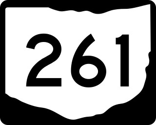
State Route 261 is an east–west state highway located in northeastern Ohio that passes through Medina, Summit, and Portage counties. At a length of 26 miles (42 km), SR 261 runs from a signalized intersection with SR 94 in Wadsworth to a signalized T-intersection with SR 59 in Franklin Township just east of Kent.

<span class="mw-page-title-main">Public Square, Cleveland</span> Historic central plaza in Cleveland, Ohio, U.S.

Public Square is the central plaza of Downtown Cleveland, Ohio. Based on an 18th-century New England model, it was part of the original 1796 town plat overseen by city founder General Moses Cleaveland of the Connecticut Land Company. The historical center of the city's downtown, it was added to the National Register of Historic Places in 1975.

<span class="mw-page-title-main">Ohio State Route 246</span> State highway in Lucas County, Ohio, US

State Route 246 (SR 246) is a 7.77-mile-long (12.50 km) east–west state highway in the northwestern part of the U.S. state of Ohio. The western terminus of SR 246 is at the interchange with Interstate 475/U.S. Route 23 (I-475/US 23) at the western border of Toledo. Its eastern terminus is at a signalized intersection with SR 51 in downtown Toledo.

<span class="mw-page-title-main">Ohio State Route 88</span> State highway in northeastern Ohio, US

State Route 88 is a highway generally running in an east–west direction in the northeastern portion of the U.S. state of Ohio. Its southern terminus is in Portage County at SR 59 at the intersection of Freedom Street with Main Street in Ravenna. SR 88 is labeled north-south southwest of U.S. Route 422 (US 422) and SR 168/SR 528, and labeled east-west east of there. SR follows a northerly direction for a little more than one mile (1.6 km) along Freedom Street, to the SR 14 and SR 44 concurrency bypass. From here, the route heads in a northeasterly direction. Its next intersection is with SR 700, at the southern terminus of the latter route. One-quarter mile (0.40 km) further to the northeast, SR 88 joins SR 303 for about one-half mile (0.80 km). SR 88 then continues northeast, crossing over Interstate 80 and the Ohio Turnpike, before turning due north as it enters Garrettsville. Here, as South Street, the route intersects SR 82, then becomes North Street before exiting the corporation limits.

<span class="mw-page-title-main">Ohio State Route 10</span> State highway in Ohio, US

State Route 10 is a state highway located in and around Cleveland, Ohio. The route's western terminus is in Eaton Township in Lorain County, and the eastern terminus is in Cleveland's University Circle neighborhood.

<span class="mw-page-title-main">Ohio State Route 17</span> State highway in Cuyahoga County, Ohio, US

State Route 17 is an east–west highway in Northeast Ohio running from North Olmsted at State Route 10 to State Route 43 in Bedford Heights. The entire route has been paralleled by Interstate 480 and has junctions with this interstate via numerous cross streets such as Clague Road, Tiedeman Road, and Warrensville Center Road, and also via State Route 94 and State Route 14. It also has two direct junctions with the interstate. State Route 17 provides access to many industrial and commercial areas in this area of Cleveland.

<span class="mw-page-title-main">Ohio State Route 83</span> North-south state highway in Ohio, US

State Route 83 is a north–south state highway in the U.S. state of Ohio. Its southern terminus is near the town of Beverly at State Route 60, and its northern terminus is overlooking Lake Erie at U.S. Route 6 in Avon Lake. A portion of SR 83 is part of the Morgan County Scenic Byway.

<span class="mw-page-title-main">Ohio State Route 327</span> State highway in Ohio, US

State Route 327 (SR 327) is a north–south state highway in the south central portion of the U.S. state of Ohio. Its southern terminus is at U.S. Route 35 (US 35) about seven miles (11 km) southeast of Jackson, at a one-quadrant interchange. It ends at its northern terminus at SR 180 in Adelphi.

<span class="mw-page-title-main">Ohio State Route 243</span> State highway in Lawrence County, Ohio, US

State Route 243 is an east–west state highway in the southern portion of the U.S. state of Ohio. The western terminus of SR 243 is at a diamond interchange with the U.S. Route 52 (US 52) in Coal Grove. The eastern terminus of the state highway is at its signalized junction with State Route 7 approximately 1.25 miles (2.01 km) west of Proctorville near the northern banks of the Ohio River.

<span class="mw-page-title-main">Ohio State Route 173</span> East-west state highway in northeastern Ohio, US

State Route 173 (SR 173) is located in northeastern Ohio, and runs east–west from State Route 44, about 4 miles (6.4 km) north of Louisville, Ohio to State Route 14 and State Route 9 in downtown Salem, Ohio. It primarily passes through Stark and Columbiana counties, though it also straddles the county line between Mahoning County and Columbiana County for some of its length. Much of the route is also run in concurrency with U.S. Route 62.

<span class="mw-page-title-main">Ohio State Route 31</span> State highway in Ohio, US

State Route 31 (SR 31) is a 32.12-mile-long (51.69 km) Ohio State Route that runs between Marysville and Kenton in the US state of Ohio. The southern terminus of SR 31 is at an intersection with SR 38 in downtown Marysville and the northern terminus is at an intersection with U.S. Route 68 (US 68), in downtown Kenton. None of the highway is listed on the National Highway System. Most of the route is a rural two-lane highway and passes through both farmland and residential properties.

<span class="mw-page-title-main">Ohio State Route 39</span> East-west state highway in Ohio, US

State Route 39 is a primarily east–west running state highway in north-central and northeastern portion of the U.S. state of Ohio. The route runs through seven counties on its approximately 155-mile (249 km) trip through the region. Its western terminus is at State Route 103 near New Washington, and its eastern terminus is at PA 68 near East Liverpool.

<span class="mw-page-title-main">Ohio State Route 132</span> State highway in southwestern Ohio, US

State Route 132 (SR 132) is a north–south state highway in the southwestern portion of the U.S. state of Ohio. Its southern terminus is at its interchange with U.S. Route 52 in New Richmond and its northern terminus is at its intersection with SR 350 and SR 133 in Clarksville.

<span class="mw-page-title-main">Interstate 77 in Ohio</span> Highway in Ohio

Interstate 77 (I-77) in Ohio is an Interstate Highway that runs for 163.03 miles (262.37 km) through the state. The highway crosses into Ohio on the Marietta–Williamstown Interstate Bridge over the Ohio River near Marietta. The northern terminus is in Cleveland at the junction with I-90. From the West Virginia state line to Cleveland, I-77 serves the cities of Marietta, Cambridge, New Philadelphia, Canton, Akron, and the Cleveland suburban city of Brecksville.

<span class="mw-page-title-main">U.S. Route 50 in Ohio</span> Segment of American highway

U.S. Route 50 runs east–west across the southern part of the state of Ohio, passing through Cincinnati, Chillicothe, and Athens. It is mainly a two-lane road except for the easternmost and westernmost parts. Near Athens it runs concurrently with State Route 32 (SR 32), a four-lane divided highway known as Corridor D, and from Coolville to the Ohio–West Virginia border it also overlaps SR 7 before crossing into Parkersburg, West Virginia.

<span class="mw-page-title-main">Ohio State Route 164</span> State highway in Ohio, US

State Route 164 (SR 164) is a state highway passing through four counties in east-central Ohio. The route runs in a general southwest to northeast fashion, and is signed north–south accordingly. The southern terminus is at an intersection with State Route 212 1-mile (1.6 km) south of Leesville, and the northern terminus is at Interstate 680 and Western Reserve Road on the Beaver and Boardman township boundary between North Lima and Boardman. The southern part of the route serves more rural areas while it makes its way through larger villages and cities toward its northern end.

<span class="mw-page-title-main">Ohio State Route 133</span> State highway in southwestern Ohio, US

State Route 133 (SR 133) is a north–south state highway in the southwestern portion of the U.S. state of Ohio. Its southern terminus is at its interchange with U.S. Route 52 near Felicity and its northern terminus is at its interchange with SR 350 in Clarksville.

<span class="mw-page-title-main">Ohio State Route 134</span> State highway in southwestern Ohio, US

State Route 134 (SR 134) is a north–south state highway in the southwestern portion of the U.S. state of Ohio. Its southern terminus is at its intersection with SR 32 in Sardinia and its northern terminus is at its intersection with Main Street in Port William.

<span class="mw-page-title-main">Ohio State Route 256</span> State highway in central Ohio, US

State Route 256 (SR 256) is a 25.99-mile (41.83 km) east–west state highway in the central portion of the U.S. state of Ohio. The western terminus of SR 256 is at a T-intersection with U.S. Route 40 (US 40) in Reynoldsburg. Its eastern terminus is at a T-intersection with SR 13 approximately 5.50 miles (8.85 km) west-northwest of Somerset.

<span class="mw-page-title-main">Ohio State Route 219</span> State highway in western Ohio, US

State Route 219 is an east–west state highway in the western portion of the U.S. state of Ohio. State Route 219's western terminus is at the Indiana State Line approximately 5.5 miles (8.9 km) northwest of Fort Recovery, with the roadway continuing west into the Hoosier State being County Road 300N. The eastern terminus of State Route 219 is at a diamond interchange with Interstate 75 at its Exit 104 in Botkins.

References

  1. Google (August 5, 2015). "Euclid Avenue" (Map). Google Maps . Google. Retrieved August 5, 2015.
  2. Theiss, Evelyn (2011-04-03). "The Stockbridge in Cleveland has been sitting proudly on Euclid since the days of Millionaires' Row". The Plain Dealer . Retrieved 2011-04-05.
  3. 1 2 Eyle, p. 39
  4. Eyle, p. 40
  5. Morrow, James B. January 5, 1913. "No sentiment, just plain common sense made him the first active worker for forest conservation", Sunday Plain Dealer, editorial and drama section. Quoted in Eyle, p. 40
  6. Sessions, Gordon M. (1971). Traffic devices: historical aspects thereof. Washington: Institute of Traffic Engineers. pp. 27–28. OCLC   278619.
  7. "New Traffic Signal Installed". The Motorist. Ken Pub. Co: 28–29. August 1914.
  8. Ewinger, James (2006-04-17). "Spidey's web to make Euclid Ave., E. 9th sticky". The Plain Dealer . Retrieved 2009-07-01.
  9. Jarboe, Michelle (2009-11-29). "Cleveland's Euclid corridor project has paved the way to economic development". The Plain Dealer . Retrieved 2009-11-30.
  10. DeMarco, Laura (July 27, 2009). "More on Cleveland walking tours and history". The Plain Dealer . Retrieved August 7, 2022.
  11. Ohio State Highway Department (June 1918). Highway Map of Ohio (PDF) (Map). 1:500,000. Columbus: Ohio State Highway Department. Retrieved August 7, 2022.
  12. Ohio State Highway Department (July 1919). Highway Map of Ohio Showing Conditions for Travel (PDF) (Map). 1:506,880. Columbus: Ohio State Highway Department. Retrieved August 7, 2022.
  13. Ohio Department of Highways and Public Works (April 1922). Map of Ohio State Highways Showing All Improved Roadways and Indicating System Constructed Under Administration of Gov. Harry L. Davis (PDF) (Map). c. 1:563,200. Columbus: Ohio Department of Highways and Public Works. Retrieved August 7, 2022.
  14. Ohio Department of Highways and Public Works (July 1923). Map of Ohio Showing State Routes (PDF) (Map). 1:760,320. Columbus: Ohio Department of Highways and Public Works. Retrieved August 7, 2022.
  15. Ohio Department of Highways and Public Works (August 1925). Map of Ohio Showing State Routes (PDF) (Map). 1:760,320. Columbus: Ohio Department of Highways and Public Works. OCLC   5673562 . Retrieved August 7, 2022.
  16. 1 2 Ohio Department of Highways and Public Works (August 1, 1926). Map of Ohio Showing State Routes (PDF) (Map). 1:760,320. Columbus: Ohio Department of Highways and Public Works. OCLC   5673562 . Retrieved August 7, 2022.
  17. Ohio Department of Highways and Public Works (June 1, 1927). Map of Ohio Showing State Routes (PDF) (Map). 1:760,320. Columbus: Ohio Department of Highways and Public Works. OCLC   5673562 . Retrieved August 7, 2022.
  18. Ohio Department of Highways (1931). Map of Ohio Showing State Highway System (PDF) (Map). 1:760,320. Columbus: Ohio Department of Highways. OCLC   5673562, 7231737 . Retrieved August 7, 2022.
  19. Ohio Department of Highways (1932). Map of Ohio Showing State Highway System (PDF) (Map). 1:760,320. Columbus: Ohio Department of Highways. OCLC   5673562, 7231704 . Retrieved August 7, 2022.
  20. Ohio Department of Highways (1935). Official Highway Map of Ohio (PDF) (Map). [1:760,320]. Columbus: Ohio Department of Highways. OCLC   5673562, 54667348 . Retrieved August 7, 2022.
  21. Ohio Department of Highways (1936). Official Highway Map of Ohio (PDF) (Map). 1:760,320. Columbus: Ohio Department of Highways. OCLC   5673562 . Retrieved August 7, 2022.
  22. Ohio Department of Highways (1949). Ohio Highway Map (PDF) (Map). 1:633,600. Columbus: Ohio Department of Highways. OCLC   5673562, 13655762 . Retrieved August 7, 2022.
  23. Ohio Department of Highways (1950). Ohio Highway Map (PDF) (Map). 1:633,600. Columbus: Ohio Department of Highways. OCLC   5673562, 7448760 . Retrieved August 7, 2022.
  24. Ohio Department of Highways (1966). Official Highway Map (PDF) (Map). c. 1:563,200. Columbus: Ohio Department of Highways. OCLC   5673562 . Retrieved August 7, 2022.
  25. Ohio Department of Highways (1967). Official Highway Map (PDF) (Map). c. 1:563,200. Columbus: Ohio Department of Highways. OCLC   5673562, 7444249 . Retrieved August 7, 2022.
  26. Bullard, Stan (November 17, 2008). "Huntington moving to 200 Public Square". Crain's Cleveland Business . Retrieved September 1, 2015.
  27. Perkins, Olivera (June 3, 2011). "New sign on Public Square: Huntington Bank regional headquarters". The Plain Dealer . Cleveland, Ohio. Retrieved September 1, 2015.
  28. McFee, Michelle Jarboe (June 22, 2011). "200 Public Square skyscraper for sale in downtown Cleveland". Cleveland.com . Advance Publications . Retrieved September 1, 2015.
  29. Dave Davis (April 6, 2011). "Gifts to renovate Soldiers and Sailors Monument sit in bank while county awaits repayment". The Plain Dealer . cleveland.com. Retrieved September 1, 2015.
  30. "Arcade". Encyclopedia of Cleveland History. Case Western Reserve University . Retrieved September 1, 2015.
  31. "East 4th & Arcades". clevelandgatewaydistrict.com. Archived from the original on September 26, 2015. Retrieved September 1, 2015.
  32. Cindi, Szymanski (January 14, 2014). "PlayhouseSquare Announces GE Lighting as Major Supporter of Neighborhood Transformation and Exclusive Chandelier Sponsor" (PDF) (Press release). PlayhouseSquare. Archived from the original (PDF) on May 3, 2014. Retrieved May 3, 2014.
  33. Simakis, Andrea (May 2, 2014). "Chandelierious! Dazzle the District Lights the Way to New Era for Playhouse Square". The Plain Dealer . Retrieved May 3, 2014.
  34. "Innerbelt Freeway". 'Encyclopedia of Cleveland History. Case Western Reserve University . Retrieved September 1, 2015.
  35. "Cleveland Restoration Society: About Us - Contact Us". www.clevelandrestoration.org. Archived from the original on 2018-05-17. Retrieved 2018-05-16.
  36. "CLEVELAND-MARSHALL LAW SCHOOL". The Encyclopedia of Cleveland History. Case Western Reserve University . Retrieved September 2, 2015.
  37. Earnest, G. Brooks (1974). History of Fenn College. Cleveland, Ohio: The Fenn Educational Fund of the Cleveland Foundation. pp. 718 (total).
  38. "History". Trinity Cathedral. Archived from the original on September 19, 2015. Retrieved September 2, 2015.|work=trinitycleveland.org|publisher=Trinity Cathedral
  39. "The Edge on Euclid".
  40. "NewsChannel5's first 60 years". WEWS-TV . E. W. Scripps Company. Archived from the original on September 5, 2015. Retrieved September 2, 2015.
  41. "WEWS (Channel 5)". The Encyclopedia of Cleveland History. Case Western Reserve University . Retrieved September 2, 2015.

Further reading

Cigliano, Jan (1991). Showplace of America: Cleveland's Euclid Avenue, 1850-1910. Kent, Ohio: Kent State University Press. ISBN   0-87338-445-8.

41°30′14″N81°36′42″W / 41.504007°N 81.611555°W / 41.504007; -81.611555