This is a list of the extreme points of Tajikistan .
This is a list of the extreme points of Tajikistan .
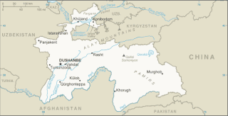
The northernmost region is Sughd Region. [1] The easternmost region is Gorno-Badakhshan Autonomous Region. [2] The country shares a border (Tajikistan–Uzbekistan border) with Uzbekistan in the west and a border (Afghanistan–Tajikistan border) with Afghanistan in the south. [3]
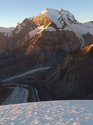
At 7,495 m (24,590 ft) above sea level, Ismoil Somoni Peak, formerly called Communism Peak and originally named Stalin Peak, is the highest point of Tajikistan and was the highest point in the USSR. [4] [3] [5] [6] [7] [8] [9] [10]
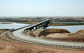
At 300 m (980 ft) above sea level, the lowest point of Tajikistan is in the Syr Darya (Sirdaryo), [4] [3] [8] a river that flows into the North Aral Sea.[ clarification needed ]

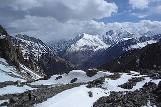
Tajikistan is nestled between Kyrgyzstan and Uzbekistan to the north and west, China to the east, and Afghanistan to the south. Mountains cover 93 percent of Tajikistan's surface area. The two principal ranges, the Pamir Mountains and the Alay Mountains, give rise to many glacier-fed streams and rivers, which have been used to irrigate farmlands since ancient times. Central Asia's other major mountain range, the Tian Shan, skirts northern Tajikistan. Mountainous terrain separates Tajikistan's two population centers, which are in the lowlands of the southern and northern sections of the country. Especially in areas of intensive agricultural and industrial activity, the Soviet Union's natural resource utilization policies left independent Tajikistan with a legacy of environmental problems.

Lenin Peak or Ibn Sina (Avicenna) Peak, rises to 7,134 metres (23,406 ft) in Gorno-Badakhshan (GBAO) on the border of Tajikistan and Kyrgyzstan, and is the second-highest point of both countries. It is considered one of the less technical 7000 m peaks in the world to climb and it has by far the most ascents of any 7000 m or higher peak on Earth, with every year seeing hundreds of mountaineers make their way to the summit. Lenin Peak is the highest mountain in the Trans-Alay Range of Central Asia, and in the Pamir Mountains in Tajikistan it is exceeded only by Ismoil Somoni Peak. It was thought to be the highest point in the Pamirs in Tajikistan until 1933, when Ismoil Somoni Peak was climbed and found to be more than 300 metres higher. Two mountains in the Pamirs in China, Kongur Tagh and Muztagh Ata, are higher than the Tajik summits.

Ismoil Somoni Peak is the highest mountain in Tajikistan. Because it was within the territory of the former Russian Empire and the former Soviet Union, it was the highest mountain in the Russian Empire and Soviet Union before Tajikistan became independent. The mountain is named after Ismail Samani, a ruler of the Samanid dynasty. It is located in the Pamir Range.
Stalin Peak may refer to the former name of:

The Pamir Mountains are a mountain range between Central Asia and Pakistan. It is located at a junction with other notable mountains, namely the Tian Shan, Karakoram, Kunlun, Hindu Kush and the Himalaya mountain ranges. They are among the world's highest mountains.


The Snow Leopard award was a Soviet mountaineering award, given to highly skilled mountain climbers. It is still recognized in the Commonwealth of Independent States. To receive this award, a climber was required to summit all five peaks within the former Soviet Union with elevation greater than 7,000 m (23,000 ft).

Academy of Sciences Range is a mountain range in the Western Pamirs of Tajikistan. It is stretched in a north-south direction and considered to be the core of the Pamir mountain system.

The Pamir River is a shared river located in the Badakhshan Province of Afghanistan and in the Gorno-Badakhshan in Tajikistan. It is a tributary of the Panj River, and forms the northern boundary of Afghanistan's Wakhan District.

The Vanch-Yakh Glacier is a large glacier in the Yazgulem Range, Pamir Mountains, of north-central Gorno-Badakhshan province, Tajikistan. The glacier is long and narrow, currently extending for 77 kilometres (48 mi) and covering over 700 square kilometres (270 sq mi). It is the longest glacier in the world outside of the polar regions. The maximum thickness of the glacier is 1,000 metres (3,300 ft), and the volume of the Fedchenko and its dozens of tributaries is estimated at 144 cubic kilometres (35 cu mi)—about a third the volume of Lake Erie.

Yevgeniy Mikhaylovich Abalakov was a Soviet mountaineer and sculptor.

Peak Ozodi, is the third highest peak in the Pamir Mountains of Tajikistan. It is one of the five "Snow Leopard Peaks" in the territory of the former Soviet Union. It is named after Evgenia Korzhenevskaya, the wife of Russian geographer Nikolai L. Korzhenevskiy, who discovered the peak in August 1910.
Ismoil Somoni may refer to:

The following outline is provided as an overview of and topical guide to Tajikistan:

Mount Garmo is a mountain of the Pamirs in Tajikistan, Central Asia, with a height reported to be between 6,595 metres and 6,602 metres.

The Zarafshan Range is a mountain range in Tajikistan and Uzbekistan, part of the Pamir-Alay mountains. Almost all of the range belongs to the drainage basins of the Zarafshan River.

The China–Tajikistan border is 477 km (296 mi) in length and runs from the tripoint with Kyrgyzstan following a roughly north–south line across various mountain ridges and peaks of the Pamir range down to the tripoint with Afghanistan. The border divides Murghob District, Gorno-Badakhshan Autonomous Region in Tajikistan from Akto County, Kizilsu Kyrgyz Autonomous Prefecture and Taxkorgan Tajik Autonomous County, Kashgar Prefecture in Xinjiang Uygur Autonomous Region, China.
The Darvaz Range or Darvoz Range is a mountain range in the Western Pamirs, in Gorno-Badakhshan Autonomous Region of Tajikistan. Its name derives from the historical region of Darvaz.

The Afghanistan–Tajikistan border is 1,357 km (843 mi) in length and runs from the tripoint with Uzbekistan in the west to the tripoint with China in the east, almost entirely along the Amu Darya, Pyanj and Pamir rivers, except for the easternmost section along the Wakhan Corridor.
This is a list of the extreme points of Afghanistan.
The northernmost region of Tajikistan, Sughd,
Dry Cold Desert: This region of Tajikistan is found in eastern Pamir, a high mountain desert, is situated in the easternmost partion[ sic?] of Tajikistan.{...}This cold desert is part of Garno Badakhshan Autonomous Oblast (GBAO).
Tajikistan is bordered on the west and north by Uzbekistan and Kyrgyzstan, on the south by Afghanistan, and on the east by China.{...}Tajikistan is a typical mountainous country with absolute heights from 300 to 7495 m. 93% of its territory is occupied by mountains belonging to the highest mountain systems of Central Asia—Tien-Shan and Pamir. Many peaks in Tajikistan are among the highest in the world, rising to a maximum of 7,495m (24,590ft) at Ismoil Somoni Peak (formerly Peak Communism).
The lowest spot of the country is on the height of 300 meters and the highest spot is on the height of 7495 meters above sea level.{...}on the South-East – Pamir (one of the highest spot of the Earth – peak Somoni, with the height of 7495 meters)
Highest elevation
24,590 ft (Kommunizm Peak, in the Pamir Range)
The tallest peaks (in feet above sea-level):
Stalin Peak (Pamirs) 24,583;
The highest peak, Stalin Peak, 24,590 feet, is here.
lowest point: Syr Darya (Sirdaryo) 300 m highest point: Qullai Ismoili Somoni 7,495 m{...}Geography – landlocked; highest point, Qullai Ismoili Somoni (formerly Communism Peak), was the tallest mountain in the former USSR
IN 1933 THE USSR'S HIGHEST MOUNTAIN, PEAK STALIN ((7,495 m), subsequently renamed Peak Communism and ultimately Ismail Somoni) was climbed as part of a large expedition, the Tajikistan-Pamirs-expedition (TPE).{..}Mount Stalin was the highest point in the USSR
ISMOIL SOMONI PEAK Formerly Stalin Peak and Communism Peak, the highest mountain in the former Soviet Union territories is now called after Ismoil Somoni or Ismail Samani (d. 907), leader of the Samani dynasty which conquered the region now known as the country of Tajikistan in which the mountain rises to a heigh of 7,495m (24,590 ft).