Examples
New Zealand

- Lake Wakatipu, Otago, South Island.
United Kingdom
England
- Many of the lakes of the Lake District are finger lakes.
Scotland
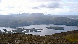
- Many lochs of Scotland are finger lakes. Some like Loch Broom and Loch Maree form fjord and finger lake systems.
Wales
- Many of the Welsh llynnoedd.
United States
- Finger Lakes, New York State