
Wheaton is a city in Milton and Winfield Townships and is the county seat of DuPage County, Illinois, United States. It is located approximately 25 miles (40 km) west of Chicago. As of the 2020 census, Wheaton's population was 53,970, making it the 27th most populous municipality in Illinois.

Highwood is a North Shore suburb of Chicago in Moraine Township, Lake County, Illinois, United States. As of the 2020 census, the population was 5,074. It is known for its entertainment, restaurants, bars, and festivals.

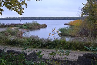
Mettawa is a village in Lake County, Illinois, United States. Per the 2020 census, the population was 533. The village maintains trails for pedestrian, bicycle and equestrian usage. Five forest preserves of the Lake County Forest Preserve District are located within village boundaries.

The Pecatonica River is a tributary of the Rock River, 194 miles (312 km) long, in southern Wisconsin and northern Illinois in the United States.

Naval Station Great Lakes is the home of the United States Navy's only current boot camp, located near North Chicago, in Lake County, Illinois. Important tenant commands include the Recruit Training Command, Training Support Center and Navy Recruiting District Chicago. Naval Station Great Lakes is the largest military installation in Illinois and the largest training station in the Navy. The base has 1,153 buildings situated on 1,628 acres (6.59 km2) and has 69 mi (111 km) of roadway to provide access to the base's facilities. Within the naval service, it has several different nicknames, including "The Quarterdeck of the Navy", or the more derogatory "Great Mistakes". It is also referred to as "second boot camp" while at Training Support Command.

The Golden Gate National Recreation Area (GGNRA) is a U.S. National Recreation Area protecting 82,116 acres (33,231 ha) of ecologically and historically significant landscapes surrounding the San Francisco Bay Area. Much of the park is land formerly used by the United States Army. GGNRA is managed by the National Park Service and is the second-most visited unit of the National Park system in the United States, with more than 15.6 million visitors in 2022. It is also one of the largest urban parks in the world, with a size two-and-a-half times that of the consolidated city and county of San Francisco.
Fort Hunter Liggett is a United States Army base in Jolon, California, in southern Monterey County, California. The fort, named in 1941 after General Hunter Liggett, is primarily used as a training facility, where activities such as field maneuvers and live fire exercises are performed. It is roughly 25 miles northwest of Camp Roberts, California.

Salt Springs State Park is a Pennsylvania state park in Franklin Township, Susquehanna County, Pennsylvania, in the United States. The park is home to massive hemlock trees that are over 500 years old and are among the largest trees in all of Pennsylvania. The Fall Brook Natural Area within the park is recognized as a part of the Old-Growth Forest Network. The park also features a gorge with three waterfalls on Fall Brook. Salt Springs State Park is 7 miles (11 km) north of Montrose, just off Pennsylvania Route 29. The park is the only state park in Pennsylvania that is managed by a non-profit organization, the Friends of Salt Springs Park. The state owns 405 acres (164 ha) of land and the Friends own an additional 437 acres (177 ha) bringing the total amount of protected land to 842 acres (341 ha).

White Pines Forest State Park, more commonly referred to as White Pines State Park, is an Illinois state park in Ogle County, Illinois. It is located near the communities of Polo, Mount Morris and Oregon. The 385-acre (156 ha) park contains the southernmost remaining stand of native white pine trees in the state of Illinois, and that area, 43 acres (17 ha), was designated an Illinois Nature Preserve in 2001.

Beaver Dam State Park is an Illinois state park on 750 acres (304 ha) in Macoupin County, Illinois in the United States. The park is 7 miles (11 km) southwest of Carlinville, Illinois and is managed by the Illinois Department of Natural Resources (IDNR) as a public place for fishing.
Trail of Tears State Forest is a State of Illinois conservation area on 5,114 acres (2,070 ha) in Union County, Illinois, United States.
Marshall State Fish and Wildlife Area is an Illinois state park on 6,000 acres (2,400 ha) in Marshall County, Illinois, United States.
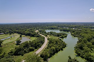
Skokie Lagoons is a nature preserve in Glencoe and Winnetka, Illinois, owned and managed by the Forest Preserve District of Cook County. The park is bordered by Dundee Road to the north, Forestway Drive to the east, Willow Road to the south, and the Edens Expressway to the west. Within the park, there are seven inter-connected lagoons totaling 190 acres (0.77 km2). Water flows southward from the Chicago Botanic Garden through the lagoons to the Skokie River. The overall water level in the lagoons is controlled by the main control dam at Willow Road. Three low dams keep the water levels below the inner islands. Recreational opportunities at Skokie Lagoons include biking, fishing, boating, and birding.

Fort Logan was a military installation located eight miles southwest of Denver, Colorado. It was established in October 1887, when the first soldiers camped on the land, and lasted until 1946, when it was closed following the end of World War II. After the fort closed the site was used as a mental health center and part of the land was set aside for the Fort Logan National Cemetery.
Openlands is a non-profit conservation organization and accredited land trust that works with groups and individuals in northeastern Illinois, northwestern Indiana, and southeastern Wisconsin to preserve open space, develop walking and biking trails, restore natural areas, and connect people to the outdoors. Openlands has protected and expanded public access to more than 55,000 acres of land for parks, forest preserves, land and water greenway corridors, and urban gardens across the Chicago metropolitan region. It is a member of Chicago Wilderness.
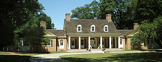
The Edward L. Ryerson Conservation Area is a protected area and historic district in Riverwoods, Illinois, United States. The area was a weekend getaway for businessman Edward L. Ryerson, who built a cabin there in 1928. He built three other cabins for friends, and had a country house built in 1942. It is representative of the type of getaways used by successful Chicagoans who sought the tranquil surroundings of the Des Plaines River. The Ryersons donated the property to the Lake County Forest Preserve district for public use. 471 acres (191 ha) are recognized as the Edward L. Ryerson Area Historic District.

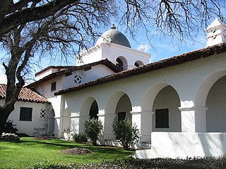
The Philip H. Sheridan Reserve Center is the former Fort Sheridan now in Lake Forest, Highwood, and Highland Park in Lake County, Illinois, United States. It was originally established as a United States Army Post named after Civil War Cavalry General Philip Sheridan, to honor his services to Chicago. When the main fort was officially closed by the Army on May 3, 1993, the majority of the property was sold by the Department of Defense to commercial land developers. Most of the original housing structures were then refurbished and resold as a residential community. Other buildings were given to cultural organizations like Midwest Young Artists, the largest youth music program in the Midwest. Approximately 90 acres (36 ha) of the southern end of the original post were retained by the Army; there the Army now operates the Sheridan Reserve Center complex.
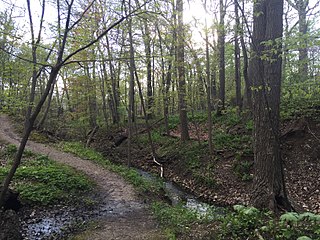
Ravine Park is a community park located in Lake Bluff, Illinois. Measuring roughly 14 acres (5.7 ha) in area, it is dominated by a ravine formed by an ephemeral stream that flows after heavy rainfall and consists of a series of muddy ponds otherwise. The park's main attraction is a small system of nature trails. Ravine Park is one of the only officially protected ravines in all of Lake County, Illinois and offers a refuge for nature in the densely inhabited suburbs of Chicago.
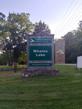
Whalon Lake was once a quarry and is now a lake open to the public. Located in Bolingbrook, Illinois, it offers many activities like fishing, kayaking, walking, and biking. The lake is currently owned and operated by the Forest Preserve District of Will County.
Middlefork Savanna is a of 687 acres (278 ha) nature preserve in Lake Forest, Illinois. Several biomes including oak savannas, dry-mesic prairies, wet-mesic prairies, marshes, deciduous woodlands, and sedge meadows as well as a portion of the North Branch of the Chicago River are found in the preserve. The Middlefork Savanna also contains 25 acres (10 ha) of the “highest quality tallgrass savanna of its kind” in the United States. Such ecosystems are globally endangered. The preserve includes 5.5 miles of gravel trails for hiking and cross-country skiing as well as 4.2 miles of trails for biking. It is managed by Lake County Forest Preserves.


