Mettawa, Illinois

Last updated

Mettawa, Illinois
Lake County Illinois Incorporated and Unincorporated areas Mettawa Highlighted.svg
Location of Mettawa in Lake County, Illinois.
Illinois in United States (US48).svg
Location of Illinois in the United States
Coordinates: 42°14′38″N87°55′4″W / 42.24389°N 87.91778°W / 42.24389; -87.91778
CountryUnited States
StateIllinois
County Lake
Government
  Mayor Casey Urlacher
Area
[1]
  Total5.53 sq mi (14.32 km2)
  Land5.45 sq mi (14.12 km2)
  Water0.08 sq mi (0.20 km2)
Population
 (2020)
  Total533
  Density97.78/sq mi (37.76/km2)
Time zone UTC-6 (CST)
  Summer (DST) UTC-5 (CDT)
ZIP Code(s)
60045, 60048, 60052
Area code 847
FIPS code 17-48671
Wikimedia CommonsMettawa, Illinois
Website www.mettawa.org

Mettawa is a village in Lake County, Illinois, United States. Per the 2020 census, the population was 533. [2] The village maintains trails for pedestrian, bicycle and equestrian usage. Five forest preserves of the Lake County Forest Preserve District are located within village boundaries.

Contents

History

The name of the town derived from Potawatomi chief Mettaywah, who lived in the area before signing the 1833 Treaty of Chicago and being displaced to Kansas. [3] The traveler Colbee reported visiting the chief's village near the Des Plaines River and eating pork, cakes fried in pork fat, and a corn and bean dish. [4] Many Potawatomi returned to Illinois annually until the end of the nineteenth century to visit their burial grounds. [3]

Mettawa was founded by area residents in 1960 who worked together with a common goal of protecting their rural area from encroaching commercial development. Mettawa's first mayor was James Getz; subsequent mayors included Edward FitzSimons, Julius Abler, Barry McLean and Jess Ray. The current treasurer is Amy Weiland. Famous residents and property owners within the area now known as Mettawa have included two-time presidential nominee Adlai E. Stevenson, city planner Edward H. Bennett, and more recently, news anchor and rancher Bill Kurtis and Chicago Bears' linebacker Brian Urlacher (brother of current Mettawa Mayor Casey Urlacher) and running back Matt Forte. [5] Stevenson's Mettawa estate on the Des Plaines River is a designated Illinois Historic Site and is listed on the National Register of Historic Places.

Government

Mettawa is governed by an elected Mayor and a six-member Board of Trustees.

Mayor
Board of Trustees

Mettawa lacks a dedicated Village Hall and has few paid administrative staff. Village meetings are held in a local hotel, and the Village contracts with an engineer, attorney, Mettawa Open Lands Association, and various consultants for operational services. In January 2009, the Village Board established its website which serves as a virtual Village Hall, providing official information including Village contacts, official documents and maps, meeting agendas and the Comprehensive Plan.

Conservation and recreation

Mettawa was founded by conservationist landowners and continues to be a center of land conservation and restoration activities. The village also supports a rural, equestrian-friendly lifestyle. Some residents maintain small farming operations, and there are eight horse stables within the village's borders.

The Mettawa Open Lands Association [6] (MOLA) is a non-profit organization which promotes quality open space within the village and encourages the protection of public and private open lands. MOLA supports Mettawa-area residents and open lands (including unincorporated housing developments that are surrounded by village land) with public workdays and educational programs, and provides quality open space management on village properties. In celebration of Mettawa's 50th anniversary in 2010, MOLA distributed complimentary wildflower seed packets to all village residents and to many residents in neighboring areas, and suggested that recipients plant the seeds along roadsides to help beautify the area.

MOLA maintains the Whippoorwill Farm Preserve, an open lands area owned by the village (just west of I-94 at the northwest corner of IL-60/Townline Road and Riverwoods Boulevard). Whippoorwill Farm is currently undergoing restoration to a native prairie/wetland habitat.

Stevenson's home in Mettawa, IL Adlai E. Stevenson II's home in Mettawa.jpg
Stevenson's home in Mettawa, IL

The Lake County Forest Preserve District [7] maintains five forest preserves within village boundaries, including Old School, [8] Grainger Woods, [9] McArthur Woods, [10] Captain Daniel Wright Woods [11] and Adlai Stevenson Historic Home. [12]

Mettawa also includes nine areas designated as Illinois Nature Preserves, [13] one area within the Libertyville Township Open Space District, and the Covington Charitable Trust area (maintained by the Lake Forest Open Lands Association).

The Des Plaines River Trail runs through the western edge of Mettawa and connects with the village's own Mettawa Trail system, which is used by pedestrians, cyclists and equestrians.

Commercial development

Commercial development has occurred within and adjacent to Mettawa in recent years, despite resistance by residents and the Village Board). However, an unusually high percentage of the commercial structures are green buildings which have achieved high Leadership in Energy and Environmental Design (LEED) ratings. Tax revenues from businesses in Mettawa provide income to the village, which in turn provides eligible residents with a tax rebate.

HSBC completed construction of its North American headquarters in Mettawa in 2008. Although no longer corporate headquarters, the building remains partially occupied by HSBC. This building achieved LEED Gold Certification and in March 2009 was named Green Development of the Year by the National Association of Industrial and Office Properties (NAIOP). [14]

The W. W. Grainger company's headquarters is located on unincorporated land enclosed within Mettawa's borders. In 2008 this building was updated to achieve its 2009 Gold LEED certification. Grainger purchased 535 acres (2.17 km2) of land in Mettawa (1993–1998), then disconnected from the village to become part of unincorporated Lake County. In 1996, all of this land was annexed back into the village, with the exception of the 155 acres (0.63 km2) office campus. Grainger donated 257 acres (1.04 km2) to the Lake County Forest Preserve District. The resulting Grainger Forest Preserve hosts an equestrian center and includes open lands filled with rare ecosystems and species. [9] The remaining Grainger acreage is within the village and zoned 5-acre (20,000 m2) residential. Major businesses are also located near the busy intersection of Interstate 94 and Illinois Route 60 in Mettawa.

Residential development

The village maintains a low-density five-acre zoning requirement for residential development. Most of Mettawa's Planned Unit Developments (PUD) have included conservation easements and land restoration.

The Deerpath Farm [15] conservation community, Mettawa's largest (200-acre (0.81 km2)) PUD, includes 140 acres (0.57 km2) of restored open lands managed by the Lake Forest Open Lands Association, [16] and also sponsors community workdays and nature education events. In 2006 it was named Development of the Year by the Lake County Stormwater Management Association for its innovative hydrology management based on wetland restoration.

Other PUDs within Mettawa include Sanctuary Estates and Mettawa Woods.

Notable people

Geography

Mettawa is located at 42°14′38″N87°55′4″W / 42.24389°N 87.91778°W / 42.24389; -87.91778 (42.243972, -87.917909).

According to the 2010 census, Mettawa has a total area of 5.39 square miles (13.96 km2), of which 5.31 square miles (13.75 km2) (or 98.52%) is land and 0.08 square miles (0.21 km2) (or 1.48%) is water. [17]

Demographics

Historical population
CensusPop.Note
1960 126
1970 285126.2%
1980 33015.8%
1990 3485.5%
2000 3675.5%
2010 54749.0%
2020 533−2.6%
U.S. Decennial Census [18]
2010 [19] 2020 [20]

2020 census

Mettawa village, Illinois – Racial and ethnic composition
Note: the US Census treats Hispanic/Latino as an ethnic category. This table excludes Latinos from the racial categories and assigns them to a separate category. Hispanics/Latinos may be of any race.
Race / Ethnicity (NH = Non-Hispanic)Pop 2010 [19] Pop 2020 [20] % 2010% 2020
White alone (NH)45040982.27%76.74%
Black or African American alone (NH)1041.83%0.75%
Native American or Alaska Native alone (NH)010.00%0.19%
Asian alone (NH)25554.57%10.32%
Pacific Islander alone (NH)000.00%0.00%
Some Other Race alone (NH)010.00%0.19%
Mixed Race/Multi-Racial (NH)260.37%1.13%
Hispanic or Latino (any race)605710.97%10.69%
Total547533100.00%100.00%

2000 Census

As of the census of 2000, there were 367 people, 135 households, and 108 families living in the village. The population density was 67.1 inhabitants per square mile (25.9/km2). There were 141 housing units at an average density of 25.8 units per square mile (10.0 units/km2). The racial makeup of the village was 95.64% White, 2.45% Asian, 1.09% from other races, and 0.82% from two or more races. Hispanic or Latino of any race were 4.09% of the population.

There were 135 households, out of which 33.3% had children under the age of 18 living with them, 75.6% were married couples living together, 1.5% had a female householder with no husband present, and 19.3% were non-families. 16.3% of all households were made up of individuals, and 6.7% had someone living alone who was 65 years of age or older. The average household size was 2.68 and the average family size was 2.96.

In the village, the population was spread out, with 24.0% under the age of 18, 6.0% from 18 to 24, 20.4% from 25 to 44, 36.2% from 45 to 64, and 13.4% who were 65 years of age or older. The median age was 45 years. For every 100 females, there were 103.9 males. For every 100 females age 18 and over, there were 103.6 males.

The median income for a household in the village was $127,388, and the median income for a family was $153,129. Males had a median income of $100,000 versus $51,250 for females. The per capita income for the village was $89,104. About 3.1% of families and 4.6% of the population were below the poverty line, including 7.1% of those under age 18 and 7.1% of those age 65 or over.

Adjacent communities include Lake Forest, Lincolnshire, Vernon Hills, Libertyville, and Green Oaks.

As of the 2010 US Census, there were 547 people living in the village. The racial makeup of the village was 89.95% White, 1.83% African American, 4.57% Asian, 1.83% from other races, and 1.83% from two or more races. Hispanic or Latino of any race were 10.97% of the population.

Notes

  1. "2020 U.S. Gazetteer Files". United States Census Bureau. Retrieved March 15, 2022.
  2. "Mettawa village, Illinois". United States Census Bureau . Retrieved April 15, 2022.
  3. 1 2 Madigan, Tim (December 5, 1992). "Richest suburb regrets its wealth of publicity". Chicago Tribune.
  4. Benton, Colbee (1957). A Visitor to Chicago in Indian Days: "Journal to the 'Far-Off West'". Chicago: The Caxton Club. pp. 82–83.
  5. "The Bears' Matt Forte Just Bought a Secluded Mettawa Home". Chicago magazine.
  6. "Mettawa Open Lands Association". mettawaopenlands.org.
  7. "Preserves & Facilities, Recreation, Conservation - Lake County Forest Preserves". lcfpd.org.
  8. "Old School Forest Preserve, Libertyville - Lake County Forest Preserves (Illinois)". Archived from the original on June 21, 2010. Retrieved June 15, 2010.
  9. 1 2 "Grainger Woods Conservation Preserve, Mettawa - Lake County Forest Preserves (Illinois)". Archived from the original on June 21, 2010. Retrieved June 15, 2010.
  10. "Forest Preserve Land Purchases and Donation - News Release 16-Jun-06 - Lake County Forest Preserves (Illinois)". Archived from the original on April 30, 2010. Retrieved July 20, 2010.
  11. "Wright Woods Forest Preserve, Mettawa - Lake County Forest Preserves (Illinois)". Archived from the original on June 23, 2010. Retrieved July 20, 2010.
  12. "Adlai e. Stevenson Historic Home, Mettawa - Lake County Forest Preserves". Archived from the original on July 8, 2013. Retrieved March 14, 2013.
  13. "DNR". Archived from the original on February 25, 2015. Retrieved February 24, 2015.
  14. "HSBC North American Headquarters". e-architect. March 20, 2009.
  15. "Deerpath Farm Conservation Community". deerpathfarm.com.
  16. "Lake Forest Open Lands Association". lfola.org.
  17. "G001 - Geographic Identifiers - 2010 Census Summary File 1". United States Census Bureau. Archived from the original on February 13, 2020. Retrieved December 19, 2015.
  18. "Decennial Census of Population and Housing by Decades". US Census Bureau.
  19. 1 2 "P2 HISPANIC OR LATINO, AND NOT HISPANIC OR LATINO BY RACE – 2010: DEC Redistricting Data (PL 94-171) – Mettawa village, Illinois". United States Census Bureau .
  20. 1 2 "P2 HISPANIC OR LATINO, AND NOT HISPANIC OR LATINO BY RACE – 2020: DEC Redistricting Data (PL 94-171) – Mettawa village, Illinois". United States Census Bureau .

Related Research Articles

<span class="mw-page-title-main">Lake County, Illinois</span> County in Illinois, United States

Lake County is located in the northeastern corner of the U.S. state of Illinois, along the shores of Lake Michigan. As of the 2020 census, it has a population of 714,342, making it the third-most populous county in Illinois. Its county seat is Waukegan, the tenth-largest city in Illinois. The county is primarily suburban, with some urban areas and some rural areas. Due to its location, immediately north of Cook County, Lake County is one of the collar counties of the Chicago metropolitan area. Its northern boundary is the Wisconsin state line.

<span class="mw-page-title-main">Cook County, Illinois</span> County in Illinois, United States

Cook County is the most populous county in the U.S. state of Illinois and the second-most-populous county in the United States, after Los Angeles County, California. More than 40 percent of all residents of Illinois live within Cook County. As of 2020, the population was 5,275,541. The county seat is Chicago, the most populous city in Illinois and the third most populous city in the United States. The county is at the center of the Chicago metropolitan area.

<span class="mw-page-title-main">Glenview, Illinois</span> Village in Illinois, United States

Glenview is an incorporated village located in Cook County, Illinois, United States, approximately 15 miles northwest of the Chicago Loop. Per the 2020 census, the population was 48,705. The current Village President is Michael Jenny.

<span class="mw-page-title-main">Bannockburn, Illinois</span> Village in Illinois, United States

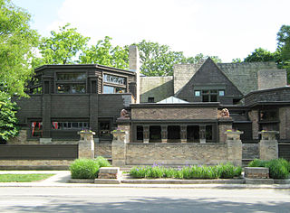
Bannockburn is a village in West Deerfield and Vernon townships in Lake County, Illinois, United States. Per the 2020 census, the population was 1,013. The village is generally considered part of the Chicago area's North Shore region. The Friedman house by Frank Lloyd Wright is located in Bannockburn.

<span class="mw-page-title-main">Grayslake, Illinois</span> Village in Illinois, United States

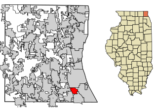
Grayslake is a village in Lake County, Illinois, United States. It is located in the Chicago metropolitan area, about 40 miles (64 km) north of Chicago's downtown, 14 miles (23 km) west of Lake Michigan, and 15 miles (24 km) south of the Wisconsin border. The village's population at the 2020 census was 21,248.

<span class="mw-page-title-main">Gurnee, Illinois</span> Village in Illinois, United States

Gurnee is a village and suburb in Lake County, Illinois, United States. Its population was 30,706 as of the 2020 census. It borders the city of Waukegan, and is a popular tourist attraction within the Chicago metropolitan area.

<span class="mw-page-title-main">Kildeer, Illinois</span> Village in Illinois, United States

Kildeer is a village in southwestern Lake County, Illinois, United States, and a suburb of Chicago. Per the 2020 census, the population was 4,091. It has limited development to custom houses on large lots, and has worked to preserve natural features and open space.

<span class="mw-page-title-main">Lake Bluff, Illinois</span> Village in Illinois, United States

Lake Bluff is a village in Lake County, Illinois, United States. Per the 2020 census, the population was 5,616.

<span class="mw-page-title-main">Lake Forest, Illinois</span> City in Illinois, United States

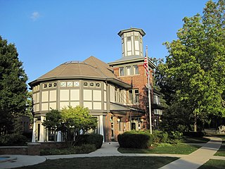
Lake Forest is a city located in Lake County, Illinois, United States. Per the 2020 census, the population was 19,367. The city is along the shore of Lake Michigan, and is a part of the Chicago metropolitan area and the North Shore. Lake Forest was founded with Lake Forest College and was laid out as a town in 1857, a stop for travelers making their way south to Chicago. The Lake Forest City Hall, designed by Charles Sumner Frost, was completed in 1898. It originally housed the fire department, the Lake Forest Library, and city offices.

<span class="mw-page-title-main">Libertyville, Illinois</span> Village in Illinois, United States

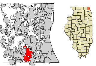
Libertyville is a village in Lake County, Illinois, United States, and a northern suburb of Chicago. It is located 5 miles (8 km) west of Lake Michigan along the Des Plaines River. The 2020 census population was 20,579. It is part of Libertyville Township, which includes the village, neighboring Green Oaks, and portions of Vernon Hills, Mundelein, unincorporated Waukegan and Lake Forest, and part of Knollwood CDP. Libertyville neighbors these communities as well as Gurnee to the north and Grayslake to the northwest. Libertyville is about 40 miles north of the Chicago Loop and is part of the United States Census Bureau's Chicago combined statistical area (CSA).

<span class="mw-page-title-main">Lincolnshire, Illinois</span> Village in Illinois, United States

Lincolnshire is a village in Vernon Township, Lake County, in the U.S. state of Illinois. The village is a northern suburb of Chicago. Per the 2020 census, the population was 7,940. Lincolnshire was incorporated on August 5, 1957, from the unincorporated Half Day area when land was purchased to build a residential subdivision. The community underwent an aggressive era of expansion from 1983 to the 1990s. The Des Plaines River bisects the village, passing from north to south; Illinois Route 22 also divides the village into two parts, crossing the village from east to west.

<span class="mw-page-title-main">Long Grove, Illinois</span> Village in Lake County, Illinois, United States

Long Grove is a village in Lake County, Illinois, United States, approximately 35 miles (56 km) away from and a northwest suburb of Chicago. Per the 2020 census, the population was 8,366. The village has strict building ordinances to preserve its "country atmosphere".

<span class="mw-page-title-main">North Chicago, Illinois</span> City in Illinois, United States

North Chicago is a city in Lake County, Illinois, United States, and a suburb of the Chicago metropolitan area. The population was 30,759 at the 2020 census making it the third-most populous city by population in the county, after Waukegan and Mundelein.

<span class="mw-page-title-main">Vernon Hills, Illinois</span> Village in Illinois, United States

Vernon Hills is a suburb north of Chicago, Illinois in Lake County, Illinois, United States. The population was 26,850 at the 2020 census. Vernon Hills serves as a retail hub for its surrounding area.

<span class="mw-page-title-main">Beecher, Illinois</span> Village in Illinois, United States

Beecher is a village in Will County, Illinois, United States. It is located on the old Chicago and Eastern Illinois Railroad and the Dixie Highway. Situated in the center of Washington Township, it was originally named Washington Center. Named for Henry Ward Beecher, Beecher was founded in 1870 and incorporated as a village in 1884. Originally governed by a village president and board of trustees, a village administrator was hired to handle daily tasks in 1988. The city clerk is an appointed position.

<span class="mw-page-title-main">North Shore (Chicago)</span> Many affluent suburbs north of Chicago, Illinois

The North Shore consists of many affluent suburbs north of Chicago, Illinois, bordering the shores of Lake Michigan. These communities fall within suburban Cook County and Lake County. The North Shore's membership is often a topic of debate, and it includes some Chicago suburbs which do not border Lake Michigan. However, Lake Bluff, Lake Forest, Highwood, Highland Park, Deerfield, Glencoe, Northbrook, Northfield, Winnetka, Kenilworth, Wilmette, Golf, Glenview, Niles, Morton Grove, Skokie, and Evanston, are generally considered to be the main constituents of the North Shore. The North Shore is known for its affluence, high level of education, proximity to Chicago, and top-rated public schools.

Knollwood is an unincorporated community and census-designated place (CDP) in Lake County, Illinois, United States. Per the 2020 census, the population was 2,221. It is located within Shields Township and Libertyville Township. Knollwood shares a ZIP Code with the neighboring village of Lake Bluff, and children attend Lake Bluff schools. The residents of Knollwood were served by the Knollwood Fire Department until October 2018, after the trustees of the Rockland Fire Protection District ended their relationship with the department. Residents now receive fire protection from the Libertyville and Lake Forest fire departments. Police protection is provided by the Lake County Sheriff's Department.

<span class="mw-page-title-main">Libertyville Township, Lake County, Illinois</span> Township in Illinois, United States

Libertyville Township is a township in Lake County, Illinois, United States. As of the 2010 census, its population was 53,139. The village of Libertyville is part of the township, as are parts of Green Oaks, Lake Bluff, Lake Forest, Mettawa, Mundelein, North Chicago, Rondout, Vernon Hills and Waukegan.

<span class="mw-page-title-main">Vernon Township, Lake County, Illinois</span> Township in Illinois, United States

Vernon Township is a township in Lake County, Illinois, USA. As of the 2010 census, its population was 67,095. The name "Vernon Township" comes from George Washington's estate, Mount Vernon.

<span class="mw-page-title-main">Adlai E. Stevenson II Farm</span> Historic house in Illinois, United States

The Adlai E. Stevenson II Farm, also known as Adlai E. Stevenson Historic Home is a historic property located on St. Mary's Road in Mettawa, Illinois. Between 1936 and his death it was the home of Adlai Stevenson II (1900-1965), a Democratic politician who was the governor of Illinois between 1949 and 1953, was twice the Democratic Party's presidential candidate in the 1952 and 1956 elections, and was a candidate for the Democratic presidential nomination again in 1960, losing to Senator John F. Kennedy. Stevenson served as the US Ambassador to the United Nations from 1961 until his death in July 1965. He was America's UN Ambassador during the Cuban Missile Crisis in October 1962. The farm was listed on the National Register of Historic Places and has also been designated a National Historic Landmark. The property is located in the northern suburbs of Chicago, in the Captain Daniel Wright Woods Forest Preserve. It currently functions as a museum.

References