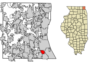
Lake County is situated in the northeastern corner of the U.S. state of Illinois, along the shores of Lake Michigan. As of the 2020 census, it has a population of 714,342, making it the third-most populous county in Illinois. Its county seat is Waukegan, the tenth-largest city in Illinois. The county is primarily suburban, with some urban areas and some rural areas. Due to its location, immediately north of Cook County, Lake County is one of the collar counties of the Chicago metropolitan area. Its northern boundary is the Wisconsin state line.

Buffalo Grove is a village in Lake and Cook Counties in the U.S. state of Illinois. A suburb of Chicago, it lies about 30 miles (50 km) northwest of Downtown Chicago and 20 miles (32 km) north of O'Hare International Airport. As of the 2020 Census, Buffalo Grove has a population of 43,212. It totals 9.6 square miles (25 km2) of land, with the top three-quarters in Lake County and the bottom quarter in Cook County. Roads in the village such as Lake Cook Road and Illinois Route 83 converge on I-294. It is part of the Chicago Metropolitan Area.

Bannockburn is a village in West Deerfield and Vernon townships in Lake County, Illinois, United States. Per the 2020 census, the population was 1,013. The village is generally considered part of the Chicago area's North Shore region. The Friedman house by Frank Lloyd Wright is located in Bannockburn.

Lincolnshire is a village in Vernon Township, Lake County, in the U.S. state of Illinois. The village is a northern suburb of Chicago. Per the 2020 census, the population was 7,940. Lincolnshire was incorporated on August 5, 1957, from the unincorporated Half Day area when land was purchased to build a residential subdivision. The community underwent an aggressive era of expansion from 1983 to the 1990s. The Des Plaines River bisects the village, passing from north to south; Illinois Route 22 also divides the village into two parts, crossing the village from east to west.

Illinois Route 22, also known as Half Day Road for part of its length, is an east–west state highway in northeastern Illinois. It runs from U.S. Route 14 in Fox River Grove to U.S. Route 41 in Highland Park. It travels a distance of 19.7 miles (31.7 km) and is one of the few roads that runs almost entirely across southern Lake County while also providing access to southeastern McHenry County. Throughout its length, it shifts between two and four lanes as it passes through a frequently changing setting of scenic forestry and smaller populations, as well as busy intersections and larger developments.

Area codes 847 and 224 are telephone area codes in the North American Numbering Plan (NANP) for the U.S. state of Illinois. The numbering plan area (NPA) comprises the northeastern part of Illinois and many northern suburbs of Chicago. This includes most of Lake County, the northern part of Cook County, the northern part of Kane County, and a small part of McHenry County.
Half Day is a former unincorporated town in Lake County, Illinois, in the state's northeastern region. It is about 30 miles (48 km) north of downtown Chicago via Milwaukee Avenue.
Prairie View is an unincorporated community located in northeastern Illinois, in southern Lake County. It is a part of Vernon Township. Prairie View has not been annexed entirely by either Lincolnshire or Buffalo Grove, although tiny portions of it have been.
Big Foot Prairie is an unincorporated community and census-designated place in McHenry County, Illinois, United States. It was named a CDP for the 2020 census, at which time it had a population of 65. It is located in Chemung Township. Big Foot Prairie is located on U.S. Route 14, 5 miles (8.0 km) north of Harvard. The community extends north into Walworth County, Wisconsin, where there is a CDP of the same name in the town of Walworth.
Barclay is an unincorporated community in Clear Lake and Williams townships, Sangamon County, Illinois, United States. Barclay is located on Illinois Route 54 and the Canadian National Railway, 1.3 miles (2.1 km) northeast of Spaulding.
Bissell is an unincorporated community in Clear Lake Township, Sangamon County, Illinois, United States. Bissell is located on Illinois Route 54 and the Canadian National Railway near the northeast border of Springfield.
Diamond Lake is an unincorporated community in Lake County, Illinois, United States. Diamond Lake is located along Illinois Route 60 and Illinois Route 83, north of Long Grove and south of Mundelein.
Gilmer is an unincorporated community in Lake County, Illinois, United States. Gilmer is located along Gilmer Road and the Canadian National Railway north of Hawthorn Woods.
Fremont Center is an unincorporated community in Fremont Township, Lake County, Illinois, United States. Fremont Center is located at the junction of Illinois Route 60 and County Route 65V, 4.3 miles (6.9 km) west-northwest of downtown Mundelein.
Monaville is an unincorporated community in Lake Villa Township, Lake County, Illinois, United States. Monaville is located at the junction of County Routes 18A and 65V near the southern border of Lake Villa.
Loon Lake is an unincorporated community in Antioch Township, Lake County, Illinois, United States. Loon Lake is located at the junction of Illinois Route 83 and County Route 10A on the northern border of Lake Villa.
West Miltmore is an unincorporated community in Lake Villa Township, Lake County, Illinois, United States. West Miltmore is located on County Route 18A near the northern border of Round Lake Beach. It is included in the Venetian Village census-designated place.
Grass Lake is an unincorporated community in Antioch Township, Lake County, Illinois, United States. Grass Lake is on County Route A10, 3 miles (4.8 km) southwest of Antioch.
Reily Lake is an unincorporated community in Randolph County, Illinois, United States. The community is on the Mississippi River and County Route 6 7 miles (11 km) northwest of Chester.
Kennedy is an unincorporated community in Lake County, Illinois, United States. It is at the intersection of Illinois Route 43 and Illinois Route 60.


