Gary, Minnesota

Last updated
Gary
Gary, Minnesota-04.jpg
City Hall
Norman County Minnesota Incorporated and Unincorporated areas Gary Highlighted.svg
Location of Gary, Minnesota
Coordinates: 47°22′18″N96°15′58″W / 47.37167°N 96.26611°W / 47.37167; -96.26611 Coordinates: 47°22′18″N96°15′58″W / 47.37167°N 96.26611°W / 47.37167; -96.26611
CountryUnited States
State Minnesota
County Norman
Area
[1]
  Total0.32 sq mi (0.83 km2)
  Land0.32 sq mi (0.83 km2)
  Water0.00 sq mi (0.00 km2)
Elevation
1,099 ft (335 m)
Population
 (2020) [2]
  Total227
  Estimate 
(2021) [3]
225
  Density704.97/sq mi (272.39/km2)
Time zone UTC-6 (CST)
  Summer (DST) UTC-5 (CDT)
ZIP code
56545
Area code 218
FIPS code 27-23246
GNIS feature ID0644055 [4]

Gary is a city in Norman County, Minnesota, United States. The population was 227 at the 2020 census. [2]

Contents

History

Gary was laid out in 1883, and named for Garrett L. Thorpe, a pioneer merchant. [5] A post office has been in operation at Gary since 1887. [6]

Geography

According to the United States Census Bureau, the city has a total area of 0.33 square miles (0.85 km2), all land. [7]

The Agassiz Recreational Trail, a 53-mile multi-use trail built on an abandoned railroad grade, passes through the city. [8]

Demographics

Historical population
CensusPop.Note
1910 251
1920 33332.7%
1930 308−7.5%
1940 300−2.6%
1950 278−7.3%
1960 262−5.8%
1970 2651.1%
1980 241−9.1%
1990 200−17.0%
2000 2157.5%
2010 214−0.5%
2020 2276.1%
2021 (est.)225 [3] −0.9%
U.S. Decennial Census [9]
2020 Census [2]

2010 census

As of the census of 2010, there were 214 people, 83 households, and 59 families residing in the city. The population density was 648.5 inhabitants per square mile (250.4/km2). There were 96 housing units at an average density of 290.9 per square mile (112.3/km2). The racial makeup of the city was 95.8% White, 2.3% African American, 0.5% Native American, 0.5% Asian, and 0.9% from two or more races. Hispanic or Latino of any race were 0.5% of the population.

There were 83 households, of which 28.9% had children under the age of 18 living with them, 62.7% were married couples living together, 6.0% had a female householder with no husband present, 2.4% had a male householder with no wife present, and 28.9% were non-families. 25.3% of all households were made up of individuals, and 12% had someone living alone who was 65 years of age or older. The average household size was 2.58 and the average family size was 3.14.

The median age in the city was 40.5 years. 29% of residents were under the age of 18; 5.1% were between the ages of 18 and 24; 26.2% were from 25 to 44; 22.4% were from 45 to 64; and 17.3% were 65 years of age or older. The gender makeup of the city was 51.9% male and 48.1% female.

2000 census

As of the census of 2000, there were 215 people, 83 households, and 54 families residing in the city. The population density was 669.0 inhabitants per square mile (258.3/km2). There were 93 housing units at an average density of 289.4 per square mile (111.7/km2). The racial makeup of the city was 99.07% White, and 0.93% from two or more races. Hispanic or Latino of any race were 0.93% of the population.

There were 83 households, out of which 33.7% had children under the age of 18 living with them, 59.0% were married couples living together, 3.6% had a female householder with no husband present, and 34.9% were non-families. 31.3% of all households were made up of individuals, and 14.5% had someone living alone who was 65 years of age or older. The average household size was 2.55 and the average family size was 3.30.

In the city, the population was spread out, with 30.7% under the age of 18, 3.3% from 18 to 24, 30.7% from 25 to 44, 18.6% from 45 to 64, and 16.7% who were 65 years of age or older. The median age was 36 years. For every 100 females, there were 102.8 males. For every 100 females age 18 and over, there were 106.9 males.

The median income for a household in the city was $36,875, and the median income for a family was $47,250. Males had a median income of $29,844 versus $15,938 for females. The per capita income for the city was $15,683. About 6.8% of families and 14.8% of the population were below the poverty line, including 12.3% of those under the age of eighteen and 26.5% of those 65 or over.

Related Research Articles

<span class="mw-page-title-main">McGrath, Minnesota</span> City in Minnesota, United States

McGrath is a city in Aitkin County, Minnesota, United States. The population was 80 at the 2010 census.

<span class="mw-page-title-main">McGregor, Minnesota</span> City in Minnesota, United States

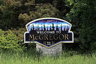
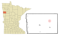
McGregor is a city in Aitkin County, Minnesota, United States. The population was 391 at the 2010 census.

<span class="mw-page-title-main">Thomson, Minnesota</span> Former City in Minnesota, United States

Thomson was a city in Carlton County, Minnesota, United States, located along the Saint Louis River. The population was 159 at the 2010 census.

<span class="mw-page-title-main">Wyoming, Minnesota</span> City in Minnesota, United States

Wyoming is a city in Chisago County, Minnesota. The population was 7,791 at the time of the 2010 census.

<span class="mw-page-title-main">Garfield, Minnesota</span> City in Minnesota, United States

Garfield is a city in Douglas County, Minnesota, United States. The population was 349 at the 2020 census.

<span class="mw-page-title-main">Fountain, Minnesota</span> City in Minnesota, United States

Fountain is a city in Fillmore County, Minnesota, United States. The population was 410 at the 2010 census. Fountain is the western terminus of the Root River segment of the Root River State Trail. Local attractions include the Fillmore County History Center.

<span class="mw-page-title-main">Whalan, Minnesota</span> City in Minnesota, United States

Whalan is a city in Fillmore County, Minnesota, United States. The population was 63 at the 2010 census.

<span class="mw-page-title-main">Nevis, Minnesota</span> City in Minnesota, United States

Nevis is a city in Hubbard County, Minnesota, United States. The population was 377 at the 2020 census.

<span class="mw-page-title-main">Silver Bay, Minnesota</span> City in Minnesota, United States

Silver Bay is a city in Lake County, Minnesota, United States. The population was 1,857 at the time of the 2020 census. It is the largest population center in a natural tourism area which includes, Tettegouche State Park and the Split Rock Lighthouse. It is a port along Lake Superior for iron ore and has taconite mining facilities of its own.

<span class="mw-page-title-main">Bluffton, Minnesota</span> City in Minnesota, United States

Bluffton is a city in Otter Tail County, Minnesota, United States, along the Leaf River. The population was 210 at the 2020 census.

<span class="mw-page-title-main">Erhard, Minnesota</span> City in Minnesota, United States

Erhard is a city in Otter Tail County, Minnesota, United States. The population was 132 at the 2020 census.

<span class="mw-page-title-main">Trail, Minnesota</span> City in Minnesota, United States

Trail is a city in Polk County, Minnesota, United States. It is part of the Grand Forks, ND-MN Metropolitan Statistical Area. The population was 40 at the 2020 census.

<span class="mw-page-title-main">Gaylord, Minnesota</span> City in Minnesota, United States

Gaylord is a city and the county seat of Sibley County, Minnesota, United States, along the shore of Titlow Lake. It is approximately 65 miles (105 km) west-southwest of Minneapolis-St. Paul. The population was 2,305 at the 2010 census.

<span class="mw-page-title-main">Gilbert, Minnesota</span> City in Minnesota, United States

Gilbert is a city in St. Louis County, Minnesota, United States. The population was 1,799 at the 2010 census. State Highway 37 and State Highway 135 are two of the main routes in Gilbert. Gilbert is part of the Quad Cities, with Virginia, Eveleth, and Mountain Iron. The city is named for Giles Gilbert, who led the exploration of the McKinley mine property in the 1890s.

<span class="mw-page-title-main">Elba, Minnesota</span> City in Minnesota, United States

Elba is a city in Winona County, Minnesota, United States. The population was 152 at the 2010 census. It is on Minnesota State Highway 74 just north of Whitewater State Park.

<span class="mw-page-title-main">St. Bonifacius, Minnesota</span> City in Minnesota, United States

Saint Bonifacius, often stylized as St. Bonifacius, is a small city in Hennepin County, Minnesota, United States, 25 miles west of Minneapolis. Settled in the 1850s, the town has a combination of rural and exurban features. It is completely surrounded by Minnetrista, Minnesota, and is close to the county line with Carver County. It hosted a Nike Hercules battery during the Cold War, one of four protecting Minneapolis–Saint Paul from Soviet bombers.

<span class="mw-page-title-main">Cedar Mills, Minnesota</span> City in Minnesota, United States

Cedar Mills is a city in Meeker County, Minnesota, United States. The population was 45 at the 2010 census.

<span class="mw-page-title-main">Twin Valley, Minnesota</span> City in Minnesota, United States

Twin Valley is a city in Norman County, Minnesota, United States, along the Wild Rice River. The population was 723 at the 2020 census.

<span class="mw-page-title-main">Battle Lake, Minnesota</span> City in Minnesota, United States

Battle Lake is a city in Otter Tail County, Minnesota, United States. The population was 857 according to the 2020 census.

<span class="mw-page-title-main">Minnesota Lake, Minnesota</span> City in Minnesota, United States

Minnesota Lake is a city in Blue Earth and Faribault counties in the State of Minnesota. The population was 661 at the 2020 census. The bulk of the city is in Faribault County; a small part extends into Blue Earth County.

References

  1. "2020 U.S. Gazetteer Files". United States Census Bureau. Retrieved July 24, 2022.
  2. 1 2 3 "Explore Census Data". United States Census Bureau . Retrieved April 20, 2022.
  3. 1 2 "City and Town Population Totals: 2020-2021". United States Census Bureau. June 19, 2022. Retrieved June 19, 2022.
  4. "US Board on Geographic Names". United States Geological Survey. October 25, 2007. Retrieved January 31, 2008.
  5. Upham, Warren (1920). Minnesota Geographic Names: Their Origin and Historic Significance. Minnesota Historical Society. p.  382.
  6. "Norman County". Jim Forte Postal History. Archived from the original on March 5, 2016. Retrieved July 26, 2015.
  7. "US Gazetteer files 2010". United States Census Bureau. Archived from the original on July 2, 2012. Retrieved November 13, 2012.
  8. "Agassiz Recreational Trail (Minnesota)". American Trails. Archived from the original on March 14, 2011. Retrieved March 2, 2011.
  9. United States Census Bureau. "Census of Population and Housing" . Retrieved February 12, 2014.