Golden Grove, St. John's

Last updated
Golden Grove
Neighbourhood
Antigua and Barbuda location map.svg
Red pog.svg
Golden Grove
Location in Antigua and Barbuda
Coordinates: 17°06′12″N61°50′49″W / 17.10333°N 61.84694°W / 17.10333; -61.84694
Country Antigua and Barbuda
Island Antigua
Civil parish Saint John Parish
Government
  TypeVillage Council [1] (possibly dissolved) [2]
Population
 (2011)
  Total567
Time zone UTC-4 (AST)

Golden Grove is a neighbourhood in St. John's, Antigua and Barbuda.

Contents

The Golden Grove Primary School is located in the town. [3]

History

Golden Grove Estate

Source: [4]

According to William Milder's 1669 will, "To my son Jacob Hill, together with 12 or 13 slaves, is half of my Antigua estate named "Paul's," which I just acquired from the widow Elliner [sic] Paull. The other half of my plantation, as well as my moiety of the sloop "Martha" and half of the ship "Charles" of Nevis, were given to my friend John Travers." In the same year, William Mildon of Bristol and Nevis included his farm known as "Paull Plantation" on the island of Antigua in his will. Thomas Ayson of Bristol, England, left his kinsman 50,000 pounds of muscovado sugar from his plantation in Nevis in the same year. Elliner Paull had just lately acquired it, as was mentioned above.

In a petition from William McKinnon in 1698, it was stated that Thomas Trant, a deceased Roman Catholic, was the owner of the Golden Grove Plantation and that William Bridges, Esq. was holding it in trust for him. "By his letter of attorney dated November 1998 appointed Mr. Garret Trant of Montserrat, Mr. David Rice and Mr. Thomas Trant, Jr., of London to sell or let that estate, and two of them accordingly.

Captain John Gamble "seized of certain plantations... one called Golden Grove, and the other the Road Plantation previously Rakes Bay" in 1716 while under indenture to William and Elizabeth Bridges.

For many years, William McKinnon neglected his plantations. In 1773, he went back to Antigua and joined the Council. He was the owner of the 830-acre estates McKinnon's (#10) and Golden Grove.

From 1801 through 1812, Charles Curtis oversaw the management of this plantation for Samuel Martin. Samuel Martin served as Bertie Entwhistle's trustee after his death in 1803, and as a result, Mr. Curtis was appointed manager of Golden Grove, Barnacle Point (#58), and Jolly Hill (#167). In 1822, Mr. Curtis traveled back to England. He had a box of letters with Samuel Martin that Janet Richards, a distant relative, found. The correspondence included 41 pages of accounting for the Bertie Entwhistle Trust for these estates between 1812 and 1822.

People of color were formerly denied burial space in the churchyard at St. John's Cathedral. The bell, which ordinarily rang to commemorate the passing of plantation owners and their family, "was forbidden to do that service for those degraded ones whose veins flowed the least drop of tarnished blood from Africa." As a result, a smaller bell (which still hangs in the belfry) was purchased from the Golden Grove estate, which was frequently reserved for the use of people of color alone.

When slavery was abolished by the British Parliament in 1833, Golden Grove received a legacy award of £2,363, 5s. 9p. for releasing slaves. Ralph Peters received the only honor.

Flying Horse Hill had a tavern called Flying Horse during World War II. It was situated close to the current Wendy's location. The conflict between Con White SrPub's Allie's and Flying Horse saw a lot of action throughout the conflict. In Allie's Bar, images of Stalin, Churchill, Roosevelt, and Chiang Kai-Shek were prominently displayed. In Golden Grove, where the Antigua State College is currently located, Mr. White also ran a nightclub. In one club, there were "brams," a harsh and inexpensive dance. The land at this location was sold by Flying Horse Hill to the government so that the State College could be built there.

The Antigua Sugar Factory, Ltd. predicted that Golden Grove and Clare Hall (#13b) would yield 2,518 tons of sugar from 2,567 tons of cane delivered at a price of 19.26 cents per ton; 120 acres; and 26 acres with peasants in 1941.

Demographics

Golden Grove has two enumeration districts.

Census data (2011)

Ethnic Data for Golden Grove [5]
Q48 EthnicCounts%
African descendent54195.35%
East Indian/India91.67%
Mixed (Black/White)50.93%
Mixed (Other)40.74%
Hispanic40.74%
Other10.19%
Don't know/Not stated20.37%
Total567100.00%
Religion Data for Golden Grove [6]
Q49 ReligionCounts%
Adventist9616.95%
Anglican549.50%
Baptist111.86%
Church of God407.08%
Evangelical10218.06%
Jehovah Witness40.74%
Methodist254.47%
Moravian285.03%
Nazarene30.56%
None/no religion376.52%
Pentecostal10919.18%
Rastafarian30.56%
Roman Catholic274.84%
Wesleyan Holiness132.23%
Other122.05%
Don't know/Not stated20.37%
Total566100.00%
NotApp :1
Internet Use in Golden Grove [7]
Q55 Internet UseCounts%
Yes20636.25%
No34360.41%
Don't know/Not stated193.35%
Total567100.00%
Country of birth data for Golden Grove [8]
Q58. Country of birthCounts%
Africa10.19%
Antigua and Barbuda35462.45%
Other Caribbean countries10.19%
Other Asian countries10.19%
Dominica447.81%
Dominican Republic20.37%
Guyana7012.27%
Jamaica5810.22%
Monsterrat81.49%
St. Kitts and Nevis50.93%
St. Lucia30.56%
St. Vincent and the Grenadines50.93%
Trinidad and Tobago30.56%
USA20.37%
USVI United States Virgin Islands20.37%
Not Stated61.12%
Total567100.00%
Country of citizenship data for Golden Grove [9]
Q71 Country of Citizenship 1Counts%
Antigua and Barbuda46181.23%
Other Caribbean countries30.56%
Dominica193.35%
Dominican Republic10.19%
Guyana274.83%
Jamaica457.99%
Monsterrat30.56%
St. Lucia10.19%
St. Vincent and the Grenadines30.56%
USA10.19%
Not Stated20.37%
Total567100.00%
Country of second citizenship data for Golden Grove [10]
Q71 Country of Citizenship 2 (Country of Second Citizenship)Counts%
Other Caribbean countries64.88%
Canada21.63%
Dominica2317.89%
Dominican Republic21.63%
Guyana5038.21%
Jamaica2217.07%
Monsterrat54.07%
St. Lucia32.44%
St. Vincent and the Grenadines21.63%
Trinidad and Tobago21.63%
United Kingdom54.07%
USA54.07%
Other countries10.81%
Total130100.00%
NotApp :437
Business earning data for Golden Grove [11]
Q91 Business EarningCounts%
Under $1,000 EC per month420.00%
1,000 to $1,999 EC per month420.00%
2,000 to $2,999 EC per month630.00%
3,000 to $4,999 EC per month15.00%
$5,000 EC and over per month525.00%
Total21100.00%
NotApp :528
Missing :18
Employment status data for Golden Grove [12]
Employment statusCounts%
Employed24356.48%
Unemployed5913.69%
Inactive12929.83%
Total431100.00%
NotApp :136
Money overseas data for Golden Grove [13]
Q117 MoneyOverseas (Money from friends and relatives overseas)Counts%
Under 100 EC$42899.27%
1,000 to 1,999 EC$20.49%
5,000 to 99,999 EC$10.24%
Total431100.00%
NotApp :136

Related Research Articles

<span class="mw-page-title-main">Barbuda</span> Island in Antigua and Barbuda

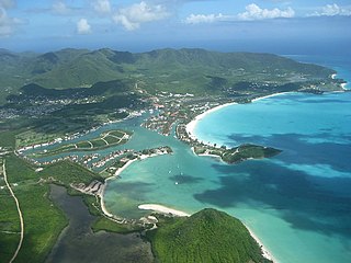
Barbuda is an island located in the eastern Caribbean forming part of the twin-island state of Antigua and Barbuda as an autonomous entity. Barbuda is located approximately 30 miles (48 km) north of Antigua. The sole settlements on the island are Codrington and its surrounding localities. Barbuda is a flat island with the western portion being dominated by Codrington Lagoon, and the eastern portion being dominated by the low-lying Barbuda Highlands, with salty ponds and scrubland spread throughout the island. The climate is classified as tropical marine.

<span class="mw-page-title-main">Saint Mary, Antigua and Barbuda</span> Parish in Antigua and Barbuda

Saint Mary, officially the Parish of Saint Mary, is a parish of Antigua and Barbuda on the island of Antigua. Saint Mary borders Saint John to the north, and Saint Paul to the east. Saint Mary is dominated by the Shekerley Mountains, and its northern border is largely defined by the mountains, and by Cooks Creek. The largest city in the parish is Bolans, home to the Jolly Harbour neighbourhood, and the parish church is located in Old Road. Saint Mary was created with the other five original parishes on 11 January 1692. It had a population of 7,341 in 2011, and 8,141 in 2018.

<span class="mw-page-title-main">Saint Paul, Antigua and Barbuda</span> Parish in Antigua and Barbuda

Saint Paul, officially the Parish of Saint Paul, is a parish of Antigua and Barbuda on the island of Antigua. Saint Paul borders Saint Peter and Saint John to the north, Saint Mary to the west, and Saint Philip to the east. Saint Paul is dominated by farmland in the north, with various creeks and Potworks Dam marking its northern border, and low-lying hills to the south, defining its western border with Saint Mary. The largest city fully within the parish is Liberta, the fourth largest city in the country. The parish capital, and the location of the parish church, is Falmouth. The main economic and tourism hub of the parish is English Harbour. Saint Paul was created with the other five original parishes on 11 January 1692. It had a population of 9,004 in 2018.

<span class="mw-page-title-main">Saint Peter, Antigua and Barbuda</span> Parish in Antigua and Barbuda

Saint Peter, officially the Parish of Saint Peter, is a parish of Antigua and Barbuda on the island of Antigua. Saint Peter borders Saint Paul to the south, Saint Philip to the east, and Saint George and Saint John to the west. Saint Peter is dominated by farmland, savanna, and undeveloped fields, and its borders are not well-defined. The largest city fully within the parish is Parham, which is also the capital. However, the portion of the city of All Saints in Saint Peter is significantly larger than Parham. Saint Peter was created with the other five original parishes on 11 January 1692. It had a population of 5,325 in 2011.

<span class="mw-page-title-main">Saint John, Antigua and Barbuda</span> Parish in Antigua, Antigua and Barbuda

Saint John, officially the Parish of Saint John, is a civil parish of Antigua and Barbuda, on the northwestern portion of Antigua island. Its capital is the city of St. John's. Saint John borders Saint Mary, Saint Peter, Saint George, and Saint Paul. Saint John faces the Caribbean Sea. Saint John is surrounded by some of Antigua's most premier beaches. Saint John had a population of 56,736 in a 2018 estimate, making it home to the majority of the population in Antigua and Barbuda.

<span class="mw-page-title-main">Hinduism in the West Indies</span> Overview of Hinduism in the West Indies territories

Hinduism is the leading single religion of the Indo-Caribbean communities of the West Indies. Hindus are particularly well represented in Guyana, Suriname and Trinidad and Tobago. The Cayman Islands also hosts a sizable Hindu population, with 2.4 percent of the country affiliating with the religion. Smaller groups of Indo-Caribbeans live elsewhere in the Caribbean, especially Puerto Rico, Jamaica, Belize, Barbados, Saint Vincent and the Grenadines, Saint Lucia, and Bahamas.

<span class="mw-page-title-main">All Saints, Antigua and Barbuda</span> Village in Antigua, Antigua and Barbuda

All Saints is the second largest town in Antigua and Barbuda, with a population of 3,412. It is located in the middle of Antigua, at 17°3′N61°47′W. Just 5 miles NW of here is the capital, St. John's. It had a population of 3,900 in 2001.

<span class="mw-page-title-main">Parham, Antigua and Barbuda</span> Town in Antigua, Antigua and Barbuda

Parham, officially known as Parham Town, is the capital of Saint Peter, the largest city in Saint Peter, and the fourteenth largest city in Antigua and Barbuda. Parham had a population of 1,307 in 2011, distributed over 1.99 square kilometres. Parham is similar in population to Potters Village, the thirteenth largest city in Antigua and Barbuda, and Bendals, the fifteenth largest city. Parham is situated on the shore of Parham Harbour, one of the most important harbors in the country enclosed by the Parham Peninsula and Long Island. Parham comprises four main neighbourhoods: Lovers Lane, Parham Market, Byam Wharf, and the School neighborhood. If the Saint Peter portion of All Saints, home to 1,954 people extending across three parishes, is considered a separate city, Parham would be considered the second largest city of Saint Peter. The major division of Parham, the town's metropolitan area, stretching over the eastern portion of the parish, had a 2011 population of 3,499 people.

<span class="mw-page-title-main">Swetes</span> Town in Antigua, Antigua and Barbuda

Swetes is located in Saint Paul Parish on the island of Antigua, in Antigua and Barbuda.

Piggotts, also known as St Mark's Village, is a small township in Saint George Parish on Antigua island in Antigua and Barbuda. It had a population of 1,478 in 2001.

Freemans is a town located in Saint Peter Parish on the island of Antigua, in Antigua and Barbuda.

<span class="mw-page-title-main">Belmont, Antigua and Barbuda</span> Town in Antigua, Antigua and Barbuda

Belmont is a town in Saint John Parish, Antigua and Barbuda.

Cedar Valley is a settlement in Saint John Parish, Antigua and Barbuda.

Montpelier is a small village in Saint Philip Parish, Antigua and Barbuda.

Diamonds, also known as The Diamond is a rural hamlet in Saint Peter, Antigua and Barbuda.

Ottos is a settlement in Saint John Parish, Antigua and Barbuda.

<span class="mw-page-title-main">Indian Antiguans and Barbudans</span>

Indian Antiguans and Indian Barbudans are Antiguans and Barbudans of entirely or predominantly Indian descent.

McKinnon's is a major city in the Major Division of North Coast, Saint John Parish, Antigua and Barbuda.

<span class="mw-page-title-main">St. Claire, Antigua and Barbuda</span> Town in Antigua, Antigua and Barbuda

St. Claire is a town in Saint John Parish, Antigua and Barbuda. It is located in the Major Division of Potters.

Mercers Creek Division is a division of Saint Peter, Antigua and Barbuda. It also coincides with the borders of enumeration district 51303, part of Vernons.

References

  1. "CHAPTER 466 THE VILLAGE COUNCILS ACT" (PDF). Government of Antigua and Barbuda.
  2. "The political Neanderthal". 12 March 2020.
  3. "Golden Grove Primary School, Valley Road, Saint John (2021)". www.schoolandcollegelistings.com. Retrieved 2021-12-21.
  4. "Golden Grove/Paul's – Antigua Sugar Mills" . Retrieved 2023-02-17.
  5. "ECLAC/CELADE Redatam+SP 02/18/2023" (PDF). 2023-02-18. Archived from the original (PDF) on 2023-02-18. Retrieved 2023-02-18.
  6. "ECLAC/CELADE Redatam+SP 02/18/2023" (PDF). 2023-02-18. Archived from the original (PDF) on 2023-02-18. Retrieved 2023-02-18.
  7. "ECLAC/CELADE Redatam+SP 02/18/2023" (PDF). 2023-02-18. Archived from the original (PDF) on 2023-02-18. Retrieved 2023-02-18.
  8. "ECLAC/CELADE Redatam+SP 02/18/2023" (PDF). 2023-02-18. Archived from the original (PDF) on 2023-02-18. Retrieved 2023-02-18.
  9. "ECLAC/CELADE Redatam+SP 02/18/2023" (PDF). 2023-02-18. Archived from the original (PDF) on 2023-02-18. Retrieved 2023-02-18.
  10. "ECLAC/CELADE Redatam+SP 02/18/2023" (PDF). 2023-02-18. Archived from the original (PDF) on 2023-02-18. Retrieved 2023-02-18.
  11. "ECLAC/CELADE Redatam+SP 02/18/2023" (PDF). 2023-02-18. Archived from the original (PDF) on 2023-02-18. Retrieved 2023-02-18.[ dead link ]
  12. "ECLAC/CELADE Redatam+SP 02/18/2023" (PDF). 2023-02-18. Archived from the original (PDF) on 2023-02-18. Retrieved 2023-02-18.
  13. "ECLAC/CELADE Redatam+SP 02/18/2023" (PDF). 2023-02-18. Archived from the original (PDF) on 2023-02-18. Retrieved 2023-02-18.