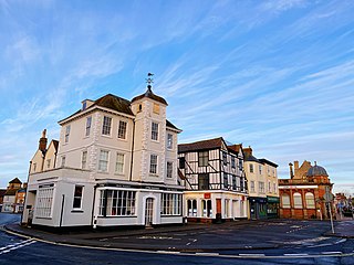
Bicester is a historical market town, garden town, and civil parish in the Cherwell district of northeastern Oxfordshire in south-central England that also comprises an eco town development at North West Bicester and a self-build village at Graven Hill. Its local market continues to thrive and is now located on Sheep Street, a very wide pedestrian zone in the conservation area of the town. Bicester is also known for Bicester Village, a nearby shopping centre.

Cherwell is a local government district in northern Oxfordshire, England. The district was created in 1974 and takes its name from the River Cherwell, which drains south through the region to flow into the River Thames at Oxford. Towns in Cherwell include Banbury and Bicester. Kidlington is a contender for largest village in England.

The River Cherwell is a tributary of the River Thames in central England. It rises near Hellidon, Northamptonshire and flows southwards for 40 miles (64 km) to meet the Thames at Oxford in Oxfordshire.
Kidlington is a large village and civil parish in Oxfordshire, England, between the River Cherwell and the Oxford Canal, 5 miles (8 km) north of Oxford and 7+1⁄2 miles (12.1 km) south-west of Bicester. It remains officially a village despite its size. The 2011 census put the parish population at 13,723.

Stagecoach in Oxfordshire is the trading name of Thames Transit Ltd. It is a bus operator serving the county of Oxfordshire, England. Since 1997 has been a subsidiary of Stagecoach Group, and since February 2021 it has been part of Stagecoach West, managed from the latter's headquarters in Gloucester.

Islip is a village and civil parish on the River Ray, just above its confluence with the River Cherwell in Oxfordshire, England. It is about 2 miles (3 km) east of Kidlington and about 5 miles (8 km) north of Oxford. The 2011 Census recorded the parish's population as 652.

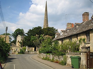
Lower Heyford is a village and civil parish beside the River Cherwell in Oxfordshire, about 6 miles (10 km) west of Bicester. The 2011 Census recorded the parish's population as 492.

Arncott or Arncot is a village and civil parish about 3+1⁄2 miles (5.6 km) southeast of Bicester in Oxfordshire. The 2011 Census recorded the parish's population as 1,738.

Bladon is a village and civil parish on the River Glyme about 6+1⁄2 miles (10.5 km) northwest of Oxford, Oxfordshire, England. It is where Sir Winston Churchill is buried. The 2011 Census recorded the parish's population as 898.

Bodicote is a village and civil parish in North Oxfordshire, approximately 2 miles (3 km) south of the centre of Banbury. The 2011 Census recorded the parish's population as 2,126. The Church of England parish church of Saint John the Baptist is a Grade II* listed building, with the chancel arch dating back to the 13th century.

Summertown in North Oxford is a suburb of Oxford, England. Summertown is a one-mile square residential area, north of St Giles, the boulevard leading out of Oxford's city centre. Summertown is home to several independent schools and the city's most expensive houses. On both sides of Banbury Road are Summertown's popular shops. There is also a smaller street of shops and restaurants, South Parade, that links Banbury Road and Woodstock Road. Summertown is home to much of Oxford's broadcast media. BBC Radio Oxford and the BBC Television's Oxford studios are on Banbury Road. Start-ups also have an increasing presence on the parade, such as Brainomix and Passle. The studios for JACK FM, Glide FM, and Six TV Oxford are on Woodstock Road.
Water Eaton is a hamlet in the civil parish of Gosford and Water Eaton, in the Cherwell district, in the county of Oxfordshire, England. It is between Oxford and Kidlington.
Gosford and Water Eaton is a civil parish in the Cherwell district of the county of Oxfordshire, England. It is north of the city of Oxford and is crossed nearby by two major roads for, or by-passing, the city. The parish contains the village of Gosford and the hamlet of Water Eaton and as at the 2011 census had 1373 people resident across its 8.75 km².

Shipton-on-Cherwell is a village on the River Cherwell about 2 miles (3 km) north of Kidlington in Oxfordshire, England. The village is part of the civil parish of Shipton-on-Cherwell and Thrupp.

North Leigh is a village and civil parish about 3 miles (5 km) northeast of Witney in Oxfordshire. The parish includes the hamlet of East End and since 1932 has also included the hamlet of Wilcote. The 2011 Census recorded the parish's population as 1,929.

Rousham is a village and civil parish beside the River Cherwell in Oxfordshire. The village is about 6+1⁄2 miles (10.5 km) west of Bicester and about 6 miles (10 km) north of Kidlington. The parish is bounded by the River Cherwell in the east, the A4260 main road between Oxford and Banbury in the west, partly by the B4030 in the north, and by field boundaries with Tackley parish in the south. The 2001 Census recorded the parish's population as 80. Rousham was founded early in the Anglo-Saxon era. Its toponym is derived from Old English meaning Hrothwulf's ham or farm.
Thrupp is a hamlet just north of Kidlington in Oxfordshire. It is beside the Oxford Canal and close to the River Cherwell.
Enslow is a hamlet on the banks of both the River Cherwell and the Oxford Canal in Bletchingdon civil parish, Oxfordshire. The medieval main road linking London with Chipping Norton and Worcester crosses the Cherwell at Enslow. There was a bridge here by the time that John Leland toured England in 1538–43. John Ogilby's Britannia Atlas of 1675 records a timber bridge here that he called "Emley Bridg". In 1718 the road was made into a turnpike and at some stage the timber bridge was replaced by one with pointed stone arches. In 1814 the stone bridge was widened on its downstream side. to almost double its former width. In contrast with the older upstream side of the bridge, the 1814 arches are semicircular. The road is now the A4095.
Shipton-on-Cherwell and Thrupp is a civil parish in Oxfordshire, England. It was formed in 1955 by removing the hamlet of Thrupp from the parish of Kidlington and merging it with the parish of Shipton-on-Cherwell. It covers 6.04 km² and as at the 2011 census had 493 residents.
The 2007 Cherwell District Council election took place on 3 May 2007 to elect members of Cherwell District Council in Oxfordshire, England. One third of the council was up for election and the Conservative Party stayed in overall control of the council.


