North Aston

Last updated

North Aston
NorthAston StMary SE01.JPG
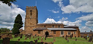
St Mary the Virgin parish church
Oxfordshire UK location map.svg
Red pog.svg
North Aston
Location within Oxfordshire
Area8.83 km2 (3.41 sq mi)
OS grid reference SP4728
Civil parish
  • North Aston
District
Shire county
Region
Country England
Sovereign state United Kingdom
Post town Bicester
Postcode district OX25
Dialling code 01869
Police Thames Valley
Fire Oxfordshire
Ambulance South Central
UK Parliament
List of places
UK
England
Oxfordshire
51°57′22″N1°18′32″W / 51.956°N 1.309°W / 51.956; -1.309

North Aston is a village and civil parish about 7+12 miles (12 km) south of Banbury and 10 miles (16 km) north of Oxford. The 2001 Census recorded its population as 212. [1] The 2011 Census did not publish its population separately, but gave a combined total of 316 for the parishes of North Aston and Middle Aston. [2] The village is on a ridge about 460 feet (140 m) above sea level. The parish measures almost 2 miles (3 km) wide east – west and about 1+12 miles (2.4 km) north – south. It is bounded to the east by the River Cherwell, and to the north by a stream that flows east to join the Cherwell. The A4260 road linking Oxford and Banbury forms part of its western boundary. Field boundaries form the southern boundary and the remainder of the western boundary. In 1983 the parish covered an area of 1,288 acres (521 ha). [3]

Contents

Manor

Overlords

The Domesday Book records that in 1086 Edward of Salisbury, High Sheriff of Wiltshire, held the over-lordship of the manor of North Aston, and that through him it became attached to the manor of Amesbury. [3] From Edward, North Aston descended through his son Patrick to his grandson Patrick of Salisbury, 1st Earl of Salisbury (died 1168). [3] The overlordship descended with the Earls of Salisbury to Margaret Longespée, 4th Countess of Salisbury and thence to her daughter and heiress Alice de Lacy, 3rd Countess of Lincoln (died 1348) who was also 5th Countess of Salisbury. [3] Alice was married to Thomas, 2nd Earl of Lancaster but in 1322 he was deposed by a party of barons and executed.

One of the barons, Hugh Despenser the Younger, obtained North Aston, which was now a manor of two and a half knight's fees. [3] However, in 1326 Despenser was executed for treason. It is not clear whether the Crown re granted the manor of North Aston immediately after Despenser's death, but by 1389 William de Montacute, 2nd Earl of Salisbury held it with the manor of Amesbury. [3] By the late 14th century the Earls of March held an estate of one knight's fee at North Aston as part of the barony of Clifford Castle. [3] This is likely to be because Margaret Longespée inherited the barony of Clifford from her grandfather Walter de Clifford (died 1263). [3]

Lords of the Manor

St Mary the Virgin parish church: 15th-century alabaster monument to a knight and his lady; reputedly John and Alicia Anne St Mary, North Aston, Oxon - Tomb chest - geograph.org.uk - 1614981.jpg
St Mary the Virgin parish church: 15th-century alabaster monument to a knight and his lady; reputedly John and Alicia Anne

In 1086 Edward of Salisbury's tenant at North Aston was Anchetil de Greye. [3] The tenancy had passed to the Trivet family by 1279 and to the Anne family by the middle of the 15th century. [3] In 1554, on the death of a John Anne, North Aston passed to Sir Robert Broke, Lord Chief Justice of the Common Pleas; possibly through the marriage of John Anne's granddaughter to Robert Broke's son. [3] The manor descended via Broke's son John and grandson Sir Basil (died 1646) to Thomas Brooke. Sir Basil Brooke and his son were recusants and Thomas was a Royalist, so in 1653 the Commonwealth authorities sequestrated his estates. [3] The Parliamentarian Major John Wildman, who speculated in confiscated lands, bought North Aston [3] but in 1655 he was jailed. Thomas Brooke seems to have recovered the manor thereafter, as his sister Frances was married there in 1656. [3] Thomas's grandson Basil inherited North Aston in 1687, and it remained in the Brooke family until Basil's widow Winifred died in 1716 leaving North Aston to another recusant: Henrietta Fermor, sister of James Fermor of Tusmore. [3]

Soon afterwards Henrietta seems to have sold the estate to Anthony Rowe, Clerk of the Green Cloth. [3] Rowe's son-in-law Trevor Hill, 1st Viscount Hillsborough inherited North Aston from him but sold it in 1733. [3] The buyer was Charles Oldfield, a Jamaica merchant who on his death in about 1740 gave the estate to his friend Charles Bowles. [3] Three generations of the Bowles family held the estate, the last being Charles Oldfield Bowles who in 1862 sold it to William Foster-Melliar. [3] When Foster-Melliar died in 1906 a Captain John Taylor of Southgate, Middlesex bought North Aston, which included a 990 acres (400 ha) estate. [3] In 1911 Capt. Taylor moved to North Aston Manor and sold North Aston Hall, 200 acres (81 ha) and part of the village to Thomas Pakenham, 5th Earl of Longford. [3] Lionel Hichens, chairman of Cammell Laird, bought North Aston Hall in 1929 and his family still owned it in 1980. [3]

Manor House

The present North Aston Manor House is an H-shaped 16,970 square feet (1,577 m2) building of which the central part was probably the hall of a 15th-century house [4] or earlier. After the Dissolution of the Monasteries in 1539 the neighbouring and ultimately much larger North Aston Hall became the primary home of the lords of the manor of North Aston, while the manor house became one of the main farm houses of the estate. Occupied by various tenants, the property was called Great House Farm during the 18th and 19th centuries, later Manor House Farm. In the 1930s Captain John Vickris Taylor had a new house built on land that had once formed part of the tract associated with Great House Farm, and called this Manor Farm. In 1976 the Captain's son, Colonel Anthony Taylor, sold the Manor itself to Charles Mackenzie Hill, who subsequently[ when? ] also bought North Aston Hall. [5]

North Aston Hall

North Aston Hall is a large Jacobethan country house built in the 17th century [6] The ten-bay front was added in the 18th century and the present windows and parapet were added in about 1850. [4]

Parish church

St Mary the Virgin parish church: 19th-century stained glass in the east window of the chancel St Mary, North Aston, Oxon - Window - geograph.org.uk - 1614985.jpg
St Mary the Virgin parish church: 19th-century stained glass in the east window of the chancel

The Church of England parish church of Saint Mary the Virgin existed by 1151, when William of Aston gave it to the Augustinian Bradenstoke Priory in Wiltshire. [3] The present building is mostly Decorated Gothic, with early 14th-century windows and north and south arcades. [6] However, the south aisle ends in a chapel that has a 15th-century Perpendicular Gothic east window [6] and the nave has a 15th or 16th-century clerestory. [7] The baptismal font is in an unusual style and it is not known in what era it was carved. Sherwood and Pevsner suggested it might be 14th century; [6] English Heritage says it is probably 17th century but might be earlier. [7]

One of its panels has been carved into a shield but the others are blank and the carving seems incomplete. In 1867 the building was restored and enlarged to designs by George Gilbert Scott, who had the north aisle extended to be as long as the south aisle. [6] The church is a Grade II* listed building. [7] The tower has a ring of six bells. [8] Henry III Bagley, who had bell-foundries at Chacombe and Witney, [9] cast the tenor bell in 1741. [10] John Warner and Sons of London [9] cast the fourth and fifth bells in 1866. [10] John Taylor & Co of Loughborough [9] cast the treble, second and third bells in 1979. [10] Since 1976 St Mary's has been part of a united Church of England Benefice with the neighbouring parishes of Steeple Aston and Tackley.

Economic and social history

Traditional cottages in Somerton Road Somerton Road, North Aston 01.jpg
Traditional cottages in Somerton Road
Oxford Canal bridge on the parish boundary between North Aston and Somerton Bridge 196, Oxford Canal - geograph.org.uk - 799793.jpg
Oxford Canal bridge on the parish boundary between North Aston and Somerton

The Domesday Book records a watermill in the parish, probably on the River Cherwell. [3] The Gambon family were the millers for most of the 13th century, and it continued to be called Gambon's Mill until the 18th century. [3] From the latter part of the 16th century until early in the 18th century it seems to have been a double mill with two millraces and two separate tenants. [3] The last known record of a double mill is from 1733. [3] The Rose family were millers here continuously from 1673 until its commercial closure in 1938, although grain continued to be milled for local use throughout the period of the Second World War, and for a brief time afterwards. The Mill was sold off by the Estate in 1950 and by 1955 had been converted into a private home. [11] Its machinery has been restored and in 1980 remained in situ. [3]

The stretch of the Oxford Canal between Banbury and Tackley was completed in 1787. [12] It runs along the Cherwell valley and for a short distance it forms the eastern boundary of North Aston parish. A village school was built in 1844 and was supervised by the Church of England Diocese of Oxford. [3] In 1872 it moved to new premises when William Foster-Melliar converted the original coach house to the North Aston Hall into a schoolroom with two teachers' cottages attached. In 1923 it was reorganised as a junior school and senior pupils were transferred to the school at Steeple Aston. After the second World War the number of pupils steadily declined, and in 1955 North Aston school was closed. For some twenty years the old schoolroom was a village hall for the community, but in 1976 the building was converted into a private house. [13]

Current economy and amenities

North Aston has a substantial garden centre, Nicholsons Nurseries. [14]

Climate

Climate in this area has mild differences between highs and lows, and there is adequate rainfall year-round. The Köppen Climate Classification subtype for this climate is "Cfb" (Marine West Coast Climate/Oceanic climate). [15]

Related Research Articles

<span class="mw-page-title-main">Stanford in the Vale</span> Human settlement in England

Stanford in the Vale is a village and civil parish in the Vale of White Horse about 3+12 miles (5.6 km) southeast of Faringdon and 5 miles (8 km) northwest of Wantage. It is part of the historic county of Berkshire, however since 1974, it has been administered as a part of Oxfordshire. The 2011 Census recorded the parish's population 2,093.

<span class="mw-page-title-main">Upper Heyford, Oxfordshire</span> Human settlement in England

Upper Heyford is a village and civil parish about 6 miles (10 km) northwest of Bicester in Oxfordshire, England. The 2011 Census recorded the parish's population as 1,295.

<span class="mw-page-title-main">Adderbury</span> Human settlement in England

Adderbury is a winding linear village and rural civil parish about 3 miles (5 km) south of Banbury in northern Oxfordshire, England. The settlement has five sections: the new Milton Road housing Development & West Adderbury towards the southwest; East Adderbury to the centre, both with a village green and a manor house; and the new housing Development on the Aynho Road; and the northeast, which is known as Twyford, named after a small outlying settlement by a forked section of the River Cherwell.

<span class="mw-page-title-main">Charwelton</span> Human settlement in England

Charwelton is a village and civil parish about 5 miles (8 km) south of Daventry in Northamptonshire, England. The 2011 Census recorded the parish's population as 220.
<span class="mw-page-title-main">Cropredy</span> Human settlement in England

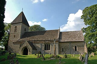
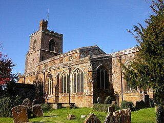
Cropredy is a village and civil parish on the River Cherwell, 4 miles (6.4 km) north of Banbury in Oxfordshire.

<span class="mw-page-title-main">Steeple Aston</span> Human settlement in England

Steeple Aston is a village and civil parish on the edge of the Cherwell Valley, in the Cherwell District of Oxfordshire, England, about 12 miles (19 km) north of Oxford, 7 miles (11 km) west of Bicester, and 10 miles (16 km) south of Banbury. The 2011 Census recorded the parish population as 947. The village is 108 metres (354 ft) above sea level. The River Cherwell and Oxford Canal pass 1 mile (2 km) east of the village. The river forms part of the eastern boundary of the parish. The parish's southern boundary, 12 mile (800 m) south of the village, also forms part of Cherwell District's boundary with West Oxfordshire.
<span class="mw-page-title-main">Swalcliffe</span> Human settlement in England

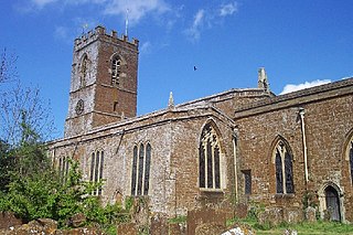
Swalcliffe is a village and civil parish about 5 miles (8 km) west of Banbury in Oxfordshire. The parish is about 2+12 miles (4 km) long north–south and about 1 mile (1.6 km) east–west. The 2011 Census recorded the population of the modern Swalcliffe parish as 210. The toponym "Swalcliffe" comes from the Old English swealwe and clif, meaning a slope or cliff frequented by swallows. The ancient parish of Swalcliffe was larger than the present civil parish, and included the townships of Epwell, Shutford, Sibford Ferris and Sibford Gower.

<span class="mw-page-title-main">Tackley</span> Human settlement in England

Tackley is a village and civil parish beside the River Cherwell in Oxfordshire, England. It is about 6 miles (10 km) west of Bicester and 4+12 miles (7 km) north of Kidlington. The village consists of two neighbourhoods: Tackley itself, and Nethercott. The 2011 Census recorded the parish's population as 998.

<span class="mw-page-title-main">Lower Heyford</span> Human settlement in England

Lower Heyford is a village and civil parish beside the River Cherwell in Oxfordshire, about 6 miles (10 km) west of Bicester. The 2011 Census recorded the parish's population as 492.

<span class="mw-page-title-main">Aston Rowant</span> Human settlement in England

Aston Rowant is a village, civil parish and former manor about 4+12 miles (7 km) south of Thame in South Oxfordshire, England. The parish includes the villages of Aston Rowant and Kingston Blount, and adjoins Buckinghamshire to the southeast. The 2011 Census recorded the parish's population as 793. The Lower Icknield Way passes through the parish southeast of the village.

<span class="mw-page-title-main">Bodicote</span> Human settlement in England

Bodicote is a village and civil parish in North Oxfordshire, approximately 2 miles (3 km) south of the centre of Banbury. The 2011 Census recorded the parish's population as 2,126. The Church of England parish church of Saint John the Baptist is a Grade II* listed building, with the chancel arch dating back to the 13th century.
<span class="mw-page-title-main">Mollington, Oxfordshire</span> Human settlement in England

Mollington is a village and civil parish about 4 miles (6.4 km) north of Banbury in Oxfordshire, England. The 2011 Census recorded the parish's population as 479.

<span class="mw-page-title-main">Wardington</span> Human settlement in England

Wardington is a village and civil parish in Oxfordshire, about 4 miles (6.4 km) northeast of Banbury. The village consists of two parts: Wardington and Upper Wardington. The village is on a stream that rises in Upper Wardington and flows north to join the River Cherwell.

<span class="mw-page-title-main">Shipton-on-Cherwell</span> Human settlement in England

Shipton-on-Cherwell is a village on the River Cherwell about 2 miles (3 km) north of Kidlington in Oxfordshire, England. The village is part of the civil parish of Shipton-on-Cherwell and Thrupp.
<span class="mw-page-title-main">Duns Tew</span> Human settlement in England

Duns Tew is an English village and civil parish about 7+12 miles (12 km) south of Banbury in Oxfordshire. The 2011 Census recorded the parish's population as 478. With nearby Great Tew and Little Tew, Duns Tew is one of the three villages known collectively as "The Tews". A 'tew' is believed to be an ancient term for a ridge of land.

<span class="mw-page-title-main">Shenington</span> Human settlement in England

Shenington is a village about 5 miles (8 km) west of Banbury in the United Kingdom. It was an exclave of Gloucestershire until the Counties Act 1844 transferred it to Oxfordshire. Shenington is on Oxfordshire's boundary with Warwickshire. Shenington was an ancient parish of 1,628 acres (659 ha). It is now part of the civil parish of Shenington with Alkerton.

<span class="mw-page-title-main">Rousham</span> Human settlement in England

Rousham is a village and civil parish beside the River Cherwell in Oxfordshire. The village is about 6+12 miles (10.5 km) west of Bicester and about 6 miles (10 km) north of Kidlington. The parish is bounded by the River Cherwell in the east, the A4260 main road between Oxford and Banbury in the west, partly by the B4030 in the north, and by field boundaries with Tackley parish in the south. The 2001 Census recorded the parish's population as 80. Rousham was founded early in the Anglo-Saxon era. Its toponym is derived from Old English meaning Hrothwulf's ham or farm.

<span class="mw-page-title-main">Somerton, Oxfordshire</span> Human settlement in England

Somerton is a village and civil parish in Oxfordshire, England, in the Cherwell valley about 6 miles (10 km) northwest of Bicester. The 2011 Census recorded the parish's population as 305.

<span class="mw-page-title-main">Hanwell, Oxfordshire</span> Human settlement in England

Hanwell is a village and civil parish in Oxfordshire, about 2 miles (3 km) northwest of Banbury. Its area is 1,240 acres (500 ha) and its highest point is about 500 feet (150 m) above sea level. The 2011 Census recorded the parish's population as 263.

<span class="mw-page-title-main">Fritwell</span> Human settlement in England

Fritwell is a village and civil parish about 5+12 miles (9 km) northwest of Bicester in Oxfordshire. The 2011 Census recorded the parish's population as 736.

References

Baptismal font in St Mary the Virgin parish church St Mary, North Aston, Oxon - Font - geograph.org.uk - 1614977.jpg
Baptismal font in St Mary the Virgin parish church
  1. "Area: North Aston CP (Parish): Parish Headcounts". Neighbourhood Statistics. Office for National Statistics. Archived from the original on 22 June 2011. Retrieved 8 March 2010.
  2. UK Census (2011). "Local Area Report – North Aston Parish (1170217734)". Nomis. Office for National Statistics . Retrieved 14 August 2018.
  3. 1 2 3 4 5 6 7 8 9 10 11 12 13 14 15 16 17 18 19 20 21 22 23 24 25 26 27 28 29 Crossley 1983 , pp. 6–21
  4. 1 2 Sherwood & Pevsner 1974, p. 719.
  5. Potts & Harvey-Lee 2007 [ page needed ]
  6. 1 2 3 4 5 Sherwood & Pevsner 1974, p. 718.
  7. 1 2 3 Historic England. "Church of St Mary (Grade II*) (1200620)". National Heritage List for England . Retrieved 22 August 2012.
  8. "Oxford Diocesan Guild of Church Bell Ringers, Banbury Branch: Tower Guide: North Aston". Archived from the original on 19 July 2011. Retrieved 8 March 2010.
  9. 1 2 3 Dovemaster (25 June 2010). "Bell Founders". Dove's Guide for Church Bell Ringers . Central Council of Church Bell Ringers . Retrieved 8 March 2011.
  10. 1 2 3 Davies, Peter (30 March 2007). "North Aston S Mary V". Dove's Guide for Church Bell Ringers . Central Council of Church Bell Ringers . Retrieved 8 March 2011.
  11. Potts & Harvey-Lee 2007 [ page needed ]
  12. Compton 1976, p. 37.
  13. Potts & Harvey-Lee 2007 [ page needed ]
  14. Nicholsons Nurseries
  15. "Ardley, England". weatherbase. Retrieved 20 June 2013.

Sources

Commons-logo.svg Media related to North Aston at Wikimedia Commons