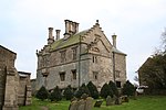
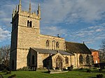
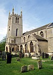
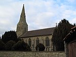
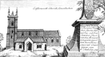
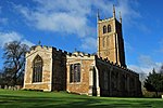
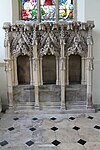
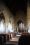
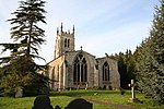
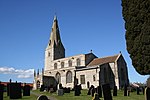
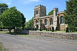
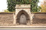
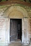
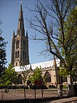
There are over 9,000 Grade I listed buildings in England. This page is a list of these buildings in the district of South Kesteven in Lincolnshire.

Caistor is a town and civil parish in the West Lindsey district of Lincolnshire, England. As its name implies, it was originally a Roman castrum or fortress. It lies at the north-west edge of the Lincolnshire Wolds, on the Viking Way, and just off the A46 between Lincoln and Grimsby, at the A46, A1084, A1173 and B1225 junction. It has a population of 2,601. Its name comes from the Anglo-Saxon ceaster and was given in the Domesday Book as Castre.

Burwell is a small village and Civil parish in the East Lindsey district of Lincolnshire, England. It is situated on the A16 road, and north from Spilsby. The village covers approximately 2,200 acres (8.9 km2).

Digby is a small village and civil parish in the district of North Kesteven, Lincolnshire, England. The village is in the vale of the Digby Beck watercourse, 6 miles (10 km) north from the town of Sleaford and 12 miles (19 km) south from Lincoln city centre. The village has a population of about 574, increasing to 621 at the 2011 census, and a parish council.

Swineshead is a village and civil parish in the Borough of Boston in Lincolnshire, England. It is 7 miles (11 km) west of the town of Boston. The population of the civil parish including Baythorpe was 2,810 at the 2011 census. The parish includes the areas of Swineshead Bridge and North End to the north, Fenhouses and Blackjack to the east, and Drayton to the south.

Harty is a small hamlet on the Isle of Sheppey in Kent consisting of a few cottages, a church and a public house, the Ferry Inn. It is part of the civil parish of Leysdown.
Tunstall is a village in the civil parish of Roos, in Holderness, in the East Riding of Yorkshire, England, close to the North Sea coast. It is situated approximately 3 miles (4.8 km) north-west of the town of Withernsea, and less than 0.6 miles (1 km) from the North Sea coast, at a height of 10 to 15 m above sea level, and close to the Prime Meridian at its northernmost point on land anywhere in the world.

Knaith is a village and civil parish about 3 miles (5 km) south of the town of Gainsborough in the West Lindsey district of Lincolnshire, England. The population of the civil parish at the 2011 census was 335.

Lutton is a village and civil parish in the South Holland district of Lincolnshire, England. The population of the civil parish at the 2011 census was 1,261. It is situated about 4 miles (6 km) north-east from the town of Holbeach. The village has been known by the alternative name of Sutton St Nicholas. The civil parish comprises the village of Lutton, with Lutton Marsh to the north-east and Lutton Garnsgate to the south-west.

Northorpe is a village and civil parish in the West Lindsey district of Lincolnshire, England, about 8 miles (13 km) north-east from the town of Gainsborough. The population of the civil parish at the 2011 census was 126.
Tydd St Mary is a village and civil parish in the South Holland district of Lincolnshire, England, about 9 miles (14 km) east of the town of Spalding and about 5 miles (8.0 km) north of Wisbech, Cambridgeshire. The Civil Parish includes the village of Tydd Gote which lies partly in Tydd St Mary and partly in Tydd St Giles, Cambridgeshire.

There are 27 scheduled monuments in Maidstone, Kent, England. In the United Kingdom, a scheduled monument is an archaeological site or historic building of "national importance" that has been given protection against unauthorised change by being placed on a list by the Secretary of State for Digital, Culture, Media and Sport; Historic England takes the leading role in identifying such sites. Scheduled monuments are defined in the Ancient Monuments and Archaeological Areas Act 1979 and the National Heritage Act 1983. They are also referred to as scheduled ancient monuments. There are about 20,000 scheduled monument entries on the list and more than one site can be included in a single entry. While a scheduled monument can also be recognised as a listed building, Historic England considers listed building status as a better way of protecting buildings than scheduled monument status. If a monument is considered by Historic England to "no longer merit scheduling" it can be removed from the schedule.

Knowlton Circles are a complex of henges and earthworks in Knowlton, Dorset, England. The henge enclosing Knowlton Church is the best known and best preserved, but there are at least two other henges in the vicinity as well as numerous round barrows.

Milecastle 70 (Braelees) was one of a series of Milecastles or small fortlets built at intervals of approximately one Roman mile along Hadrian's Wall (grid reference NY35155898).

Bath and North East Somerset is a unitary authority created on 1 April 1996, following the abolition of the County of Avon, which had existed since 1974. Part of the ceremonial county of Somerset, Bath and North East Somerset occupies an area of 220 square miles (570 km2), two-thirds of which is green belt. It stretches from the outskirts of Bristol, south into the Mendip Hills and east to the southern Cotswold Hills and Wiltshire border. The city of Bath is the principal settlement in the district, but BANES also covers Keynsham, Midsomer Norton, Radstock and the Chew Valley. The area has a population of 170,000, about half of whom live in Bath, making it 12 times more densely populated than the rest of the area.

Taunton Deane was a local government district with borough status in Somerset, England. It merged with West Somerset to form Somerset West and Taunton on 1 April 2019. Its council was based in Taunton. The district was formed on 1 April 1974, under the Local Government Act 1972, by a merger of the Municipal Borough of Taunton, Wellington Urban District, Taunton Rural District, and Wellington Rural District. Taunton Deane was granted borough status in 1975, enabling the mayoralty of Taunton to be continued, when other districts did not have mayors. The district was given the name of an alternate form of the Taunton Deane Hundred.

Dormington is a village and civil parish in Herefordshire, in the West Midlands of England. Dormington village is at the north of its parish, 5 miles (8 km) east from the centre of the city and county town of Hereford, and 8 miles (13 km) west-northwest from the town of Ledbury. The parish is a significant traditional centre for hop growing.