Green County, Kentucky

Last updated

Green County
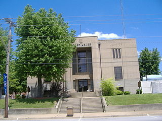
Fourth Green County Courthouse in Greensburg.jpg
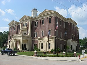
Green County Justice Center in Greensburg, Kentucky.
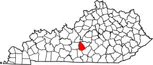
Map of Kentucky highlighting Green County.svg
Location within the U.S. state of Kentucky
Kentucky in United States.svg
Kentucky's location within the U.S.
Coordinates: 37°16′N85°33′W / 37.26°N 85.55°W / 37.26; -85.55
CountryFlag of the United States.svg United States
StateFlag of Kentucky.svg  Kentucky
FoundedDecember 20, 1792
Named for Nathanael Greene
Seat Greensburg
Largest cityGreensburg
Area
  Total289 sq mi (750 km2)
  Land286 sq mi (740 km2)
  Water2.8 sq mi (7 km2)  1.0%
Population
 (2020)
  Total11,107
  Estimate 
(2023)
11,468 Increase2.svg
  Density38/sq mi (15/km2)
Time zone UTC−6 (Central)
  Summer (DST) UTC−5 (CDT)
Congressional district 2nd
Website www.greencounty.ky.gov

Green County is a county located in the U.S. state of Kentucky. Its county seat and only municipality is Greensburg. [1] Green was a prohibition or dry county until 2015.

Contents

History

Green County was formed in 1792 from portions of Lincoln and Nelson Counties. [2] Green was the 16th Kentucky county in order of formation. [3] The county is named for Revolutionary War hero General Nathanael Greene, but the reason why the final E is missing is unknown. [4] [5]

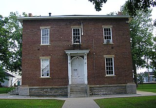
Three courthouses have served Green County. In 1804, a brick building replaced an earlier log structure, and while no longer operational, it stands in the Downtown Greensburg Historic District as the oldest courthouse building in the commonwealth. The present courthouse dates from 1931. [6]

The Cumberland Trace runs through Green County. This early road started in Lincoln County, Kentucky, and went to Nashville. (1)

Three counties (Cumberland, Adair, Taylor) were formed entirely from Green County, along with a portion of four more (Pulaski, Barren, Hart, and Metcalfe). (1)

Green River flows east to west through Green County. The Paddle Trail provides canoe rentals. In the early history of the county, flatboats would take tobacco from Green County, to New Orleans. There, farmers would sell their tobacco, sell their boat (for wood), and walk back to Green County. (1)

Green County was without a sheriff from 1879 until 1918, due to a dispute over railroad taxes. Individuals were elected sheriff, but were unable to post enough bond to cover not collecting railroad property taxes, and the office was declared vacant. From 1896 until 1915, a total of 34 murders were committed in the county. (1)

An oil boom from 1958 until the early 1960s gave the county an economic lift. Temporary air strips were built in the communities of Summersville, and Pierce. (1)

An adobe brick house was uncovered in Greensburg during 2007. The structure is thought to be the only "mud brick house" in Kentucky. (1)

The Goose Creek Footbridge connects the town square to what was once the train depot. Built in the late 1920s, the structure is 445 feet long, 40 feet high at its highest point, and has a plank walkway which is five feet wide. (1)

The community of Summersville is home to weekend music at Green River Live, and to the Skyline Drive-In Theater. (1)

A public hanging in Greensburg on September 21, 1841, attracted a crowd recorded at 10,000 people. Two other men who were convicted of the same crime - robbery and murder - died in their jail cell. (1)

The country's first known serial killers, Big Harpe and Little Harpe, murdered a twelve-year-old Green County boy in 1799. (1)

(1) "History of Green County, Kentucky," by Lanny Tucker.

The Cow Days Festival is held in Greensburg the 3rd weekend of September. The event originated during the late 1930s, when Greensburg merchants would give away a cow to entice people to come to town.

Geography

According to the U.S. Census Bureau, the county has a total area of 289 square miles (750 km2), of which 286 square miles (740 km2) is land and 2.8 square miles (7.3 km2) (1.0%) is water. [7]

Green County is in the central time zone.

Adjacent counties

Demographics

Historical population
CensusPop.Note
1800 6,096
1810 6,73510.5%
1820 11,94377.3%
1830 13,13810.0%
1840 14,2128.2%
1850 9,060−36.3%
1860 8,806−2.8%
1870 9,3796.5%
1880 11,87126.6%
1890 11,463−3.4%
1900 12,2556.9%
1910 11,871−3.1%
1920 11,391−4.0%
1930 11,4010.1%
1940 12,3218.1%
1950 11,261−8.6%
1960 11,249−0.1%
1970 10,350−8.0%
1980 11,0436.7%
1990 10,371−6.1%
2000 11,51811.1%
2010 11,258−2.3%
2020 11,107−1.3%
2023 (est.)11,468 [8] 3.3%
U.S. Decennial Census [9]
1790-1960 [10] 1900-1990 [11]
1990-2000 [12] 2010-2021 [13]

As of the census [14] of 2000, there were 11,518 people, 4,706 households, and 3,378 families residing in the county. The population density was 40 per square mile (15/km2). There were 5,420 housing units at an average density of 19 per square mile (7.3/km2). The racial makeup of the county was 96.19% White, 2.61% Black or African American, 0.10% Native American, 0.13% Asian, 0.31% from other races, and 0.65% from two or more races. 0.95% of the population were Hispanic or Latino of any race.

There were 4,706 households, out of which 29.90% had children under the age of 18 living with them, 59.70% were married couples living together, 8.50% had a female householder with no husband present, and 28.20% were non-families. 25.40% of all households were made up of individuals, and 13.20% had someone living alone who was 65 years of age or older. The average household size was 2.41 and the average family size was 2.87.

In the county, the population was spread out, with 22.70% under the age of 18, 8.10% from 18 to 24, 26.80% from 25 to 44, 25.40% from 45 to 64, and 16.90% who were 65 years of age or older. The median age was 40 years. For every 100 females there were 96.90 males. For every 100 females age 18 and over, there were 91.90 males.

The median income for a household in the county was $25,463, and the median income for a family was $31,852. Males had a median income of $25,764 versus $17,510 for females. The per capita income for the county was $16,107. About 15.20% of families and 18.40% of the population were below the poverty line, including 23.10% of those under age 18 and 18.50% of those age 65 or over.
Communities

City

Census-designated place

Other unincorporated places

Notable people

Politics

United States presidential election results for Green County, Kentucky [15]
Year Republican Democratic Third party
No.%No.%No.%
2020 4,83883.24%92015.83%540.93%
2016 4,37281.98%83215.60%1292.42%
2012 3,63474.84%1,16523.99%571.17%
2008 3,78574.52%1,20423.71%901.77%
2004 3,86674.26%1,31225.20%280.54%
2000 3,61576.01%1,08522.81%561.18%
1996 2,76360.86%1,28528.30%49210.84%
1992 2,70954.33%1,76035.30%51710.37%
1988 3,13966.07%1,59533.57%170.36%
1984 3,21066.35%1,61133.30%170.35%
1980 2,77560.50%1,75838.33%541.18%
1976 2,39753.04%2,08546.14%370.82%
1972 2,75568.82%1,20930.20%390.97%
1968 2,44858.71%1,00324.05%71917.24%
1964 2,11049.23%2,16050.40%160.37%
1960 3,60669.53%1,58030.47%00.00%
1956 2,95162.93%1,72636.81%120.26%
1952 2,77359.75%1,85740.01%110.24%
1948 2,18655.97%1,62841.68%922.36%
1944 2,37956.39%1,80942.88%310.73%
1940 2,49755.39%1,99344.21%180.40%
1936 2,33654.17%1,97045.69%60.14%
1932 2,28149.77%2,27749.68%250.55%
1928 2,82468.84%1,27231.01%60.15%
1924 1,92055.16%1,54844.47%130.37%
1920 2,31057.04%1,72342.54%170.42%
1916 1,41252.88%1,23946.40%190.71%
1912 68727.67%1,11744.99%67927.35%

See also

Related Research Articles

<span class="mw-page-title-main">Shelby County, Iowa</span> County in Iowa, United States

Shelby County is a county located in the U.S. state of Iowa. As of the 2020 census, the population was 11,746. The county seat is Harlan. Its name is in honor of Isaac Shelby, the first Governor of Kentucky.

<span class="mw-page-title-main">Nicholas County, West Virginia</span> County in West Virginia, United States

Nicholas County is a county located in the central region of U.S. state of West Virginia. As of the 2020 census, the population was 24,604. Its county seat is Summersville. The county was created in 1818 by the Virginia General Assembly and named for Virginia Governor Wilson Cary Nicholas.

<span class="mw-page-title-main">Texas County, Missouri</span> County in Missouri, United States

Texas County is a county located in the southern portion of the U.S. state of Missouri. As of the 2020 census, the population was 24,487. Its county seat is Houston. The county was organized in 1843 as Ashley County. Its name was changed in 1845 to Texas County, after the Republic of Texas. The 2010 U.S. Census indicates that the county was the center of population for the United States.

<span class="mw-page-title-main">Todd County, Kentucky</span> County in Kentucky, United States

Todd County is a county located in the U.S. state of Kentucky. As of the 2020 census, the population was 12,243. Its county seat is Elkton. The county is named for Colonel John Todd, who was killed at the Battle of Blue Licks in 1782 during the American Revolution.

<span class="mw-page-title-main">Spencer County, Kentucky</span> County in Kentucky, United States

Spencer County is a county located in the U.S. state of Kentucky. As of the 2020 census, the total population was 19,490. Its county seat is Taylorsville. The county was founded in 1824 and named for Spier Spencer.

<span class="mw-page-title-main">Ohio County, Kentucky</span> County in Kentucky, United States

Ohio County is a county located in the U.S. state of Kentucky. As of the 2020 census, the population was 23,772. Its county seat is Hartford, and its largest city is Beaver Dam. The county is named after the Ohio River, which originally formed its northern boundary. It is a moist county, which means that the sale of alcohol is only legal within certain city limits.

<span class="mw-page-title-main">Henderson County, Kentucky</span> County in Kentucky, United States

Henderson County is a county in the U.S. state of Kentucky. The county is located in western Kentucky on the Ohio River across from Evansville, Indiana. As of the 2020 census, the population was 44,793. Its county seat is Henderson.

<span class="mw-page-title-main">Hancock County, Kentucky</span> County in Kentucky, United States

Hancock County is a county located in the U.S. state of Kentucky. As of the 2020 census, the population was 9,095. Its county seat is in the city of Hawesville located in the Northern part of the county, and its largest city of Lewisport is located in the Northwestern part of the county.

<span class="mw-page-title-main">Fleming County, Kentucky</span> County in Kentucky, United States

Fleming County is a county located in the U.S. state of Kentucky. As of the 2020 census, the population was 15,082. Its county seat is Flemingsburg. The county was formed in 1798 and named for Colonel John Fleming, an Indian fighter and early settler. It is a moist county. In 1998, the Kentucky General Assembly designated Fleming County as the Covered Bridge Capital of Kentucky.

<span class="mw-page-title-main">Adair County, Kentucky</span> County in Kentucky, United States

Adair County is a county located in the U.S. state of Kentucky. As of the 2020 census, the population was 18,903. Its county seat and only municipality is Columbia. The county was founded in 1801 and named for John Adair, then Speaker of the House in Kentucky and later Governor of Kentucky. Adair County has some of the few surviving American Chestnut trees in the United States.

<span class="mw-page-title-main">Hancock County, Illinois</span> County in Illinois, United States

Hancock County is a county in the U.S. state of Illinois. According to the 2020 census, it has a population of 17,620. Its county seat is Carthage, and its largest city is Hamilton. The county is composed of rural towns with many farmers.

<span class="mw-page-title-main">Greensburg, Kansas</span> City in Kiowa County, Kansas

Greensburg is a city in, and the county seat of, Kiowa County, Kansas, United States. As of the 2020 United States census, the population of the city was 740. It is home to the world's largest hand-dug well.

<span class="mw-page-title-main">Greensburg, Kentucky</span> City in Kentucky, United States

Greensburg is a home rule-class city in and the county seat of Green County, Kentucky, United States. The population was 2,163 at the 2010 census, down from 2,396 at the 2000 census.

<span class="mw-page-title-main">Munfordville, Kentucky</span> City in Kentucky, United States

Munfordville is a home rule-class city in, and the county seat of, Hart County, Kentucky, United States. The population was 1,615 at the 2010 U.S. census.

<span class="mw-page-title-main">Edmonton, Kentucky</span> City in Kentucky, United States

Edmonton is a home rule-class city in and the county seat of Metcalfe County, Kentucky, United States. It is part of the Glasgow Micropolitan Statistical Area. The population was 1,671 at the 2020 census.

<span class="mw-page-title-main">Hartford, Kentucky</span> City in Kentucky, United States

Hartford is a home rule-class city in Ohio County, Kentucky, in the United States. It is the seat of its county. The population was 2,668 at the 2020 census. The town slogan, "Home of 2,000 happy people and a few soreheads", welcomes visitors when they enter the community. The Hartford, Kentucky website explains that "soreheads are community-minded, progressive citizens who work to promote civic pride".

<span class="mw-page-title-main">Fincastle, Virginia</span> Town in Virginia, United States

Fincastle is a town in Botetourt County, Virginia, United States. The population was 755 at the 2020 census. It is the county seat of Botetourt County.

<span class="mw-page-title-main">Charlotte Court House, Virginia</span> Town in Virginia, United States

Charlotte Court House is a town in and the county seat of Charlotte County, Virginia, United States. The population was 756 at the 2020 census.

<span class="mw-page-title-main">Summersville, Missouri</span> City in Missouri, United States

Summersville is a city in Shannon and Texas counties in the U.S. state of Missouri. The population was 453 at the 2020 census.

<span class="mw-page-title-main">Tyrone Township, Franklin County, Illinois</span> Township in Illinois, United States

Tyrone Township is one of twelve townships in Franklin County, Illinois, USA. As of the 2020 census, its population was 4,706 and it contained 2,330 housing units.

References

  1. "Find a County". National Association of Counties. Archived from the original on May 31, 2011. Retrieved June 7, 2011.
  2. "Green County". The Kentucky Encyclopedia. 2000. Retrieved August 21, 2014.
  3. Collins, Lewis (1882). Collins' Historical Sketches of Kentucky: History of Kentucky, Volume 2. Collins & Company. p. 26.
  4. Rennick, Robert M. (1987). Kentucky Place Names. University Press of Kentucky. p. 125. ISBN   0813126312 . Retrieved April 28, 2013.
  5. Gannett, Henry (1905). The Origin of Certain Place Names in the United States. Govt. Print. Off. p. 143.
  6. Hogan, Roseann Reinemuth (1992). Kentucky Ancestry: A Guide to Genealogical and Historical Research. Ancestry Publishing. p. 241. ISBN   9780916489496 . Retrieved July 26, 2013.
  7. "2010 Census Gazetteer Files". United States Census Bureau. August 22, 2012. Archived from the original on August 12, 2014. Retrieved August 14, 2014.
  8. "Annual Estimates of the Resident Population for Counties: April 1, 2020 to July 1, 2023". United States Census Bureau. Retrieved March 14, 2024.
  9. "U.S. Decennial Census". United States Census Bureau. Retrieved August 14, 2014.
  10. "Historical Census Browser". University of Virginia Library. Retrieved August 14, 2014.
  11. "Population of Counties by Decennial Census: 1900 to 1990". United States Census Bureau. Retrieved August 14, 2014.
  12. "Census 2000 PHC-T-4. Ranking Tables for Counties: 1990 and 2000" (PDF). United States Census Bureau. Archived (PDF) from the original on March 27, 2010. Retrieved August 14, 2014.
  13. "State & County QuickFacts". United States Census Bureau. Archived from the original on June 7, 2011. Retrieved March 6, 2014.
  14. "U.S. Census website". United States Census Bureau . Retrieved January 31, 2008.
  15. Leip, David. "Dave Leip's Atlas of U.S. Presidential Elections". uselectionatlas.org. Retrieved July 1, 2018.

37°16′N85°33′W / 37.26°N 85.55°W / 37.26; -85.55