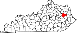
Morgan County, Kentucky

Last updated

Morgan County
Morgan County, Kentucky courthouse.jpg
Morgan County courthouse in West Liberty
Map of Kentucky highlighting Morgan County.svg
Location within the U.S. state of Kentucky
Kentucky in United States.svg
Kentucky's location within the U.S.
Coordinates: 37°55′N83°16′W / 37.92°N 83.26°W / 37.92; -83.26
CountryFlag of the United States.svg United States
StateFlag of Kentucky.svg  Kentucky
FoundedDecember 7, 1822
Named for Daniel Morgan
Seat West Liberty
Largest cityWest Liberty
Area
  Total384 sq mi (990 km2)
  Land381 sq mi (990 km2)
  Water2.7 sq mi (7 km2)  0.7%
Population
 (2020)
  Total13,726
  Estimate 
(2023)
14,283 Increase2.svg
  Density36/sq mi (14/km2)
Time zone UTC−5 (Eastern)
  Summer (DST) UTC−4 (EDT)
Congressional district 5th
Website morgancounty.ky.gov

Morgan County is a county located in the U.S. state of Kentucky. As of the 2020 census, the population was 13,726. [1] Its county seat is West Liberty. [2] The county is among the dry counties, which means that the sale of alcohol is restricted or prohibited.

Contents

History

Morgan County was formed on December 7, 1822, from portions of Bath County and Floyd County. [3] It was named for Daniel Morgan, a distinguished general in the American Revolutionary War. [4]

The first white settler in the county was Daniel Williams, a traveling preacher from Virginia who built the first permanent home in the vicinity several miles south of present-day West Liberty.

During the Civil War, Morgan County was firmly pro-confederate in sentiment, donating hundreds of men to the 5th KY Infantry (CSA).

Morgan County was hit by an EF3 tornado on March 2, 2012, which cost the lives of six people and injured many others. Following the tornado, Morgan County's population decreased, but the county seat still has a strong population for a small town.

Morgan County had begun building a new court house in 2011, but the tornado delayed its construction to late 2013.

Geography

According to the United States Census Bureau, the county has a total area of 384 square miles (990 km2), of which 300 square miles (780 km2) is land and 2.7 square miles (7.0 km2) (0.7%) is water. [5]

Adjacent counties

National protected area

Demographics

Historical population
CensusPop.Note
1830 2,857
1840 4,60361.1%
1850 7,62065.5%
1860 9,23721.2%
1870 5,975−35.3%
1880 8,45541.5%
1890 11,24933.0%
1900 12,79213.7%
1910 16,25927.1%
1920 16,5181.6%
1930 15,130−8.4%
1940 16,82711.2%
1950 13,624−19.0%
1960 11,056−18.8%
1970 10,019−9.4%
1980 12,10320.8%
1990 11,648−3.8%
2000 13,94819.7%
2010 13,923−0.2%
2020 13,726−1.4%
2023 (est.)14,283 [6] 4.1%
U.S. Decennial Census [7]
1790-1960 [8] 1900-1990 [9]
1990-2000 [10] 2010-2020 [1]

As of the census of 2000, there were 13,948 people, 4,752 households, and 3,568 families residing in the county. The population density was 37 per square mile (14/km2). There were 5,487 housing units at an average density of 14 per square mile (5.4/km2). The racial makeup of the county was 94.59% White, 4.38% Black or African American, 0.15% Native American, 0.16% Asian, 0.01% Pacific Islander, 0.06% from other races, and 0.65% from two or more races. 0.61% of the population were Hispanic or Latino of any race.

There were 4,752 households, out of which 34.80% had children under the age of 18 living with them, 62.40% were married couples living together, 9.20% had a female householder with no husband present, and 24.90% were non-families. 22.60% of all households were made up of individuals, and 10.30% had someone living alone who was 65 years of age or older. The average household size was 2.55 and the average family size was 2.97.

In the county, the population was spread out, with 22.40% under the age of 18, 10.60% from 18 to 24, 32.90% from 25 to 44, 22.30% from 45 to 64, and 11.80% who were 65 years of age or older. The median age was 36 years. For every 100 females there were 123.30 males. For every 100 females age 18 and over, there were 128.40 males.

The median income for a household in the county was $21,869, and the median income for a family was $26,135. Males had a median income of $23,966 versus $18,463 for females. The per capita income for the county was $12,657. 27.20% of the population and 23.50% of families were below the poverty line. Out of the total people living in poverty, 33.90% are under the age of 18 and 28.50% are 65 or older.

Politics

Morgan County was a strongly Democratic county throughout the 20th century, with the party's candidate winning in every presidential election from 1912 until 2000, when Al Gore became the first Democrat to lose the county since Woodrow Wilson in 1912. In the 21st century, however, like almost all of Kentucky, the county has flipped to the Republicans in US presidential elections.

United States presidential election results for Morgan County, Kentucky [11]
Year Republican Democratic Third party
No.%No.%No.%
2020 4,30177.58%1,17521.19%681.23%
2016 3,62875.98%1,00621.07%1412.95%
2012 3,02167.55%1,36930.61%821.83%
2008 2,39654.72%1,87942.91%1042.37%
2004 2,68250.87%2,53248.03%581.10%
2000 2,29554.13%1,87544.22%701.65%
1996 1,43938.94%1,84349.88%41311.18%
1992 1,23928.09%2,65560.19%51711.72%
1988 1,45238.04%2,32961.02%360.94%
1984 1,83442.36%2,48157.30%150.35%
1980 1,45034.53%2,69864.25%511.21%
1976 97324.97%2,89774.34%270.69%
1972 1,53545.56%1,81553.87%190.56%
1968 1,34133.86%2,22256.10%39810.05%
1964 54614.05%3,29384.72%481.23%
1960 1,71837.12%2,91062.88%00.00%
1956 1,87837.20%3,16462.68%60.12%
1952 1,31129.29%3,16170.62%40.09%
1948 98721.94%3,48877.53%240.53%
1944 1,21727.26%3,24272.63%50.11%
1940 1,50926.67%4,14873.33%00.00%
1936 1,26928.01%3,25671.86%60.13%
1932 1,43525.70%4,13774.09%120.21%
1928 2,02544.02%2,57555.98%00.00%
1924 1,80535.09%3,31164.37%280.54%
1920 1,80234.88%3,34764.79%170.33%
1916 1,12332.43%2,31966.97%210.61%
1912 87629.94%1,80061.52%2508.54%

Communities

City

Census-designated place

Other unincorporated places

See also

Related Research Articles

<span class="mw-page-title-main">Wolfe County, Kentucky</span> County in Kentucky, United States

Wolfe County is a county located in the U.S. state of Kentucky. As of the 2020 census, the population was 6,562. Its county seat is Campton. The county is named for Nathaniel Wolfe.

<span class="mw-page-title-main">Webster County, Kentucky</span> County in Kentucky, United States

Webster County is a county located in the U.S. state of Kentucky. As of the 2020 census, the population was 13,017. Its county seat is Dixon and its largest city is Providence. It is the southernmost county in the Evansville, IN–KY Metropolitan Statistical Area. The county was formed in 1860 from parts of Henderson, Hopkins, and Union Counties and named for American statesman Daniel Webster (1782–1852). It was mainly pro-Confederate during the American Civil War and was the site of several skirmishes and some guerrilla warfare. Since 2018 it has been a moist county, with Providence and Sebree voting to allow alcohol sales, and Clay doing so in 2022.

<span class="mw-page-title-main">Trigg County, Kentucky</span> County in Kentucky, United States

Trigg County is a county located on the far southwest border of the U.S. state of Kentucky. As of the 2020 census, the population was 14,061. Its county seat is Cadiz. Formed in 1820, the county was named for Stephen Trigg, an officer in the American Revolutionary War who was killed at the Battle of Blue Licks, now in Robertson County, Kentucky. It was a victory for British and allied troops.

<span class="mw-page-title-main">Simpson County, Kentucky</span> County in Kentucky, United States

Simpson County is a county located in the south central portion of the U.S. state of Kentucky. As of the 2020 census, the total population was 19,594. Its county seat is Franklin.

<span class="mw-page-title-main">Nicholas County, Kentucky</span> County in Kentucky, United States

Nicholas County is a county located in the U.S. state of Kentucky. As of the 2020 census, the population was 7,537. Its county seat is Carlisle, which is also the only incorporated community in the county. Founded in 1799, the county is named for Col. George Nicholas, the "Father of the Kentucky Constitution."

<span class="mw-page-title-main">Metcalfe County, Kentucky</span> County in Kentucky, United States

Metcalfe County is a county located in the U.S. state of Kentucky. Its county seat and only municipality is Edmonton. The county was founded in May 1860 and named for Thomas Metcalfe, Governor of Kentucky from 1828 to 1832. Metcalfe County is part of the Glasgow, KY Micropolitan Statistical Area, which is also included in the Bowling Green-Glasgow, KY Combined Statistical Area.

<span class="mw-page-title-main">Menifee County, Kentucky</span> County in Kentucky, United States

Menifee County is a county located in the U.S. state of Kentucky. As of the 2020 census, the population was 6,113, making it the fifth-least populous county in Kentucky. Its county seat is Frenchburg. The county is named for Richard Hickman Menefee, U.S. Congressman, although the spelling has changed. It is a prohibition or dry county. Menifee County is part of the Mount Sterling, KY Micropolitan Statistical Area, which is also included in the Lexington-Fayette–Richmond–Frankfort, KY combined statistical area. It is located in the foothills of the Cumberland Plateau.

<span class="mw-page-title-main">Marion County, Kentucky</span> County in Kentucky, United States

Marion County is a county in the U.S. state of Kentucky. As of the 2020 census, the total population was 19,581. Its county seat is Lebanon. The county was founded in 1834 and named for Francis Marion, the American Revolutionary War hero known as the "Swamp Fox".

<span class="mw-page-title-main">Magoffin County, Kentucky</span> County in Kentucky, United States

Magoffin County is a county located in the U.S. state of Kentucky. As of the 2020 census, the population was 11,637. Its county seat is Salyersville. The county was formed in 1860 from adjacent portions of Floyd, Johnson, and Morgan Counties. It was named for Beriah Magoffin who was Governor of Kentucky (1859–62).

<span class="mw-page-title-main">Lyon County, Kentucky</span> County in Kentucky, United States

Lyon County is a county located in the U.S. state of Kentucky. As of the 2020 census, the population was 8,680. Its county seat is Eddyville. The county was formed from Caldwell County, Kentucky in 1854 and named for former Congressman Chittenden Lyon.

<span class="mw-page-title-main">Lincoln County, Kentucky</span> County in Kentucky, United States

Lincoln County is a county located in south-central Kentucky. As of the 2020 census, the population was 24,275. Its county seat is Stanford. Lincoln County is part of the Danville, KY Micropolitan Statistical Area.

<span class="mw-page-title-main">Harrison County, Kentucky</span> County in Kentucky, United States

Harrison County is a county located in the U.S. state of Kentucky. As of the 2020 census, the population was 18,692. Its county seat is Cynthiana. The county was founded in 1793 and named for Colonel Benjamin Harrison, an advocate for Kentucky statehood, framer of the Kentucky Constitution, and Kentucky legislator.

<span class="mw-page-title-main">Cumberland County, Kentucky</span> County in Kentucky, United States

Cumberland County is a county located in the Pennyroyal Plateau region of the U.S. state of Kentucky. As of the 2020 census, the population was 5,888. Its county seat is Burkesville. The county was formed in 1798 and named for the Cumberland River, which in turn may have been named after the Duke of Cumberland or the English county of Cumberland.

<span class="mw-page-title-main">Casey County, Kentucky</span> County in Kentucky, United States

Casey County is a county located in the U.S. Commonwealth of Kentucky. As of the 2020 census, the population was 15,941. Its county seat is Liberty. The county was formed in 1806 from the western part of Lincoln County and named for Colonel William Casey, a pioneer settler who moved his family to Kentucky in 1779. It is the only Kentucky county entirely in the Knobs region. Casey County is home to annual Casey County Apple Festival, and is a prohibition or dry county. It is considered part of the Appalachian region of Kentucky.

<span class="mw-page-title-main">Bath County, Kentucky</span> County in Kentucky, United States

Bath County is a county located in the U.S. state of Kentucky. As of the 2020 census, the population was 12,750. The county seat is Owingsville. The county was formed in 1811. Bath County is included in the Mount Sterling, KY Micropolitan Statistical Area, which is also included in the Lexington-Fayette–Richmond–Frankfort, KY combined statistical area.

<span class="mw-page-title-main">Liberty, Kentucky</span> City in Kentucky, United States

Liberty is a home rule-class city in Casey County, Kentucky, in the United States. It is the seat of its county. Its population was 2,168 at the 2010 U.S. census.

<span class="mw-page-title-main">Brandenburg, Kentucky</span> City in Kentucky, United States

Brandenburg is a home rule-class city on the Ohio River in Meade County, Kentucky, in the United States. The city is 40 miles (64 km) southwest of Louisville. It is the seat of its county. The population was 2,894 at the 2020 census.

<span class="mw-page-title-main">West Liberty, Kentucky</span> City in Kentucky, United States

West Liberty is a home rule-class city in Morgan County, Kentucky, United States. It is the county seat of Morgan County. As of the 2020 census, the city population was 3,215. It is located along the Licking River at the junction of Kentucky Route 7 and U.S. Route 460.

<span class="mw-page-title-main">Bremen, Kentucky</span> City in Kentucky, United States

Bremen is a home rule-class city in Muhlenberg County, Kentucky, in the United States. The population was 172 at the 2020 census.

<span class="mw-page-title-main">Dawson Springs, Kentucky</span> City in Kentucky, United States

Dawson Springs is a home rule-class city in Hopkins and Caldwell counties in the U.S. state of Kentucky. As of the 2020 census, the population of the city was 2,452.

References

  1. 1 2 "State & County QuickFacts". United States Census Bureau. Retrieved February 26, 2023.
  2. "Find a County". National Association of Counties. Retrieved June 7, 2011.
  3. "Morgan County". The Kentucky Encyclopedia. 2000. Retrieved August 23, 2014.
  4. The Register of the Kentucky State Historical Society, Volume 1. Kentucky State Historical Society. 1903. pp.  36.
  5. "2010 Census Gazetteer Files". United States Census Bureau. August 22, 2012. Archived from the original on August 12, 2014. Retrieved August 18, 2014.
  6. "Annual Estimates of the Resident Population for Counties: April 1, 2020 to July 1, 2023". United States Census Bureau. Retrieved March 14, 2024.
  7. "U.S. Decennial Census". United States Census Bureau. Retrieved August 18, 2014.
  8. "Historical Census Browser". University of Virginia Library. Retrieved August 18, 2014.
  9. "Population of Counties by Decennial Census: 1900 to 1990". United States Census Bureau. Retrieved August 18, 2014.
  10. "Census 2000 PHC-T-4. Ranking Tables for Counties: 1990 and 2000" (PDF). United States Census Bureau. Archived (PDF) from the original on March 27, 2010. Retrieved August 18, 2014.
  11. Leip, David. "Dave Leip's Atlas of U.S. Presidential Elections". uselectionatlas.org. Retrieved July 5, 2018.

37°55′N83°16′W / 37.92°N 83.26°W / 37.92; -83.26