Related Research Articles

Sumter County is a county located in the U.S. state of South Carolina. As of the 2020 census, the population was 105,556. Its county seat is Sumter.

Oconee County is the westernmost county in the U.S. state of South Carolina. As of the 2020 census, the population was 78,607. Its county seat is Walhalla and its largest city is Seneca. Oconee County is included in the Seneca, SC Micropolitan Statistical Area, which is also included in the Greenville-Spartanburg-Anderson, SC Combined Statistical Area. South Carolina Highway 11, the Cherokee Foothills National Scenic Highway, begins in southern Oconee County at Interstate Highway 85 at the Georgia state line.

McCormick County is a county located in the U.S. state of South Carolina. As of the 2020 census, its population was 9,526, making it the second least-populous county in South Carolina. Its county seat is McCormick. The county was formed in 1916 from parts of Edgefield, Abbeville, and Greenwood counties.

Fairfield County is a county located in the U.S. state of South Carolina. As of the 2020 census, its population was 20,948. Its county seat is Winnsboro.

Sumter County is a county located in the west-central portion of the U.S. state of Georgia. As of the 2020 census, its population was 29,616. The county seat is Americus. The county was created on December 26, 1831.

Barnwell is a city in and county seat of Barnwell County, South Carolina, United States, located along U.S. Route 278. The population was 4,750 at the 2010 census.
Jefferson is a town in western Chesterfield County, South Carolina, United States at the junction of SC routes 265 and 151. Jefferson is located in the Piedmont region of South Carolina just in the edge meeting the Sandhills region. Jefferson is located 16 miles northwest of McBee, 8 miles south of Pageland, 50 miles southeast of Charlotte, North Carolina, and 70 miles north-northeast of the state capitol Columbia. As of the 2010 census, the city population was 753.

Turbeville is a town in Clarendon County, South Carolina, United States. The population was 766 at the 2010 census, up from 602 in 2000.

Pickens, formerly called Pickens Courthouse, is a city in and the county seat of Pickens County, South Carolina, United States. The population was 3,126 at the 2010 census. Pickens changed its classification from a town to a city in 1998, but it was not reported to the Census Bureau until 2001. It was named after Andrew Pickens (1739–1817), an American revolutionary soldier and US Congressman for South Carolina.
Dalzell is a census-designated place (CDP) in Sumter County, South Carolina, United States. The population was 3,175 at the 2020 census. It is included in the Sumter, South Carolina Metropolitan Statistical Area.

Sumter is a city in and the county seat of Sumter County, South Carolina. The city makes up the Sumter, SC Metropolitan Statistical Area. Sumter County, along with Clarendon and Lee counties, form the core of Sumter–Lee–Clarendon Tri-county area of South Carolina that includes three counties straddling the border of the Sandhills, Pee Dee, and Lowcountry regions. The population was 43,463 at the 2020 census, making it the 9th most populous city in the state.
The Pee Dee is a region in the northeast corner of the U.S. state of South Carolina. It lies along the lower watershed of the Pee Dee River, which was named after the Pee Dee, an Indigenous tribe historically inhabiting the region.

South Carolina's 5th congressional district is a congressional district in northern South Carolina bordering North Carolina. The district includes all of Cherokee, Chester, Fairfield, Kershaw, Lancaster, Lee, Union and York counties and parts of Newberry, Spartanburg and Sumter counties. Outside the rapidly growing cities of Rock Hill, Fort Mill, and Lake Wylie the district is mostly rural and agricultural. The district borders were contracted from some of the easternmost counties in the 2012 redistricting.

South Carolina's 6th congressional district is in central and eastern South Carolina. It includes all of Allendale, Bamberg, Calhoun, Clarendon, Hampton, and Williamsburg counties and parts of Charleston, Colleton, Dorchester, Florence, Jasper, Orangeburg, Richland and Sumter counties. With a Cook Partisan Voting Index rating of D+14, it is the only Democratic district in South Carolina.

Wedgefield is an unincorporated community in the High Hills of Santee area in western Sumter County, South Carolina, United States. Wedgefield is also a Census Designated Place (CDP). Wedgefield was so named because its location was likened to a "wedge" into the High Hills of Santee. In the 18th and 19th centuries it was the location of many plantations, notably those of the Singleton family, which produced First Lady of the United States, Angelica Singleton Van Buren. Today the plantations are gone except for their cemeteries and Wedgefield is today noted as the location of a state park, a state forest and other recreational places. When the railroad came through in the 19th century, the commercial center of Wedgefield developed at the intersection of the railroad, Kings Highway and Wedgefield Road. It has its own post office with the Zip Code of 29168.
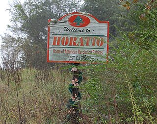
Horatio is an unincorporated community in the High Hills of Santee area in western Sumter County, South Carolina, United States.

Magnolia Hall is an historic plantation located in the High Hills of Santee at 2025 Horatio-Hagood Road, Hagood, South Carolina. Its Greek Revival plantation house was built in 1821 by its owner Isaac Barnes. After Dr. Swepson Saunders bought the property in 1853, he added onto it in 1855 and 1860.

The High Hills of Santee, sometimes known as the High Hills of the Santee, is a long, narrow hilly region in the western part of Sumter County, South Carolina. It has been called "one of the state's most famous areas". The High Hills of Santee region lies north of the Santee River and east of the Wateree River, one of the two rivers that join to form the Santee. It extends north almost to the Kershaw county line and northeasterly to include the former summer resort town of Bradford Springs. Since 1902 the town has been included in Lee County.

South Carolina Highway 441 (SC 441) is a 26.280-mile-long (42.294 km) state highway in the U.S. state of South Carolina. The highway connects the Sumter area in Sumter County with rural areas of Lee County.
