A sluice is a water channel containing a sluice gate, a type of lock to manage the water flow and water level. It can also be an open channel which processes material, such as a River Sluice used in gold prospecting or fossicking. A mill race, leet, flume, penstock or lade is a sluice channeling water toward a water mill. The terms sluice, sluice gate, knife gate, and slide gate are used interchangeably in the water and wastewater control industry.

The Louth Navigation was a canalisation of the River Lud. It ran for 11 miles (18 km) from Louth in Lincolnshire, England, to Tetney Haven, at the mouth of the Humber. It was authorised by Act of Parliament in 1763 and completed in 1770, under the supervision of the engineer John Grundy Jr. and then by James Hogard. Eight locks were required to overcome the difference in altitude, six of which were constructed with sides consisting of four elliptical bays.

The Sloan–Parker House, also known as the Stone House, Parker Family Residence, or Richard Sloan House, is a late-18th-century stone residence near Junction, Hampshire County, in the U.S. state of West Virginia. It was built on land vacated by the Shawnee after the Native American nation had been violently forced to move west to Kansas following their defeat at the Battle of Point Pleasant in 1774. The building was added to the National Register of Historic Places on June 5, 1975, becoming Hampshire County's first property to be listed on the register. The Sloan–Parker House has been in the Parker family since 1854. The house and its adjacent farm are located along the Northwestern Turnpike in the rural Mill Creek valley.

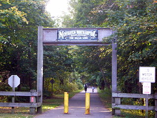
The Farmington Canal, also known as the New Haven and Northampton Canal, was a major private canal built in the early 19th century to provide water transportation from New Haven into the interior of Connecticut, Massachusetts and beyond. Its Massachusetts segment was known as the Hampshire and Hampden Canal. With the advent of railroads, it was quickly converted to a railroad in the mid-19th century and in recent years has been converted to a multi-use trail after being abandoned for years.

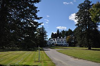
Gwyn Careg is a historic country estate at 68 Wolf Den Road in the Abington section of Pomfret, Connecticut. It is currently operated as a bed and breakfast. The main house on the property is a two-story brick structure built c. 1760, altered in the late 19th century and again in the 1920s, giving it a Colonial Revival appearance. When the property was developed as a country estate in the 1920s by Eleanor Clark Murray, it included significant landscape design by William Jackson, a noted New York City landscape designer. Despite a significant period of neglect in the 20th century, the property has one of the most extensive collections of specimen trees in the state. The property was added to the National Register of Historic Places in 1994.

The Hotchkissville Historic District is a historic district in the town of Woodbury, Connecticut, that was listed on the National Register of Historic Places in 1995. The district encompasses most of the historic village of Hotchkissville, which is centered at the junction of Washington and Weekeepeemee roads. The village began as a dispersed rural agricultural community, but developed in the 19th century with the arrival of industry, primarily the manufacture of textiles. Despite this, the village has retained a significantly rural character, and includes a broad cross-section of 18th- and 19th-century architectural styles.

The Bisbee Mill is a historic gristmill at 66 East Street in Chesterfield, Massachusetts. Located on the Dead Branch of the Westfield River, the mill complex includes a wood frame mill building, along with its former mill pond, impounded by a dam across the river, and a canal that brought river water to the mill for power. Also included on the property is the site of the Damon sawmill, which was established in 1761, and the Pierce cornmill, which occupied a site north of the Bisbee mill building in 1823. The Pierce mill was moved to the site, from an earlier one that may also be on the grounds of the Bisbee mill complex.

The Main Street–Frye Street Historic District is a historic district comprising houses on Frye Street and parts of College Street and Main Street in Lewiston, Maine. This area was part of the most fashionable residential district of the city in the second half of the 19th century, and was home to many of the city's elite. Its architectural styles are diverse, with a significant number of homes designed by local architect George M. Coombs. The district was added to the National Register of Historic Places in 2009.

Sloat's Dam and Mill Pond is located between Waldron Terrace and Ballard Avenue in Sloatsburg, New York, United States. The 200-foot–long concrete dam creates the mill pond north of it by impounding the Ramapo River.

The Daniel Cragin Mill, known in the twenty-first century as the Frye's Measure Mill, is a historic watermill established in 1858. The mill is about three miles (5 km) west of the town of Wilton in Hillsborough County, New Hampshire. For over 150 years it has produced woodenware and wooden dry measuring boxes. In 2021 it mainly made Shaker-style pantry boxes and furniture pieces for the various Shaker communities and their commercial retail shops. The mill was added to the U.S. National Register of Historic Places in 1982.

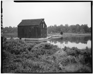
Van Wyck-Lefferts Tide Mill is a historic tide mill located at Lloyd Harbor in Suffolk County, New York. It was built about 1793 and is a 3+1⁄2-story, gable-roofed, timber-framed rectangular building little altered since the early 19th century. The property also includes the earthen mill dam with sluice gates. The Nature Conservancy, which owns the mill, offers free boat tours to the site from May through October.

The Boston Mills Historic District is a historic district in the Cuyahoga Valley National Park in Northeast Ohio in the United States. With the opening of the Ohio and Erie Canal in 1827, people began to settle in this vicinity. By 1842, there was a water-powered mill, a large warehouse, a boat-yard, two stores and a hotel, and the population was around 300. A number of houses and other buildings dating back to that period remain.

The Dundee Canal was an industrial canal in Clifton and Passaic in Passaic County, New Jersey. It was built between 1858 and 1861 and ran parallel to the Passaic River. It supplied hydropower and water for manufacturing. There was interest by some members of the business community to modify the canal to support navigational uses, but the canal was never used for that purpose.

The Luke Richardson House is a historic house at 204 Hancock Road in Dublin, New Hampshire. Built about 1820, it is a good local example of a mid-19th century farmhouse with modest Greek Revival features. It was listed on the National Register of Historic Places in 1983.

The Bennington Village Historic District of Bennington, New Hampshire encompasses the 19th-century center of the village. Growth of the village followed a typical pattern for rural New Hampshire towns, based in this case around the growth in the early 19th century of the paper industry, which continues to be a significant economic force in the community. The district is centered on the junctions of Main, Center, and School Streets with Bible Hill Road and Francestown Road. The district was listed on the National Register of Historic Places in 2010.

The Old County Road South Historic District is a rural historic district encompassing a well-preserved collection of 18th and early 19th-century rural farm properties in Francestown, New Hampshire. It includes nine houses, whose construction dates from 1774 to 1806, and the only two extant 18th-century saltbox-style houses in the town. There is also a Cape-style house built using the relatively rare vertical-plank method of framing, and there are several surviving 19th-century barns. The district covers 500 acres (200 ha) along all or part of Old County Road South, Pratt (Clark) Road, and Birdsall Road. The district was listed on the National Register of Historic Places in 1980.

The Exeter Waterfront Commercial Historic District encompasses the historic commercial and residential waterfront areas of Exeter, New Hampshire. The district extends along the north side of Water Street, roughly from Main Street to Front Street, and then along both sides of Water and High streets to the latter's junction with Portsmouth Street. It also includes properties on Chestnut Street on the north side of the Squamscott River. This area was where the early settlement of Exeter took place in 1638, and soon developed as a shipbuilding center. The district was listed on the National Register of Historic Places in 1980. It was enlarged in 1986 to include the mill complex of the Exeter Manufacturing Company on Chestnut Street.

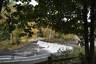
The Wiswall Falls Mill Site is a historic archaeological industrial site in Durham, New Hampshire. It is located in John Hatch Park, a small public park just south of Wiswall Road on the eastern bank of the Lamprey River. The 3-acre (1.2 ha) site encompasses the remains of a small 19th-century mill complex that was one of Durham's major industrial sites of the 19th century until it burned in 1883. The site, which includes remains of the waterworks and foundations, was listed on the National Register of Historic Places in 1988.

The Dexter Grist Mill, now the Dexter Historical Society Museum, is a historic 19th-century industrial property in Dexter, Maine. Built in 1854, the mill was operated by a single family for over a century, and was converted to a museum in 1967. It was listed on the National Register of Historic Places in 1975.

The River Lyde or Lyde River is a small river in the English county of Hampshire. It rises near Mapledurwell, where the water is used in watercress beds before entering the main channel. It flows in a generally northerly direction, and used to supply power to watermills along its route. Near Sherfield on Loddon it joins the River Loddon, which is a tributary of the River Thames.


