Happy Jack, Arizona

Last updated

Happy Jack, Arizona
USA Arizona location map.svg
Red pog.svg
Happy Jack
Usa edcp location map.svg
Red pog.svg
Happy Jack
Coordinates: 34°44′36″N111°24′27″W / 34.74333°N 111.40750°W / 34.74333; -111.40750
Country United States
State Arizona
County Coconino
Elevation
7,493 ft (2,284 m)
Time zone UTC-7 (Mountain (MST))
ZIP code
86024
GNIS feature ID 29736

Happy Jack is an unincorporated community and campground located in the Mogollon Rim Region of Coconino County, Arizona, United States. The Lowell Discovery Telescope is located there. It is located on Lake Mary Road southeast of Flagstaff, Arizona.

Contents

History

Happy Jack was founded in 1947 as a logging camp. The community also contained a ranger station and post office. [1] By 1948, 300 people lived in the town, and at its peak, housed around 500 people. [2] The town was built by the Saginaw and Manistee Lumber company. [2]

The community petitioned for a school in 1970. [3]

The first logging camp closed approximately 30 years after it opened. The logging company requested Happy Jack be moved 13 miles, closer to Clints Well, starting around 1974. [4] The Happy Jack post office moved 15 miles down the road to a place known locally as Long Valley in 1983 and is also known as Happy Jack Too. [5] However, Long Valley does not appear on any maps. [1]

Etymology

The town was founded at a place called Onion Flat, and was originally called "Yellowjacket." However, three other Yellowjacket place names already existed, so a new name had to be chosen for the new community. [6]

Happy Jack may have been named for a cheerful local lumberman. [7] However, another newspaper report says the Coconino National Forest Supervisor Ronald Rotty named Happy Jack, after an area of Wyoming where a bandit named Happy Jack committed crimes. [1]

Climate

According to the Köppen Climate Classification system, Happy Jack has a Continental climate, abbreviated "Dsb" on climate maps. [8]

Climate data for Happy Jack, Arizona (1991–2020 normals, extremes 1969–present)
MonthJanFebMarAprMayJunJulAugSepOctNovDecYear
Record high °F (°C)65
(18)
76
(24)
72
(22)
76
(24)
87
(31)
97
(36)
94
(34)
92
(33)
88
(31)
80
(27)
71
(22)
70
(21)
97
(36)
Mean maximum °F (°C)54.3
(12.4)
56.9
(13.8)
62.2
(16.8)
69.3
(20.7)
77.3
(25.2)
86.3
(30.2)
87.7
(30.9)
84.6
(29.2)
79.8
(26.6)
72.7
(22.6)
64.8
(18.2)
56.3
(13.5)
88.8
(31.6)
Mean daily maximum °F (°C)40.4
(4.7)
42.2
(5.7)
48.7
(9.3)
55.6
(13.1)
64.9
(18.3)
75.2
(24.0)
78.3
(25.7)
75.4
(24.1)
70.5
(21.4)
60.6
(15.9)
49.7
(9.8)
40.7
(4.8)
58.5
(14.7)
Daily mean °F (°C)29.7
(−1.3)
31.3
(−0.4)
36.8
(2.7)
42.5
(5.8)
50.3
(10.2)
59.3
(15.2)
64.9
(18.3)
63.2
(17.3)
57.1
(13.9)
47.2
(8.4)
37.4
(3.0)
29.8
(−1.2)
45.8
(7.7)
Mean daily minimum °F (°C)18.9
(−7.3)
20.4
(−6.4)
24.9
(−3.9)
29.4
(−1.4)
35.8
(2.1)
43.4
(6.3)
51.4
(10.8)
51.0
(10.6)
43.8
(6.6)
33.9
(1.1)
25.1
(−3.8)
18.8
(−7.3)
33.1
(0.6)
Mean minimum °F (°C)−0.8
(−18.2)
3.7
(−15.7)
8.1
(−13.3)
17.3
(−8.2)
23.5
(−4.7)
30.8
(−0.7)
41.0
(5.0)
41.8
(5.4)
32.0
(0.0)
20.0
(−6.7)
8.8
(−12.9)
−0.1
(−17.8)
−5.1
(−20.6)
Record low °F (°C)−35
(−37)
−16
(−27)
−12
(−24)
−2
(−19)
12
(−11)
22
(−6)
31
(−1)
30
(−1)
23
(−5)
0
(−18)
−5
(−21)
−27
(−33)
−35
(−37)
Average precipitation inches (mm)2.97
(75)
2.93
(74)
2.53
(64)
1.00
(25)
0.81
(21)
0.34
(8.6)
2.55
(65)
3.15
(80)
1.99
(51)
1.48
(38)
1.70
(43)
2.60
(66)
24.05
(611)
Average snowfall inches (cm)13.8
(35)
20.6
(52)
8.1
(21)
5.2
(13)
0.9
(2.3)
0.0
(0.0)
0.0
(0.0)
0.0
(0.0)
0.0
(0.0)
1.0
(2.5)
5.8
(15)
14.3
(36)
69.7
(176.8)
Average precipitation days (≥ 0.01 inch)4.04.14.52.33.21.69.911.55.54.02.74.357.6
Average snowy days (≥ 0.1 inch)2.83.32.31.20.30.00.00.00.00.51.13.915.4
Source: National Oceanic and Atmospheric Administration [9] [10]

Related Research Articles

<span class="mw-page-title-main">Flagstaff, Arizona</span> City in Arizona

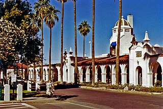
Flagstaff is the county seat of Coconino County, Arizona, in the southwestern United States. As of the 2020 United States census, the city's population was 76,831.

<span class="mw-page-title-main">Coconino County, Arizona</span> County in Arizona, United States

Coconino County is a county in the north-central part of the U.S. state of Arizona. Its population was 145,101 at the 2020 census. The county seat is Flagstaff. The county takes its name from Cohonino, a name applied to the Havasupai people. It is the second-largest county by area in the contiguous United States, behind San Bernardino County, California. It has 18,661 sq mi (48,300 km2), or 16.4% of Arizona's total area, and is larger than the nine smallest states in the U.S.

<span class="mw-page-title-main">Yavapai County, Arizona</span> County in Arizona, United States

Yavapai County is near the center of the U.S. state of Arizona. As of the 2020 census, its population was 236,209, making it the fourth-most populous county in Arizona. The county seat is Prescott.

<span class="mw-page-title-main">Sedona, Arizona</span> City in Coconino and Yavapai Counties, Arizona, US

Sedona is a city that straddles the county line between Coconino and Yavapai counties in the northern Verde Valley region of the U.S. state of Arizona. As of the 2010 census, its population was 10,031. It is within the Coconino National Forest.

<span class="mw-page-title-main">Munds Park, Arizona</span> CDP in Coconino County, Arizona

Munds Park is an unincorporated census-designated place (CDP) in Coconino County, Arizona, United States. The year round population was 631 at the 2010 census.

<span class="mw-page-title-main">Ajo, Arizona</span> Community in Pima County, Arizona

Ajo is an unincorporated community in Pima County, Arizona, United States. It is the closest community to Organ Pipe Cactus National Monument. The population was 3,039 at the 2020 census. Ajo is located on State Route 85 just 43 miles (69 km) from the Mexican border.

<span class="mw-page-title-main">Village of Oak Creek, Arizona</span> Community in Yavapai County, Arizona

Village of Oak Creek is an unincorporated community located within Big Park a census-designated place (CDP) in Yavapai County, Arizona, United States. The population was 6,147 at the 2010 census, up from 5,245 in 2000. Big Park is the name of the CDP while the community is more commonly known as the Village of Oak Creek (VOC), and is a bedroom community for Sedona, located seven miles away. Tourism and service to retirees and second-home owners are the basis for the local economy. Big Park, the pioneers' name for the large open area that became the Village of Oak Creek in the early 1960s, is set among scenic red-rock buttes and canyons. The Bell Rock scenic area adjoins the north end of VOC, and the town is surrounded by the Coconino National Forest. A Forest Service Visitor Center is located at the south end of VOC.

<span class="mw-page-title-main">Wupatki National Monument</span> Protected area in Coconino County, Arizona

The Wupatki National Monument is a United States National Monument located in north-central Arizona, near Flagstaff. Rich in Native American archaeological sites, the monument is administered by the National Park Service in close conjunction with the nearby Sunset Crater Volcano National Monument. Wupatki was established as a national monument in 1924 and was listed on the National Register of Historic Places on October 15, 1966. The listing included three contributing buildings and 29 contributing structures on 35,422 acres (14,335 ha).

<span class="mw-page-title-main">Humphreys Peak</span> Highest mountain in Arizona

Humphreys Peak is the highest natural point and the second most prominent peak after Mount Graham in the U.S. state of Arizona, with an elevation of 12,637 feet (3,852 m) and is located within the Kachina Peaks Wilderness in the Coconino National Forest, about 11 miles (17.7 km) north of Flagstaff, Arizona. Humphreys Peak is the highest of a group of dormant volcanic peaks known as the San Francisco Peaks.

<span class="mw-page-title-main">Tortilla Flat, Arizona</span> Unincorporated community in the state of Arizona, United States

Tortilla Flat is a small unincorporated community in far eastern Maricopa County, Arizona, United States. It is located in the central part of the state, northeast of Apache Junction. It is the last surviving stagecoach stop along the Apache Trail. According to the Gross Management Department of Arizona's main U.S. Post Office in Phoenix, Tortilla Flat is presumed to be Arizona's smallest official "community" having a U.S. Post Office and voting precinct. The town has a population of 6. Tortilla Flat can be reached by vehicles on the Apache Trail, via Apache Junction.

<span class="mw-page-title-main">Fish Camp, California</span> Census-designated place in California, United States

Fish Camp is a census-designated place in Mariposa County, California, United States. It is located 18 miles (29 km) east of Mariposa, at an elevation of 5,062 feet (1,543 m). The population was 49 at the 2020 census. The ZIP Code is 93623, and the community is inside area code 559.

<span class="mw-page-title-main">Chiriaco Summit, California</span> Unincorporated community in California, United States

Chiriaco Summit is a small unincorporated community and travel stop located along Interstate 10 in the Colorado Desert of Southern California. It lies 19 miles (31 km) west of Desert Center on the divide between the Chuckwalla Valley and the Salton Sea basin at an elevation of 1,706 feet (520 m).

Arizona's 2nd congressional district is a congressional district located in the U.S. state of Arizona. The district is in the north eastern part of the state and includes Apache, Coconino, Gila, Navajo, and Yavapai counties in their entirety and portions of Graham, Maricopa, Mohave, and Pinal counties. The largest city in the district is Flagstaff.

<span class="mw-page-title-main">Alpine, Arizona</span> CDP in Apache County, Arizona

Alpine is a census-designated place in Apache County, Arizona, United States, in Bush Valley in the east central part of the state. As of the 2010 census, it had a population of 145. It is located near the eastern border of the state.

<span class="mw-page-title-main">Forest Lakes, Arizona</span> Unincorporated community in the state of Arizona, United States

Forest Lakes is a small unincorporated community in Coconino County in the northern part of the U.S. state of Arizona. It is located on the edge of the Mogollon Rim and is in close proximity to several recreational lakes within the Apache-Sitgreaves National Forest, and is named for such.

House Mountain is a shield volcano located in the U.S. state of Arizona located between the Sedona Red Rock Country and the Verde Valley in the Coconino National Forest. House Mountain erupted approximately 13–15 million years ago on the edge of where the Mogollon Rim stood at that time. Thus, the basalt that was emitted preserved the sedimentary layers below it, including the Schnebly Hill Formation and the thin band of Fort Apache Limestone. The Mogollon Rim has receded at a rate of 1 foot per 600 years since and the current edge of the rim can be seen several miles away from the summit.

<span class="mw-page-title-main">Fort Valley, Arizona</span> CDP in Coconino County, Arizona

Fort Valley is a census-designated place in the southern portion of Coconino County in the state of Arizona, United States. Fort Valley is located very close to the city of Flagstaff. The population as of 2010, was 779.

Riordan was a populated place situated in Coconino County, Arizona, United States. It has an estimated elevation of 7,316 feet (2,230 m) above sea level.

References

  1. 1 2 3 Cook, James E. (July 14, 1988). "Long Valley disappears under Happy Jack".
  2. 1 2 "Cabins House 300 Dwellers". Arizona Republic. October 10, 1948. p. 1, Section 2.
  3. "Happy Jack School Studied; Bus Changes Rejected". Arizona Daily Sun. September 2, 1970.
  4. "Happy Jack plans move south". Arizona Daily Sun. September 25, 1974.
  5. O'Connell, Maureen (March 28, 1991). "Deep in the forest, Happy Jack represents 'untouched solitude'". Arizona Daily Sun.
  6. "'Happy Jack' formerly was 'Onion Flats'". Arizona Daily Sun. May 19, 1949. p. 6.
  7. Blackwood, Alisa (April 15, 2001). "Whimsical names mark Arizona towns". Reading Eagle. pp. E11. Retrieved April 23, 2015.
  8. Climate Summary for Happy Jack, Arizona
  9. "NOWData - NOAA Online Weather Data". National Oceanic and Atmospheric Administration . Retrieved August 14, 2022.
  10. "U.S. Climate Normals Quick Access – Station: Happy Jack RS, AZ". National Oceanic and Atmospheric Administration. Retrieved January 28, 2023.