Canyon Diablo, Arizona

Last updated

Canyon Diablo, Arizona
OldCynDiablo.jpg
Canyon Diablo in its heyday, c. 1890
USA Arizona location map.svg
Red pog.svg
Canyon Diablo, Arizona
Location in the state of Arizona
Usa edcp location map.svg
Red pog.svg
Canyon Diablo, Arizona
Canyon Diablo, Arizona (the United States)
Coordinates: 35°09′46″N111°07′04″W / 35.16278°N 111.11778°W / 35.16278; -111.11778 Canyon Diablo
Country United States
State Arizona
County Coconino
Elevation
[1]
5,433 ft (1,656 m)
Time zone UTC-7 (MST (no DST))

Canyon Diablo is a ghost town in Coconino County, Arizona, United States on the edge of the arroyo Canyon Diablo. The community was settled in 1880 and died out in the early 20th century.

Contents

The town, which is about 12 mi (19 km) northwest of Meteor Crater, was the closest community to the crater when portions of the meteorite were removed. Consequently, the meteorite that struck the crater is officially called the "Canyon Diablo Meteorite." [2]

History

Cowboys hold up the corpse of outlaw John Shaw, who died in the Canyon Diablo shootout, 1905. Outlaw John Shaw Canyon Diablo AZ 1905.jpg
Cowboys hold up the corpse of outlaw John Shaw, who died in the Canyon Diablo shootout, 1905.

The ramshackle camp of railroad workers originated in 1880, due to the construction of the Atlantic and Pacific Railroad bridge over a large canyon named Canyon Diablo. The temporary community assumed the name of the canyon that stood in the way of the railroad construction - Canyon Diablo. The bridge construction took six months, during which many regular railroad construction workers were encamped and waiting to recommence their work once the canyon had been spanned. After the bridge was completed, construction resumed and the camp was largely abandoned. [3]

Construction of the railroad normally involved a constantly moving work area. The completed rail was used to transport materials and workers to the end of the line, where the bed was graded, small bridges were built, and the rail laid down. The workers would camp in tents spread out along the work area depending on the jobs they performed. However, when very large rivers or canyons were encountered, construction would slow to a stop as large, specialized bridges had to be constructed. This could result in a larger temporary camp or community springing up as the idle workers consolidated together in one place near where the bridge was being constructed. This is how Canyon Diablo came to be.

The original pillars the bridge was mounted on were excavated from the surrounding Kaibab Limestone and shaped on site by Italian stonemasons. The ruins of the lodgings of the railroad workmen are on the west end of the bridge site. Although the railroad ended at the edge of the canyon, work on the railroad route still progressed. Crews were sent ahead to survey the route, prepare the grade and bed, cut and pre-stage railroad ties and other supplies in advance of the iron rails that would accompany the trains once the canyon was spanned when the new bridge arrived. Work quickly progressed until the A&P crew linked up with the Southern Pacific Railroad crews at Needles, California on August 9, 1883.

Originally a small mobile business community catering to the needs of railroad men, once the railroad stopped at the edge of the canyon this community quickly produced numerous saloons, brothels, dance halls, and gambling houses, all of which remained open 24 hours a day. No lawmen were employed by the community initially, so it quickly became a very dangerous place. Its population was mostly railroad workers, along with passing outlaws, gamblers, and prostitutes. The town was designed with two lines of buildings facing one another across the rock bed main street. The center street, however, was not named Main Street, but "Hell Street". It consisted of fourteen saloons, ten gambling houses, four brothels and two dance halls. Also on this street were two eating counters, one grocery store, and one dry goods store. Scattered about in the vicinity of downtown were large numbers of tents, shotgun houses, and hastily thrown up shacks that served as local residences.

Within a short time the town had 2,000 residents. A regular stagecoach route from Flagstaff to Canyon Diablo began running and was often the victim of robberies. Within its first year, the town received its first marshal. He was sworn in at 3:00pm, and was being buried at 8:00pm that same night. Five more town marshals would follow, the longest lasting one month, and all were killed in the line of duty. A "Boot Hill" cemetery sprouted up at the end of town, which in less than a decade had 35 graves, all of whom had been killed by way of violent death. The 36th grave was that of former trading post owner Herman Wolfe, who died in 1899, the only one to have died a nonviolent death.

Herman Wolfe's trading post was at "Wolfe's Crossing" on the Little Colorado River about 12 miles north of Leupp, Arizona and near a place called Tolchaco. Herman Wolfe died there and his body was transported to Canyon Diablo for burial. Currently Wolfe's grave is heavily monumented and the story is that after World War II a relative from Germany found his grave and installed the headstone and other improvements on the grave site.

When the railroad bridge was completed, the town quickly died. The original railroad bridge was replaced in 1900 with a new bridge to carry heavier locomotives and cars. By 1903, the only thing remaining in the town was a Navajo trading post. A new double track railroad bridge was completed across the Canyon in 1947. What remains today at Canyon Diablo are a few building foundations, the grave marker and grave of Herman Wolfe, the ruins of the trading post, a railroad siding and a double track railroad bridge.

Canyon Diablo's population was 30 in 1890, [4] 29 in 1900, [5] and 36 in 1920. [6]

Access

Access to Canyon Diablo is north on a very poor road from Exit 230/Two Guns off Interstate 40. A high ground clearance vehicle is recommended.

See also

Related Research Articles

<span class="mw-page-title-main">First transcontinental railroad</span> First US railroad to connect the Pacific coast to the Eastern states, built from 1863 to 1869.

America's first transcontinental railroad was a 1,911-mile (3,075 km) continuous railroad line constructed between 1863 and 1869 that connected the existing eastern U.S. rail network at Council Bluffs, Iowa, with the Pacific coast at the Oakland Long Wharf on San Francisco Bay. The rail line was built by three private companies over public lands provided by extensive US land grants. Building was financed by both state and US government subsidy bonds as well as by company-issued mortgage bonds. The Western Pacific Railroad Company built 132 miles (212 km) of track from the road's western terminus at Alameda/Oakland to Sacramento, California. The Central Pacific Railroad Company of California (CPRR) constructed 690 miles (1,110 km) east from Sacramento to Promontory Summit, Utah Territory. The Union Pacific Railroad (UPRR) built 1,085 miles (1,746 km) from the road's eastern terminus at the Missouri River settlements of Council Bluffs and Omaha, Nebraska, westward to Promontory Summit.

<span class="mw-page-title-main">Meteor Crater</span> Meteorite impact crater in northern Arizona

Meteor Crater or Barringer Crater is a meteorite impact crater about 37 mi (60 km) east of Flagstaff and 18 mi (29 km) west of Winslow in the desert of northern Arizona, United States. The site had several earlier names, and fragments of the meteorite are officially called the Canyon Diablo Meteorite, after the adjacent Cañon Diablo.

<span class="mw-page-title-main">Coconino County, Arizona</span> County in Arizona, United States

Coconino County is a county in the north-central part of the U.S. state of Arizona. Its population was 145,101 at the 2020 census. The county seat is Flagstaff. The county takes its name from Cohonino, a name applied to the Havasupai people. It is the second-largest county by area in the contiguous United States, behind San Bernardino County, California. It has 18,661 sq mi (48,300 km2), or 16.4% of Arizona's total area, and is larger than each of the nine smallest states in the U.S.

<span class="mw-page-title-main">Holbrook, Arizona</span> City in Navajo County, Arizona, US

Holbrook is a city in Navajo County, Arizona, United States. According to the 2010 census, the population of the city was 5,053. The city is the county seat of Navajo County.

<span class="mw-page-title-main">Winslow, Arizona</span> City in Arizona, United States

Winslow is a city in Navajo County, Arizona, United States. According to the 2010 census, the population of the city is 9,655. It is approximately 57 miles (92 km) southeast of Flagstaff, 240 miles (390 km) west of Albuquerque, New Mexico, and 329 miles (529 km) southeast of Las Vegas.

<span class="mw-page-title-main">Ash Fork, Arizona</span> CDP in Yavapai County, Arizona

Ash Fork is a census-designated place in Yavapai County, Arizona, United States. Its population was 396 at the 2010 U.S. Census, down from 457 in 2000.

<span class="mw-page-title-main">U.S. Route 66 in Arizona</span> Former designated US highway in Arizona

U.S. Route 66 also known as the Will Rogers Highway, was a major United States Numbered Highway in the state of Arizona from November 11, 1926, to June 26, 1985. US 66 covered a total of 385.20 miles (619.92 km) through Arizona. The highway ran from west to east, starting in Needles, California, through Kingman and Seligman to the New Mexico state line. Nationally, US 66 ran from Santa Monica, California, to Chicago, Illinois. In its height of popularity, US 66 was one of the most popular highways in the state of Arizona, sometimes carrying over one million cars a year.

<span class="mw-page-title-main">U.S. Route 66 in New Mexico</span> Historic highway in the United States

The historic U.S. Route 66 ran east–west across the central part of the state of New Mexico, along the path now taken by Interstate 40 (I-40). However, until 1937, it took a longer route via Los Lunas, Albuquerque, and Santa Fe, now roughly New Mexico State Road 6 (NM 6), I-25, and US 84. Large portions of the old road parallel to I-40 have been designated NM 117, NM 118, NM 122, NM 124, NM 333, three separate loops of I-40 Business, and state-maintained frontage roads.

<span class="mw-page-title-main">Pinedale, Arizona</span> Unincorporated community in the state of Arizona, United States

Pinedale is an unincorporated community in Navajo County, Arizona, United States. The population was 487 at the 2010 census. The elevation is approximately 6,500 ft (2,000 m) and it is part of the Mogollon Rim mountain range.

<span class="mw-page-title-main">Harvey H. Nininger</span> American lay scientist (1887–1986)

Harvey Harlow Nininger was an American meteoriticist and educator, and although he was self-taught, he revived interest in scientific study of meteorites in the 1930s and assembled the largest personal collection of meteorites up to that time.

<span class="mw-page-title-main">Drake, Arizona</span> Unincorporated community in the state of Arizona, United States

Drake was an unincorporated community on the Verde River in Yavapai County, Arizona, United States, and a station on the BNSF Railway's Phoenix Subdivision. Drake is also the junction and western terminus of the Verde Canyon Railroad. Drake is the site of the old Hell Canyon Bridge, formerly used by US Route 89, and now on the National Register of Historic Places.

<span class="mw-page-title-main">Canyon Diablo (canyon)</span> Valley in Coconino County, Arizona, US

Canyon Diablo is a canyon near Two Guns in Northern Arizona. Part of it is located on the Navajo Nation.

Canyon Diablo may refer to:

<span class="mw-page-title-main">Two Guns, Arizona</span> Ghost town in Arizona, United States

Two Guns is a ghost town in Coconino County, Arizona, United States. Located on the east rim of Canyon Diablo about 30 mi (48 km) east of Flagstaff, Two Guns prospered as a tourist stop along Route 66.

<span class="mw-page-title-main">Canyon Diablo shootout</span> 1905 gunfight in Arizona

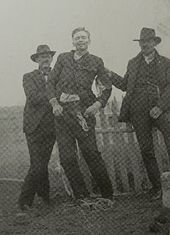
The Canyon Diablo shootout was a gunfight between American lawmen and a pair of bandits that occurred on April 8, 1905, in the present-day ghost town of Canyon Diablo, Arizona. On the night before, two men named William Evans and John Shaw robbed a saloon in Winslow and made off with at least $200 in coins. Two lawmen pursued the bandits and on the following day they encountered each other in Canyon Diablo. A three-second shootout ensued, which was described at the time as "one huge explosion" that resulted in the death of Shaw and the wounding and capture of Evans.

<span class="mw-page-title-main">History of Flagstaff, Arizona</span> Review of the topic

Flagstaff is a city in, and the county seat of, Coconino County in northern Arizona, in the southwestern United States. Established as a modern settlement in 1876 and incorporated as a city in 1928, the land had previously been lived on by native peoples of the southwest, primarily the Sinagua. Mountaineer Antoine Leroux then traveled the area, with Edward Fitzgerald Beale following in his footsteps and establishing a trail through the city in the mid-1800s. With a local spring, a small settlement grew by the wagon road, and the town was dominated by the McMillan, Riordan, and Babbitt families. Focused on agricultural pursuits, these families constructed some historic red stone buildings that still stand today.

<span class="mw-page-title-main">Canyon Diablo Bridge</span> Bridge in Winona, Arizona, United States

Canyon Diablo Bridge is an abandoned automobile bridge in Coconino County, Arizona, United States, approximately 30 mi (48 km) east of Flagstaff, Arizona. The bridge carried Route 66 over Canyon Diablo. The ghost town of Two Guns, once a prosperous tourist stop, is near the east end of the bridge.

References

  1. U.S. Geological Survey Geographic Names Information System: Canyon Diablo
  2. Meteor Crater: Proof of Impact – amnh.org – Retrieved September 19, 2008 Archived October 11, 2008, at the Wayback Machine
  3. "Canyon Diablo, Arizona: Why nearly all the stories about it are lies". The Arizona Republic. Retrieved August 17, 2023.
  4. Cram, George Franklin (1890). Cram's Universal Atlas: Geographical, Astronomical and Historical, Containing a Complete Series of Maps of Modern Geography, Illustrated by Numerous Views and Charts; the Whole Supplemented with Valuable Statistics, Diagrams, and a Complete Gazetteer of the United States. G.F. Cram. p. 349.
  5. Cram's Modern Atlas: The New Unrivaled. J. R. Gray & Company. 1902.
  6. Premier Atlas of the World: Containing Maps of All Countries of the World, with the Most Recent Boundary Decisions, and Maps of All the States, Territories, and Possessions of the United States with Population Figures from the Latest Official Census Reports, Also Data of Interest Concerning International and Domestic Political Questions. Rand McNally & Company. 1925. pp. 165–166.