Hartwick, New York

Last updated

Hartwick, New York
Otsego County outline map Hartwick red.png
Otsego County map with the Town of Hartwick in Red
Coordinates: 42°38′33″N75°0′55″W / 42.64250°N 75.01528°W / 42.64250; -75.01528
Country United States
State New York
County Otsego
Area
[1]
  Total40.42 sq mi (104.69 km2)
  Land40.08 sq mi (103.80 km2)
  Water0.34 sq mi (0.89 km2)
Elevation
1,667 ft (508 m)
Population
 (2010)
  Total2,110
  Estimate 
(2018) [2]
2,006
  Density50.23/sq mi (19.39/km2)
Time zone UTC-5 (Eastern (EST))
  Summer (DST) UTC-4 (EDT)
ZIP code
13348
Area code 607
FIPS code 36-32589
GNIS feature ID0979056

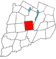
Hartwick is a town located in Otsego County, New York, United States. As of the 2010 census, the town had a population of 2,110. The Town of Hartwick is located in the middle of the county, southwest of the Village of Cooperstown.

Contents

History

The town was named for Lutheran minister John Christopher Hartwick (17141796), an early landowner of the town. He bought the area (the Hartwick Patent, granted 1761) that now constitutes the township from the Mohawk Indians in 1763. Discontented with the sparsely settled communities of Palatine Germans in the Mohawk Valley to the north, which Hartwick believed made people immoral, he bought the original Hartwick Patent with the intent to build a "New Jerusalem". Hartwick tried to control development, stipulating that residents look to him as their religious superior. By the 1790s the shrewd land speculator William Cooper had sold most of Hartwick's land against his wishes.

Hartwick requested in his will that a Lutheran seminary be opened with his estate. Upon Hartwick's death in 1797, efforts to do this started but were complicated by the fact that Hartwick left his estate to Jesus Christ.[ citation needed ] The Lutheran seminary established at Hartwick in 1797 was incorporated in 1816. It moved to Oneonta after 1931 and in 1947 merged with the Hartwick College, established in 1927. The town was established in 1802 from the Town of Otsego. In 1803, the north town line was altered.

The largest commercial enterprise to occur in Hartwick was probably the Southern New York Railroad which was constructed to the town in 1901. It was supported by extensive shops, a car barn and yards on the southeast side of the village. Many of the hamlets and crossings still show architectural signs related to the trolley line nearly a century after the last passenger service. [ citation needed ]

The Hartwick Historic District, Mathewson–Bice Farmhouse and Mathewson Family Cemetery, Old Hartwick Village Cemetery, and The White House are listed on the National Register of Historic Places. [3] [4] [5]

People of note in Hartwick

Geography

According to the United States Census Bureau, the town has a total area of 40.3 square miles (104 km2), of which 40.2 square miles (104 km2) is land and 0.2 square miles (0.52 km2) (0.45%) is water. New York State Route 205 is a north-south highway in the western side of Hartwick. Otsego Creek flows through the western part of Hartwick. The Susquehanna River defines the eastern town line.

Demographics

Historical population
CensusPop.Note
1820 2,579
1830 2,7727.5%
1840 2,490−10.2%
1850 2,352−5.5%
1860 2,4966.1%
1870 2,339−6.3%
1880 2,3400.0%
1890 1,894−19.1%
1900 1,800−5.0%
1910 1,8130.7%
1920 1,648−9.1%
1930 1,487−9.8%
1940 1,438−3.3%
1950 1,4732.4%
1960 1,400−5.0%
1970 1,63116.5%
1980 1,79610.1%
1990 2,04513.9%
2000 2,2037.7%
2010 2,110−4.2%
2016 (est.)2,013 [2] −4.6%
U.S. Decennial Census [6]

As of the census [7] of 2000, there were 2,203 people, 850 households, and 601 families residing in the town. The population density was 54.9 inhabitants per square mile (21.2/km2). There were 1,098 housing units at an average density of 27.3 per square mile (10.5/km2). The racial makeup of the town was 97.96% White, 0.41% African American, 0.73% Asian, 0.05% Pacific Islander, 0.23% from other races, and 0.64% from two or more races. Hispanic or Latino of any race were 1.36% of the population.

There were 850 households, out of which 36.6% had children under the age of 18 living with them, 54.7% were married couples living together, 11.1% had a female householder with no husband present, and 29.2% were non-families. 24.7% of all households were made up of individuals, and 10.9% had someone living alone who was 65 years of age or older. The average household size was 2.59 and the average family size was 3.06.

In the town, the population was spread out, with 28.1% under the age of 18, 5.6% from 18 to 24, 27.0% from 25 to 44, 25.4% from 45 to 64, and 13.8% who were 65 years of age or older. The median age was 40 years. For every 100 females, there were 98.8 males. For every 100 females age 18 and over, there were 94.2 males.

The median income for a household in the town was $30,764, and the median income for a family was $38,889. Males had a median income of $28,529 versus $21,111 for females. The per capita income for the town was $17,473. About 9.9% of families and 13.9% of the population were below the poverty line, including 21.6% of those under age 18 and 10.7% of those age 65 or over.

Communities and locations in Hartwick

Related Research Articles

<span class="mw-page-title-main">Otsego County, New York</span> County in New York, United States

Otsego County is a county in the U.S. state of New York located within the Mohawk Valley Region. As of the 2020 census, the population was 58,524. The county seat is Cooperstown. The county's population center is Oneonta. The name Otsego is from a Mohawk or Oneida word meaning "place of the rock." The county is part of the Mohawk Valley region of the state.

<span class="mw-page-title-main">Columbia, New York</span> Town in New York, United States

Columbia is a town in Herkimer County, New York, United States. As of the 2020 census, the town population was 1,569. The town is at the southern border of the county and is southeast of Utica.

<span class="mw-page-title-main">Ohio, New York</span> Town in New York, United States

Ohio is a town in Herkimer County, New York, United States. The population was 1,002 at the 2010 census. The town is named after the state of Ohio. The town is in the northern part of the county and northeast of Utica. Part of Ohio is within the Adirondack Park.

<span class="mw-page-title-main">Winfield (town), New York</span> Town in New York, United States

Winfield is a town in Herkimer County, New York, United States. The population was 2,086 at the 2010 census. The town is named after General Winfield Scott and is in the southwestern corner of the county, south of Utica.

<span class="mw-page-title-main">Edmeston, New York</span> Town in New York, United States

Edmeston is a town located in Otsego County, New York, United States. As of the 2010 census, the town had a total population of 1,826.

<span class="mw-page-title-main">Exeter, New York</span> Town in New York, United States

Exeter is a town in Otsego County, New York, United States. The town is located in the northern part of the county. The population was 987 at the 2010 census. It is named after the county town and cathedral city of Exeter in England.

<span class="mw-page-title-main">Maryland, New York</span> Town in New York, United States

Maryland is a town in Otsego County, New York, United States. The population was 1,897 at the 2010 census. It was named for the U.S. state of the same name. The Town of Maryland is on the county's southern border. It is northeast of the City of Oneonta.

<span class="mw-page-title-main">Middlefield, New York</span> Town in New York, United States

Middlefield is a town in Otsego County, New York, United States. The population was 2,114 at the 2010 census.

<span class="mw-page-title-main">Otsego, New York</span> Town in New York, United States

Otsego is a town in the north-central part of Otsego County, New York, United States. The population was 3,641 at the 2020 census. The town is named after Lake Otsego, which forms part of the town's eastern border.

<span class="mw-page-title-main">Pittsfield, New York</span> Town in New York, United States

Pittsfield is a town in Otsego County, New York, United States. The population was 1,366 at the 2010 census.

<span class="mw-page-title-main">Richfield, New York</span> Town in Otsego County, New York, US

Richfield is a town located in Otsego County, New York, United States. As of the 2010 census, the town had a population of 2,388. The Town of Richfield is located at the northern border of the county.

<span class="mw-page-title-main">Richfield Springs, New York</span> Village in Otsego County, New York, US

Richfield Springs is a village located in the Town of Richfield, on the north-central border of Otsego County, New York, United States. The population was 1,050 at the 2020 census. The name is derived from local sulfur springs.

<span class="mw-page-title-main">Roseboom, New York</span> Town in New York, United States

Roseboom is a town in Otsego County, New York, United States. The population was 711 at the 2010 census. The name of the town is taken from those of early landowners and settlers Abram and John Roseboom.

<span class="mw-page-title-main">Springfield, New York</span> Town in New York, United States

Springfield is a town in Otsego County, New York, United States. The population was 1,358 at the 2010 census.

Worcester is a town in Otsego County, New York, United States. The population was 2,220 at the 2010 census. Worcester is on the southeastern border of the county and is northeast of Oneonta. The Worcester Central School District presently has 369 students enrolled in grades K-12.

<span class="mw-page-title-main">New Berlin, New York</span> Town in New York, United States

New Berlin is a town in Chenango County, central New York, United States. The population was 2,682 at the 2010 census. The town contains the village of New Berlin. The town is at the eastern border of the county and is northeast of Norwich.

<span class="mw-page-title-main">Herkimer, New York</span> Town in New York, United States

Herkimer is a town in Herkimer County, New York, United States, southeast of Utica. It is named after Nicholas Herkimer. The population was 9,566 at the 2020 census, down from 10,175 in 2010.

<span class="mw-page-title-main">Laurens, New York</span> Town in New York, United States

Laurens is a town in Otsego County, New York, United States. The population was 2,424 at the 2010 census.

<span class="mw-page-title-main">Milford, New York</span> Town in New York, United States

Milford is a town in Otsego County, New York, United States. The population was 3,044 at the 2010 census. Within town is the village of Milford. The town is northeast of the City of Oneonta.

<span class="mw-page-title-main">Unadilla, New York</span> Town in New York, United States

Unadilla is a town in Otsego County, New York, United States. As of the 2010 census, the town had a population of 4,392. The name is derived from an Iroquois word for "meeting place". Unadilla is located in the southwestern corner of the county, southwest of Oneonta. The village of Unadilla is located in the southern part of the town. The mayor of Unadilla is Jason Cotten.

References

  1. "2016 U.S. Gazetteer Files". United States Census Bureau. Retrieved July 5, 2017.
  2. 1 2 "Population and Housing Unit Estimates" . Retrieved November 5, 2019.
  3. "National Register of Historic Places". Weekly List of Actions Taken on Properties: 9/04/12 through 9/07/12. National Park Service. September 14, 2012.
  4. "National Register of Historic Places". Weekly List of Actions Taken on Properties: 5/28/13 through 5/31/13. National Park Service. June 7, 2013.
  5. "National Register of Historic Places". Weekly List of Actions Taken on Properties: 8/19/13 through 8/23/13. National Park Service. August 30, 2013.
  6. "Census of Population and Housing". Census.gov. Retrieved June 4, 2015.
  7. "U.S. Census website". United States Census Bureau . Retrieved January 31, 2008.

42°39′35″N75°02′56″W / 42.65972°N 75.04889°W / 42.65972; -75.04889