Milford (village), New York

Last updated

Milford, New York
Upper Susquehanna Cultural Center Milford.jpg
The Upper Susquehanna Cultural Center, formerly the Presbyterian Church of Milford (2012)
USA New York location map.svg
Red pog.svg
Milford, New York
Location within the state of New York
Coordinates: 42°35′24″N74°56′49″W / 42.59000°N 74.94694°W / 42.59000; -74.94694
CountryUnited States
State New York
County Otsego
Town Milford
Area
[1]
  Total0.42 sq mi (1.10 km2)
  Land0.42 sq mi (1.10 km2)
  Water0.00 sq mi (0.00 km2)
Elevation
1,207 ft (368 m)
Population
 (2020)
  Total367
  Density865.57/sq mi (334.00/km2)
Time zone UTC-5 (Eastern (EST))
  Summer (DST) UTC-4 (EDT)
ZIP code
13807
Area code 607
FIPS code 36-47229
GNIS feature ID0957183

The Village of Milford is a village in the northeastern part of the Town of Milford, in Otsego County, New York, United States. It is located northeast of Oneonta. As of the 2010 census, the village had a population of 415.

Contents

Geography

According to the United States Census Bureau, the village has a total area of 0.5 square mile (1.2 km2), all land.

The village is located on New York State Route 28 (North Main Street and South Main Street) at the intersection of New York State Route 166 (East Main Street) and County Highway 44 (West Main Street). NY 166 has its western terminus at this intersection.

Demographics

Historical population
CensusPop.Note
1880 557
1900 532
1910 511−3.9%
1920 505−1.2%
1930 491−2.8%
1940 460−6.3%
1950 5029.1%
1960 5489.2%
1970 527−3.8%
1980 514−2.5%
1990 462−10.1%
2000 51110.6%
2010 415−18.8%
2020 367−11.6%
U.S. Decennial Census [2]

As of the census [3] of 2000, there were 511 people, 198 households, and 143 families residing in the village. The population density was 1,071.2 inhabitants per square mile (413.6/km2). There were 232 housing units at an average density of 486.4/sq mi (187.8/km2). The racial makeup of the village was 96.67% White, 0.20% Black or African American, 0.59% Native American, 0.98% Asian, and 1.57% from two or more races. Hispanic or Latino of any race were 2.15% of the population.

There were 198 households, out of which 37.4% had children under the age of 18 living with them, 48.0% were married couples living together, 18.2% had a female householder with no husband present, and 27.3% were non-families. 20.7% of all households were made up of individuals, and 9.1% had someone living alone who was 65 years of age or older. The average household size was 2.56 and the average family size was 2.90.

In the village, the population was spread out, with 27.0% under the age of 18, 6.7% from 18 to 24, 27.0% from 25 to 44, 26.4% from 45 to 64, and 12.9% who were 65 years of age or older. The median age was 39 years. For every 100 females, there were 92.1 males. For every 100 females age 18 and over, there were 92.3 males.

The median income for a household in the village was $43,594, and the median income for a family was $45,375. Males had a median income of $25,417 versus $21,518 for females. The per capita income for the village was $17,282. About 3.6% of families and 7.1% of the population were below the poverty line, including 5.9% of those under age 18 and 6.9% of those age 65 or over.

Mayor

Related Research Articles

<span class="mw-page-title-main">Houston, Delaware</span> Town in Delaware, United States

Houston is a town in Kent County, Delaware, United States. It is part of the Dover metropolitan area. The population was 381 in 2020. It was named for John W. Houston.

<span class="mw-page-title-main">Island Falls, Maine</span> Town in the state of Maine, United States

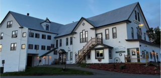
Island Falls is a town in Aroostook County, Maine, United States. The population was 758 at the 2020 census. The primary village of Island Falls in the town is situated at a falls in the West Branch Mattawamkeag River.

<span class="mw-page-title-main">Camden, Michigan</span> Village in Michigan, United States

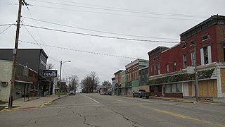
Camden is a village in Hillsdale County in the U.S. state of Michigan. The population was 496 at the 2020 census. The village is located within Camden Township.

<span class="mw-page-title-main">Milford Township, Michigan</span> Charter township in Michigan, United States

Milford Township is a charter township of Oakland County in the U.S. state of Michigan. The population was 15,736 at the 2010 census. The village of Milford is located within the township.

<span class="mw-page-title-main">Milford, Missouri</span> Village in Missouri, United States

Milford is a village in Barton County, Missouri, United States. The population was 24 at the 2020 census.

<span class="mw-page-title-main">Twin Oaks, Missouri</span> City in Missouri, United States

Twin Oaks is a 4th class city in St. Louis County, Missouri, United States. The former Village of Twin Oaks changed its status to that of a city by public election in November 2016. The population was 392 at the 2010 census.

<span class="mw-page-title-main">Milford, Michigan</span> Village in Michigan, United States

Milford is a village in Oakland County in the U.S. state of Michigan. The population was 6,175 at the time of the 2010 census. The village is located within Milford Township. The village is known for being the home of the Milford General Motors Proving Ground.

<span class="mw-page-title-main">Stanton, North Dakota</span> City in North Dakota, United States

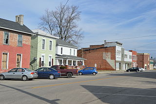
Stanton is a city in Mercer County, North Dakota, United States. It is the county seat of Mercer County. The population was 368 at the 2020 census. Stanton was founded in 1883 and became the county seat when Mercer County organized in 1884.

<span class="mw-page-title-main">Ithaca, Ohio</span> Village in Ohio, United States

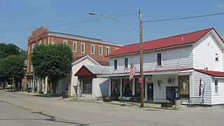
Ithaca is a village in Darke County, Ohio, United States. The population was 81 at the 2020 census.

<span class="mw-page-title-main">Spring Valley, Ohio</span> Village in Ohio, United States

Spring Valley is a village in Greene County, Ohio, United States. The population was 415 at the 2020 census. It is part of the Dayton Metropolitan Statistical Area.

<span class="mw-page-title-main">Sarahsville, Ohio</span> Village in Ohio, United States

Sarahsville is a village in Noble County, Ohio, United States. The population was 147 at the 2020 census.

<span class="mw-page-title-main">Clarksburg, Ohio</span> Village in Ohio, United States

Clarksburg is a village in Ross County, Ohio, United States. The population was 409 at the 2020 census.

<span class="mw-page-title-main">Milford Center, Ohio</span> Village in Ohio, United States

Milford Center is a village in Union County, Ohio, United States. The population was 807 at the 2020 census.

<span class="mw-page-title-main">Upper Milford Township, Pennsylvania</span> Township in Pennsylvania, United States

Upper Milford Township is a township in Lehigh County, Pennsylvania. The township's population was 7,292 at the 2010 census. Upper Milford Township is a suburb of Allentown in the Lehigh Valley, which had a population of 861,899 and was the 68th-most populous metropolitan area in the U.S. as of the 2020 census.

<span class="mw-page-title-main">Milford, Ohio</span> City in Ohio, United States

Milford is a city in Clermont and Hamilton counties in the U.S. state of Ohio. Milford is the westernmost city in Appalachian Ohio, and located along the Little Miami River and its East Fork in the southwestern part of the state, it is a part of the Cincinnati metropolitan area. The population was 6,582 at the 2020 census.

<span class="mw-page-title-main">Burkettsville, Ohio</span> Village in Ohio, United States

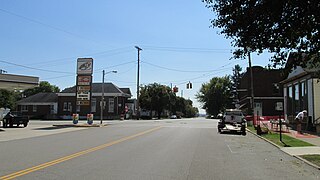
Burkettsville is a village in Darke and Mercer counties in the U.S. state of Ohio. The population was 272 at the 2020 census.

<span class="mw-page-title-main">Milford, New York</span> Town in New York, United States

Milford is a town in Otsego County, New York, United States. The population was 3,044 at the 2010 census. Within town is the village of Milford. The town is northeast of the City of Oneonta.

<span class="mw-page-title-main">Patch Grove, Wisconsin</span> Village in Wisconsin, United States

Patch Grove is a village in Grant County, Wisconsin, United States. The population was 198 at the 2010 census. The village is located within the Town of Patch Grove.

<span class="mw-page-title-main">Townsend (CDP), Massachusetts</span> Census-designated place in Massachusetts, United States

Townsend is a census-designated place (CDP) comprising the main village in the town of Townsend in Middlesex County, Massachusetts, United States. The population was 1,213 at the 2020 census, out of 9,127 in the entire town.

Milford is a town in Penobscot County, Maine, United States. It is located across the Penobscot River from the city of Old Town. The population of Milford was 3,069 at the 2020 census. The town's slogan is the "Best little town by a dam site," referring to the Milford Dam abutting Milford on the Penobscot River, south of the Penobscot Indian Island Reservation.

References

  1. "ArcGIS REST Services Directory". United States Census Bureau. Retrieved September 20, 2022.
  2. "Census of Population and Housing". Census.gov. Retrieved June 4, 2015.
  3. "U.S. Census website". United States Census Bureau . Retrieved January 31, 2008.