Richfield Springs, New York

Last updated

Richfield Springs, New York
Richfield Springs.jpg
Nickname: 
Richfield
USA New York location map.svg
Red pog.svg
Richfield Springs, New York
Location within the state of New York
Coordinates: 42°51′11″N74°59′15″W / 42.85306°N 74.98750°W / 42.85306; -74.98750
CountryUnited States
State New York
Region Central New York; Leatherstocking Region
County Otsego
Township Richfield
Area
[1]
  Total1.01 sq mi (2.61 km2)
  Land1.01 sq mi (2.61 km2)
  Water0.00 sq mi (0.00 km2)
Elevation
1,312 ft (400 m)
Population
 (2020)
  Total1,050
  Density1,042.70/sq mi (402.78/km2)
Time zone UTC-5 (Eastern (EST))
  Summer (DST) UTC-4 (EDT)
ZIP code
13439
Area code(s) 315
FIPS code 36-61489
GNIS feature ID0962471
Website Village of Richfield Springs

Richfield Springs is a village located in the Town of Richfield, on the north-central border of Otsego County, New York, United States. The population was 1,050 at the 2020 census. The name is derived from local sulfur springs.

Contents

Geography

The village is at the northern end of Canadarago Lake and is at the border of Herkimer County.

Perspective map of Richfield Springs with list of landmarks from 1885 by L.R. Burleigh Richfield Springs, N.Y. LOC 75694840.tif
Perspective map of Richfield Springs with list of landmarks from 1885 by L.R. Burleigh

Richfield Springs is located at 42°51′11″N74°59′15″W / 42.85306°N 74.98750°W / 42.85306; -74.98750 (42.853065, -74.987623). [2]

According to the United States Census Bureau, the village has a total area of 1.0 square mile (2.6 km2), all land.

U.S. Highway 20, New York State Route 28, and New York State Route 167 converge in Richfield Springs. US 20 and NY 28 intersect outside the western end of the village limits and overlap for a brief time inside the village, while NY 167 has its southern terminus at US 20 in the center of the village.

Demographics

Historical population
CensusPop.Note
1870 696
1880 1,30787.8%
1890 1,62324.2%
1900 1,537−5.3%
1910 1,503−2.2%
1920 1,388−7.7%
1930 1,333−4.0%
1940 1,209−9.3%
1950 1,53426.9%
1960 1,6306.3%
1970 1,540−5.5%
1980 1,5611.4%
1990 1,5650.3%
2000 1,255−19.8%
2010 1,2640.7%
2020 1,050−16.9%
U.S. Decennial Census [3]

As of the census [4] of 2000, there were 1,255 people, 536 households, and 324 families residing in the village. The population density was 1,259.2 inhabitants per square mile (486.2/km2). There were 619 housing units at an average density of 621.1 per square mile (239.8/km2). The racial makeup of the village was 96.02% White, 0.56% African American, 0.56% Native American, 0.88% Asian, 0.64% Pacific Islander, and 1.35% from two or more races. Hispanic or Latino of any race were 0.56% of the population.

There were 536 households, out of which 22.8% had children under the age of 18 living with them, 47.0% were married couples living together, 9.7% had a female householder with no husband present, and 39.4% were non-families. 34.0% of all households were made up of individuals, and 19.0% had someone living alone who was 65 years of age or older. The average household size was 2.27 and the average family size was 2.93.

In the village, the population was spread out, with 20.7% under the age of 18, 7.1% from 18 to 24, 22.1% from 25 to 44, 27.1% from 45 to 64, and 23.0% who were 65 years of age or older. The median age was 45 years. For every 100 females, there were 85.9 males. For every 100 females age 18 and over, there were 79.3 males.

The median income for a household in the village was $30,170, and the median income for a family was $40,956. Males had a median income of $29,097 versus $20,455 for females. The per capita income for the village was $16,865. About 7.1% of families and 12.2% of the population were below the poverty line, including 16.1% of those under age 18 and 9.7% of those age 65 or over.

History

The area of Richfield Springs was called Ga-no-wan-ges by the Oneida Indians which translated to "stinking water". [5]

The village was once served by the Southern New York Railroad, an electric trolley line that ran from Oneonta to Mohawk. [6] It began service through Richfield Springs in the summer of 1902. [7]

Noted architecture

The village is home to three national historic districts:

Individual Properties:

Richfield Springs Post Office Richfield Springs PO.jpg
Richfield Springs Post Office

Notable people

Related Research Articles

<span class="mw-page-title-main">Delaware County, New York</span> County in New York, United States

Delaware County is a county located in the US state of New York. As of the 2020 United States census, the population was 44,308. The county seat is Delhi. The county is named after the Delaware River, which was named in honor of Thomas West, 3rd Baron De La Warr, appointed governor of Virginia in 1609. The county is part of the Southern Tier region of the state.

<span class="mw-page-title-main">Herkimer County, New York</span> County in New York, United States

Herkimer County is a county in the U.S. state of New York. As of the 2020 census, the population was 60,139. Its county seat is Herkimer. The county was created in 1791 north of the Mohawk River out of part of Montgomery County. It is named after General Nicholas Herkimer, who died from battle wounds in 1777 after taking part in the Battle of Oriskany during the Revolutionary War.

<span class="mw-page-title-main">Otsego County, New York</span> County in New York, United States

Otsego County is a county in the U.S. state of New York located within the Mohawk Valley Region. As of the 2020 census, the population was 58,524. The county seat is Cooperstown. The county's population center is Oneonta. The name Otsego is from a Mohawk or Oneida word meaning "place of the rock." The county is part of the Mohawk Valley region of the state.

<span class="mw-page-title-main">Columbia, New York</span> Town in New York, United States

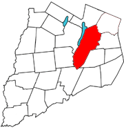
Columbia is a town in Herkimer County, New York, United States. As of the 2020 census, the town population was 1,569. The town is at the southern border of the county and is southeast of Utica.

<span class="mw-page-title-main">Middleville, New York</span> Village in New York, United States

Middleville is a village in Herkimer County, New York, United States. The population was 512 at the 2010 census.

Mohawk is a village in Herkimer County, New York, United States. The population was 2,731 at the 2010 census. The village was named after the adjacent Mohawk River.

<span class="mw-page-title-main">Norway, New York</span> Town in New York, United States

Norway is a town in Herkimer County, New York, United States. The population was 762 at the 2010 census. The town is located in the central part of the county and is northeast of Utica.

<span class="mw-page-title-main">Stark, New York</span> Town in New York, United States

Stark is a town in Herkimer County, New York, United States. The population was 757 at the 2010 census. The town was named after Revolutionary War general John Stark.

<span class="mw-page-title-main">Warren, New York</span> Town in Herkimer County, New York, US

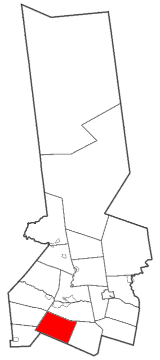
Warren is a town in Herkimer County, New York, United States. The population was 1,143 at the 2010 census. The town is named after General Joseph Warren, who was killed at the Battle of Bunker Hill. Warren is in the south part of Herkimer County. US 20 passes across the town.

<span class="mw-page-title-main">West Winfield, New York</span> Village in New York, United States

West Winfield is a village in the town of Winfield in Herkimer County, New York, United States. The population was 826 at the 2010 census. The village is indirectly named after General Winfield Scott. The village is south of Utica.

<span class="mw-page-title-main">Winfield (town), New York</span> Town in New York, United States

Winfield is a town in Herkimer County, New York, United States. The population was 2,086 at the 2010 census. The town is named after General Winfield Scott and is in the southwestern corner of the county, south of Utica.

<span class="mw-page-title-main">Gilbertsville, New York</span> Village in New York, United States

Gilbertsville is a historic village in Otsego County, New York, United States. The population was 399 at the 2010 census. The Village of Gilbertsville is in the Town of Butternuts and is west of Oneonta.

<span class="mw-page-title-main">Middlefield, New York</span> Town in New York, United States

Middlefield is a town in Otsego County, New York, United States. The population was 2,114 at the 2010 census.

<span class="mw-page-title-main">Richfield, New York</span> Town in Otsego County, New York, US

Richfield is a town located in Otsego County, New York, United States. As of the 2010 census, the town had a population of 2,388. The Town of Richfield is located at the northern border of the county.

<span class="mw-page-title-main">Springfield, New York</span> Town in New York, United States

Springfield is a town in Otsego County, New York, United States. The population was 1,358 at the 2010 census.

<span class="mw-page-title-main">Sharon, New York</span> Town in New York, United States

Sharon is a town in Schoharie County, New York, United States. The population was 1,697 at the 2020 census. The town is named after a location in Connecticut, whence some early settlers came. The town of Sharon is in the northwestern corner of the county and is southwest of Amsterdam.

<span class="mw-page-title-main">Herkimer (village), New York</span> Village in Herkimer County, New York, US

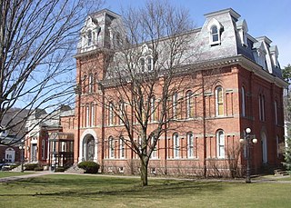
Herkimer is a village on the north side of the Mohawk River and the county seat of Herkimer County, New York, United States, about 15 miles (24 km) southeast of Utica. As of the 2020 Census, it had a population of 7,234, and a predicted population of 7,283 on July 1, 2022. It was part of the Burnetsfield Patent and the first colonial settlement this far west in the Mohawk Valley.

<span class="mw-page-title-main">Bridgewater (CDP), New York</span> Hamlet and CDP in New York, United States

Bridgewater is a hamlet in Oneida County, New York, United States. The population was 470 at the 2010 census.

Cherry Valley is a village in Otsego County, New York, United States. The population was 520 at the 2010 census.

<span class="mw-page-title-main">Schoharie (village), New York</span> Village in New York, United States

Schoharie is a village in Schoharie County, New York, United States. The population was 922 at the 2010 census. It is the county seat of Schoharie County. The name is a native word for driftwood.

References

  1. "ArcGIS REST Services Directory". United States Census Bureau. Retrieved September 20, 2022.
  2. "US Gazetteer files: 2010, 2000, and 1990". United States Census Bureau. February 12, 2011. Retrieved April 23, 2011.
  3. "Census of Population and Housing". Census.gov. Retrieved June 4, 2015.
  4. "U.S. Census website". United States Census Bureau . Retrieved January 31, 2008.
  5. "Annals of Richfield". archive.org. 1900. Retrieved January 4, 2018. data
  6. Hartwick the heart of Otsego County. Syllables Press. 2002. p. 209. ISBN   097094330-X.
  7. Commissioners, New York (State) Board of Railroad (1904). Annual Report ...
  8. 1 2 3 "National Register Information System". National Register of Historic Places . National Park Service. March 13, 2009.