Otego (town), New York

Last updated

Otego, New York
Otsego County outline map Otego red.png
Otsego County map with the Town of Otego in red
Coordinates: 42°23′50″N75°10′25″W / 42.3973°N 75.1735°W / 42.3973; -75.1735
Country United States
State New York
County Otsego
Area
[1]
  Total45.71 sq mi (118.38 km2)
  Land45.63 sq mi (118.19 km2)
  Water0.08 sq mi (0.20 km2)
Elevation
1,070 ft (330 m)
Population
 (2010)
  Total3,115
  Estimate 
(2016) [2]
2,941
  Density64.45/sq mi (24.88/km2)
Time zone UTC-5 (Eastern (EST))
  Summer (DST) UTC-4 (EDT)
ZIP code
13825
Area code 607
FIPS code 36-077-55629
Website Town website

Otego is a town in Otsego County, New York, United States. The population was 3,115 at the 2010 census. The name is a native word meaning "where there is fire."

Contents

The Town of Otego is on the southern border of the county and contains a village called Otego. The town and village are southwest of Oneonta.

History

The town was first settled circa 1775, but few more arrived until after the American Revolution. Tension between ethnic Germans and New Englanders slowed early development.

The Town of Otego was formed in 1822 from the Towns of Unadilla and Franklin (in Delaware County) as the "Town of Huntsville." In 1830, the name was changed to Otego, when part of the Town of Milford was added.

The Otsdawa Creek Site was listed on the National Register of Historic Places in 1980. [3]

Notable person

Geography

According to the United States Census Bureau, the town has a total area of 44.9 square miles (116.2 km2), all land.

The southern town line is the border of Delaware County.

The Susquehanna River flows through the southern part of the town. Otego Creek enters the Susquehanna River east of the eastern town line. Otsdawa Creek flows down the eastern side of Otego.

Interstate 88 and New York State Route 7 follow the course of the Susquehanna River.

Demographics

Historical population
CensusPop.Note
1820 1,414
1830 2,13651.1%
1840 1,919−10.2%
1850 1,792−6.6%
1860 1,9579.2%
1870 2,0524.9%
1880 1,918−6.5%
1890 1,840−4.1%
1900 1,817−1.2%
1910 1,699−6.5%
1920 1,366−19.6%
1930 1,3730.5%
1940 1,5089.8%
1950 1,76917.3%
1960 2,00813.5%
1970 2,24912.0%
1980 2,80124.5%
1990 3,12811.7%
2000 3,1831.8%
2010 3,115−2.1%
2016 (est.)2,941 [2] −5.6%
U.S. Decennial Census [5]

As of the census [6] of 2000, there were 3,183 people, 1,234 households, and 874 families residing in the town. The population density was 70.9 inhabitants per square mile (27.4/km2). There were 1,383 housing units at an average density of 30.8 per square mile (11.9/km2). The racial makeup of the town was 97.55% White, 1.01% Black or African American, 0.22% Native American, 0.44% Asian, 0.16% from other races, and 0.63% from two or more races. Hispanic or Latino of any race were 1.19% of the population.

There were 1,234 households, out of which 33.8% had children under the age of 18 living with them, 56.2% were married couples living together, 9.6% had a female householder with no husband present, and 29.1% were non-families. 22.0% of all households were made up of individuals, and 10.3% had someone living alone who was 65 years of age or older. The average household size was 2.54 and the average family size was 2.93.

In the town, the population was spread out, with 27.0% under the age of 18, 5.9% from 18 to 24, 27.0% from 25 to 44, 25.8% from 45 to 64, and 14.2% who were 65 years of age or older. The median age was 39 years. For every 100 females, there were 93.0 males. For every 100 females age 18 and over, there were 89.5 males.

The median income for a household in the town was $31,563, and the median income for a family was $36,543. Males had a median income of $27,986 versus $25,868 for females. The per capita income for the town was $15,479. About 8.7% of families and 11.4% of the population were below the poverty line, including 13.8% of those under age 18 and 6.6% of those age 65 or over.

Communities and locations in the Town of Otego

Related Research Articles

<span class="mw-page-title-main">Maine, New York</span> Town in New York, United States

Maine is a town in Broome County, New York, United States. The population was 5,377 at the 2010 census.

<span class="mw-page-title-main">Guilford, New York</span> Town in New York, United States

Guilford is a town in Chenango County, New York, United States. The town is on the eastern border of the county. The population was 2,922 at the 2010 census.

Hamden is a town in Delaware County, New York, United States. The population was 1,137 at the 2020 census.

Harpersfield is a town in Delaware County, New York, United States. The population was 1,442 at the 2020 census. The town is on the northern border of the county.

Kortright is a town in Delaware County, New York, United States. The population was 1,544 at the 2020 census. The town is in the northern part of the county.

Meredith is a town in Delaware County, New York, United States. The population was 1,484 at the 2020 census. It is an interior town in the northern part of the county.

<span class="mw-page-title-main">Roxbury, New York</span> Town in New York, United States

Roxbury is a town in Delaware County, New York, United States. The population was 2,247 at the 2020 census. The town is at the eastern end of the county.

<span class="mw-page-title-main">Butternuts, New York</span> Town in New York, United States

Butternuts is a town located in Otsego County, New York, United States. As of the 2010 census, the town had a population of 1,786. The Town of Butternuts is located in the southwestern part of the county, and is west of Oneonta.

<span class="mw-page-title-main">Middlefield, New York</span> Town in New York, United States

Middlefield is a town in Otsego County, New York, United States. The population was 2,114 at the 2010 census.

<span class="mw-page-title-main">Jefferson, New York</span> Town in Schoharie County, New York, US

Jefferson is a town in Schoharie County, New York, United States. The population was 1,333 at the 2020 census. The town is on the southwestern border of the county and is east of Oneonta.

<span class="mw-page-title-main">Summit, New York</span> Town in New York, United States

Summit is a town in Schoharie County, New York, United States. The population was 1,072 at the time of the 2020 census. The name is derived from a peak that was thought to be the highest elevation in the county.

Campbell is a town in Steuben County, New York, United States. The population was 3,163 at the 2020 census. The name is from Robert Campbell, an early landowner. The town is centrally located in the county and is northwest of Corning.

Tioga is a town in Tioga County, New York, United States. The population was 4,455 at the 2020 census. The town is in the southwestern part of the county and lies between Elmira and Binghamton. Tioga is situated in the Southern Tier District of New York.

<span class="mw-page-title-main">Halifax, Pennsylvania</span> Borough in Pennsylvania, United States

Halifax is a borough in Dauphin County, Pennsylvania, United States. Halifax was incorporated as a borough on May 29, 1785. It is situated at the confluence of Armstrong Creek and the Susquehanna River. The population was 795 at the 2020 census. It is part of the Harrisburg–Carlisle Metropolitan Statistical Area.

<span class="mw-page-title-main">Laurens, New York</span> Town in New York, United States

Laurens is a town in Otsego County, New York, United States. The population was 2,424 at the 2010 census.

<span class="mw-page-title-main">Milford, New York</span> Town in New York, United States

Milford is a town in Otsego County, New York, United States. The population was 3,044 at the 2010 census. Within town is the village of Milford. The town is northeast of the City of Oneonta.

<span class="mw-page-title-main">Oneonta (town), New York</span> Town in New York, United States

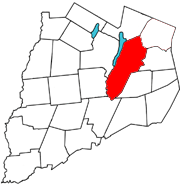
Oneonta is a town in Otsego County, New York, United States. The population was 5,065 at the 2020 census.,

Otego is a village in Otsego County, New York, United States. It is located within the Mohawk Valley Region of the state. The population was 1,010 at the 2010 census.

<span class="mw-page-title-main">Unadilla, New York</span> Town in New York, United States

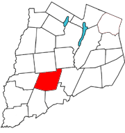
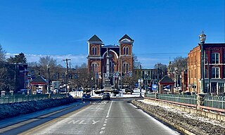
Unadilla is a town in Otsego County, New York, United States. As of the 2010 census, the town had a population of 4,392. The name is derived from an Iroquois word for "meeting place". Unadilla is located in the southwestern corner of the county, southwest of Oneonta. The village of Unadilla is located in the southern part of the town. The mayor of Unadilla is Jason Cotten.

<span class="mw-page-title-main">Owego, New York</span> Town in Tioga County, New York, US

Owego is a town in Tioga County, New York, United States. The population was 18,728 at the 2020 census. The name is derived from the Iroquois word Ahwaga, meaning "where the valley widens".

References

  1. "2016 U.S. Gazetteer Files". United States Census Bureau. Retrieved July 5, 2017.
  2. 1 2 "Population and Housing Unit Estimates" . Retrieved June 9, 2017.
  3. 1 2 "National Register Information System". National Register of Historic Places . National Park Service. March 13, 2009.
  4. American Women: The Official Who's Who Among the Women of the Nation. Vol. 1–3. Los Angeles, CA: Richard Blank Publishing Company. 1935. p. 127.
  5. "Census of Population and Housing". Census.gov. Retrieved June 4, 2015.
  6. "U.S. Census website". United States Census Bureau . Retrieved January 31, 2008.

42°23′30″N75°10′41″W / 42.39167°N 75.17806°W / 42.39167; -75.17806