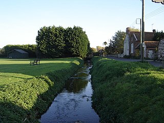
Heacham River

Last updated
Heacham River
River Hecham 5th April 2007 (3).JPG
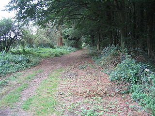
Heacham at Sedgeford
Country England
County Norfolk
Source
 - location Bircham Newton
 - coordinates 52°52′23″N0°36′50″E / 52.873°N 0.614°E / 52.873; 0.614
Mouth
 - location The Wash at Heacham Beach
 - coordinates 52°54′13″N0°28′13″E / 52.903732°N 0.470384°E / 52.903732; 0.470384 Coordinates: 52°54′13″N0°28′13″E / 52.903732°N 0.470384°E / 52.903732; 0.470384
Length16.4 km (10 mi)
Dischargefor Heacham
 - average0.21 m3/s (7 cu ft/s)
Norfolk UK relief location map.jpg
Red pog.svg
Location of the river mouth within Norfolk
River Heacham.jpg
map of the Heacham River

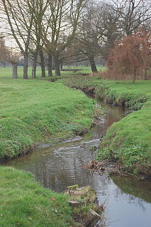
Heacham River is a small river in the King's Lynn and West Norfolk district of the English County of Norfolk. [1] Its source is near the village of Bircham Newton grid reference TF762 339 , 25 metres above sea level. The river is 16.4 kilometres (10.2 mi) long from the source to the outfall on Heacham beach, which discharges into The Wash at low tide. [2]

River Natural flowing watercourse

A river is a natural flowing watercourse, usually freshwater, flowing towards an ocean, sea, lake or another river. In some cases a river flows into the ground and becomes dry at the end of its course without reaching another body of water. Small rivers can be referred to using names such as stream, creek, brook, rivulet, and rill. There are no official definitions for the generic term river as applied to geographic features, although in some countries or communities a stream is defined by its size. Many names for small rivers are specific to geographic location; examples are "run" in some parts of the United States, "burn" in Scotland and northeast England, and "beck" in northern England. Sometimes a river is defined as being larger than a creek, but not always: the language is vague.

Kings Lynn and West Norfolk Borough in England

King's Lynn and West Norfolk is a local government district and borough in Norfolk, England. Its council is based in the town of King's Lynn. The population of the Local Authority at the 2011 Census was 147,451.

England Country in north-west Europe, part of the United Kingdom

England is a country that is part of the United Kingdom. It shares land borders with Wales to the west and Scotland to the north-northwest. The Irish Sea lies west of England and the Celtic Sea lies to the southwest. England is separated from continental Europe by the North Sea to the east and the English Channel to the south. The country covers five-eighths of the island of Great Britain, which lies in the North Atlantic, and includes over 100 smaller islands, such as the Isles of Scilly and the Isle of Wight.

Contents

Course

From its source at a pond near Bircham Newton the river flows towards Fring where it is crossed by Peddars Way and then runs across open countryside in a north westerly direction. Over the years this part of the river has been heavily modified but without any significant flood defence. After 2 miles the river runs through a shallow wooded valley south of the village of Sedgeford. From Sedgeford the river slowly curves north west towards Heacham crossing under the B1454 road and then turns west towards the only mill on the river. Just past the road bridge the river divides into two: one branch which once fed the millpond for the mill, and the other running past the mill.

Bircham Newton village in United Kingdom

Bircham Newton is the smallest of the three villages that make up the civil parish of Bircham, in the west of the English county of Norfolk. The village is located about 1 km north of the larger village of Great Bircham, 20 km north-east of the town of King's Lynn, and 60 km north-west of the city of Norwich.

Fring, Norfolk farm village in the United Kingdom

Fring is a civil parish in the English county of Norfolk. It covers an area of 6.93 km2 (2.68 sq mi) and had a population of 94 in 41 households at the 2001 census. The population remained less than 100 at the 2011 Census and qwas included in the civil parish of Sedgeford. For the purposes of local government, it falls within the district of King's Lynn and West Norfolk. There is a small cluster of buildings located along Fring road consisting of Fring All Saints.

Peddars Way

The Peddars Way is a long distance footpath in Norfolk, England.

Heacham Watermill

Caley Mill Caley Mill - home of Norfolk Lavender, Heacham, Norfolk - geograph.org.uk - 1731715.jpg
Caley Mill
Caley Mill-the mill-race Caley Mill.JPG
Caley Mill-the mill-race

Heacham watermill or Caley Mill, as it is also known, looks very different from most other mills in Norfolk, being Gothic revival in architectural style and built of local carrstone. It was also unique in Norfolk for having its waterwheel on the outside of the building. Originally used to grind corn, the building is now owned and has been used by Norfolk Lavender for lavender production since 1932. After the mill the river passes under the A149 coast road and then skirts around the northern side of the village of Heacham. The river then flows through Heacham Park where a channel from it feeds a small lake. After the lake the river goes north for a couple of hundred feet before turning west again crossing low-level meadows. The river ends up against the tidal flaps at South Beach between Snettisham and Heacham, where it fills a series of pools that run parallel to the coast. These pools discharge at low tide. The river supports a varied and diverse wildlife population including the water vole. There is also a small breeding trout population in the upper reaches, while in the lower reaches eels can be found.

Heacham village in the United Kingdom

Heacham is an English village in West Norfolk overlooking The Wash, between King's Lynn, 14 miles (23 km) to the south, and Hunstanton, about 3 miles (4.8 km) to the north. It has been a seaside resort for a century and a half.

Watermill structure that uses a water wheel or turbine to drive a mechanical process

A watermill or water mill is a mill that uses hydropower. It is a structure that uses a water wheel or water turbine to drive a mechanical process such as milling (grinding), rolling, or hammering. Such processes are needed in the production of many material goods, including flour, lumber, paper, textiles, and many metal products. These watermills may comprise gristmills, sawmills, paper mills, textile mills, hammermills, trip hammering mills, rolling mills, wire drawing mills.

Norfolk County of England

Norfolk is a county in East Anglia in England. It borders Lincolnshire to the northwest, Cambridgeshire to the west and southwest, and Suffolk to the south. Its northern and eastern boundaries are the North Sea and, to the north-west, The Wash. The county town is Norwich. With an area of 2,074 square miles (5,370 km2) and a population of 859,400, Norfolk is a largely rural county with a population density of 401 per square mile. Of the county's population, 40% live in four major built up areas: Norwich (213,000), Great Yarmouth (63,000), King's Lynn (46,000) and Thetford (25,000).

See also

Related Research Articles

River Burn, Norfolk river in Norfolk, United Kingdom

The River Burn is a river in the northwest of the County of Norfolk, in the East of England. From its source to its mouth on the North Coast of Norfolk it is 12.3 kilometres (7.6 mi). The river has a fall of 36 metres to the sea.

Hogsmill River river in the United Kingdom

The Hogsmill River in Surrey, England, is one of the tributaries of the River Thames. It rises in Ewell and flows into the Thames at Kingston upon Thames on the reach above Kingston road bridge. The river is 6 miles (9.9 km) in length and has a catchment area of 73 km². The river flows through low-lying land, most of it sports grounds and green space, with the exception of Kingston town centre.

Docking, Norfolk village in the United Kingdom

Docking is a village and civil parish in the English county of Norfolk and contains the highest point in North West Norfolk. It covers an area of 25.79 km2 (9.96 sq mi) and had a population of 1,150 in 469 households at the 2001 census, including Barwick and rising to 1,200 at the 2011 census. For the purposes of local government, it falls within the district of King's Lynn and West Norfolk.

River Colne, Essex river that runs through Essex, England

The River Colne is a small river that runs through Essex, England and passes through Colchester. It is not a tributary of any other river, instead having an estuary that joins the sea near Brightlingsea.

Sedgeford human settlement in United Kingdom

Sedgeford is a civil parish in the English county of Norfolk, about 6 km south of the North Sea and 5 km (3.1 mi) east of the Wash. It is approximately 90 km (56 mi) north east of Cambridge. It covers an area of 17.06 km2 (6.59 sq mi) and had a population of 540 in 224 households as of the 2001 census, the population including Fring and increasing to 613 at the 2011 Census. For the purposes of local government, it falls within the district of King's Lynn and West Norfolk.

Great Bircham village in the United Kingdom

Great Bircham is the largest of the three villages that make up the civil parish of Bircham, in the west of the English county of Norfolk. The village is located about 1 km south of the village of Bircham Newton, the same distance west of the village of Bircham Tofts, 20 km north-east of the town of King's Lynn, and 60 km north-west of the city of Norwich. [The King's Head is a hotel and bar.]

A149 road road

The A149 is commonly known as "The Coast Road" to local residents and tourists as this road runs along the North Norfolk coast from King's Lynn to Cromer passing through small coastal villages. The road then leaves the coastline at Cromer and reaches the Norfolk Broads.

River Babingley minor river in the northwest of the county Norfolk in England

The Babingley is a minor river in the northwest of the county Norfolk in England. It runs 12.2 miles (19.6 km) from its source at the village of Flitcham to the River Great Ouse at Wootton Marshes where it terminates.

River Roach river in the United Kingdom

The River Roach is a river that flows entirely through the English county of Essex. It is one of four main streams that originate in the Rayleigh Hills to the west, and flow east. They then flow towards the centre of the Rochford Basin, a circular feature which may have been caused by an asteroid impact in the Late Oligocene or Early Miocene periods. To the east of Rochford, the river becomes tidal, and is governed by the Crouch Harbour Authority. It joins the River Crouch between Wallasea Island and Foulness Island. To the west of Rochford, there is some doubt as to which of the four streams is officially the Roach.

River Mun river in the United Kingdom

The River Mun or Mundesley Beck is a river in the north of the county of Norfolk, England. The source of the river can be found in the Parish of Northrepps. The river finally runs into the North Sea in the village of Mundesley.

River Ingol river in Norfolk, United Kingdom

The River Ingol is a small river in the west of the English county of Norfolk.

Spring Beck (Norfolk) minor watercourse in Norfolk, England

Spring Beck is a minor watercourse flowing near and through the village of Weybourne in the north of the county of Norfolk.

Beeston Beck (Norfolk) river in the United Kingdom

Beeston Beck is a minor watercourse in the north of the county of Norfolk, England.

Holkham was a railway station which served the coastal village of Holkham in Norfolk, England. Opened by the West Norfolk Junction railway in 1866, it closed with the line in 1952.

Sedgeford railway station

Sedgeford was a railway station which served the settlement of Sedgeford in Norfolk, England. Opened by the West Norfolk Junction railway in 1866, passenger services ceased with the line in 1952.

The West Norfolk Junction Railway was a standard gauge 18½-mile single-track railway running between Wells-next-the-Sea railway station and Heacham in the English county of Norfolk. It opened in 1866 and closed in 1953.

Praia da Amoreira

Praia da Amoreira is a beach within the Municipality of Aljezur, in the Algarve, Portugal. The beach is on the western Seaboard in the north west of the Algarve. The beach is 5.4 miles (8.7 km) north west of the village of Aljezur, and is 71.8 miles (115.6 km) north west, by road, from the regions capital of Faro.

References

  1. Ordnance Survey (2002). OS Explorer Map 250 - Norfolk Coast West. ISBN   0-319-21886-4.
  2. "Heacham River". Catchment Data Explorer. Environment Agency. Retrieved 2 December 2016.