

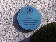
 The Blue Plaque on the wall of a Cottage in Beeston Road, Sheringham, marks the location of Sheringham watermill (Paper).
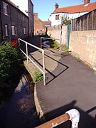 Beeston Beck's course at the Back of the Houses on Beeston Road.
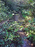 The Beck flowing through woodland on Beeston common.
 The Back common in Sheringham
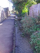 Until 1901 the Beck marked the border between the parishes of Beeston Regis and Sheringham.
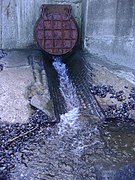 The Beck's outfall on to the east beach at Sheringham.
| Beeston Beck | |
|---|---|
 Beeston Beck at Sheringham Back Common | |
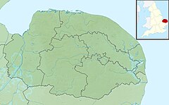 Beeston Beck Within North Norfolk | |
| Location | |
| Country | England |
| State | Norfolk |
| Region | East of England |
| District | North Norfolk |
| Physical characteristics | |
| Source | Sheringham Woods |
| Mouth | East Beach, Sheringham |
• coordinates | 52°56′43″N1°12′49″E / 52.94528°N 1.21361°E |
| Length | 1.437 mi (2.313 km) |
| watermills Sheringham Watermill(Paper & Corn) Total Fall meters from source to merger | |

Beeston Beck is a minor watercourse in the north of the county of Norfolk, England. [1]


