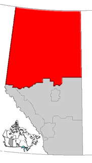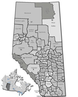
The Milk River is a tributary of the Missouri River, 729 mi (1,173 km) long, in the U.S. state of Montana and the Canadian province of Alberta. Rising in the Rocky Mountains, the river drains a sparsely populated, semi-arid watershed of 23,800 sq mi (61,642 km2), ending just east of Fort Peck, Montana.
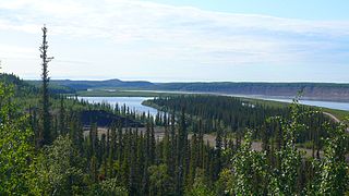
The Mackenzie River is the longest river system in Canada, and has the second largest drainage basin of any North American river after the Mississippi River. The Mackenzie River flows through a vast, thinly populated region of forest and tundra entirely within the Canadian Northwest Territories, although its many tributaries reach into four other Canadian provinces and territories.

The Tioga River is a tributary of the Chemung River, approximately 58 miles (93 km) long, in northern Pennsylvania and western New York in the United States. It drains a region of ridges in the northern Allegheny Plateau in the watershed of the Susquehanna River. It is a Northern flowing river
The Fort Nelson River is in north-eastern British Columbia, Canada. It flows 517 kilometres (321 mi) generally north-westward to the Liard River, a tributary of the Mackenzie River, which empties into the Arctic Ocean. The river drains a watershed of 55,900 square kilometres (21,600 sq mi) and is formed by the confluence of the Fontas River flowing from the east, and the Sikanni Chief River flowing from the south. These, along with the Sahtaneh and Muskwa Rivers constitute the major tributaries. The source of the Sikanni Chief, on the eastern slope of the Rocky Mountains, is ultimately the headwater of the Fort Nelson River.

Big Wapwallopen Creek is a tributary of the Susquehanna River in Luzerne County, Pennsylvania, in the United States. It is approximately 23 miles (37 km) long and flows through Bear Creek Township, Fairview Township, Rice Township, Wright Township, Dorrance Township, Hollenback Township, Nescopeck Township, and Conyngham Township. The watershed of the creek has an area of 53.2 square miles (138 km2). The creek has three named tributaries: Balliet Run, Watering Run, and Bow Creek. The creek is designated as a Coldwater Fishery and a Migratory Fishery and is also Class A Wild Trout Waters for part of its length. However, a portion is considered to be impaired by organic enrichment and/or low levels of dissolved oxygen and its pH ranges from moderately acidic to slightly alkaline.

Shamokin Creek is a tributary of the Susquehanna River in Northumberland County, Pennsylvania, in the United States. It is approximately 32.4 miles (52.1 km) long and flows through Mount Carmel, Mount Carmel Township, Coal Township, Shamokin, Ralpho Township, Shamokin Township, Snydertown, Upper Augusta Township, and Sunbury. The watershed of the creek has an area of 137 square miles (350 km2). It experiences significant impacts by abandoned mine drainage and many abandoned mine drainage discharges are in its watershed. Various other impairments also affect parts of the creek's watershed. Shamokin Creek is in the Appalachian Mountains section of the Ridge and Valley physiographic province. Rock formations consisting of sandstone, shale, and anthracite deposits occur in the watershed.

The Red Rock River is a roughly 70-mile (110 km) river in southwestern Montana in the United States. Its drainage basin covers over 1,548 square miles (4,010 km2). Its furthest tributary, Hell Roaring Creek, originates in the Beaverhead National Forest within a few hundred meters of the North American Continental Divide and Montana-Idaho border near Brower's Spring, at an elevation of about 9,100 feet (2,800 m). Brower's Spring is near the furthest headwaters of the Missouri River, one of the major watercourses of the central United States.

The Pouce Coupe River is a major tributary of the Peace River in Alberta and British Columbia, Canada. Its name is officially spelled Pouce Coupé River, but it is commonly written without the acute accent.
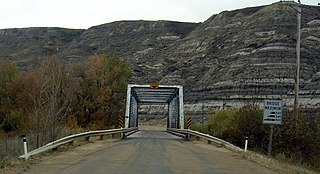
The Rosebud River is a major tributary of the Red Deer River in Alberta, Canada.
The Klamath River is a river in southern Oregon and northern California in the United States. This article describes its course.
The Kakisa River is a major tributary of the Mackenzie River in the Northwest Territories of Canada.
The Notikewin River is a tributary of the Peace River in northern Alberta, Canada. The Notikewin Provincial Park is established at the mouth of the river.
The Puskwaskau River is a short river in Northern Alberta, Canada. It is a tributary of the Smoky River flowing westwards in the Peace River Country. Its waters flow through the Smoky River, Peace River, Slave River, Great Slave Lake and Mackenzie River into the Arctic Ocean.
The Cadotte River is a tributary of the Peace River in Northern Alberta, Canada.
Pat's Creek is a tributary of the Peace River in northern Alberta, Canada whose mouth is located within the Town of Peace River.

Pisgah Mountain or Pisgah Ridge is a long ridgeline 12.5 miles (20.1 km) Tamaqua to Jim Thorpe oriented NNE-to-SSW whose northside valley is followed by U.S. Route 209 from river gap to river gap. The ridge is a succession of peaks exceeding 1,440 feet (438.9 m) looming 300–540 feet above the towns of Lansford, Coaldale, Summit Hill, and Tamaqua in the Panther Creek valley. Near Summit Hill was the 'Sharpe Mountain' (peak), where in 1791 Phillip Ginter is documented as having discovered Anthracite leading to the formation of the Lehigh Coal Mine Company. In 1818 the Lehigh Coal Company took over the mines and the mining camp gradually became a settlement and grew into Summit Hill.
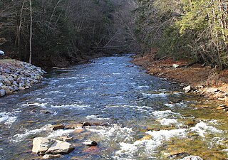
West Branch Fishing Creek is one of the northernmost major tributaries of Fishing Creek in Sullivan County, Pennsylvania and Columbia County, Pennsylvania, in the United States. It is 11.1 miles (17.9 km) long and flows through Davidson Township, Sullivan County and Sugarloaf Township, Columbia County. The creek's watershed has an area of 33.5 square miles, nearly all of which is forested land.

Toby Creek is a tributary of the Susquehanna River in Luzerne County, Pennsylvania, in the United States. It is approximately 10.5 miles (16.9 km) long and flows through Dallas Township, Dallas, Kingston Township, Courtdale, Luzerne, Pringle, Kingston, Edwardsville, and Larksville. The watershed of the creek has an area of 36.5 square miles (95 km2). The entire drainage basin is designated as a Migratory Fishery and parts are designated as either a Coldwater Fishery, a Warmwater Fishery, or a Trout Stocking Fishery. The creek has two named tributaries: Huntsville Creek and Trout Brook. It is said to show "some degraded conditions", but does not experience severe pollution and is not considered to be impaired. The creek is piped underground in Pringle, but resurfaces in Edwardsville.
