Highland Lakes, Alabama

Last updated

Highland Lakes, Alabama
Shelby County Alabama Incorporated and Unincorporated areas Highland Lakes Highlighted 0134490.svg
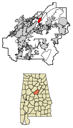
Location of Highland Lakes in Shelby County, Alabama.
USA Alabama location map.svg
Red pog.svg
Highland Lakes, Alabama
Coordinates: 33°23′54″N86°39′05″W / 33.39833°N 86.65139°W / 33.39833; -86.65139
Country United States
State Alabama
County Shelby
Area
[1]
  Total3.96 sq mi (10.25 km2)
  Land3.82 sq mi (9.88 km2)
  Water0.14 sq mi (0.36 km2)
Elevation
810 ft (250 m)
Population
 (2020)
  Total5,239
  Density1,372.90/sq mi (530.10/km2)
Time zone UTC-6 (Central (CST))
  Summer (DST) UTC-5 (CDT)
ZIP code
35242 [2]
Area code(s) 205, 659
GNIS feature ID2582679 [3]

Highland Lakes is a census-designated place in Shelby County, Alabama, United States. Its population was 3,926 as of the 2010 census. [4]

Contents

Geography

Highland Lakes is located within the Highland Lakes subdivision off U.S. Route 280 atop Double Oak Mountain, a southern extension of the Appalachian Mountains. Via U.S. 280, downtown Birmingham is 16 mi (26 km) northwest, and Chelsea is 6 mi (10 km) southeast.

Demographics

Historical population
CensusPop.Note
2020 5,239
U.S. Decennial Census [5]

Related Research Articles

<span class="mw-page-title-main">Hoover, Alabama</span> City in Alabama, United States

Hoover is a city in the Jefferson and Shelby counties in north central Alabama, United States. Hoover is the largest suburban city in Alabama and the 6th largest city in Alabama. The population was 92,606 at the 2020 census. Hoover is part of the Birmingham, AL Metropolitan Statistical Area and is also included in the Birmingham-Cullman-Talladega, AL Combined Statistical Area. Hoover's territory is along the foothills of the Appalachian Mountains.

<span class="mw-page-title-main">Brook Highland, Alabama</span> Census-designated place & Unincorporated community in Alabama, United States

Brook Highland is an unincorporated community and census-designated place in Shelby County, Alabama, United States. At the 2020 census, the population was 7,406.

<span class="mw-page-title-main">Lyons, Georgia</span> City in Georgia, United States

Lyons is a city in Toombs County, Georgia, United States. The population was 4,239 in 2020. The city is the county seat of Toombs County.

<span class="mw-page-title-main">Highland Township, Oakland County, Michigan</span> Charter township in Michigan, United States

Highland Township, officially the Charter Township of Highland, is a charter township of west Oakland County, Michigan. The population was 19,202 at the time of the 2010 census.

<span class="mw-page-title-main">Mountain Top, Pennsylvania</span> Census-designated place in Pennsylvania, United States

Mountain Top is an unincorporated area and census-designated place (CDP) in Luzerne County, Pennsylvania, United States. As of the 2010 census, its population was 10,982.

<span class="mw-page-title-main">Burnet, Texas</span> City in Texas, United States

Burnet is a city in and the county seat of Burnet County, Texas, United States. Its population was 6,436 at the 2020 census.

<span class="mw-page-title-main">Maple Heights-Lake Desire, Washington</span> Census-designated place in Washington, United States

Maple Heights-Lake Desire is a census-designated place (CDP) in King County, Washington, United States. At the 2010 census, the population was 3,152.

<span class="mw-page-title-main">Highland Lakes, New Jersey</span> Populated place in Sussex County, New Jersey, US

Highland Lakes is an unincorporated community and census-designated place (CDP) located within Vernon Township, in Sussex County, in the U.S. state of New Jersey. As of the 2010 United States Census, the CDP's population was 4,933. Highland Lakes has its own Post Office with the ZIP Code 07422.

<span class="mw-page-title-main">Ponshewaing, Michigan</span> Census-designated place & unincorporated community in Michigan, United States

Ponshewaing is an unincorporated community and census-designated place (CDP) in Emmet County in the U.S. state of Michigan. As of the 2010 census, the CDP had a population of 69. It is located within Littlefield Township.

<span class="mw-page-title-main">Yucca, Arizona</span> Community in Mohave County, Arizona

Yucca is an unincorporated community and census-designated place (CDP) in Mohave County, Arizona, United States. As of the 2020 census it had a population of 96, down from 126 at the 2010 census.

<span class="mw-page-title-main">White Mountain Lake, Arizona</span> Unincorporated community in the state of Arizona, United States

White Mountain Lake is an unincorporated community and census-designated place in Navajo County, Arizona, United States. White Mountain Lake is 7.5 miles (12.1 km) north-northeast of Show Low. White Mountain Lake has a post office with ZIP code 85912.

<span class="mw-page-title-main">Florence (CDP), Wisconsin</span> Census-designated place in Wisconsin, United States

Florence is a census-designated place in and the county seat of Florence County, Wisconsin, United States. Florence is located in northern Florence County, in the town of Florence. Florence has a post office with ZIP code 54121. The community was named a census-designated place in 2010. As of the 2010 census, its population was 592.

Gamalielgə-MAIL-ee-ə is an unincorporated community and census-designated place (CDP) in Baxter County, Arkansas, United States. Gamaliel is located along Arkansas Highway 101, 12 miles (19 km) northeast of Mountain Home and 3 mi (4.8 km) south of the Arkansas—Missouri border. Gamaliel has a post office with ZIP code 72537.

Pine Lake is an unincorporated community and census-designated place (CDP) in Mohave County, Arizona, United States. The population was 142 at the 2020 census.

Highland Holiday is an unincorporated community and census-designated place in Highland County, Ohio, United States. Its population was 571 as of the 2020 census.

Rocky Fork Point is an unincorporated community and census-designated place in Highland County, Ohio, United States. Its population was 742 as of the 2020 census.

Eagle Point is a census-designated place in Shelby County, Alabama, United States. It was first listed as a CDP prior to the 2020 census and is part of the Birmingham Metropolitan Area. The area was struck by a long-tracked low-end EF3 tornado on March 25, 2021, damaging or destroying several homes and downing trees. Five people were injured by the tornado.

Parsippany is a census-designated place (CDP) and the central community in the township of Parsippany-Troy Hills, Morris County, in the U.S. state of New Jersey. It includes development around Lake Parsippany, as well as neighborhoods in the eastern part of the township, between Troy Hills to the south and Lake Hiawatha to the north. The southern end of Boonton Reservoir is also in the CDP.

Rainbow Lakes is a census-designated place (CDP) located in Parsippany-Troy Hills, Morris County, in the U.S. state of New Jersey. It is in the western part of the township and consists of housing built around Rainbow Lake, plus a zone of commercial buildings to the east of the lakes. It is bordered to the east by Parsippany proper, to the north by the borough of Mountain Lakes, and to the west by Denville Township. The northern edge of the CDP is formed by U.S. Route 46 and the NJ Transit Montclair-Boonton Line, and Interstate 80 forms the southern edge. It is 21 miles (34 km) northwest of Newark and 30 miles (48 km) west of the George Washington Bridge over the Hudson River.

<span class="mw-page-title-main">Highland-on-the-Lake, New York</span> Census-designated place in New York, United States

Highland-on-the-Lake is a hamlet and census-designated place (CDP) in the town of Evans, Erie County, New York, United States. It was first listed as a CDP prior to the 2020 census.

References

  1. "2020 U.S. Gazetteer Files". United States Census Bureau. Retrieved October 29, 2021.
  2. "Highland Lakes AL ZIP Code". zipdatamaps.com. 2023. Retrieved January 26, 2023.
  3. "Highland Lakes Census Designated Place". Geographic Names Information System . United States Geological Survey, United States Department of the Interior.
  4. "U.S. Census website". United States Census Bureau . Retrieved May 14, 2011.
  5. "Census of Population and Housing". Census.gov. Retrieved June 4, 2016.