
David Crockett was an American folk hero, frontiersman, soldier, and politician. He is commonly referred to in popular culture by the epithet "King of the Wild Frontier". He represented Tennessee in the U.S. House of Representatives and served in the Texas Revolution.

Tipton County is a county located on the western end of the U.S. state of Tennessee, in the Mississippi Delta region. As of the 2020 census, the population was 60,970. Its county seat is Covington. Tipton County is part of the Memphis, TN-MS-AR Metropolitan Statistical Area.

Madison County is a county located in the western part of the U.S. state of Tennessee. As of the 2020 census, the population was 98,823. Its county seat is Jackson. Madison County is included in the Jackson, TN Metropolitan Statistical Area.
The Sunflower River is one of the main tributaries of the Yazoo River in the U.S. state of Mississippi. It is navigable by barge for 50 miles. It rises in De Soto County, Mississippi near the Tennessee border and flows south for 100 miles to the Yazoo River, a major tributary of the Mississippi River. At Clarksdale, the county seat of Coahoma County, the annual Sunflower River Blues & Gospel Festival is held.

Shiloh Indian Mounds Site (40HR7) is an archaeological site of the South Appalachian Mississippian culture. It is located beside the Tennessee River on the grounds of the Shiloh National Military Park, in Hardin County of southwestern Tennessee. A National Historic Landmark, it is one of the largest Woodland era sites in the southeastern United States.
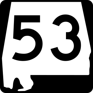
State Route 53 (SR 53) is a 345.287-mile (555.686 km) state highway in the U.S. state of Alabama. The majority, between Dothan and Huntsville, is signed as U.S. Route 231 (US 231), but the two ends – south to Florida and north to I-65/US 31 near Tennessee – are independent. In those areas, US 231 uses SR 1, sharing the route with US 431 north of Huntsville, where it is referred to as Memorial Parkway.

Clarence Bloomfield Moore, more commonly known as C.B. Moore, was an American archaeologist and writer. He studied and excavated Native American sites in the Southeastern United States.
The Roods Landing site or Roods Creek Mounds (9SW1) is an archaeological site located south of Omaha, Stewart County, Georgia, United States at the confluence of Rood Creek and the Chattahoochee River. It is a Middle Woodland / Mississippian period Pre-Columbian complex of earthen mounds. It was entered on the National Register of Historic Places on August 19, 1975.
Gulf Shipbuilding Corporation is a former shipbuilding corporation in Chickasaw, Alabama a few miles upstream of the Port of Mobile. Following the company's closure, the land became a part of the Chickasaw Shipyard Village Historic District

Randolph is an unincorporated rural community in Tipton County, Tennessee, United States, located on the banks of the Mississippi River. The lands of the Mississippi River Basin were inhabited by Paleo-Indians and later Native American tribes of the Mississippian culture for thousands of years. The Tipton phase people and the Chickasaw Indian tribe populated the Mississippi River valley near Randolph during the Mississippian period. In 1541, Spanish explorer Hernando de Soto crossed the Mississippi River at or near Randolph. French explorer Cavelier de La Salle built the first French fortification at or near Randolph on his 1682 canoe expedition of the Mississippi River.

Fort Strother was a stockade fort at Ten Islands in the Mississippi Territory, in what is today St. Clair County, Alabama. It was located on a bluff of the Coosa River, near the modern Neely Henry Dam in Ragland, Alabama. The fort was built by General Andrew Jackson and several thousand militiamen in November 1813, during the Creek War and was named for Captain John Strother, Jackson's chief cartographer.
Stone box graves were a method of burial used by Native Americans of the Mississippian culture in the Midwestern United States and the Southeastern United States. Their construction was especially common in the Cumberland River Basin, in settlements found around present-day Nashville, Tennessee.
The Swallow Bluff Island Mounds (40HR16) comprise a Mississippian culture archaeological site located near Saltillo on Swallow Bluff Island in the Tennessee River in Hardin County, Tennessee.

Jordan Mounds is a multimound archaeological site in Morehouse Parish, Louisiana. It is the type site for the Jordan Phase of the local chronology. The site was constructed during the protohistoric period between 1540 and 1685.
Horse Creek is a stream and tributary of the Tombigbee River in southern Marengo County and northern Clarke County in Alabama.
Josephine is an unincorporated community in Baldwin County, Alabama, United States.
Citico Town and Mound was a major center of the Coosa confederacy, at the mouth of Citico Creek in the area of what is now Chattanooga, Tennessee. It was second in size to Etowah at the time of Hernando de Soto's march through the area in 1540 CE. In archaeological terms it is considered as part of the 'Dallas phase' of Mississippian/Muscogee culture, c. 1300–1600 CE. For the muskogean version and origin of the name, see "Satapo." Isaac H. Bonsall photographed the site during the American Civil War era in 1864 when it was part of a garden for convalescent Union soldiers.

Fort Decatur was an earthen fort established in March 1814 on the banks of the Tallapoosa River as part of the Creek War and the larger War of 1812. The fort was located on the east bank of the Tallapoosa River, near the modern community of Milstead. Fort Decatur was also located near the Creek town of Tukabatchee. It was most likely named for Stephen Decatur.

Fort Hampton was a collection of log buildings and stables built in present-day Limestone County, Alabama, on a hill near the Elk River. It was named for Brigadier General Wade Hampton by Alexander Smyth, and once complete in the winter of 1810 both men visited the site. The fort was originally built to deter Americans from settling in Chickasaw territory, then was garrisoned during the War of 1812. Later, it was used for United States governmental functions prior to being abandoned.


